Yellow River Estuary Ecological Tourism Area
1. Introduction
The Yellow River Estuary, where the Yellow River—the Mother River of the Chinese nation—converges with the vast Bohai Sea, is developed based on the Shandong Yellow River Delta National Nature Reserve. It boasts the most extensive, intact, and youngest wetland ecosystem in China's warm temperate zone, making it a world-class tourist destination that integrates natural wonders, ecological conservation, and cultural value.
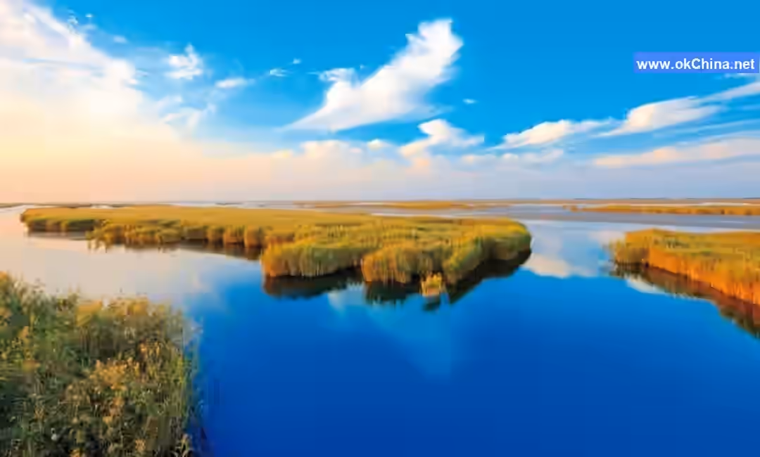
This is where the Yellow River flows into the sea. Carrying vast amounts of sediment into the Bohai Sea, it has formed the youngest land of the People's Republic. The mighty Yellow River embraces the azure sea, creating the spectacular wonder of "River-Sea Convergence." Simultaneously, it serves as an "international airport" for birds, hosting 373 bird species, including 26 nationally first-class protected species such as the Red-crowned Crane and Oriental White Stork, and 65 nationally second-class protected species like the Common Crane and Whooper Swan. As a crucial "stopover," wintering ground, and breeding site for birds migrating through Northeast Asia's interior and the Western Pacific Rim, the Yellow River Estuary is acclaimed as the "Hometown of the Oriental White Stork in China" and the "Hometown of the Saunder's Gull in China."
Furthermore, the Yellow River Estuary is China's largest coastal nascent wetland natural vegetation area, home to 685 plant species, including representative species such as Black Locust, Dryland Willow, Tamarisk, Reed, and Seepweed. The vast, contiguous "red carpet" landscape spanning tens of thousands of mu and the largest artificial Black Locust forest in the North China Plain provide an ideal setting for studying the formation, evolution, and developmental patterns of estuarine nascent wetland ecosystems.
The Yellow River Estuary Ecological Tourism Area centers around three world-class wonders: "River-Sea Convergence," "Nascent Wetlands," and "Rare Birds," endowing it with unique and irreplicable tourism resources. As a holder of multiple prestigious titles—including International Important Wetland, National Model Nature Reserve, National 5A Tourist Attraction, National Forest Park, and National Geopark—it is not only one of Shandong Province's Top Ten Cultural Tourism Destinations and one of China's Six Most Beautiful Wetlands but also a research and study base for primary and secondary school students in Shandong Province and a demonstration site for sports tourism.
Through rich cultural displays, the Yellow River Estuary narrates the arduous journey and glorious achievements of Yellow River management, allowing visitors to deeply appreciate the historical status and contemporary value of the Yellow River as the cradle of Chinese civilization while enjoying its scenic beauty. The Yellow River Estuary Tourism Area is a gift from nature, a testament to human wisdom, and a bridge connecting the past and the future.
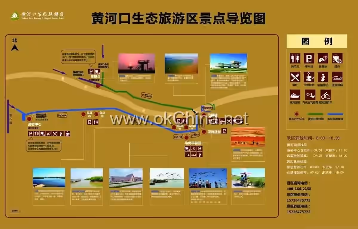
2. Main Attractions
2.1 Yellow River Delta Bird Museum
With an exhibition area of 3,516 square meters, the Yellow River Delta Bird Museum is themed "Protecting Rare Birds, Building Ecological Civilization Together." Its four main exhibition halls display over 1,400 specimens, including rare bird specimens. It serves as a city landmark showcasing the ecological conservation of the Yellow River Estuary and the harmonious development between humans, nature, and birds, and is currently the largest specialized bird museum in China.
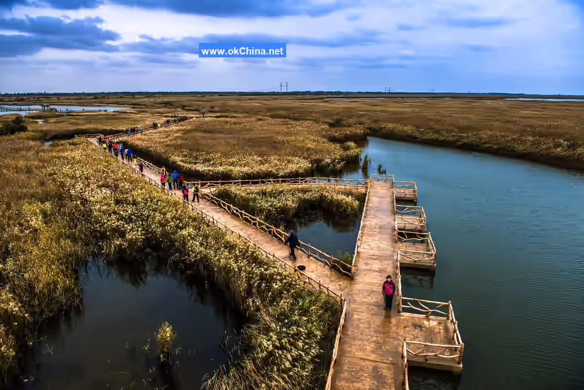
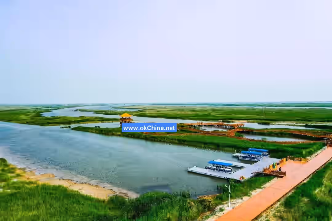
2.2 Bird Island
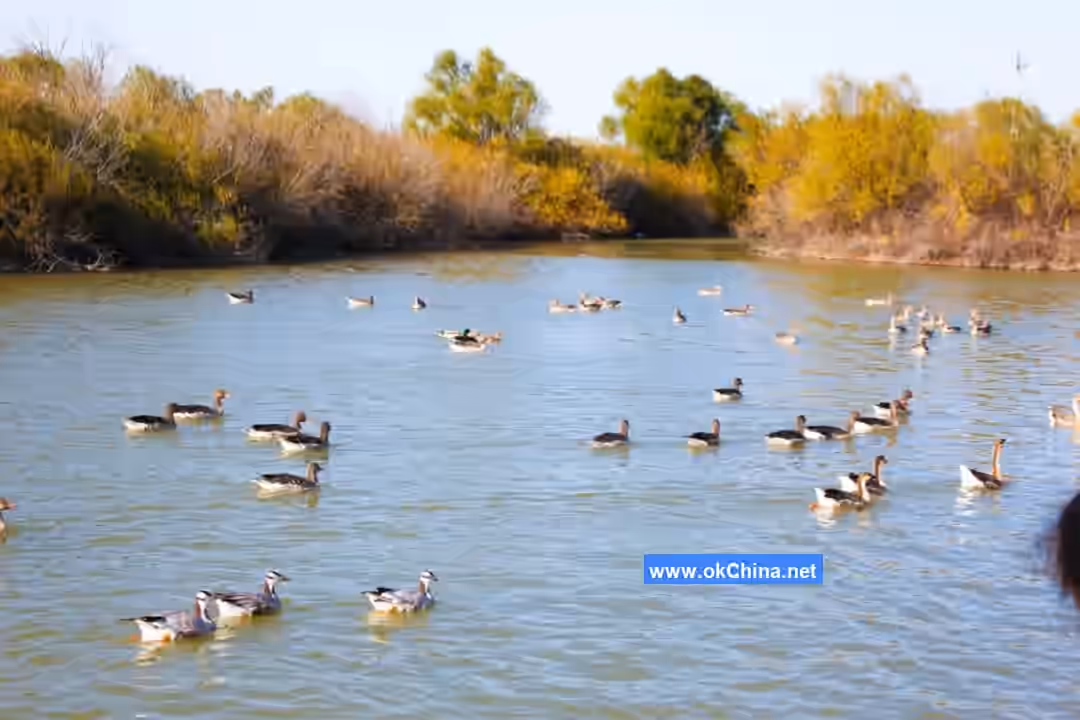
Covering 600 mu with a 1,600-meter-long boardwalk, Bird Island is the area within the scenic zone with the highest concentration of bird activity during migration seasons, serving as a key resting and feeding area for migratory birds each year. Along the way, visitors can spot the Oriental White Stork, the city bird of Dongying, in the reed marshes or on utility poles. In spring and summer, one can admire the vast reed wetland landscape, while autumn and winter offer the natural beauty of flying reed catkins and flocks of birds soaring across the sky.
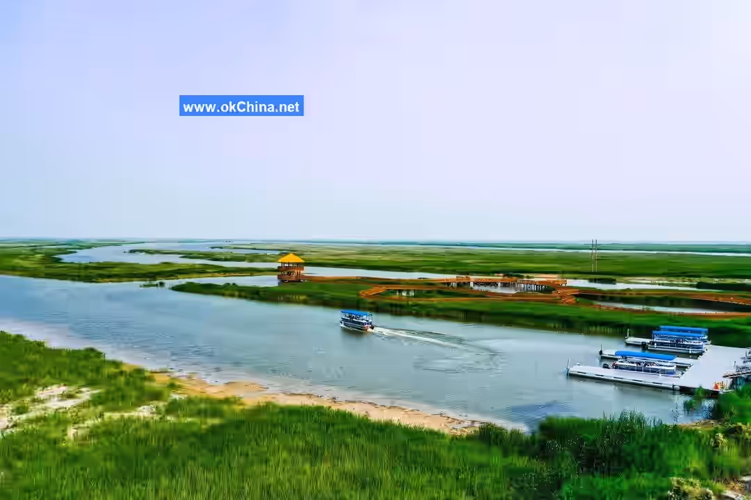
2.3 Boat Tour on White Stork Lake
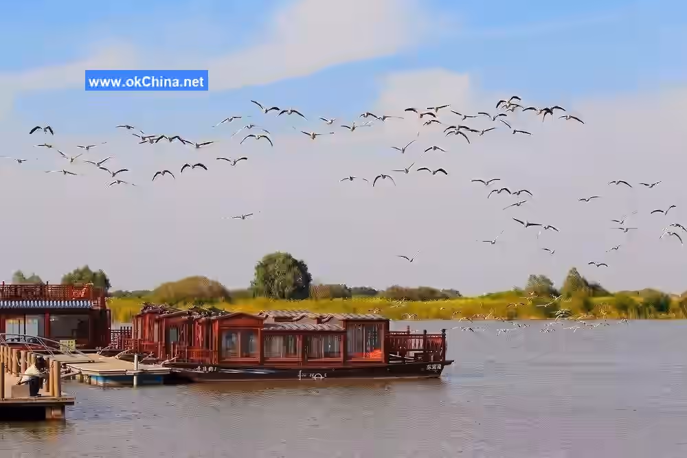
Located east of the Bird Island attraction, the "Boat Tour on White Stork Lake" project is a wetland bird-watching and nature experience activity featuring wetland boating, secret reed forest paths, and waterfront platforms. On White Stork Lake, visitors can boat through the wetlands, explore the gallery of shimmering waters and lush reeds, watch birds landing on the calm lake, and admire the dancing cranes and storks. The waterway is approximately 6 kilometers long. Boating through it allows close-up views of Oriental White Stork nests on utility poles and wild birds such as Oriental White Storks, Egrets, Wild Ducks, and Cormorants foraging in the wetlands.
2.4 Natural Willow Forest Wooden Boardwalk
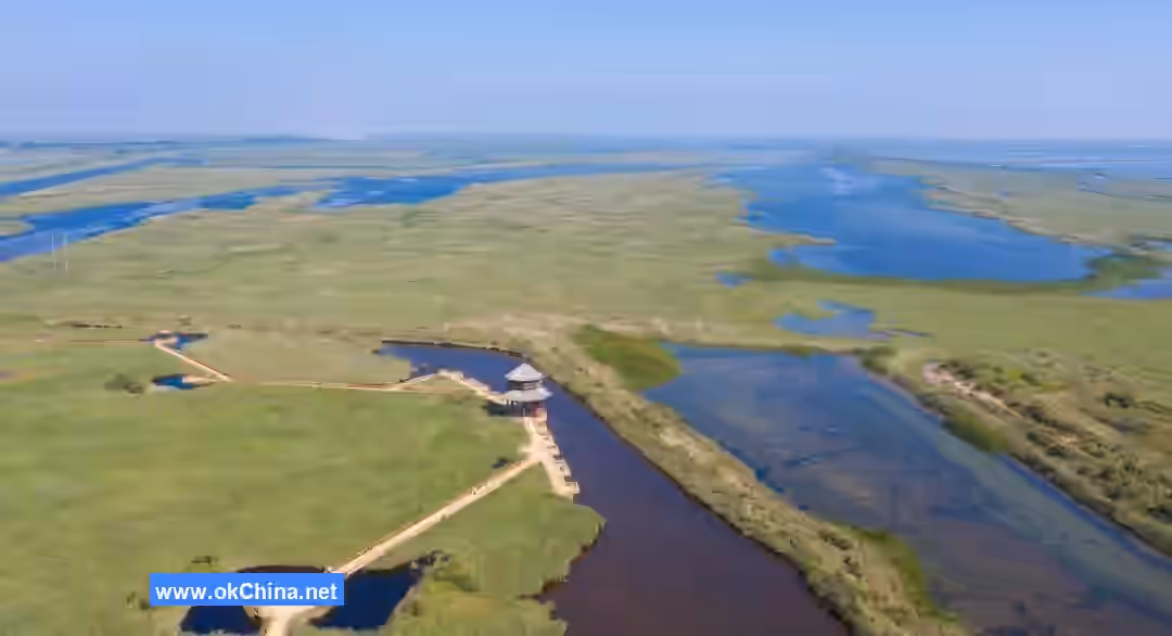
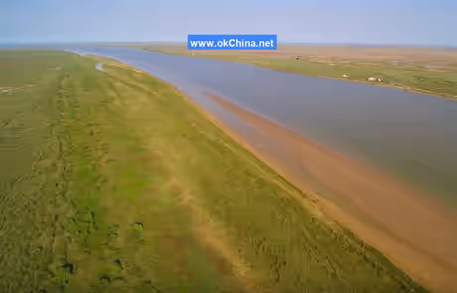
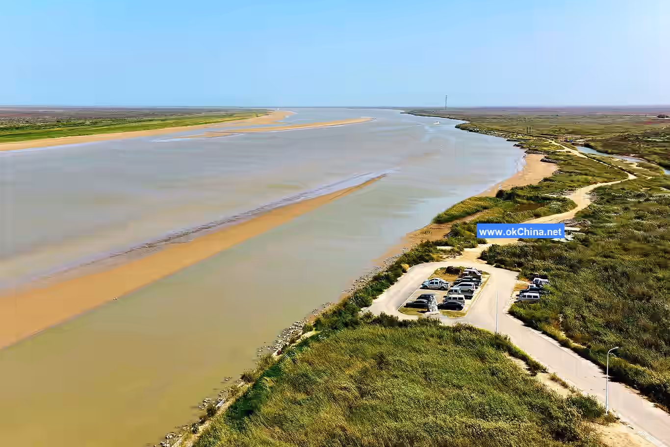
The main tree species in the Natural Willow Forest are Salix integra and Dryland Willow. Unlike ordinary willow trees, their seeds were washed down from the upper reaches of the Yellow River, taking root and growing naturally here, making them a natural vegetation gifted by the Yellow River without any human intervention. Along the long wooden boardwalk, visitors can enjoy bird-watching and fish-viewing while savoring the leisurely tranquility of the winding path. From the River Viewing Tower, one can look out over the old course of the Yellow River from 1976 to 1996, the old channel left after the artificial cut-off and straightening of the Yellow River in 2011, and the 20,000 mu of natural willow forest. Here, one can return to nature while experiencing the fresh and invigorating air of a natural oxygen bar.
2.5 Yellow River Estuary Bird Science Park
The Yellow River Estuary Bird Science Park is a large open bird sanctuary that integrates the rescue and care of individual wild animals, wildlife conservation research, and the promotion of public awareness about wildlife protection. Crane rewilding training sessions are held daily at 10:00 AM, 11:00 AM, 2:30 PM, and 3:30 PM (training times may vary based on season and weather).
Covering approximately 8,200 square meters with 18 enclosures, the Bird Science Park houses 4 species of nationally first-class protected birds (Red-crowned Crane, Oriental White Stork, Siberian Crane, and White-naped Crane), 4 species of second-class protected birds (Demoiselle Crane, Whooper Swan, Tundra Swan, and Mute Swan), and some non-threatened bird species. Visitors can observe the characteristics of various birds up close, learn about their habits through the bird science corridor, gain a more intuitive understanding of bird knowledge, and enhance their awareness of bird protection.
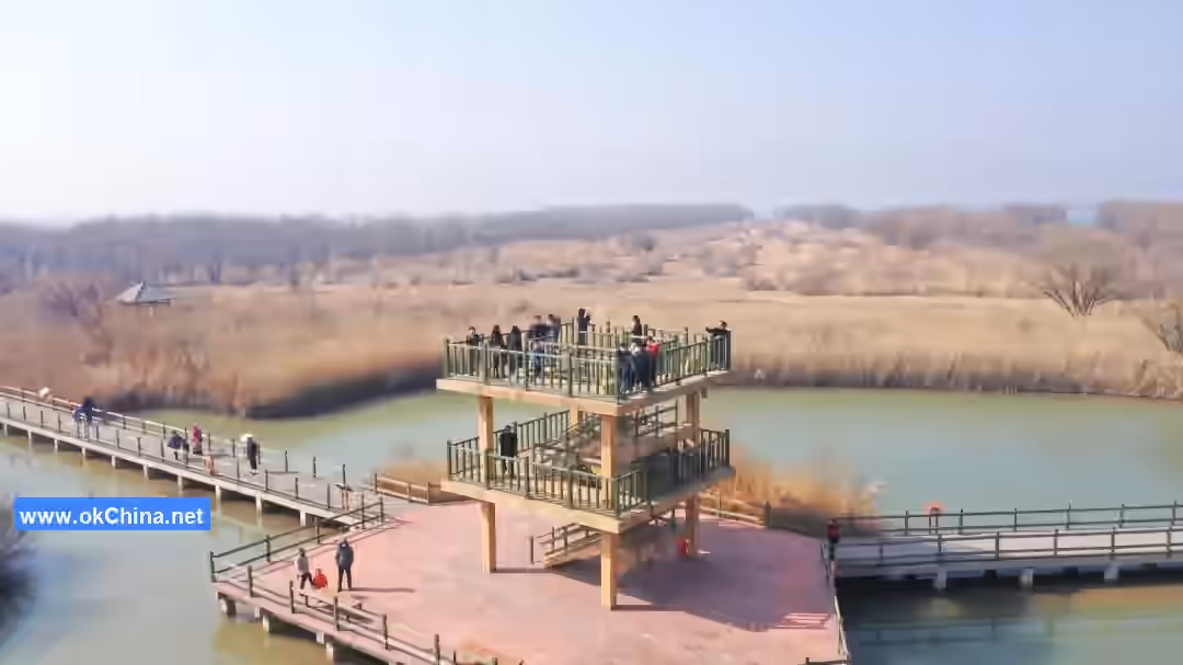
2.6 Wild Goose Lake
Wild Goose Lake Wetland covers an area of 4 square kilometers, with the main channel depth ranging from 1.7 to 2 meters. A dock is located at each end, and the wetland boat tour route spans 5 kilometers. Centered on the theme of "Entering the Wetland, Appreciating the Wetland, Understanding the Wetland, Protecting the Wetland," Wild Goose Lake Wetland showcases the natural and ecological beauty of wetlands. Boating into the wetland allows visitors to watch wild geese and ducks playing in the water and admire the wetland scenery, personally experiencing the delight and comfort of "boating on emerald waves, as if traveling within a painting."
2.7 Mudflat Crab Catching
The Yellow River Estuary features muddy beaches rich in biological food sources, making it a natural paradise for crab growth and reproduction. Here, you can roll up your pants legs and immerse yourself with your children, catching small crabs commonly known as "duluozi," and personally experience the joy of mudflat crab catching.
2.8 Yuanwang Tower (Distant View Tower)
Yuanwang Tower, meaning "From afar, the Yellow River flows endlessly; gazing out, the Bohai Sea tides surge," was named one of the "Top Ten New Qilu Cultural Landmarks" in 2011. It is a comprehensive modern building integrating dining, waiting areas, sightseeing, VR experiences, and other functions. Its unique architectural style features a suspended structure composed of two glass bodies and four core tubes in red, yellow, blue, and green, representing Seepweed, the Yellow River, the sea, and wetlands, respectively. From the Yuanwang Tower dock, a boat trip of over twenty kilometers northeast leads to the "River-Sea Convergence" boundary line, with a round trip taking approximately 100 minutes.
3. Historical Changes of the Yellow River Estuary
The Yellow River, the Mother River of the Chinese nation, nurtured the splendid Chinese civilization, yet its characteristics of being "prone to silting, breaching, and shifting" have left countless magnificent chapters in history. From the pre-Qin period to modern times, the changes in the lower reaches of the Yellow River resemble an epic of dramatic fluctuations, recording the grandeur of natural forces and the wisdom of human water management. Each breach and course alteration not only changed the river's path but also profoundly impacted the geographical environment, economic development, and social life of the coastal regions.
The changes in the Yellow River's course are both a result of natural evolution and a testament to the interplay between humans and nature. From the coexistence of the "Yu River" and the "Shan Jing Great River" in the early Warring States period, to the "Old Course of the Great River" in the late Western Han Dynasty, the dispute between the "Northern Flow" and "Eastern Flow" during the Qingli era of the Northern Song Dynasty, and finally to the "Great Qing River entering the sea" in the fifth year of the Xianfeng reign of the Qing Dynasty, each shift in the Yellow River's course influenced the pulse of history. These changes not only shaped the topography of the North China Plain but also drove advancements in water management technology, becoming a significant driving force in the development of Chinese civilization.
The following section details seven major course alterations of the Yellow River from pre-Qin times to the modern era, using the changes in the lower reaches as the main thread. By combining specific geographical locations and historical contexts, it reconstructs the complex process of the Yellow River's channel evolution. Through an in-depth analysis of these changes, we can better understand the close connection between the Yellow River and Chinese civilization and draw wisdom on harmonious coexistence between humans and nature.
The history of the Yellow River's changes is a magnificent tapestry woven from nature and humanity. Let us step into this history together, feel the majestic power of the Yellow River, and explore the glorious chapters co-written by the Chinese nation and its Mother River.
3.1 Early Warring States Period (Before approximately the 4th century BCE)
- Background: The lower reaches of the Yellow River were divided into two main channels: the "Yu River" and the "Shan Jing Great River."
- Yu River:
- The Yellow River flowed northeast from the northern foothills of Guangwu Mountain in present-day Xingyang, Henan, passed the Great Pi Mountain southwest of present-day Xunxian, Henan, then ran north along the eastern foothills of the Taihang Mountains, finally entering the sea southeast of present-day Tianjin.
- This channel was the main course of the Yellow River recorded in the Yu Gong (Tribute of Yu), known as the "Yu Gong Great River."
- Shan Jing Great River:
- The Yellow River diverged northward at present-day Shenxian, Hebei, converged with the Hutuo River, continued north to south of present-day Lixian, Hebei, then converged with the Gu River and Kou River, finally entering the sea northeast of present-day Tianjin.
- This channel was a tributary of the Yellow River recorded in the Shan Jing (Classic of Mountains), coexisting with the "Yu River."### 3.2 Late Western Han Dynasty (602 BC)
- Background: The Yellow River underwent its first major course change in the fifth year of King Ding of Zhou's reign (602 BC).
- Course Change Route:
- The Yellow River flowed east from the Suxukou (southwest of present-day Jun County, Henan), passed through the Huatai City (present-day Hua County, Henan), then flowed northeast through Liyang County (east of present-day Jun County, Henan) and Liangcheng County (northeast of present-day Hua County, Henan), finally diverging from the Luo River at Changshoujin (northeast of present-day Hua County, Henan) and flowing northeast into the sea.
- This river course was known as the "Old Channel of the Great River," marking the Yellow River's first large-scale course change.
3.3 Early Song Dynasty (AD 11)
- Background: In the third year of the Shijianguo era of Wang Mang's reign (AD 11), the Yellow River breached at Wei Commandery (southwest of present-day Linzhang County, Hebei), flooding for nearly sixty years.
- Course Change Route:
- After the breach, floodwaters inundated present-day Shandong and eastern Henan until AD 69, during the twelfth year of the Yongping era of Emperor Ming of the Eastern Han Dynasty, when Wang Jing dredged channels and built embankments, forming a new river course.
- The new course flowed east from Xingyang to Qiancheng (northeast of present-day Gaoqing County, Shandong) into the sea, known as the "Eastern Han Great River."
- This course remained stable for over eight hundred years, the most stable period in the Yellow River's history.
3.4 After the Qingli Era of the Northern Song Dynasty (1048)
- Background: In the eighth year of the Qingli era of the Northern Song Dynasty (1048), the Yellow River breached at Shanghusao, Chanzhou (present-day Changhuiji, east of Puyang, Henan), undergoing its third major course change.
- Course Change Route:
- The Yellow River changed course to flow northwest through Neihuang in Henan and Daming in Hebei, along the area between the present-day Fuyang River and the South Canal, eventually converging with the Yu River (present-day South Canal) at Qing County and flowing into the sea via Tianjin.
- This course was known as the "Northern Flow."
- Twelve years later (1060), the Yellow River again breached at the Sixth Sao of Wei County, Daming Prefecture (west of present-day Nanle, Henan), forming an eastern distributary that followed the old course of the Western Han Great River, passing through Tangyi and Xiajin in Shandong, and eventually flowing into the sea via the Majia River. This was known as the "Eastern Flow."
- Thereafter, the Yellow River sometimes followed the "Northern Flow," sometimes the "Eastern Flow," and sometimes both flows ran concurrently.
3.5 The Fifth Year of the Mingchang Era of Emperor Zhangzong of Jin (1194)
- Background: In the fifth year of the Mingchang era of Emperor Zhangzong of Jin (1194), the Yellow River breached at Yangwu (present-day Yuanyang County, Henan), undergoing its fourth major course change.
- Course Change Route:
- The Yellow River split into two branches:
- Northern Branch: Flowed into the sea along the North Qing River (present-day Yellow River), passing through Dongping, Dong'e, Pingyin, Changqing, Qihe, Licheng, Jiyang, Qidong, Wuding, Qingcheng, Binzhou, and Patai in Shandong, entering the sea at Lijin County.
- Southern Branch: Flowed into the Huai River along the South Qing River (Si River), passing through Dongping, Wenshang, Jiaxiang, and Jining in Shandong, converging with the Si River, and entering the Huai River at Qinghe County.
- After this course change, the main stream of the Yellow River shifted southward, entering the area south of the Shandong hills, ending its flow across the Hebei Plain.
- The Yellow River split into two branches:
3.6 Mid-Hongzhi Era of Ming to Xianfeng Era of Qing (1495)
- Background: In the eighth year of the Hongzhi era of the Ming Dynasty (1495), to protect the grain transport of the Beijing-Hangzhou Grand Canal, the Ming government blocked Huanglinggang, causing the entire Yellow River to flow into the Huai River, marking the fifth major course change.
- Course Change Route:
- The Yellow River flowed from Lanyang and Kaocheng, through Guide (present-day Shangqiu, Henan), Xuzhou, and Suqian, entered the Grand Canal southward, converged with the Huai River, and flowed east into the sea.
- This course became a single channel converging with the Huai River into the sea and remained stable for a relatively long period.
3.7 The Fifth Year of the Xianfeng Era of Qing (1855)
- Background: In the fifth year of the Xianfeng era of the Qing Dynasty (1855), the Yellow River breached at Tongwaxiang, Lanyang (near present-day Lankao, Henan), undergoing its sixth major course change.
- Course Change Route:
- After the breach, the Yellow River divided into three branches:
- One branch followed the Zhao Wang River, flowing south through Caozhou in Shandong.
- Two branches diverged through the north and south gates of Dongming County, Zhili (present-day Dongming County, Shandong), eventually converging at Zhangqiu Town, Shouzhang County, Shandong, cutting through the Grand Canal and flowing into the sea via the Daqing River.
- After this course change, the Yellow River ended its 660-year history of flowing into the sea via the Huai River and returned to flowing into the Bohai Sea.
- After the breach, the Yellow River divided into three branches:
Comments
Post a Comment