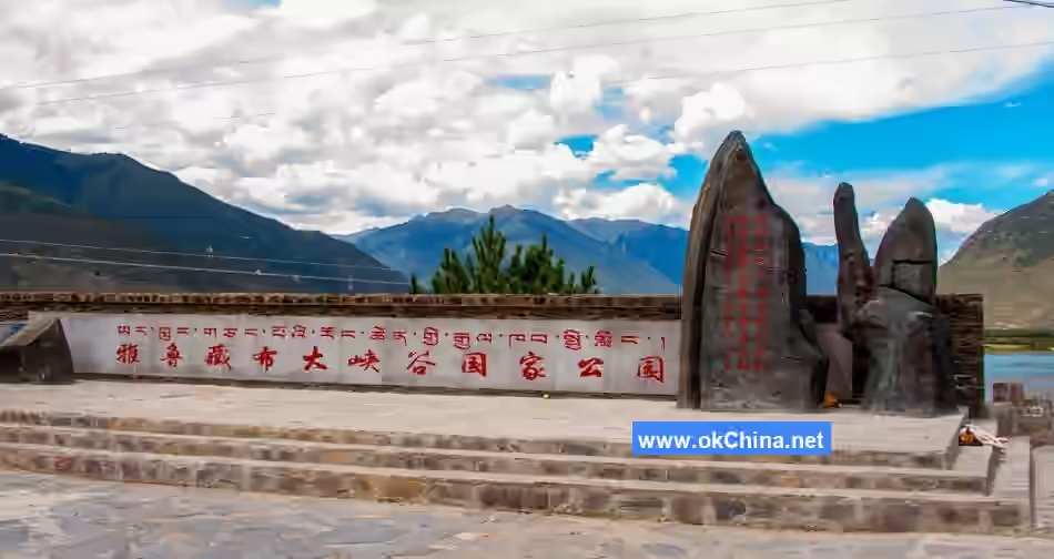
Yarlung Tsangpo Grand Canyon
1. Introduction
The Yarlung Tsangpo Grand Canyon is located in the southeastern part of the Tibet Autonomous Region of China. It is the world's largest and deepest canyon, stretching approximately 504.6 kilometers in length with a maximum depth of 6,009 meters, far surpassing the Grand Canyon in the United States. According to data released by the National Bureau of Surveying and Mapping: this grand canyon starts from Daduka Village in Pai Town, Milin County in the north (altitude 3,000 meters), passes through the great bend of the Yarlung Tsangpo River in Pailong Township, and ends at Baxika Village in Medog County in the south (altitude 115 meters, located in the southern Tibet region near India's Assam). Its main body lies within Medog County. From Duoka Village in Gandeng Township, Medog County, up to Jiala Village in Pai Town, Milin County, is the uninhabited area of the Yarlung Tsangpo Grand Canyon. The Yarlung Tsangpo Grand Canyon is not only a significant geographical landmark of the Qinghai-Tibet Plateau but also one of the most biodiverse regions globally. It boasts a unique ecosystem and rare flora and fauna resources, earning it the title "The Last Secret Land on Earth."
2. Geographical Environment
2.1 Location and Extent
The Yarlung Tsangpo Grand Canyon Scenic Area in Nyingchi City is located within Milin County, Nyingchi City, Tibet Autonomous Region, situated in the lower reaches of the Yarlung Tsangpo River. It spans 504.6 kilometers in length with a maximum depth of 6,009 meters, considered the world's longest and deepest grand canyon.
2.2 Climate
The Yarlung Tsangpo Grand Canyon Scenic Area in Nyingchi City is located in the southeastern corner of the Tibet Autonomous Region and belongs to the subtropical humid climate zone. The climate here is characterized by warmth and high humidity, with substantial precipitation. Combined with the immense elevation variation, this creates rich and complex vegetation types and provides habitats for various animals.
2.3 Geology and Topography
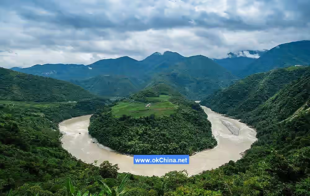
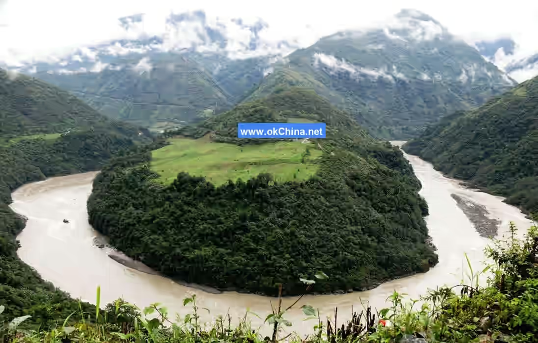
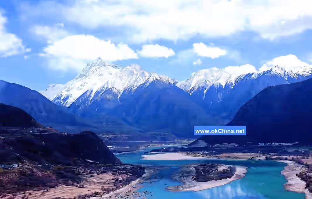
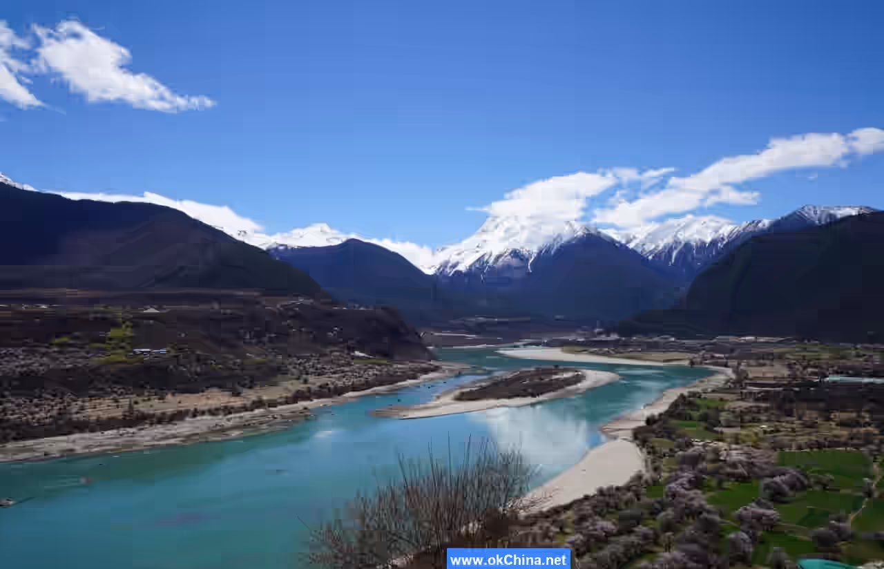
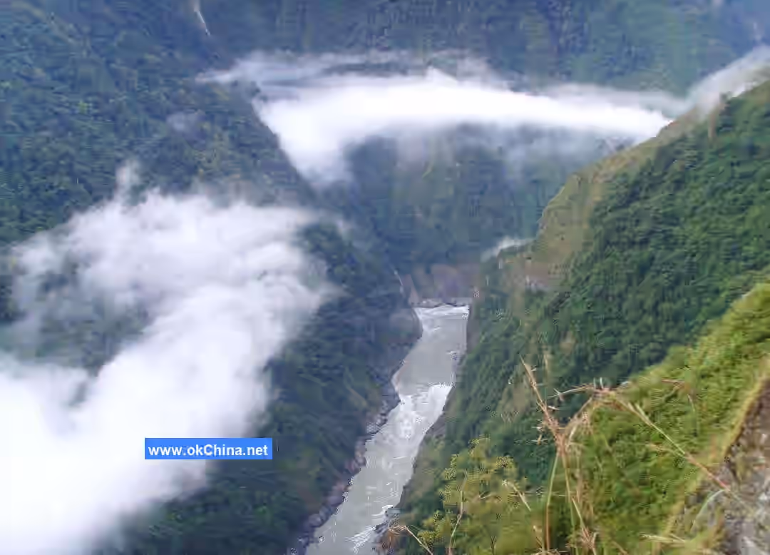
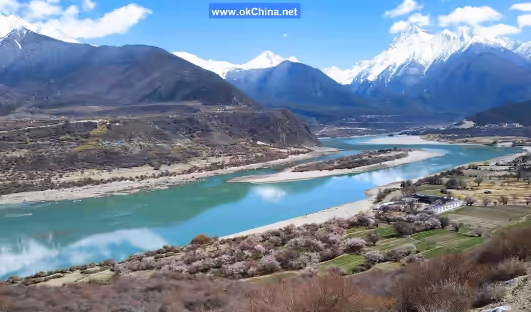
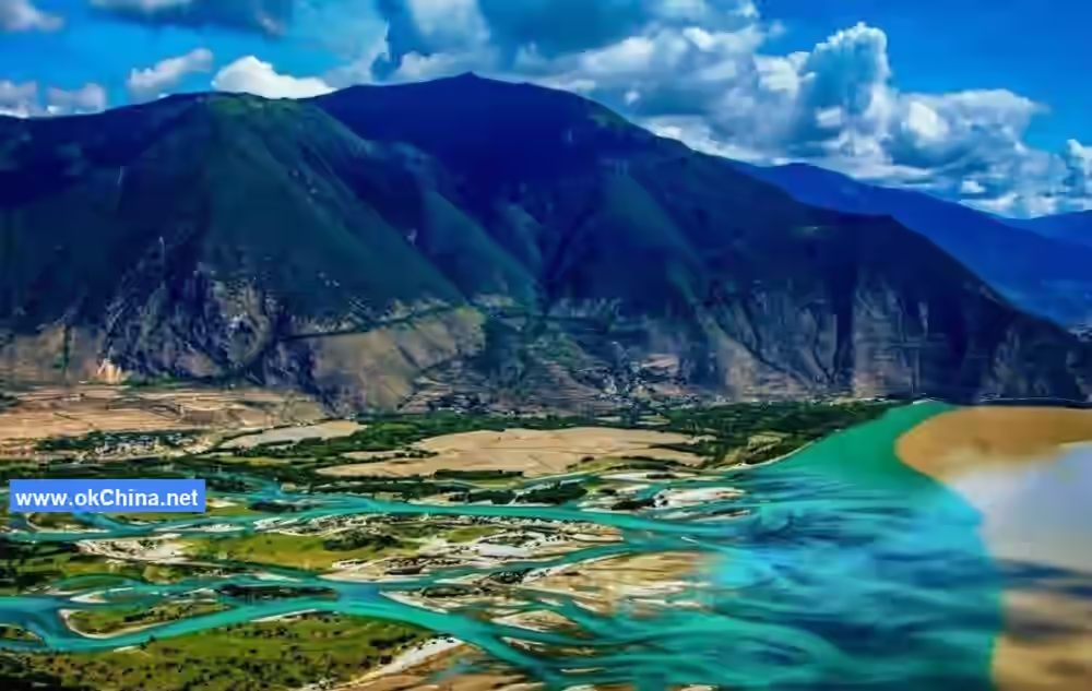
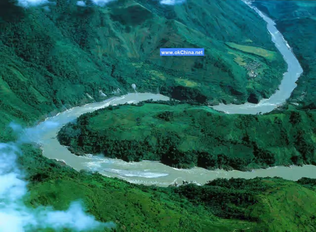
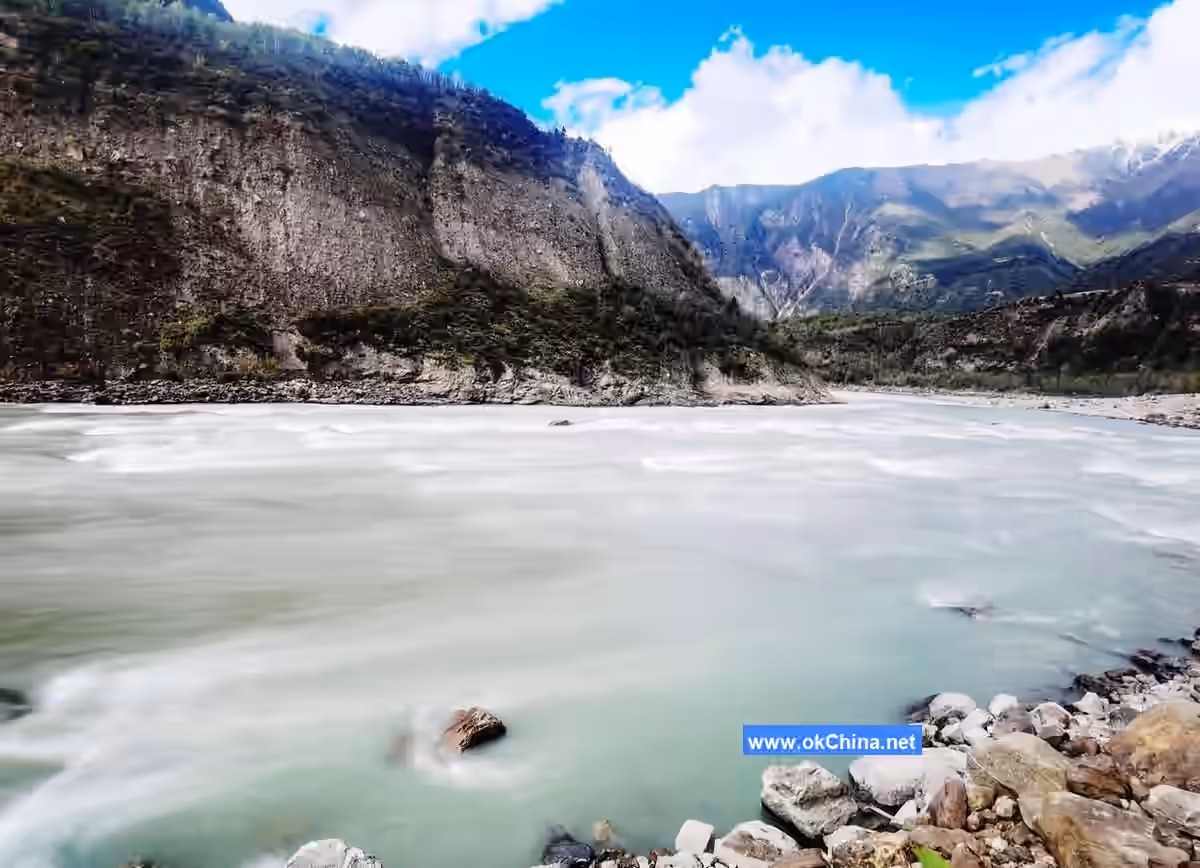
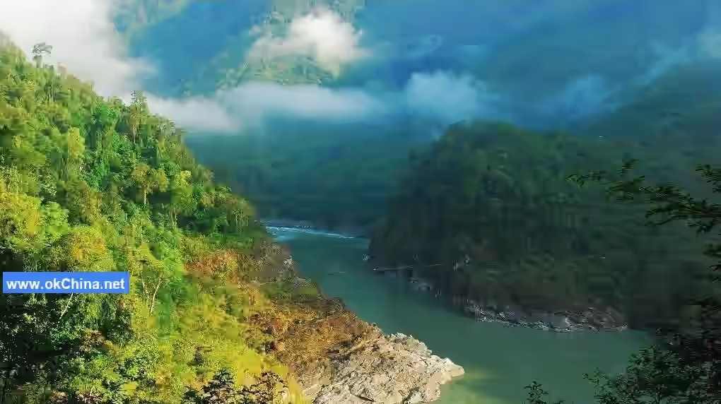
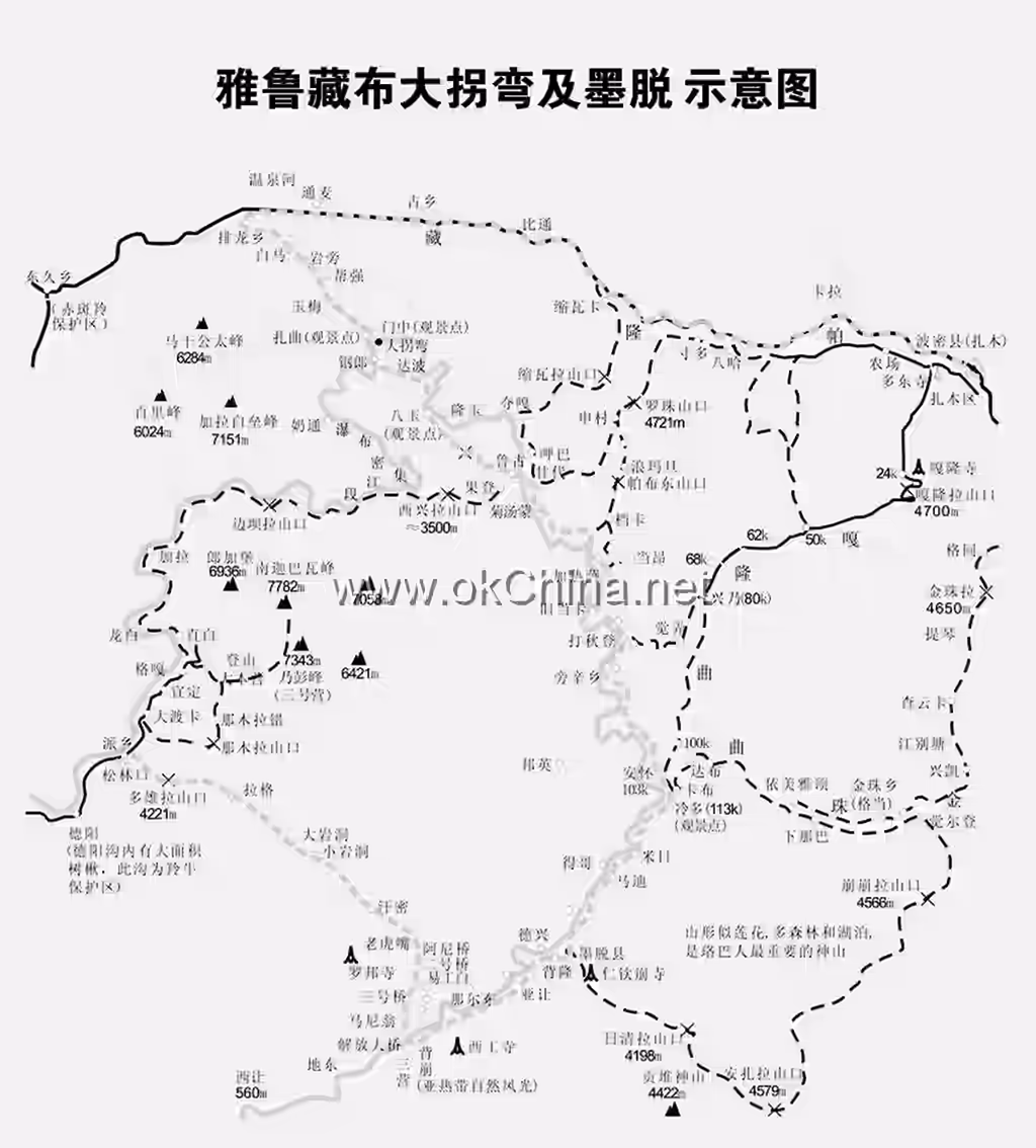
The Yarlung Tsangpo Grand Canyon Scenic Area in Nyingchi City is a horseshoe-shaped great bend formed by the Yarlung Tsangpo River at the foot of Namcha Barwa (elevation 7,782 meters), the highest peak in the eastern Himalayas. Opposite Namcha Barwa to the north is Gyala Peri Peak, with an elevation of 7,257 meters. In the heart of the canyon, between Baima Gouxiong (northeast side of the southern peak) and Zhaqu, there is a series of small right-angled turning gorges, which is the most treacherous section. Here, the riverbed width is less than 100 meters, with local flow velocities reaching up to 16 meters per second. Past Baima Gouxiong, the river channel between Xixingla and the confluence with the Parlung Tsangpo is only over 20 kilometers long, representing the most dangerous stretch of the entire grand canyon. This section has an average riverbed gradient of 9.6%. Within the 2.9-kilometer segment where the Tsangpo Badong waterfall group appears downstream from Xixingla, the riverbed gradient reaches an extreme value of 75.6%. Subsequently, the main channel between Gyala Sha and Damu forms a nearly north-south "bow"-shaped meandering section. From below Damu Township to Xirang (or Xirang) in Beibeng Township, the valley floor riverbed widens to over 150 meters, and the main channel forms an elongated "S"-shaped meandering section within the NE-trending fault zone.
3. World-Class Nine Complete Vertical Natural Belts
As the last secret land on the blue planet, the Yarlung Tsangpo Grand Canyon precisely cuts through the topographic barrier of the Himalayas, becoming the largest moisture channel for the Indian Ocean monsoon to enter the plateau. The exceptionally humid climate has shifted the tropical mountain environment northward by 6 degrees of latitude and nurtured the world's most comprehensive, complete, and richest nine mountain vertical natural belts. From low to high elevation, they are sequentially: Valley Quasi-Tropical Monsoon Rainforest Belt, Mountain Subtropical Evergreen Broadleaf Forest Belt, Mountain Quasi-Subtropical Semi-Evergreen Broadleaf Forest Belt, Mountain Warm Temperate Coniferous and Broadleaf Mixed Forest Belt, Mountain Cold Temperate Dark Coniferous Forest Belt, Subalpine Cold Temperate Shrub Meadow Belt, Alpine Cold Temperate Meadow Belt, Alpine Cold Freeze-thaw Weathering Crust Lichen Belt, and Alpine Ice and Snow Belt. The unique natural conditions and geographical environment together have established the Yarlung Tsangpo Grand Canyon's unparalleled, lofty status as a world-class rare tourism resource.
Correspondingly, this area is also a natural geological museum and a treasure trove of plant and animal genes, gathering 60%-70% of the biological species of the Qinghai-Tibet Plateau. This includes 3,768 species of vascular plants, 512 species of bryophytes, 686 species of macrofungi, 63 species of mammals, 232 species of birds, and 1,500 species of insects. Among them are rare species such as the Phayre's leaf monkey, wild takin, rock lizard, Tibetan eared pheasant, and Tibetan macaque. It is no exaggeration to say that traversing the entire Yarlung Tsangpo Grand Canyon is like passing through all four seasons in a year, or as if experiencing a century.
The nine vertical natural belts formed around Namcha Barwa Peak are an ecological miracle on Earth. The main causes of this great miracle are threefold: First, plate tectonics. The northward drifting Indian plate collided with the Indian landmass at the southwestern margin of the Eurasian continent, and under mutual impact, created the majestic Namcha Barwa Peak and the immense Yarlung Tsangpo Grand Canyon. Second, the deep great bend canyon moisture channel guides the tropical, humid marine air masses that land from the Bay of Bengal in summer northward, allowing the tropical rainforest ecosystem to spread and extend. This enables the tropical rainforest ecosystem, which developed under the humid climate of eastern India, to extend along the lower reaches of the Yarlung Tsangpo River valley all the way to the southern foothills of Namcha Barwa at 29°30′ north latitude, exceeding its normal distribution by 6 latitudinal zones. Third, due to the rapid uplift of the Namcha Barwa mountain area, reaching heights above the snow line, it created an extremely favorable heterogeneous space for the differentiation of biological species, populations, vegetation, and ecosystems. The magical combination of these three elements in the Namcha Barwa Peak region ultimately created this rare and peculiar landscape in the world.
4. Main Attractions
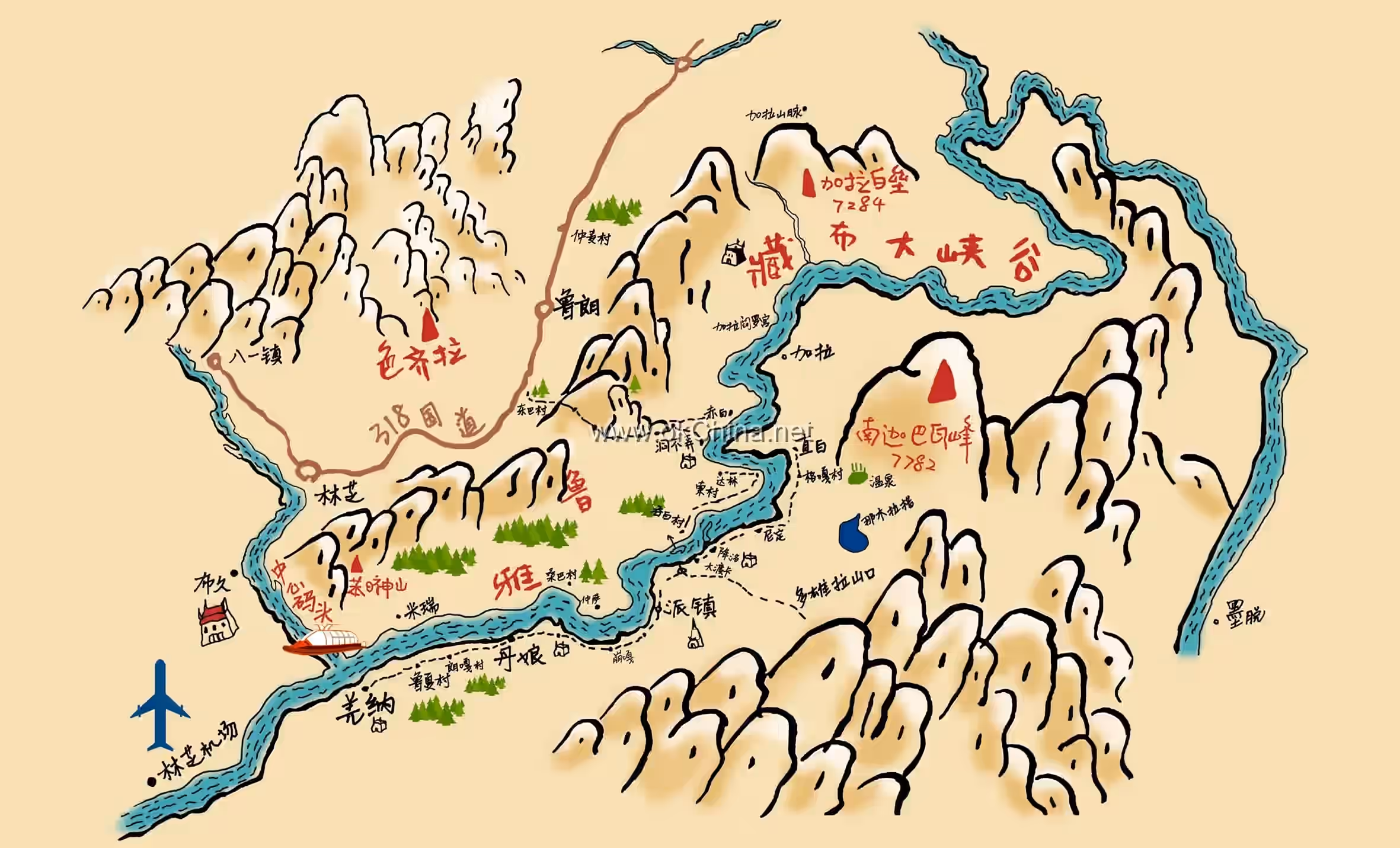
4.1 Namcha Barwa Peak
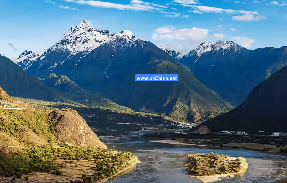
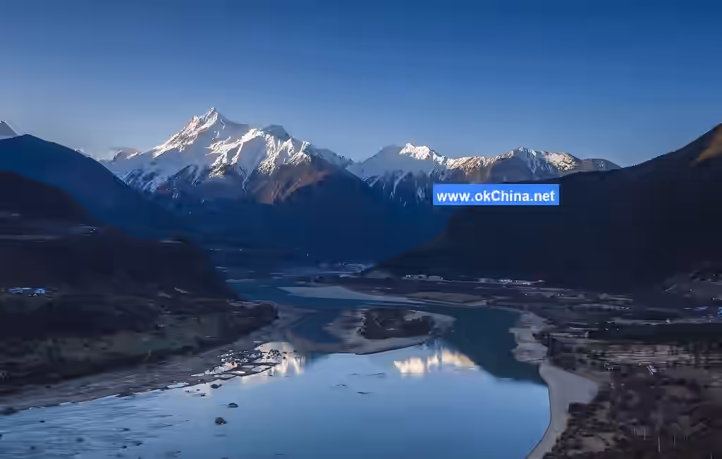
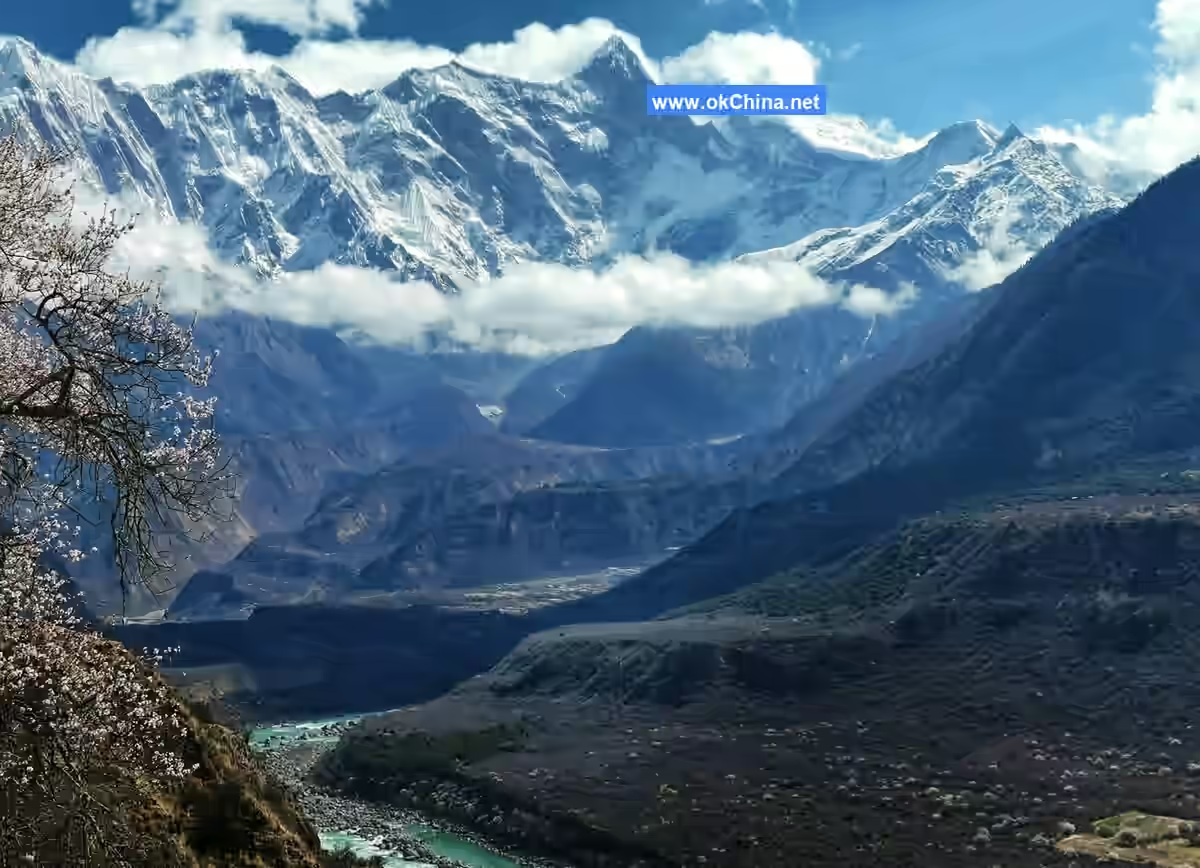
Namcha Barwa Peak, with an elevation of 7,782 meters, is the world's 28th highest peak (independent peak, not a subsidiary peak). It is situated at the easternmost end of the Himalayas, at the convergence of the Nyenchen Tanglha Mountains and the Hengduan Mountains. "Namcha Barwa" has several interpretations in Tibetan: one is "thunder and fire burning," another is "a spear piercing the sky," and yet another is "a stone fallen from the sky." It also has another name, "Muzhuba'er Mountain." The peak's massive triangular body is perpetually snow-capped and shrouded in clouds and mist, rarely revealing its true face, hence it is also called the "Shy Maiden Peak." It is a sacred site of Tibet's most ancient Buddhist religion, "Yungdrung Bon," and is known as the "Father of Tibet's Mountains." Namcha Barwa Peak has a mild climate and abundant precipitation, possessing the world's most complete vertical spectrum of forest vegetation. The area contains dense virgin forests with diverse plant species, including precious vegetation like Dipterocarpaceae, Michelia, and spruce. It is also a habitat for many wild animals, including protected species like the takin and red panda, earning it the title "Gene Bank of Mountain Biological Resources." The area is primarily inhabited by ethnic minorities such as the Lhoba and Monpa, who live by hunting and practice slash-and-burn agriculture.
Namcha Barwa Peak features a northward-dipping short-axis synclinal structure, with the mountain body composed mainly of gneiss. It has three main ridges: the northwest ridge, the northeast ridge, and the south ridge. The northeast ridge winds for about 30 kilometers, reaching directly to the banks of the Yarlung Tsangpo River. Along the ridgeline, six summits over 6,000 meters undulate. Naipeng Peak, located two kilometers along the south ridge, has an elevation of 7,043 meters; the pass between them is called the "South Col." Because its main peak towers into the clouds, perpetually shrouded in mist, it is filled with mystical legends. Local people believe that the gods of heaven often descend upon this mountain to gather and perform incense-burning rituals. The banner clouds formed by high-altitude winds are seen as the smoke from the gods' incense. Since ancient times, this steep peak has attracted immense human reverence and awe. From Naipeng Peak, two herringbone-shaped ridges extend southeast and southwest respectively. The northwest ridgeline prominently features two snow peaks at 6,936 meters and 7,146 meters. The three major slopes of Namcha Barwa Peak are largely carved by ice and snow into steep, weathered cliffs, with the western slope being the most extreme. The slope walls expose bedrock, marked by channels left by avalanches, and the gorges are filled with massive glaciers.
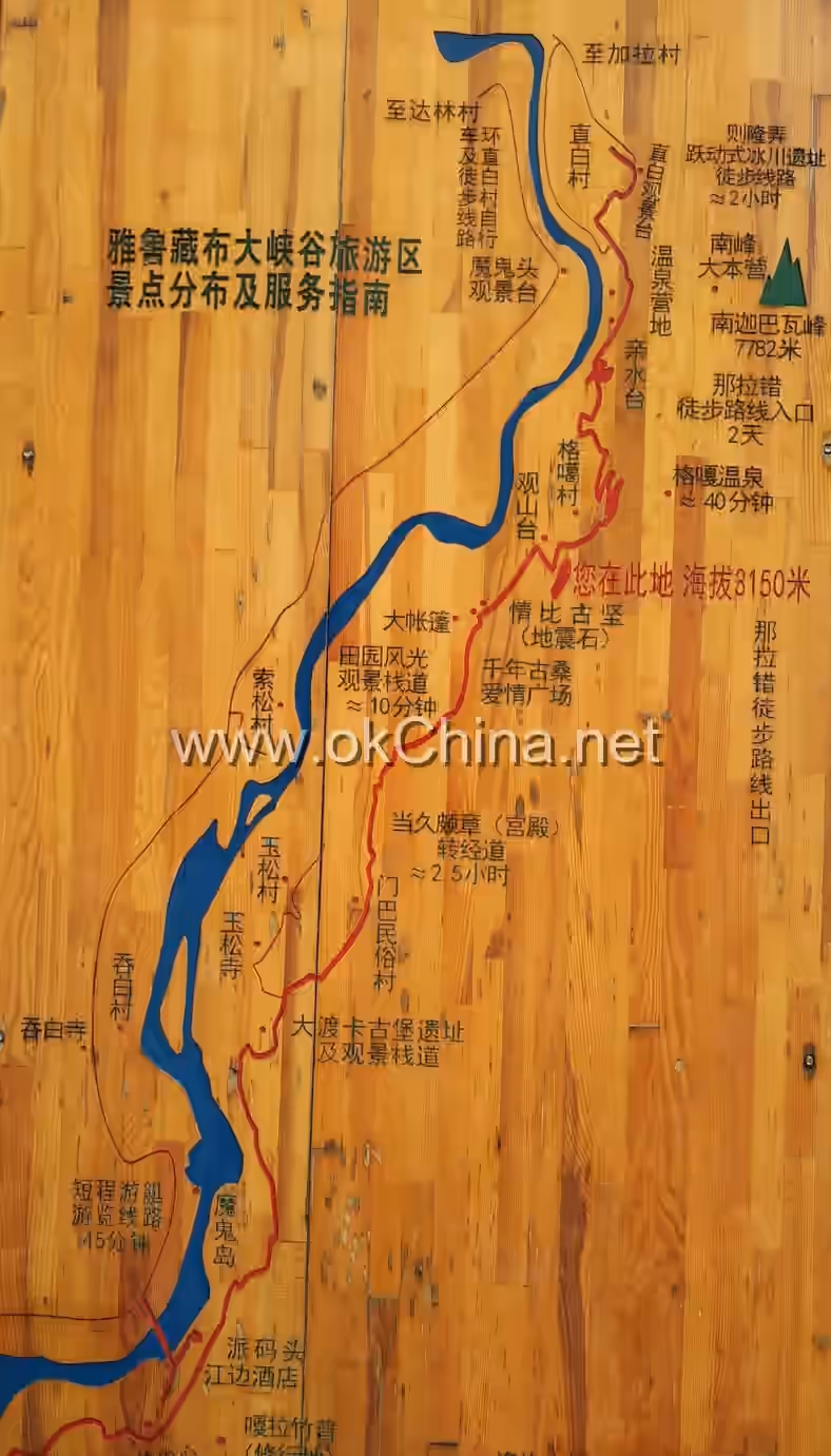
4.2 Suosong Village
Suosong Village is an ecotourism village. In spring, peach blossoms bloom all over the mountainsides, complementing the blue sky, white clouds, and snow-capped mountains to form a breathtaking picture, praised by tourists as a "Shangri-La." The village also features extensive peach groves, making it an ideal location for photographing Namcha Barwa Peak and the peach blossoms. The village is perched on cliffs hundreds of meters high, with the magnificent Yarlung Tsangpo River flowing below.
4.3 Zhibai Village
Zhibai Village is situated at the foot of Namcha Barwa Mountain, facing Suosong Village from a distance. From this village's location, viewing Namcha Barwa Mountain offers an upward-looking perspective, making it one of the preferred spots for photography enthusiasts. Visitors can conveniently reach Zhibai Village by taking the shuttle bus within the Yarlung Tsangpo Grand Canyon Scenic Area in Nyingchi City. This village marks the deepest point accessible by vehicle within the scenic area. Although the village is small, comprising only over twenty households, it provides an excellent vantage point for viewing the snow-capped peak of Namcha Barwa. Additionally, some villagers operate Tibetan-style guesthouses, offering accommodation services for tourists.
4.4 Daduka Ruins
Legendary as the castle of the Gongbo King, it is also a landmark at the entrance of the Yarlung Tsangpo Grand Canyon in Nyingchi City. It offers superb views overlooking the wide river surface at the canyon's entrance section, known as the "Magic Lake," the Devil's Island in the river's center, Tunbai Temple on the opposite bank, and the canyon scenery. "Daduka" in Tibetan means "horse grazing place," as it was formerly where villagers grazed their horses. The Daduka Ruins are the site of the former garden castle of the local Gongbo chieftain. It was later destroyed by cannon fire during wars with Pome, dating back about 500 years.### 4.5 The Millennial Mulberry Tree Within the Yarlung Zangbo Grand Canyon stands a great mulberry tree, over 1,600 years old, 7.4 meters tall, and with a circumference of 13 meters. This ancient tree is lush with foliage and blooms every year but bears no fruit. Locals call it "Bu'ou Sexin," meaning "Male Mulberry Tree," and regard it as a mascot. Legend has it that it was personally planted by Songtsen Gampo and Princess Wencheng. The area has been designed as a square, where large expanses of white gravel reflect a sacred halo of light under the clear plateau sun, intermingling with the khata scarves offered by visitors to the great mulberry tree. This imbues the scene with a sense of pilgrimage.
4.6 Namcha Barwa Viewing Platform
The Namcha Barwa Viewing Platform is located on a seemingly suspended mountainside terrace between Yidain Village and Gegar Village within the Grand Canyon. This is the optimal spot for viewing the peaks of Namcha Barwa and the turbulent rapids of the Yarlung Zangbo Grand Canyon. Looking out in all directions from this viewing platform offers a complete 360-degree panoramic view of the entrance section of the Grand Canyon.
4.7 Love Stronger Than Stone
"Love Stronger Than Stone" is a famous love-themed attraction within the Yarlung Zangbo Grand Canyon scenic area in Nyingchi City. A peach tree, symbolizing unwavering love until death, grows tenaciously from a crevice in a massive boulder. In spring, it blooms profusely with beautiful peach blossoms. Following Tibetan custom, walking three circles around this tree while holding a khata scarf, bathed in the cool autumn breeze of the canyon, is believed to ensure a happy and fulfilling love life.
4.8 Yusong Village
The village is located close to the riverbank and consists of several dozen households. It is a semi-agricultural, semi-pastoral Tibetan village. Yusong Village is known for the famous attraction, the Buddha's Palm Sand Dune. This enormous, desert-like sand dune lies isolated by the riverside, unique to this location. Situated in the strong wind corridor of the middle and lower reaches of the Yarlung Zangbo River, fierce hurricane-like winds blow from late autumn to late spring. The river sand exposed on the riverbed during the dry season is transported and accumulated year after year by these winds, forming the Buddha's Palm Sand Dune.
5. Cultural Background
5.1 Exploration History
In 1991 and 1993, the China Association for Scientific Expedition conducted exploratory investigations of the Yarlung Zangbo Grand Canyon. In 1994, Liu Dongsheng and others demonstrated and confirmed that the Yarlung Zangbo Grand Canyon is the world's largest canyon, with a total length of 496.3 kilometers and a maximum depth of 5,382 meters. According to data released by the National Administration of Surveying, Mapping and Geoinformation: This grand canyon starts from Daduka Village in Pai Town, Mainling County (elevation 2,880 meters) in the north, and extends to Baxika Village in Medog County (elevation 115 meters, located in the southern Tibet region near India's Assam) in the south. (Passing through the Great Bend of the Yarlung Zangbo River at Pailong Township). With a total length of 504.6 kilometers, a maximum depth of 6,009 meters, and an average depth of 2,268 meters, it is indisputably the world's largest canyon. Xinhua News Agency promptly reported this news to the world, causing a global sensation. In September 1998, the State Council of the People's Republic of China officially approved the scientific formal name of the canyon as "Yarlung Zangbo Daxiagu" (雅鲁藏布大峡谷), with the English spelling as Yarlung Zangbo Daxiagu. From late October to early December 1998, an expedition team trekked through the Grand Canyon, conducted further measurements, and reaffirmed its status as the world's largest canyon.
5.2 Naming
The Yarlung Zangbo Grand Canyon is traversed by the Yarlung Zangbo River. In ancient Tibetan texts, the Yarlung Zangbo River was called Yangqab Zangbo, meaning "water flowing from the highest peak." It has three source tributaries: the northern branch originates from the Gangdise Mountains and is called Mayong Zangbo; the middle branch is called Qiemayongdong and, due to its consistently large water volume, is considered the main source of the Yarlung Zangbo River; the southern branch originates from the Himalayas and is called Kubi Zangbo, which carries a larger volume during summer. After the confluence of these three tributaries, the section up to Lhaze is collectively called the Maquan River. However, in the Zhatong area, it is also called Dabra Zangbo, meaning "horse river" in Tibetan, or Mazang Zangbo, meaning "mother river" in Tibetan. In the Lhaze area, it is called Yangqoi Zangbo. West of Lhaze, the river is collectively called Dazhokab, meaning "water flowing from the mouth of a good horse" in Tibetan. In the Qushui area, it is called Yarlung in Tibetan. As the river flows to the Shannan area, it is called Yarlung (named after the Yarlung Chu in Shannan). Therefore, the river came to be called Yarlung Zangbo. However, in the Qushui area, it is pronounced as "Yarlu." Because the precise Tibetan phonetic for "Lu" is "Lung," meaning the river flowing through the valley plains above Qushui, the entire river is collectively named the Yarlung Zangbo River.
Comments
Post a Comment