185th Regiment White Sand Lake Scenic Area (Altay Prefecture)
I. Introduction
The 10th Division White Sand Lake Scenic Area, abbreviated as White Sand Lake Scenic Area, is a tourist attraction located in Habahe County, Altay Prefecture, Xinjiang Uygur Autonomous Region. White Sand Lake is approximately 800 meters long from north to south and 600 meters wide from east to west, shaped like a pea pod, concave on the east side and bulging on the west side. White Sand Lake is a small desert lake surrounded by sand dunes, with tall and dense mixed forest belts and thick reeds growing in the lake center, along the lakeshore, and around the lake. The White Sand Lake Scenic Area is rich in wetland plant and wildlife species. The scenic spots include natural and cultural attractions such as White Sand Lake, Singing Sand Mountain, Eye Mountain, the 185th Regiment Flood Control and Land Defense Monument, and the Northwest Border First Company. In 2015, White Sand Lake Scenic Area was selected as one of the first batch of "China Self-Driving Tour Campsites." In January 2017, it was rated as a "National Red Tourism Classic Scenic Area" and a "National Research and Practice Education Base for Primary and Secondary School Students." In the same year, it successfully advanced to become a National AAAAA-level Tourist Attraction.
II. Location and Layout
10th Division White Sand Lake Scenic Area
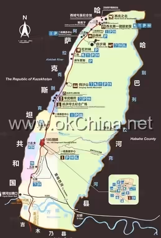
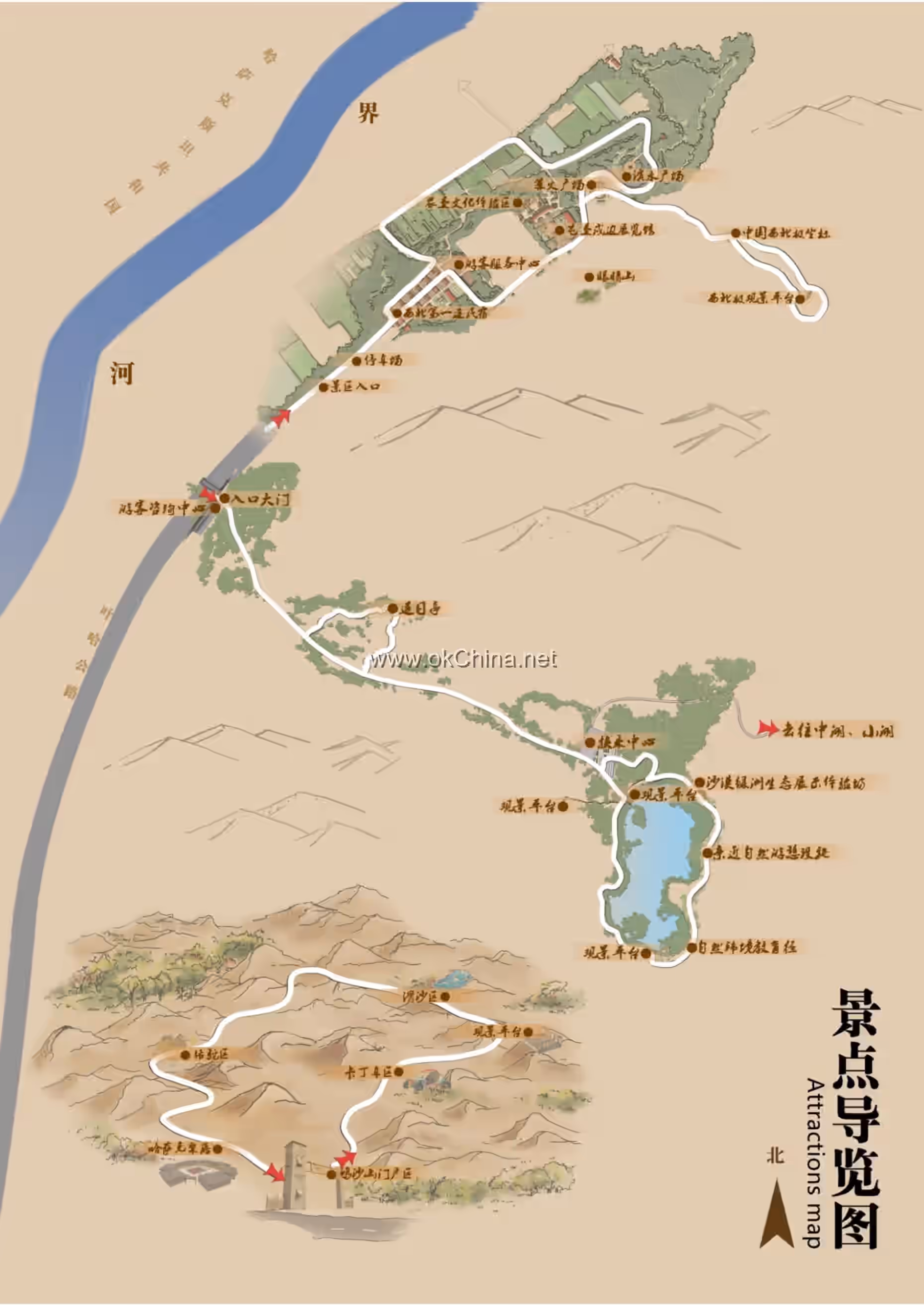
Located in Habahe County, Altay Prefecture, Xinjiang Uygur Autonomous Region, it consists of attractions such as White Sand Lake, Singing Sand Mountain, and the Northwest First Company.
Climate
The White Sand Lake Scenic Area has a temperate continental climate, characterized by windy and snowy winters, hot and high-temperature summers, and indistinct boundaries between spring and autumn. The local average annual temperature is 4°C, with an extreme maximum temperature of 39.4°C (July 11, 1974) and an extreme minimum temperature of -50.1°C (January 27, 1969). The average annual precipitation is 178.2 mm. Prevailing winds are from the east and west, with an average of 42 days per year of wind force level 8 or above. The average annual wind speed is 3.9 m/s, with a maximum wind speed of 4.5 m/s.
Topography and Landforms
The White Sand Lake Scenic Area is dominated by sandy landforms, with sandy land covering an area of approximately 124 square kilometers. According to the land desertification classification system, it is divided into three types: naturally fixed sandy land, naturally semi-fixed sandy land, and mobile sandy land.
Hydrology
The water area of the 10th Division White Sand Lake Scenic Area is 0.5 square kilometers, with an elevation of about 650 meters. White Sand Lake is approximately 800 meters long from north to south and 600 meters wide from east to west, shaped like a pea pod, concave on the east side and bulging on the west side.
Biodiversity
Plants
The 10th Division White Sand Lake Scenic Area is rich in wetland plant species, including reeds, Achnatherum splendens, Typha angustata, Calamagrostis epigeios, Cyperus serotinus, Scirpus strobilinus, Scirpus setaceus, Schoenoplectus tabernaemontani, and Carex arenaria, among others.
Animals
The wildlife in the 10th Division White Sand Lake Scenic Area includes reptiles, mammals, birds, and fish, with species such as sand lizards, racerunners, and agamids being predominant.
III. Key Scenic Areas
White Sand Lake
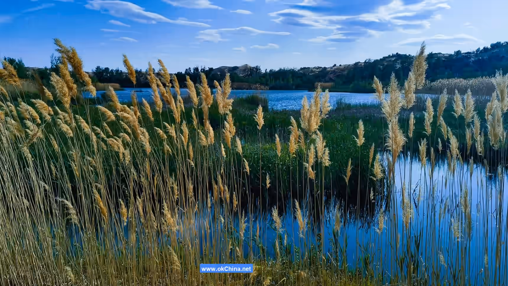
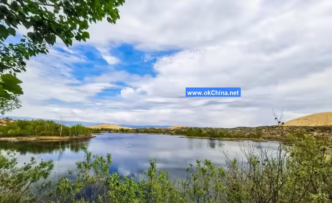
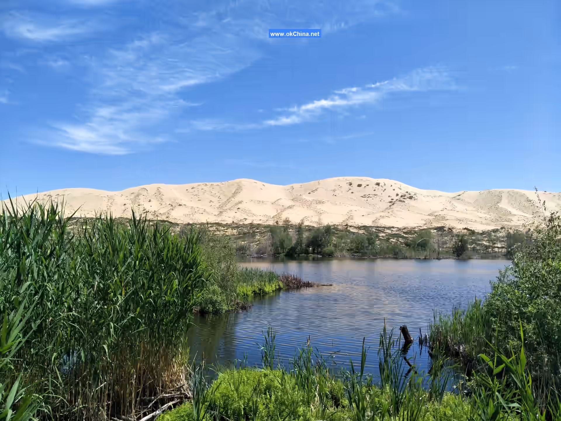
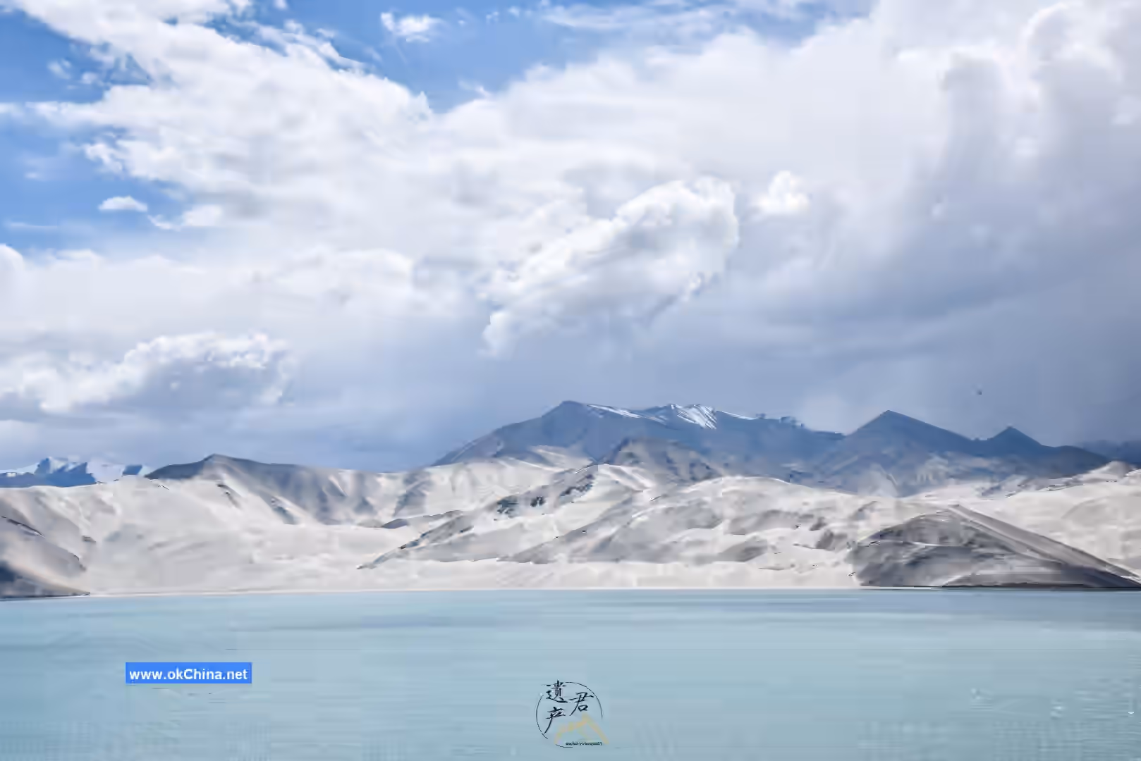
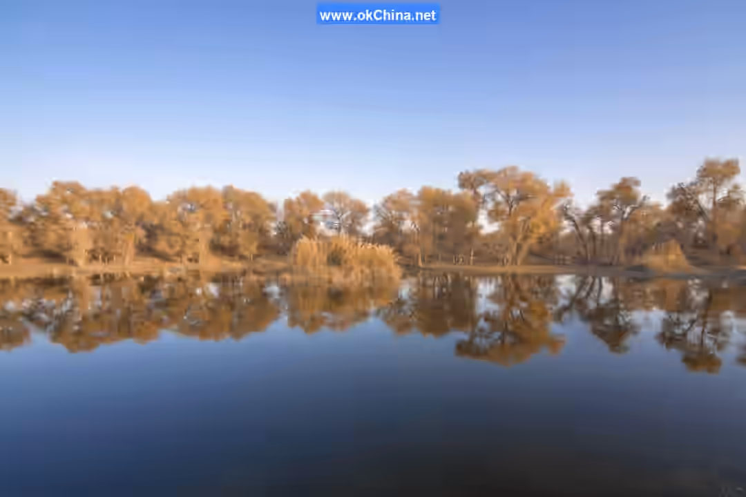
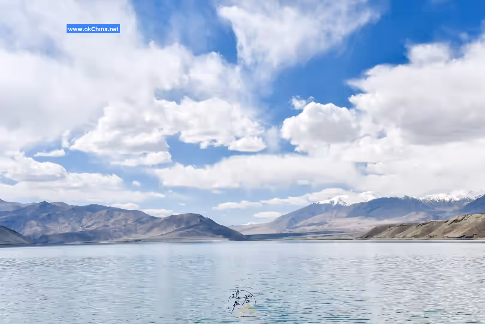
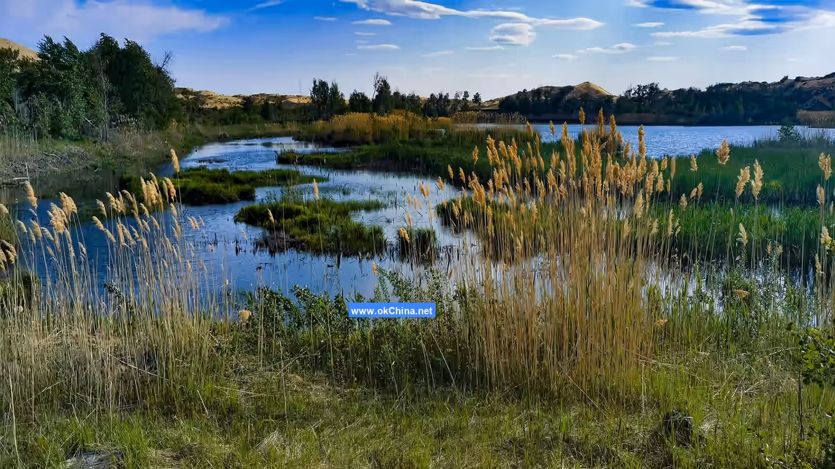
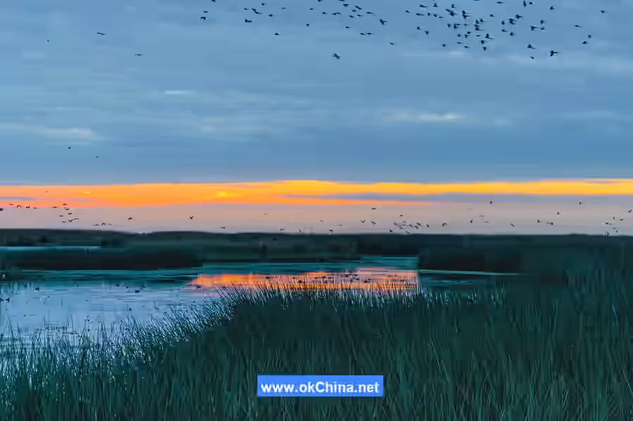
White Sand Lake is surrounded by sand on all sides and is named "White Sand Lake" because the sand grains on the lakeside dunes are yellow and whitish. It is known as the "Desert Holy Spring" and is a freshwater lake located north of China's second-largest desert, the Gurbantünggüt Desert. It is situated within the 185th Regiment of Habahe County, 100 kilometers from Habahe County town, 260 kilometers from Altay Airport, 150 kilometers from Kanas Airport, 260 kilometers from Beitun Railway Station, and 770 kilometers from Urumqi, the capital of Xinjiang. The White Sand Lake Scenic Area is located within the Third Company in the northeastern part of the 185th Regiment, approximately 2.5 kilometers northwest of the China-Kazakhstan border, accessible by road. At an elevation of about 650 meters, it is approximately 2100 meters long from north to south and 1300 meters wide from east to west, with a water surface of about 10 hectares. It is a small desert lake surrounded by sand dunes, with tall and dense mixed forest belts and thick reeds growing in the lake center, along the lakeshore, and around the lake. It has no inlet or outlet, lying quietly in the vast desert as an original ecological desert lake. The lake area is surrounded by white sand mountains, with birch trees, gray poplars, and silver-gray poplars growing along the lakeshore. White Sand Lake is shaped like a pea pod. During the day, the white sand reflects on the lake surface like a silver jade plate sprinkled by celestial beings; at night, a gentle breeze blows, and the birch and maple trees by the lake reflect playfully...
White Sand Lake is known as a "desert wonder." Regardless of the season, the lake water neither increases nor decreases, neither freezes nor becomes turbid. Where does this water come from, and why can it maintain its state year-round? This is a question that lingers in people's minds, and there is no clear answer yet, but this is also an important reason why White Sand Lake is so captivating.
The scenic area is perfectly combined, and the scenery of White Sand Lake is uniquely composed. In June, lotus flowers bloom in the lake, and wild ducks swim among them. In September, the autumn wind dyes the leaves around the lake in vibrant colors—some red like flames, others yellow like gold coins. The reeds in the lake sway with the wind, and the delicate water lilies on the shore open their arms, awakening from their drowsy sleep to show their bright smiles to visitors.
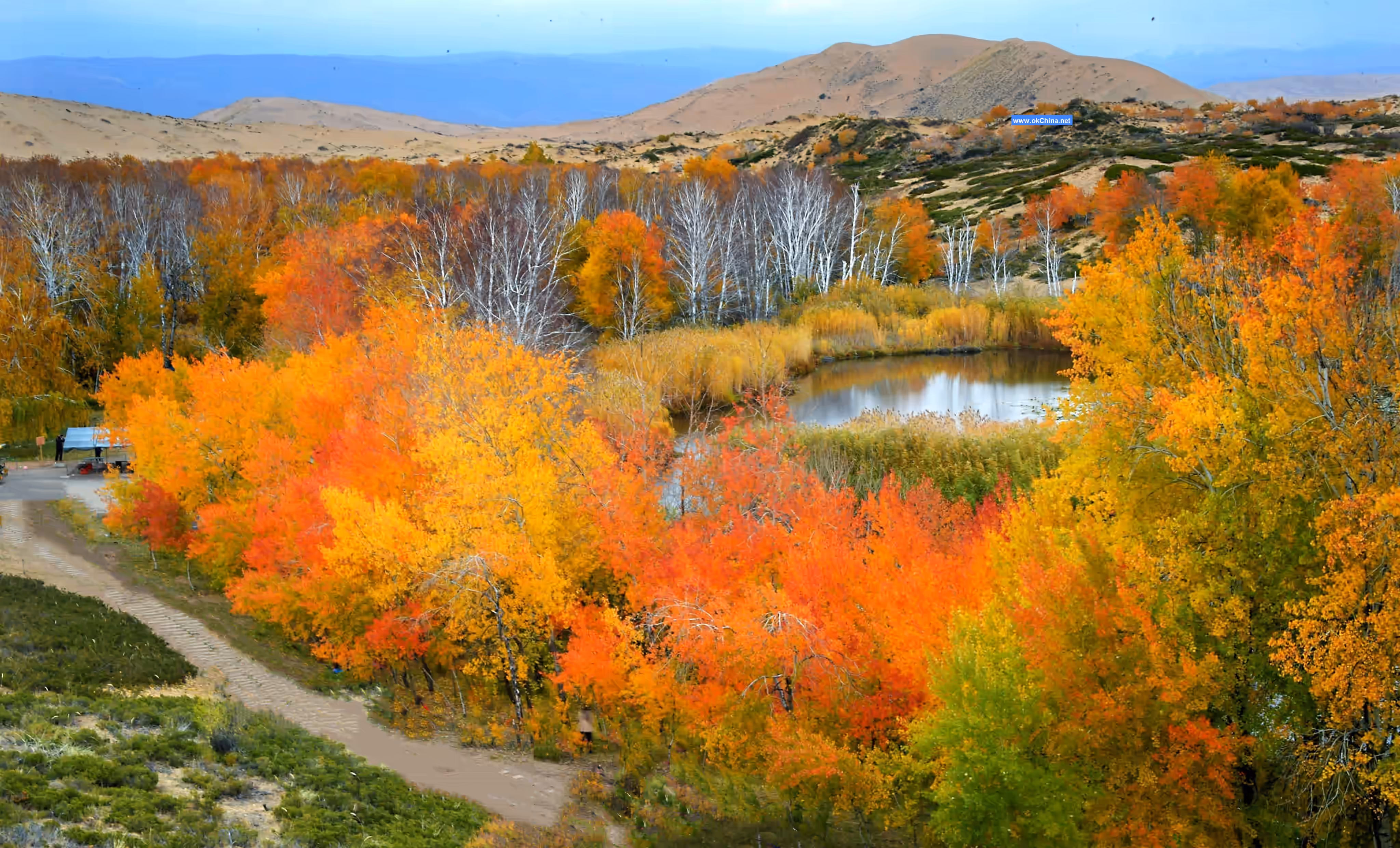
In the golden autumn of October, red and yellow leaves flutter in the wind. The green lake water is as smooth as a mirror, with the lake and mountains reflecting each other. Whether viewed from afar or up close, the scenery is ever-changing. The sandy land emits the fragrance of soil under the sunlight, intoxicating the senses. The distant golden Singing Sand Mountain is reflected in the emerald green lake water, and the mixed forests along the lakeshore layer upon layer, complementing each other, like a perfect natural bonsai displayed before visitors.
Distant view of White Sand Lake—blue sky and white clouds set off the undulating chain of sand dunes; middle view—the emerald water reflects the winding white sand ridges and the tapestry of red, yellow, and green trees, with reeds of high, medium, and low levels outlining the curved and beautiful water surface; close view—the vigorous poplar trunks and birch branches tinged with yellow and red. White Sand Lake is not so much a masterpiece of nature as a desert bonsai created by a top artist with inspiration and passion, exquisite and flawless. It is known as the "Little Jiangnan of the North." It is one of the important scenic areas on the thousand-mile gallery of Altay Prefecture, Xinjiang.
In 2016, on the National Tourism Administration's "Red and Black List" for the National Day holiday tourism, White Sand Lake Scenic Area was listed on the red list, praised as the "Best Scenic Area for Toilet Revolution."
Singing Sand Mountain
Singing Sand Mountain is adjacent to White Sand Lake, about 95 kilometers from Habahe County town, with a relative height of about 25 meters. It consists of six sand ridges, about 2 kilometers long and 100–200 meters wide. The temperature on Singing Sand Mountain is relatively high in summer, reaching around 40–60°C at noon. The main activities at Singing Sand Mountain are sand climbing and sand sliding. Visitors can choose to climb the windward slope or the sand ridge line, as these parts have gentle slopes and compact sand grains, making climbing easier. Lying quietly at the mountaintop, one can look west to enjoy the farm scenery of East Kazakhstan Region's Markakol County in Kazakhstan or listen carefully to the singing sound of sand grains blown by the wind. When sliding down the sand, no tools are needed; one can slide down the sand dune alone.
Once immersed in it, you will discover the uniqueness of Singing Sand Mountain. A gentle breeze causes the sand to flow like water. Carried by the wind, it emits a deep and resonant sound, hence people vividly named it Singing Sand Mountain. Singing Sand Mountain is called a mountain, but it is essentially a large pile of sand. However, its charm lies in the sound the sand makes. The sand accumulated here has endured countless winds and rains, neither spreading around nor being swallowed by green vegetation. Instead, after being stepped on and slid down by climbers, it slowly retracts, which is truly rare! Visitors who have been here feel that Singing Sand Mountain is a mountain that sings and plays music. Although the reason for its sound has not been confirmed, the roaring sound of Singing Sand Mountain is indisputable. Many tourists who have visited Dunhuang's Singing Sand Mountain report that the sound here is far greater than that of Dunhuang's Singing Sand Mountain. The scenic area is close to the China-Kazakhstan border river, combining natural and cultural tourism resources with unique landscape value, gathering desert oasis, military reclamation culture, border scenery, desert sports, and other tourism resources. With the upcoming opening of the Aheituobieke Port, the scenic area will have great development value and potential.
At the same time, standing on the top of Singing Sand Mountain, everyone can also overlook the foreign scenery of Kazakhstan opposite. Perhaps precisely because of these functions and its unique ecological environment, in recent years, during the summer and autumn seasons, tourists from various places come in groups to visit Singing Sand Mountain. When people see the sand mountain shining like gold and soft as silk, some immediately take off their jackets, and some even discard their shoes and socks, climbing barefoot up the soft sand dunes from bottom to top, sometimes using both hands and feet. Even if they become breathless and sweaty, they want to personally experience the pleasure of climbing the sand mountain. Later, during free time, interested friends can also go and experience it.
Eye Mountain
Eye Mountain is located on the tall sand mountain east of the First Company of the 185th Regiment, about 35 kilometers from the regiment headquarters. On Eye Mountain, there are several drought-resistant and cold-tolerant creeping pines that twist and grow toward the ground, resembling the eyes of border guards. It is said that during the tense Sino-Soviet relations, these vigilant eyes were wide open. Now, with the easing of Sino-Kazakh relations, one of the eyes has gradually become a solid circle as the creeping pine grew, and people call it "turning a blind eye." Below Eye Mountain is the First Company of the 185th Regiment, known as the "Northwest First Company," a patriotic education base.
185th Regiment MonumentThe 185th Regiment of the 10th Division of the Xinjiang Production and Construction Corps is located in the northwestern border of the motherland, at the China-Kazakhstan border on the southwestern end of the Altai Mountains, and at the exit point of the Irtysh River flowing into the Arctic Ocean. To the northwest, it borders the Republic of Kazakhstan along the Alakbek River; to the east, it borders Hababe County along the Bielezeke River; and to the south, it neighbors Jeminay County across the Irtysh River. The regiment covers a total area of 907.95 square kilometers, with a border line stretching 86 kilometers. Situated at the northwesternmost point of the motherland’s territory, it is hailed as the "First Regiment of the Northwestern Border." The regiment’s 23 grassroots units are arranged in a straight line from north to south along the China-Kazakhstan border river, the Alakbek River, standing like border guards steadfastly defending the northwestern frontier of the motherland. As the local folk song goes: "My home lies at the road’s end, the boundary marker stands behind my house; we farm by the border river and herd cattle and sheep along the frontier line." This not only expresses the immense pride of the 185th Regiment’s people in their glorious mission of reclaiming and guarding the border but also reflects the true portrayal of their work and life.
The 185th Regiment’s Monument to Flood Fighting and Land Defense is one of the attractions in the Baisha Lake scenic area. On April 23, 1988, a catastrophic snowmelt flood erupted in the Alakbek River, the border river between China and the Soviet Union. The roaring flood breached the Sandeke Longkou embankment, submerging vast areas of houses, pastures, and fertile farmland. According to international practice at the time, the river’s course determined the national boundary. Areas submerged by the river could potentially become Soviet territory. To defend the land, the entire 185th Regiment, border troops, and local residents joined forces in the flood-fighting efforts. After 16 days and nights of relentless struggle, they finally sealed the breach, not losing a single inch of territory. Today, in the 185th Regiment’s history museum located in the First Company, photos of some of the heroes who fought the flood and defended the land are still displayed.
IV. Cultural Resources
The First Company of the Northwest
The First Company of the Northwest is an agricultural company of the 185th Regiment, 10th Agricultural Division of the Xinjiang Production and Construction Corps, stationed at the westernmost point of the motherland. It is located 35 kilometers from the regiment headquarters, adjacent to the China-Kazakhstan border. The residential area of the company is less than 1,300 meters from the border line, and its farmland is less than 20 meters away. Due to its geographical location, it is known as the "First Company of the Northwestern Border."
This special geographical location is guarded by a special group of military reclamation personnel. It is not only a patriotic education base for the Corps’ mission of reclaiming and guarding the border but has also been named a National Advanced Civilized Village and Town by the Central Civilization Commission. Key sites such as the First Household of the Northwest, the Old Residence of Military Reclamation Personnel, the First Well of Military Reclamation, the Regiment History Museum, the site where Shen Guishou raised the national flag, and the incident of the former Soviet helicopter landing serve as living teaching materials for patriotic education on reclaiming and guarding the border. Being there evokes deep emotions, offers profound education and enlightenment, and inspires admiration not only for the entrepreneurial spirit of the Corps personnel—their love for the motherland, hard work, selfless dedication, and pioneering spirit—but especially for the 185th Regiment’s people, who stand firm at the border, strive tirelessly, work unitedly and pragmatically, and dare to excel. For them, farming is standing guard, and herding is patrolling. Two generations of military reclamation personnel have devoted their youth, their lives, and even their descendants, silently and without regret, faithfully fulfilling the sacred mission of reclaiming and guarding the border.
This area is covered by 70–80 centimeters of snow for half of the year and is also one of the world’s four major mosquito zones, alongside regions like the Amazon Basin in South America. In the early 1960s, when tensions were high along the Sino-Soviet border, five military reclamation soldiers arrived here and established the First Company. For decades, they have guarded the forefront of the 320-kilometer border line, cultivating "political fields" and herding "political livestock" in harsh natural conditions, forming an indestructible living boundary marker along the border.
During an inspection, a former State Council leader emotionally remarked, "It’s not about how much grain they contribute to the country or how much profit they create. Simply living here makes them the greatest citizens of the republic."
Agricultural Development
The 185th Regiment integrates tourism with agriculture, planting crops such as rapeseed, quinoa, and sunflowers along the roads leading to scenic areas. These crops have both观光 value and economic benefits. At the same time, the Corps encourages residents to grow local specialty, pollution-free green agricultural products such as oil sunflowers and hull-less pumpkin seeds, which are provided to tourists visiting the scenic areas.
Honors and Awards
- In 2012, the Baisha Lake Scenic Area of the 10th Division was rated as a National AAA Tourist Attraction.
- In 2015, the Baisha Lake Scenic Area of the 10th Division was selected as one of the first "China Self-Driving Tour Campsites."
- In 2016, the Baisha Lake Scenic Area of the 10th Division was listed on the "National Day Holiday Tourism Red List." In the same year, it was included in the national "Scenic Area Leading Village" tourism poverty alleviation demonstration project list.
- In January 2017, the Baisha Lake Scenic Area of the 10th Division was recognized as a "National Red Tourism Classic Scenic Area" and a "National Primary and Secondary School Student Research and Practice Education Base." In the same year, it successfully advanced to become a National AAAAA Tourist Attraction.
- In 2019, the Baisha Lake Scenic Area of the 10th Division was designated as a National All-for-One Tourism Demonstration Zone.
Comments
Post a Comment