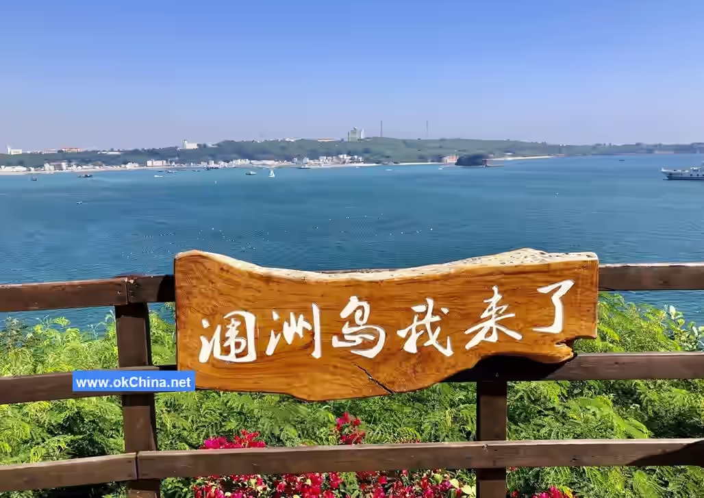
Weizhou Island
1. Introduction
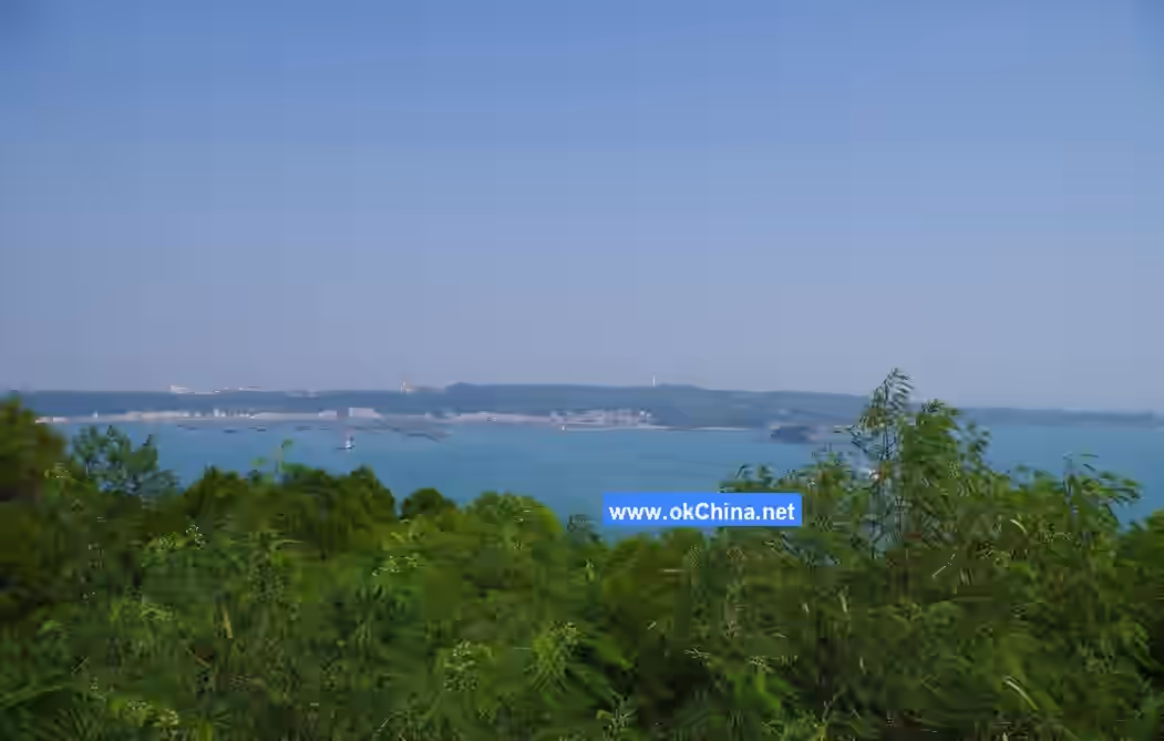
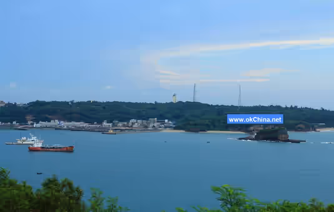
Weizhou Island is located in the central part of the Beibu Gulf in the waters off Beihai City, Guangxi Zhuang Autonomous Region. It borders Beihai City, Guangxi to the north, overlooks the Leizhou Peninsula of Zhanjiang City to the east, is adjacent to Xieyang Island to the southeast, faces Hainan Island across the sea to the south, and looks towards Vietnam to the west.
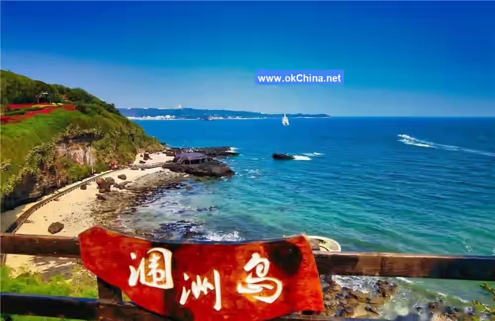
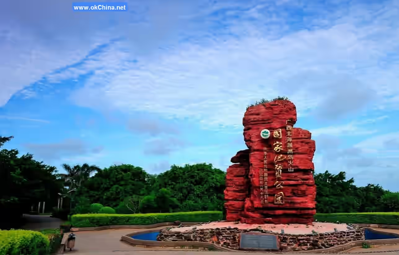
Weizhou Island is 6.5 kilometers long from north to south and 6 kilometers wide from east to west, with a total area of 24.74 square kilometers. The highest point on the island is 79 meters above sea level. Formed by volcanic eruptions and accumulation, over 95% of its strata consist of volcanic rock. It features landscapes such as sea erosion, sea accumulation, and lava formations, earning it the nickname "Penglai Island." It is China's youngest volcanic island in terms of geological age and the largest island in Guangxi.
The total population within Weizhou Island's jurisdiction is 15,000, with over 85% being Hakka people, known for their hospitality, diligence, and simplicity. The main cultural attractions include Sanpo Temple, Catholic Church, Crocodile Mountain Scenic Area, Dripping Water Danping Scenic Area, Shiluo Kou Scenic Area, Catholic Church Scenic Area, and Five-Color Beach Scenic Area.
2. Geographical Environment
2.1 Location and Territory
Weizhou Island is located in the central part of the Beibu Gulf, bordering Beihai City, Guangxi to the north, overlooking the Leizhou Peninsula to the east, adjacent to Xieyang Island to the southeast, facing Hainan Island across the sea to the south, and looking towards Vietnam to the west. Its latitude and longitude range is 20°54'–21°10'N, 109°00'–109°15'E, with a total area of 24.74 square kilometers.
2.2 Geology and Geomorphology
Weizhou Island is situated on the continental shelf off the coast of Guangxi. Over 300 million years ago, it was a vast ocean. After 285 million years, it remained in a terrestrial state. Until the early Tertiary period 50 million years ago, the area was still in a dry and hot continental climate. Around 25 million years ago, the Beibu Gulf region began to subside on a large scale, forming a shallow continental shelf. By 3 million years ago, the seawater in the northern Beibu Gulf gradually receded, and until 900,000 years ago, Weizhou Island became land again, experiencing weathering and erosion. The climate remained warm and humid, with occasional droughts. In the early Middle Pleistocene, after 900,000 years, Weizhou Island was once again below sea level. It was not until the late Late Pleistocene, 230,000 years ago, that Weizhou Island fully rose above sea level, taking on its present appearance. Between 2.5 million years ago and 7,000 years ago, the Weizhou area experienced at least four phases of hundreds of mafic volcanic eruptions, forming the main body of the island's strata. During this period, Weizhou Island experienced numerous marine storms, earthquakes, and resulting tsunamis, along with the usual interaction between seawater and the coast, forming the rich and diverse sea erosion, sea accumulation, and beach landforms seen on Weizhou Island today.
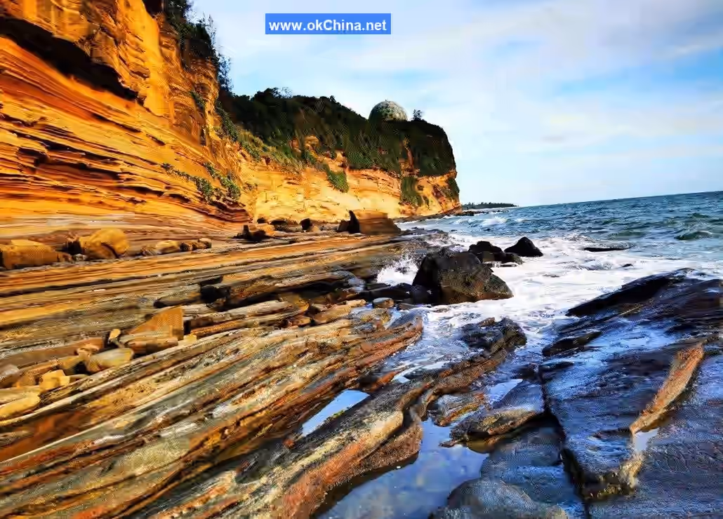
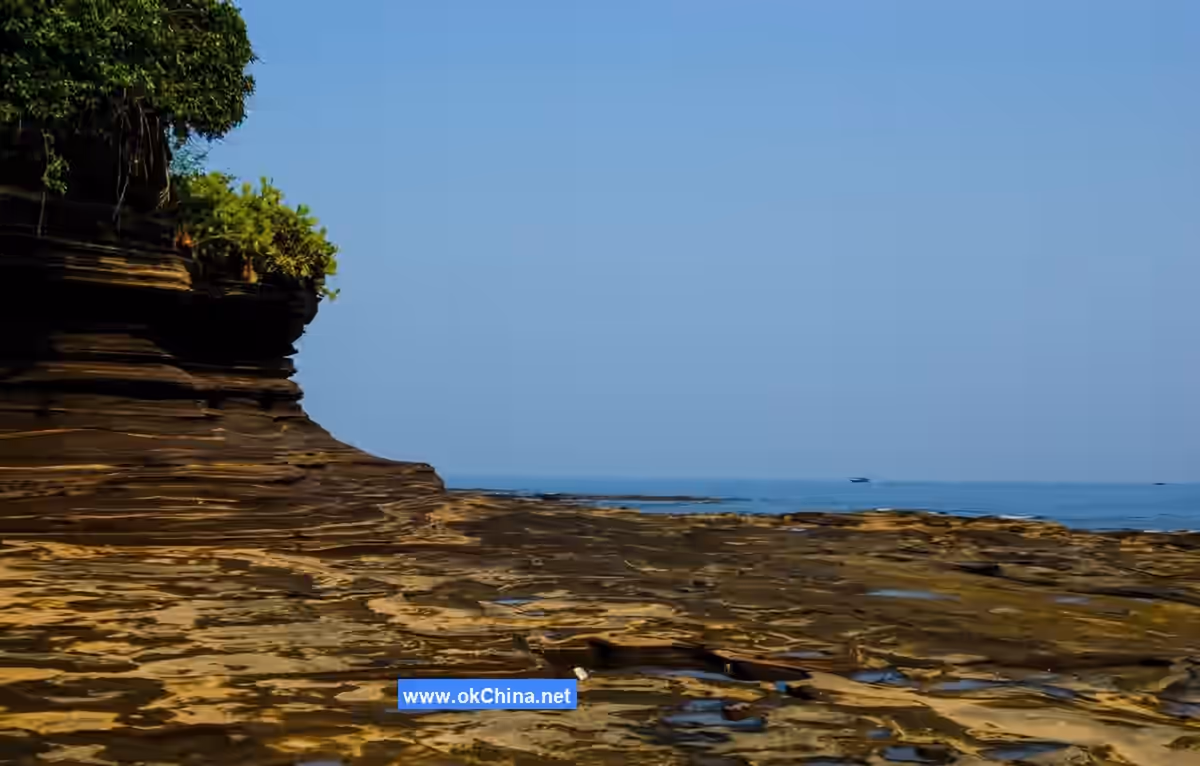
Over 95% of Weizhou Island's strata are composed of volcanic rock. The island has many remnants of volcanic eruptions: Nanwan Crater, Henglu Mountain Crater, Crocodile Mountain Crater, Xieyang Island Village Crater, and Xieyang Island Powan Crater. Under the erosion of waves, ocean currents, and tides, the coastal bedrock of Weizhou Island exhibits landforms such as sea caves, sea gullies, sea niches, sea cliffs, sea stacks, sea platforms, sea windows, and sea mushrooms.
Weizhou Island is approximately circular in shape, about 6 kilometers wide from east to west and 6.5 kilometers long from north to south. Geologically, Weizhou Island is a basalt platform with a gently undulating surface covered by a thick layer of purplish-red basalt weathering products. The island's terrain is higher in the south and lower in the north. The highest points are in the eastern and western Gongshou areas in the south, with altitudes around 75 meters. It gradually slopes northward, dropping to about 20 meters in the Beigang Village area in the north, then transitioning to flat and wide sandy beaches. The geomorphological types are relatively simple.
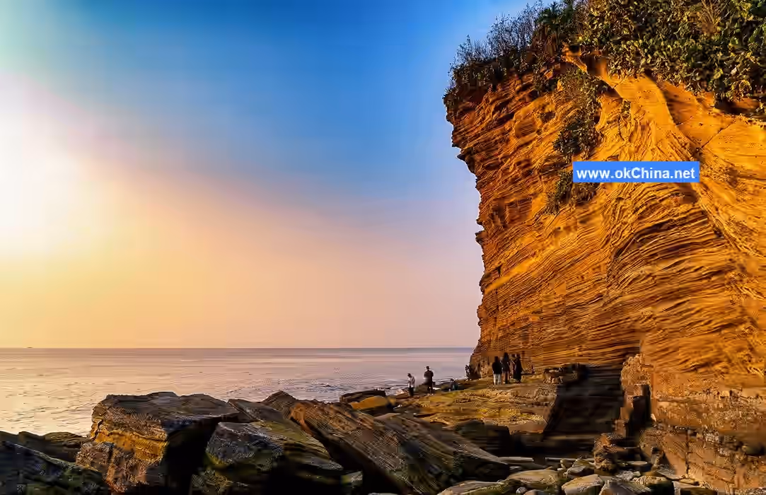
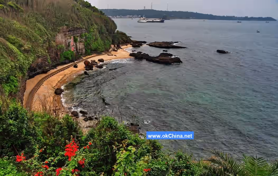
The southern half of Weizhou Island is dominated by sea erosion landforms, with well-developed sea cliffs, caves, platforms, and stacks. The northern half is mainly characterized by sea accumulation landforms, including sandbars, lagoons, beaches, and reef flats. Among the sea erosion landforms, the Nanwan coastal area is typical. Nanwan was originally a volcanic depression with a breach in the south, which was flooded by seawater to form a bay. Its surroundings are volcanic sedimentary rocks. Under the alternating erosion of waves and tides, the rocks near the intertidal zone were first destroyed, forming layered sea caves. The rocks above the caves, losing support, fractured or collapsed along vertical joints, forming steep sea cliffs. This 5-kilometer-long bay between eastern and western Gongshou is covered with such sea cliffs, ranging in height from 30 to 50 meters with slopes greater than 75°.
Sea erosion platforms are natural platforms preserved at the foot of retreating sea cliffs. The sea erosion platform at the foot of Zhuzai Ling (Piglet Ridge) on the east side of Nanwan is not only flat but also often reveals many volcanic bombs and their impact craters on its surface. When volcanic bombs are washed away, waves continue to carry rock debris to erode those pits and hollows, forming variously sized cylindrical potholes. Sometimes, some hard rock pillars remain on the sea erosion platform; these are sea stacks. Zhuzai Ling is a massive sea stack, 35 meters high, less than 30 meters wide, but about 100 meters long.
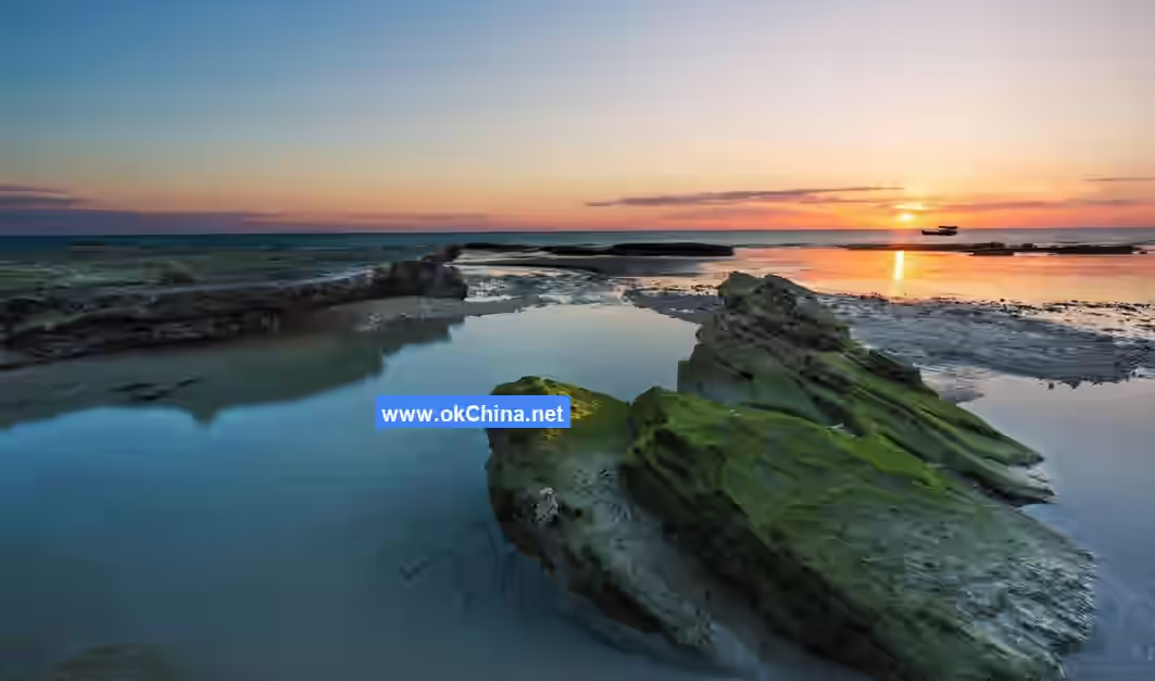
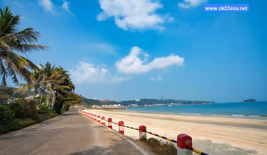
The beaches of Weizhou Island are mainly wide and flat sandy beaches, generally 150–300 meters wide, with a sand and gravel layer 4–8 meters thick, overlying basalt. Occasionally, basalt outcrops appear along the coast. The intertidal zone is generally wide, with the widest reaching 150 meters. The subtidal zone is about 60 meters wide and has coral distribution. Below the coral is the reef flat. Broken coral debris, easily cemented with shell sand and gravel, forms beach rock. The beach rock in the Beigang area of Weizhou Island extends from the ancient lagoon to the upper part of the subtidal zone, covering the basalt.
The original volcanic crater has become the deep-water port of Nanwan, with a very distinct volcanic morphology. The crater features an arc-shaped steep wall 50–80 meters high.
There are two new and old sandbars in the supratidal zone in the north of Weizhou Island, and three layers of sea caves on the sea cliffs in the south, with two levels of sea erosion platforms at the cliff base. This reflects that Weizhou Island has been intermittently uplifting since the Quaternary period, with an amplitude exceeding 20 meters.
2.3 Climate
Weizhou Island has an average annual temperature of 23°C, is frost-free year-round, and has an average annual precipitation of 1297 mm. The dry and wet seasons are distinct, with the rainy season from June to September.
3. Main Attractions
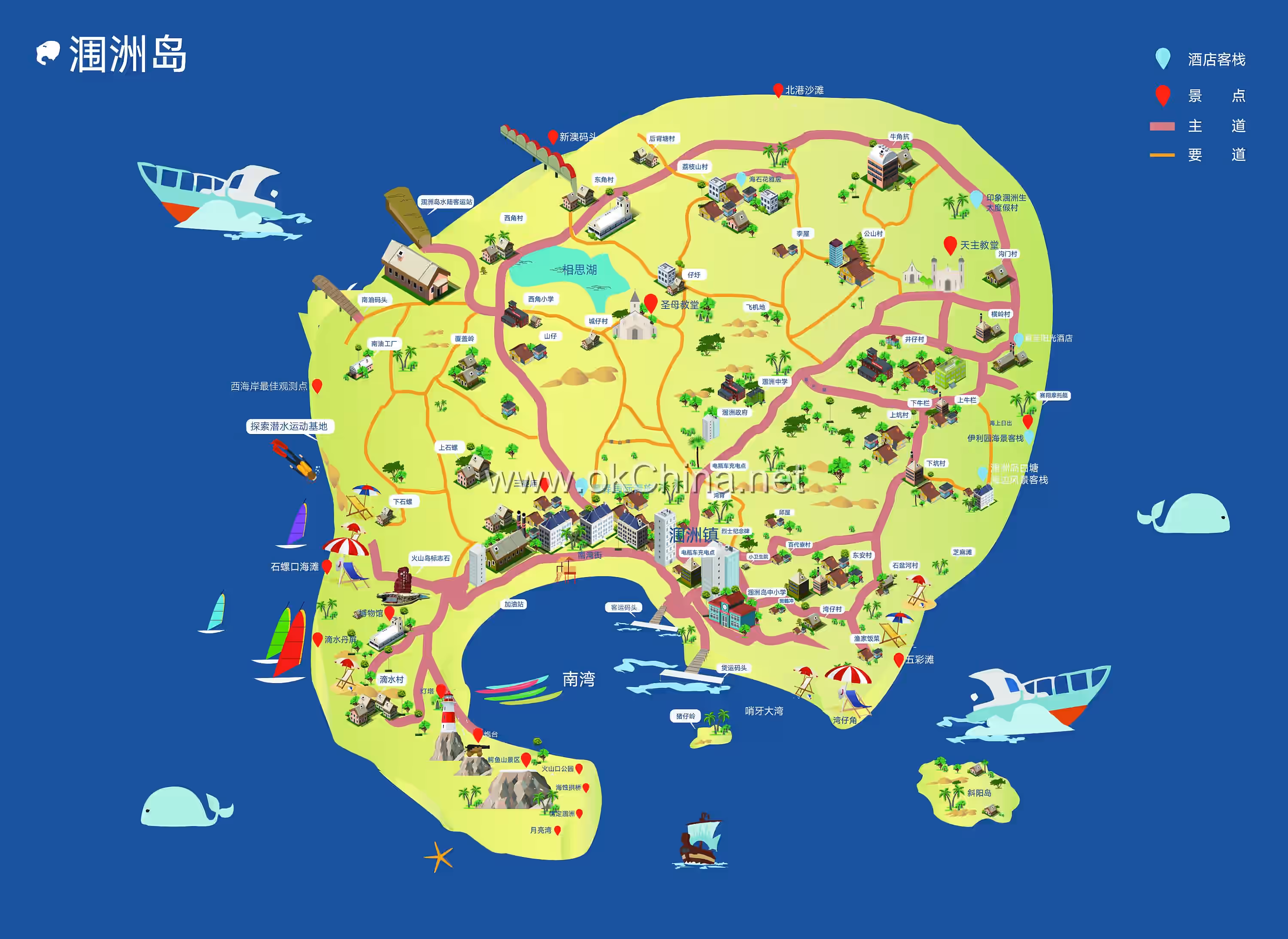
3.1 Nanwan Crocodile Mountain Scenic Area
Nanwan Crocodile Mountain Scenic Area is the most magnificent and essential scenic area on Weizhou Island. It includes Crocodile Mountain, Five-Color Beach, Red Square, Nanwan Marine Sports Park, and part of the sea area, covering a total area of 3.8 square kilometers. The Nanwan Crocodile Mountain Scenic Area is renowned at home and abroad for its beautiful island scenery, typical volcanic geological relics, unique sea erosion micro-landforms, rich eco-tourism resources, and a comfortable, pleasant climate. On December 29, 2020, the Ministry of Culture and Tourism issued the "Announcement on Determining 21 Tourist Attractions as National 5A-Level Tourist Attractions." Weizhou Island's Nanwan Crocodile Mountain Scenic Area was listed, officially promoted to a National 5A-Level Tourist Attraction, earning the highest-level golden signboard in China's tourism industry.
Crocodile Mountain, located on Crocodile Ridge on the west side of Nanwan, resembles a crocodile crouching in the sea when viewed from a distance, hence its name. Crocodile Mountain features a circular tour route (left down, right up) with a total of 871 steps up and down, a 1645-meter wooden boardwalk along the coast, and a normal visit time of about 1.5 hours. Crocodile Mountain gathers China's most typical volcanic structures, richest volcanic landscapes, and most completely preserved multi-phase volcanic geological relics. It is the most essential part of the Nanwan Crocodile Mountain Scenic Area, mainly including 17 attractions: Weizhou Lighthouse, Ancient Fort, Tangweng Terrace, Volcanic Craters (two in total: Nanwan Crater—the largest on Weizhou Island, and Crocodile Mountain Crater—the only World Geological Heritage site on the island), Dragon Palace Exploration, Hidden Turtle Cave, Thief's Cave, Hundred Beasts Roaring Sea, Sea Erosion Arch Bridge, Moon Bay, Love Lock on Weizhou, Platform Listening to Waves, Moon Square, etc.
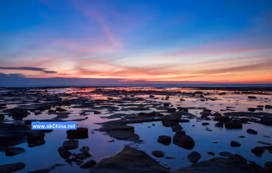
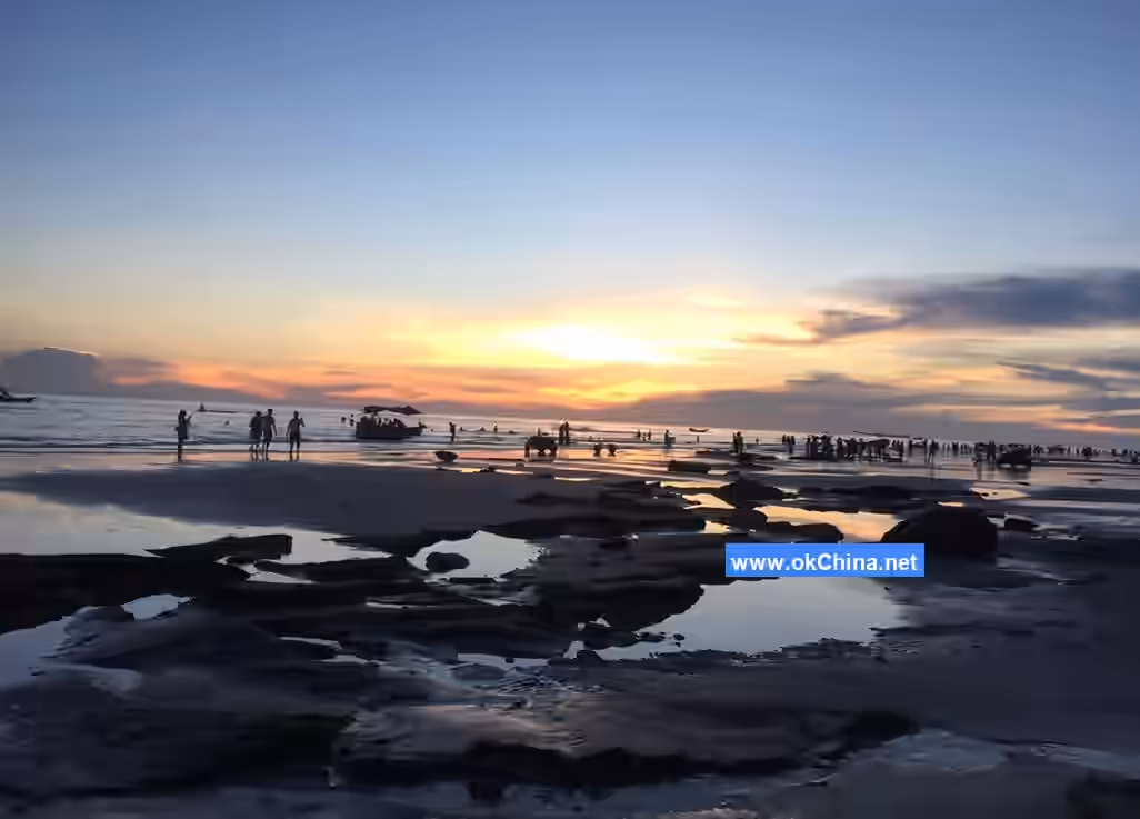
Five-Color Beach, located in the east of Weizhou Island, gets its name from the五彩斑斓 (colorful) hues the sea erosion platform displays under sunlight after the tide recedes. It is one of the best spots on the island to watch the sunrise over the sea. At low tide, large areas of the sea erosion platform are exposed. Polished by seawater, they resemble impressionist art paintings, creating a spectacular view. At Five-Color Beach, one can simultaneously see the trinity geological structure of sea cliffs, sea caves, and sea erosion platforms, which is "rare in the world." One can also see the ancient quarry sites left by Weizhou's early inhabitants who built houses using local materials.
Red Square, located at Wanbei on Weizhou Island, covers an area of 112 mu (about 7.5 hectares). It integrates national defense education, military camp experience, and cultural tourism, mainly including the Red Theater, Weizhou Island National Defense Education Museum, Martyrs' Cemetery, Red Road, and Red Era Sculpture Area. It is the spiritual home of the Weizhou people. The Red Theater is the cultural life center of Weizhou Island. The National Defense Education Museum, with an area of about 254 square meters, has two floors with four exhibition halls. Through preserved precious photos and collections, it focuses on recording the history of Weizhou's liberation as the main thread, including classic battles, major events, and important military activities that occurred on Weizhou Island in various historical periods, as well as the outstanding achievements made by the Communist Party of China and the military in Weizhou's construction in the new era. The Martyrs' Cemetery commemorates the 33 martyrs who sacrificed their lives in the final battle for Weizhou Island on March 6, 1950. The Red Road, through sculptures depicting the recovery and liberation of Weizhou, helps visitors understand the island's red history.
Nanwan Marine Sports Park is located at Chailan on the west side of Nanwan. It is an important component of the marine connection belt of the Nanwan Crocodile Mountain Scenic Area, covering an area of 10,559.9 m². It is a marine tourism and leisure sports park integrating marine entertainment, accommodation, etc. As a new tourism format within the Nanwan Crocodile Mountain Scenic Area, it provides visitors with comfortable experiential tourism, yacht and sailboat island tours, offering a different perspective of Weizhou Island from the vast ocean.### 3.2 Sacred Hall Scenic Area The Sacred Hall Scenic Area is located in Shengtang Village on Weizhou Island. It is a National Key Cultural Relics Protection Unit and one of the "Four Major Catholic Churches of the Late Qing Dynasty." The church was built by missionaries from the Paris Foreign Missions Society starting in 1853 and took ten years to complete. Its main structure is relatively well-preserved, making it one of the larger existing Catholic churches in China and a historical testament to the fusion and coexistence of Chinese and Western cultures. The entire building was primarily constructed using coral sedimentary rock from the seabed, employing meticulous mechanical design. It is a typical French Gothic church from the Renaissance period. Its towering Romanesque spire creates a dynamic sense of "reaching for the sky," evoking an illusion of "heavenly mystery," making it truly unique.
3.3 Shiluo Mouth Scenic Area
The Shiluo Mouth Scenic Area gets its name from the conch-shaped beach and the variety of sea snails found there. The beach is surrounded by the largest and best-preserved coral reef community on Weizhou Island, which is also the northernmost coral community in China and even the world, closest to the Tropic of Cancer. As the most romantic western area, Shiluo Mouth attracts numerous visitors with its unique coral sand beach, mirror-clear seawater, and ideal conditions for viewing the colorful coral world. It is one of the best spots to watch the sunset over the sea.
3.4 Dripping Danping
Originally named Dripping Rock, Dripping Danping is located in Dishui Village on the western part of Weizhou Island. The cliffs formed by rocks are typical sea erosion landforms, with exposed rock layers displaying distinct textures in alternating red, yellow, purple, green, and blue hues. Vines and trees entwine the cliff top, with red flowers and green leaves hanging upside down, presenting a charming and colorful spectacle, hence the name "Danping" (Crimson Screen). Water droplets continuously seep from the rock layers of the massive cliff and drip down, giving it the name "Dripping." The formation of Dripping Danping is considered a marvel of China's volcanic landscape.
3.5 Beihai Weizhou Island Volcano National Geopark Museum
The Beihai Weizhou Island Volcano National Geopark Museum is located on the second floor of the visitor center complex in the Nanwan Crocodile Hill Scenic Area on Weizhou Island, covering a construction area of approximately 2,000 square meters. The museum primarily focuses on volcanic geology, with popular science exhibitions as its main theme. The exhibition area mainly features graphic and textual displays along with physical specimen exhibits, combined with modern high-tech methods such as sound, light, and electricity, electronic sand tables, bionics, virtual reality, holographic projection, and QR codes. This approach highlights the volcanic island characteristics of Weizhou Island, creating a natural science museum that integrates volcanic geology, marine (historical) culture, scientific research, leisure, and entertainment.
The Geological Museum consists of three exhibition halls: the Preface Hall, the Magical Volcanic Island, and the Island Night Tales. The first hall, the Preface Hall, uses a three-dimensional electronic sand table to present the basic overview of the Guangxi Beihai Weizhou Island Volcano National Geopark. The second hall, the Magical Volcanic Island, showcases the formation of Weizhou Island and Xieyang Island, the island's diverse ecosystems, and its rich tourism resources through eight small exhibition zones. The third hall, Island Night Tales, primarily uses multimedia phantom imaging to display the marine historical culture and humanistic history of Weizhou Island.
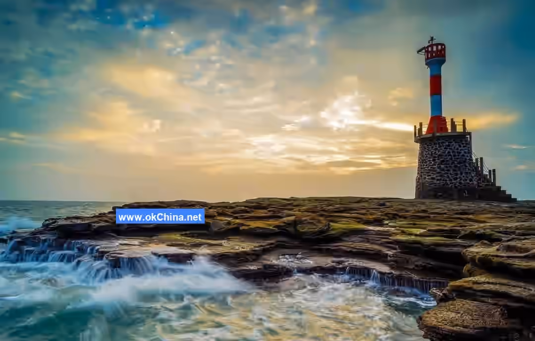
3.6 Weizhou Island Lighthouse
The Weizhou Lighthouse is situated at the summit of Weizhou Island. It was established in 1956 with an original iron frame structure and was rebuilt as a stone tower in 1969. In 2002, the Guangdong Maritime Safety Administration allocated over one million yuan for its reconstruction. The lighthouse stands 22 meters tall and features an internal spiral staircase for convenient access, with steps paved in red granite. The inner walls of the tower are lined with white ceramic tiles, while the exterior is covered with white stone-imitation bricks. The lighthouse uses high-grade aluminum alloy tempered glass watertight windows, which are corrosion-resistant and highly waterproof. Ventilation openings are cleverly designed at the base and the cantilevered room floor slab, ensuring long-term ventilation inside the tower. The top of the lighthouse is equipped with a Shanghai-made copper lantern with a light range of 18 nautical miles. An observation deck is designed at the upper part of the lighthouse, offering views of the entire island's scenery.
3.7 Sanpo Temple
Sanpo Temple, also known as Houtian Palace, was built in the third year of the Qianlong reign of the Qing Dynasty. Utilizing a sea erosion cave as a natural barrier, the temple is ingeniously integrated with the cave, highly reflecting the labor wisdom of the Weizhou people. The name "Sanpo Temple" is said to be an alternative name for the Mazu Temple in Fujian and the Mazu Temple in Taiwan. The legends surrounding Sanpo Temple are filled with mystical colors. Outside the courtyard, flowers and trees flourish, rocks crisscross, and winding paths lead directly to the mountains, creating an elegant and serene landscape. Under the shade of green trees beside the temple, there are several "Immortal Wells" with constantly overflowing spring water. The well water is said to have effects such as quenching thirst, promoting salivation, cooling, and detoxifying. Inside the temple, incense continuously burns, with a steady stream of worshippers and those seeking divination.
4. Cultural Resources
4.1 Historical Evolution
During the Han Dynasty, Weizhou Island belonged to Hepu Commandery. In the early Tang Dynasty, it was under the jurisdiction of the Leizhou Zhenchuan Inspection Department. This administrative affiliation remained unchanged through the Song and Yuan Dynasties. In the 31st year of the Zhiyuan reign of the Yuan Dynasty (1294 AD), the Weizhou Inspection Department was established "on the island in the Eighth Du Boli Village" of Suixi County, which is Weizhou Island.
In the early Ming Dynasty, it still belonged to Xiezhou Prefecture. In the seventh year of the Hongwu reign (1374 AD), the inspection department was relocated to Cancun in Leizhou's Suixi, responsible for coastal defense and supervising pearl ponds.
In the sixth year of the Wanli reign (1578 AD), immigrants from Leizhou were moved to the island for cultivation. In the twenty-eighth year (1600 AD), the游击署 (mobile command) was moved to Yong'an Suo in Hepu County, Lianzhou. Thereafter, Weizhou was under the dual military and administrative jurisdiction of the Leizhou and Lianzhou prefectures.
From the first year of the Kangxi reign to the eleventh year of the Jiaqing reign of the Qing Dynasty (1662-1806 AD), the residents of Weizhou were forced to relocate inland three times. The administrative institutions on the island were abolished, but a small number of "liao people" (shed dwellers) remained. Military control was divided between the Hai'an Battalion游击 of Xuwen County, Leizhou, and the Longmen Association of Hepu County, Lianzhou, with patrols conducted in two shifts annually.
In the late years of the Xianfeng reign (around 1860 AD), 400 people from the mainland settled on the island to escape war, disregarding hardships and official prohibitions.
In the sixth year of the Tongzhi reign (1867 AD), recognizing the established residential reality on the island, the authorities reopened the island, moving boat households and migrant people from Leizhou and Lianzhou to the island. Thus, the island, which had been deserted for over a hundred years, saw the revival of fields and dwellings. At that time, French Catholic forces took the opportunity to establish influence on the island, building a church in Shengtang Village, and later building one each in Chengzai and on Xieyang Island, widely accepting converts. This became the earliest Catholic base in the Qin-Lian area.
For over twenty years during the Guangxu reign, Weizhou was officially transferred from Leizhou to Hepu County's jurisdiction, with the Weizhou Inspection Department established. The military organization was subordinate to the Yong'an Battalion of the Longmen Association.
In the early Xuantong reign, it belonged to the Jinghai Regiment of Hepu County, with a "Public Bureau" civil administration established on the island.
From the early Republic of China period until 1931, it successively belonged to the Hepu Jinghai Regiment and the Hepu Second Autonomous District Township.
From 1936 to 1949, it successively belonged to the Hepu County Second Administrative District, Fifth Administrative District, and Third Administrative District Townships.
From September 13, 1938, Weizhou Island fell under the brutal rule of the Japanese invaders for seven years. During this period, the island became a Japanese naval and air base threatening and harassing the rear areas of South China.
On June 18, 1945, the people of Weizhou Island rose up and annihilated the remaining invaders, liberating Weizhou. It returned to a township administration under county jurisdiction.
On March 6, 1950, the People's Liberation Army crossed the sea and liberated Weizhou. Initially, a township people's government was established, directly subordinate to Hepu County. Starting in August of the same year, it came under the jurisdiction of the Beihai Town People's Government.
In 1953, it was reorganized into the Third District, divided into four townships: Weidong, Weixi, Weibei, and Nanwan.
In 1959, it was changed to the Weizhou Commune.
On December 17, 1994, the State Council approved (State Council Document [1994] No. 137): expanding the administrative area of Haicheng District. The former suburban Weizhou Town (including Xieyang Island), eight village communes of Gaode Town (Malan, Juntun, Kaijiang, Dongwei, Wengshan, Chixi, Gaonong), five neighborhood committees (First, Second, Shajiao, Lingdi, Miaoshan), and Luoke Village of Pingyang Village Commune, Longgoulu Village, as well as three village communes of Xitang Town (Xitang, Xibiandong, Yima) were placed under the jurisdiction of Haicheng District. The district people's government is located on Beibu Gulf Avenue. Three neighborhood committees (Dadunhai, Nanwan, Xincun) were placed under the jurisdiction of Yinhai District.
4.2 Customs
4.2.1 Historical Origins of the Hakka People on Weizhou Island
Weizhou Island has developed a distinctive regional Hakka culture. The original inhabitants living on Weizhou Island were the Baiyue people, belonging to the same ethnic group as those in southern regions like Jiangxi, Fujian, Guangdong, and Zhejiang. They "each had their own clans and were not unified." After the Qin and Han Dynasties, due to the continuous influx of northern Han people into the region, some Baiyue people were sinicized in batches, some were forcibly relocated to the Jianghuai region, and others retreated from the plains into deep mountains and forests, becoming the historically notable "Shanyue" people. During the Jin Dynasties, especially the Tang and Song periods, as the north suffered continuous war devastation and rural economies declined, large numbers of refugees crossed south of the Yangtze River seeking livelihoods. After repeated migrations, some immigrants arrived at Weizhou Island, intermingling with the local indigenous people. Under relatively closed social and natural conditions, they integrated with the indigenous people, creating a regional culture dominated by Han culture but distinct from surrounding cultures—this is the Hakka culture.
4.2.2 Mazu on Weizhou Island
Like fishermen in other coastal areas of China, most residents of Weizhou Island revere Mazu (locally called "Sanpo," as Mazu was the third among her siblings) as a deity. The Weizhou Sanpo Temple (also known as Mazu Temple, Tianhou Palace) is located at the northern part of Nanwan Port on the southern part of Weizhou Island. The temple is built under a volcanic cliff, nestled against the mountain and facing the sea, with unique architecture. Because the original Tianhou Palace was situated under a steep cliff and very dangerous, a new Tianhou Palace was built in front of it in imitation. The temple is reddish-brown in color, with an old banyan tree providing shade in the courtyard. During festivals, before fishing boats set sail and upon their return, residents worship with chicken, duck, fish, meat, and jewelry. Every year on the 23rd day of the third lunar month (Mazu's birthday) and during the harvest season in the tenth lunar month, fishermen hold grand celebration ceremonies to thank Sanpo for her blessings of safety and harvest. This practice is locally called "repaying blessings" to Sanpo. The Sanpo procession activity on Weizhou Island is held annually, usually at the end of the year.
Comments
Post a Comment