
Black Valley Scenic Area
1. Introduction
The Black Valley Scenic Area (Black Valley) is located within Heishan Town, Wansheng Economic and Technological Development Zone, Chongqing. It borders the Nanchuan Jinfo Mountain and the Guizhou Tongzi Baiqing Nature Reserve. It is 63 kilometers from downtown Chongqing, covers an area of 100 square kilometers, features a maximum elevation difference of 1200 meters between the mountaintop and valley floor, has a canyon length of 13 kilometers, and valley slopes ranging from 70 to 80 degrees on both sides.
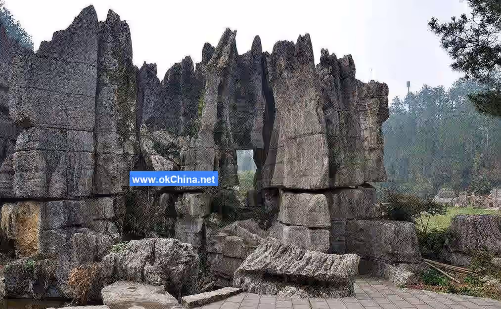
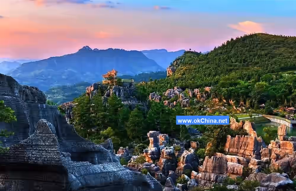
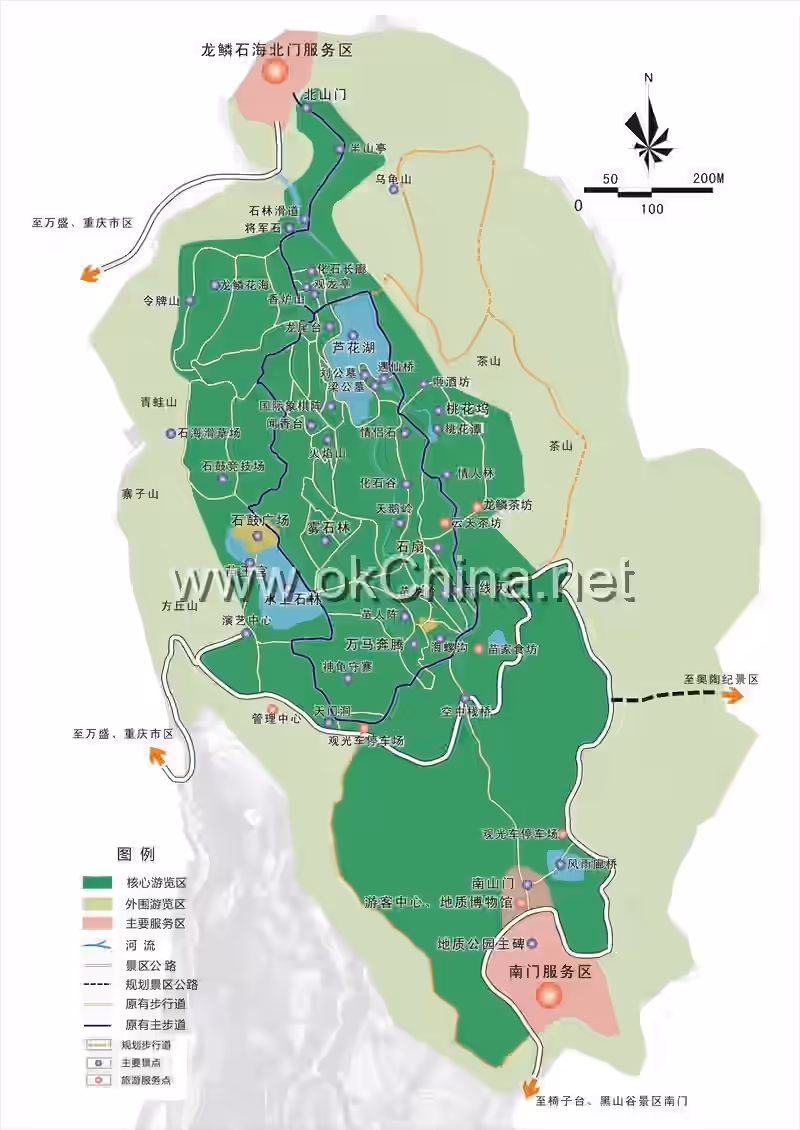
The Black Valley Scenic Area consists of two main areas: the Black Valley and the Wansheng Stone Forest. It boasts a variety of distinctive landscapes including steep ridges, peak forests, deep gorges, cliffs, forests, bamboo seas, waterfalls, clear waters, karst caves, ancient-style plank paths, floating bridges, sea of clouds, pastoral scenes, primitive vegetation, and rare flora and fauna. Within the scenic area, there are 5 gorges, 7 zones, 12 peaks, 36 bridges, 99 waterfalls, and 108 pools, gathering the essence of the karst landforms of Chongqing and Guizhou. It is acclaimed as the "Jiuzhaigou of Southern Chongqing" and the "Geological Grand View Garden."
2. Geographical Environment
2.1 Location and Territory
The Black Valley Scenic Area is situated within Heishan Town, Wansheng Economic and Technological Development Zone, Chongqing. It is 20 kilometers from Wansheng urban area and 82 kilometers from downtown Chongqing. It borders the Nanchuan Jinfo Mountain and the Guizhou Tongzi Baiqing Nature Reserve. Its geographical coordinates are 106°58′26″E, 28°51′46″N.
2.2 Geology and Geomorphology
The Black Valley is located within the Dalou Mountain range, a spur of the Yunnan-Guizhou Plateau transitioning into the Sichuan Basin. It forms the central part of the Longguxi compound anticline composed of Mesozoic limestone. The exposed strata include Silurian, Ordovician, and Cambrian systems, dating back 500-600 million years, making it one of China's oldest areas of exposed rock layers. The highest peak, Shizicao, has an elevation of 1973 meters and serves as a boundary mountain between Chongqing and Guizhou provinces, covering an area of 200-300 square kilometers. It is known as one of the "Five Famous Mountains of Chongqing," alongside Jinyun Mountain, Simian Mountain, Jinfo Mountain, and Fairy Mountain. The core scenic area is planned to cover 14.79 square kilometers, with a maximum elevation difference of 1200 meters between mountaintop and valley floor, a canyon length of 13 kilometers, and valley slopes of 70-80 degrees on both sides.
2.3 Climatic Features
The Black Valley mountainous area experiences frequent cloud and fog, limited sunshine, and abundant rainfall. The plain areas have a subtropical monsoon climate, with average January temperatures around 6.9°C and average July temperatures around 26.1°C. Due to the high altitude and steep slopes, climate zones are distinctly vertically distributed: elevations of 1500-2100 meters belong to the warm temperate zone; 2100-2500 meters to the mid-temperate zone; and above 2500 meters to the sub-frigid zone. Areas above 2000 meters are covered by snow and ice for about half the year, typically from October to April of the following year.
3. Main Attractions
3.1 Black Valley
3.1.1 Overview
The Black Valley Scenic Area is rich in natural landscapes, encompassing mountains, waters, springs, forests, and caves, blending the characteristics of wonder, peril, steepness, beauty, and seclusion. It features not only peculiar peaks, strange rocks, and towering ancient trees but also clear waters, high gorges, and cascading waterfalls. It possesses both ancient geological landforms and rare, exotic birds and animals.
3.1.2 Red Fruit Beach
Entering the scenic area from the North Gate of Black Valley, one encounters the several-hundred-meter-long Red Fruit Beach, covering an area of approximately 1000 square meters. Thousands of red-berry trees bloom with white flowers in spring and bear red fruit in autumn. In winter, the contrast of white snow and red berries is particularly striking. The red berry, also known as firethorn or commonly called "soldier's ration" or "torch fruit," is an evergreen shrub or small tree of the Pyracantha genus in the Rosaceae family. The fruit contains nutrients like starch, protein, and vitamin C. It can aid digestion, stop dysentery, promote blood circulation, and stop bleeding, and is used to treat indigestion, enteritis, and dysentery.
3.1.3 Mandarin Duck Lake
Located not far from Red Fruit Beach, Mandarin Duck Lake is a famous attraction within the Black Valley Scenic Area. It is a natural lake covering about 1000 square meters. The lake water is sweet and clear, with fish faintly visible at the bottom. It is named for the frequent presence of mandarin ducks playing in the lake.
3.1.4 Carp River
The Carp River is a boundary river between Chongqing and Guizhou provinces and the third-largest river in Wansheng. Legend says it was named for its abundant carp. Due to crustal uplift and intense downcutting by the river, the entire valley takes on a "V" shape, and the whole Black Valley Scenic Area is situated along the Carp River. The river flows 23.1 kilometers within the area, with a drainage area of 83.4 square kilometers and an average flow rate of 3.01 cubic meters per second.
3.1.5 Stone Imperial Umbrella
Located in the center of the river valley, the Stone Imperial Umbrella consists of two massive rocks, each weighing about 30 tons, tightly stacked together like a giant umbrella. It is a collapse relic landscape. After collapsing into the valley bottom, the rock mass was eroded by mountain torrents. Due to differences in rock strength between the upper and lower layers, the lower part of the collapsed mass suffered greater erosion, with smaller, loose fragments being carried away, making the rock thinner. The upper part, experiencing weaker river erosion, retained its original shape, resembling a large, open umbrella, hence the name.
3.1.6 Nine-Bend Painted Screen
Looking across the valley at the opposite mountain face from within the scenic area reveals the magical "Nine-Bend Painted Screen" of Black Valley. The cliff face winds and twists, with forests partially obscuring it and clouds swirling around, resembling a giant ink-wash landscape painting, hence the name. At the far left stands an isolated, pointed peak called Dream Brush Peak, resembling a painter's brush resting on a stand. The Nine-Bend Painted Screen is a fault relic, composed of dolomite from the Middle-Upper Cambrian Loushanguan Group. Due to faulting, the rock layers were displaced, forming a nearly vertical fault plane here, approximately 900 meters long and 100 meters high, with clearly visible striations.
3.1.7 Trapped Ox Pool
Located in the central part of the scenic area, Trapped Ox Pool is a water pool formed by long-term water erosion. A stone within the pool resembles an ox head, with its body submerged. The pool is so small it seems to trap the ox, preventing movement, hence the name.
3.1.8 Camel Journeying West
Camel Journeying West is formed by three adjacent peaks whose smooth ridgelines outline the shape of an enormous camel's head. The two peaks immediately behind aptly resemble towering humps. As the camel's head faces west and tail east, it is named Camel Journeying West. It is a typical ridge landform landscape, with the scenic rock layers composed of dolomite from the Middle-Upper Cambrian Loushanguan Group.
3.1.9 Waist-Supporting Rock
Located near the roadside close to the Sandie Spring Waterfall, Waist-Supporting Rock features a protruding rock cavity large enough to provide shelter from wind and rain. There is a local custom in Wansheng: placing a wooden pole or bamboo rod in the crevice between the upper and lower parts of such rocks is believed to cure back pain for the person who places it, hence the name. Legend says ancient Yelang porters often rested here, propping bamboo rods under the rock overhang to pray for relief from back and leg pain and to dispel fatigue.
3.1.10 Dream Veil Waterfall
Dream Veil Waterfall is the most delicate and graceful among the many waterfalls in Black Valley. It flows gently down the cliff face. Viewed from across the river, it appears graceful and elegant, like a white veil dancing lightly in the wind, dreamlike and illusory, hence the name "Dream Veil Waterfall."
3.1.11 Francois' Langur Den
The Francois' Langur Den is a cave located near Dream Veil Waterfall. The Francois' langur, also known as the black leaf monkey, is a very rare, critically endangered Class I protected animal in China. It has a slender build, and its entire body is black except for two white streaks running from the cheeks to the corners of the mouth.
3.1.12 Chongqing-Guizhou Boundary Bridge
Also known as the Wind-and-Rain Bridge, the Chongqing-Guizhou Boundary Bridge is located next to the Black Valley Folk Culture Exhibition Area. It marks the boundary between Chongqing and Guizhou. One can stand with a foot in each province and gaze into both territories.
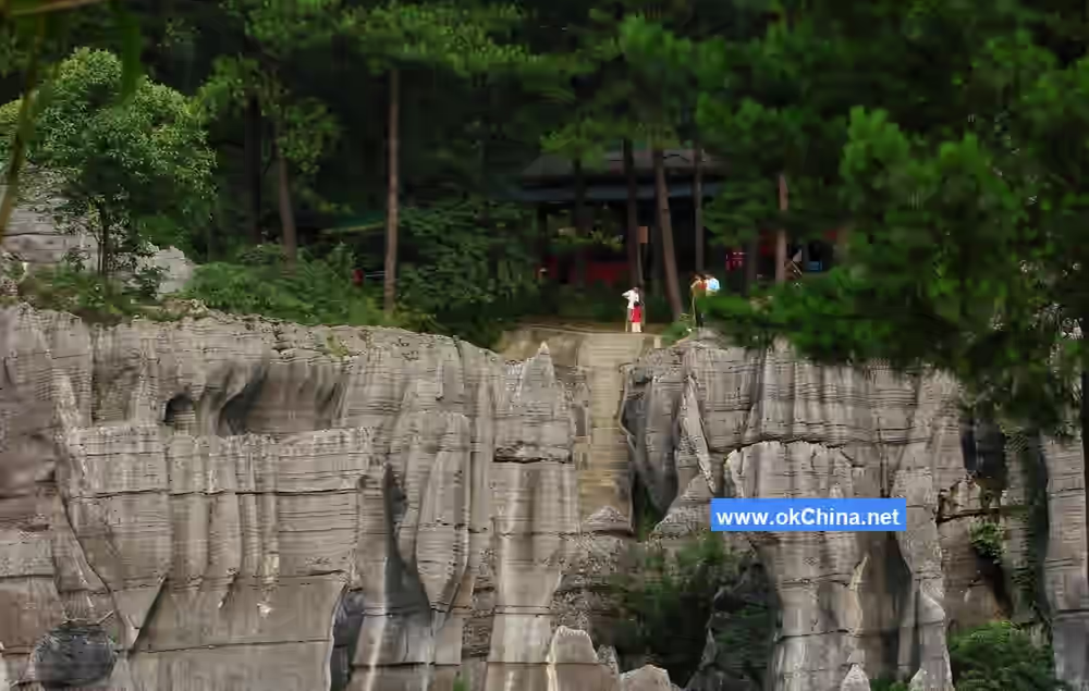
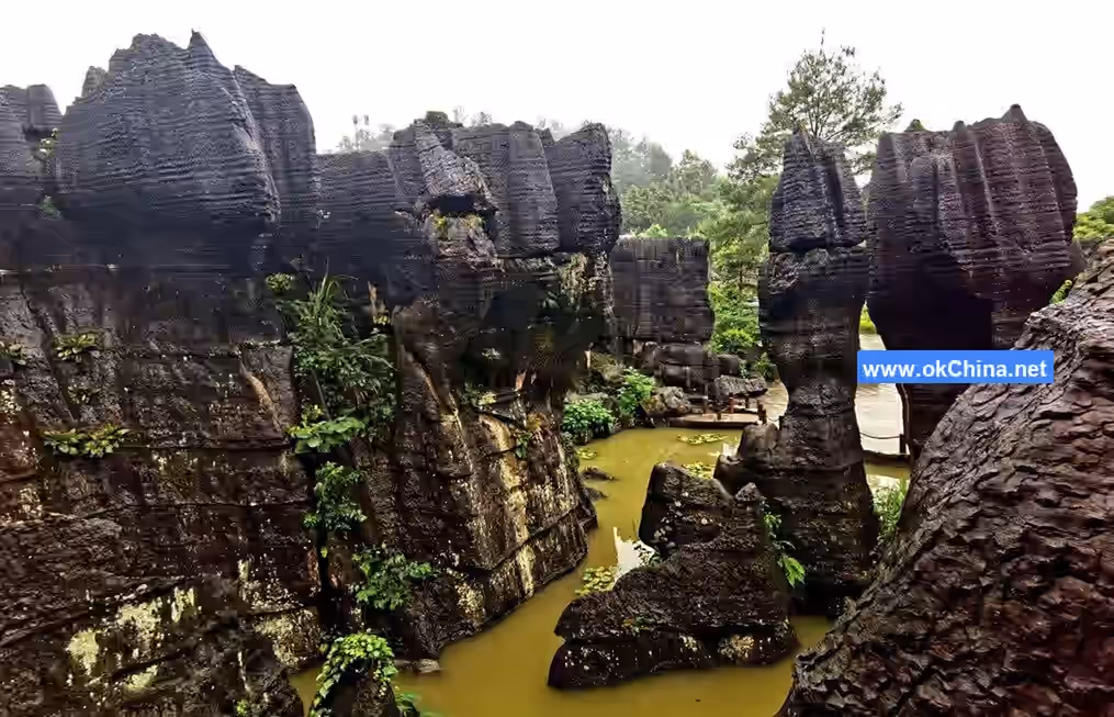
3.1.13 Golden Pheasant Gorge
Golden Pheasant Gorge is the first gorge in Black Valley. It is "V"-shaped, 360 meters long, with a vertical height of nearly 500 meters. The layered rock walls on both sides are majestic, perilous, and steep, with torrential waters rushing through and peaks soaring into the clouds. Within the bamboo thickets of the gorge, the Chinese endemic (and ornamental) Golden Pheasant is often seen.
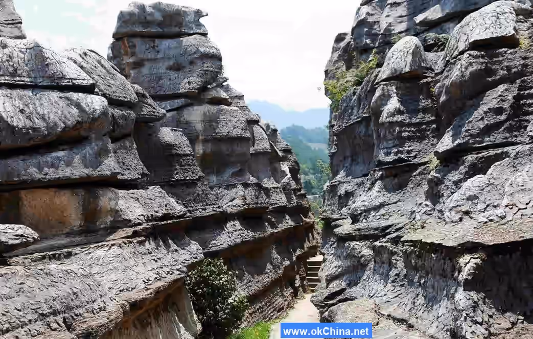
3.1.14 Black Monkey Gorge
Black Monkey Gorge is the second gorge in Black Valley. It is 420 meters long, with its narrowest point only 2 meters wide. The perilous peaks on both banks overlap like jagged teeth, with cliff walls inclined over 90 degrees, making it difficult to see sunlight year-round. Even during the scorching, sweltering heat of midsummer, this place remains chillingly cold. It is named for the frequent presence of the Class I protected animal, the Francois' langur, climbing and playing here.
3.1.15 Fish Jump Gorge
Fish Jump Gorge is the third gorge in Black Valley. It is 520 meters long. This section of the gorge winds and twists, with ancient trees towering to the sky, lush and verdant, and waterfalls and springs visible everywhere. Every spring and summer, if fish from downstream, such as red-tailed carp, green crucian carp, and red-tailed mountain catfish, want to reach the upper reaches, they must leap over the Fish Jump Rapids, which has a drop of about 1 meter. The gorge is named for this phenomenon.
3.1.16 Cicada Song Gorge
Cicada Song Gorge is the fourth gorge in Black Valley. It is approximately 300 meters long. The rock walls on both sides stand obliquely, seemingly leaning yet not. Springs drip melodiously year-round, the cliff tops are densely forested with ancient vines and verdant creepers blocking out the sky, leaving only a sliver of light. Over ten species of cicadas, such as spring cicadas, katydids, and chirping cicadas, inhabit the gorge. During spring and summer, the chirping of spring cicadas can be heard everywhere in the dark, dense forests within the gorge, hence the name.
3.1.17 Eagle Claw Rock
A rock protrudes from the cliff face, resembling an eagle's claw, which locals call "Eagle Claw Rock." Legend says a divine eagle from heaven violated celestial laws and was suppressed here by a giant rock cast down by the Jade Emperor. The heavenly eagle struggled desperately, only managing to expose its claw. The rock that fell from the sky is called the "Fallen Rock." Because the heavenly eagle was guilty, this rock is also called the "Guilty Rock."#### 3.1.18 Yu-Qian Grand Rift Valley Locally known as the "Great Chute," this rift valley stretches over 1,000 meters. It was formed by a mountain fracture during a violent crustal movement approximately 70 million years ago. The rock walls on both sides of the rift, eroded and dissolved by prolonged flooding, have become rugged, unpredictable, and extraordinarily spectacular. Located at the border between Chongqing and Guizhou, it is named the Yu-Qian Grand Rift Valley.
3.1.19 Shenlong Gorge
Shenlong Gorge is the final gorge within Heishan Valley. It derives its name from the "Shenlong Spring" inside the gorge, which is regarded as the sole tribute spring of the ancient Yelang Kingdom. The gorge is 1,200 meters long, winding and twisting like a meandering snake. Its narrowest point is only 2 meters wide, while its widest is less than 30 meters. The mountains on both banks are lush and dark green, with layered peaks, jagged rocks, sheer cliffs, streaked rock faces, and continuous cascading waterfalls.
3.1.20 Flying Fish Waterfall
Located near the south gate of Heishan Valley, Flying Fish Waterfall is one of the most spectacular among the hundreds of waterfalls in the scenic area, with a drop of about 80 meters. During the summer flood season, the water flow can reach 5 cubic meters per second, resembling a silver river cascading from the heavens, creating a majestic and powerful scene. The waterfall is named for its fish-like shape.
3.1.21 Dragon Spring
Dragon Spring is situated in the Zhuhou section of the Heishan Valley scenic area. The gorge is deep and secluded, with murmuring streams flowing year-round. The spring water emerges from the bedding planes of the Middle-Upper Cambrian Loushanguan Group rock formations, resembling a hidden dragon spouting water, hence the name Dragon Spring.
3.1.22 Twin Dragons Playing with a Pearl
This is a naturally formed stone in the gorge stream. It resembles a giant pearl dividing the murmuring flow into two streams, which then look like two agile little white dragons playing around the pearl, giving the feature its name.
3.1.23 Shenlong Cave
Shenlong Cave is a naturally formed karst cave. Inside, there are stalactite formations resembling a dragon, complete with a dragon's head, tail, claws, horns, and scales—all vividly lifelike, which is how the cave got its name.
3.1.24 Mud Waterfall
Mud Waterfall is a travertine depositional landscape with a drop of 80 meters and a width of 10 meters. The rock formation composing the scenery is dolomite from the Middle-Upper Cambrian Loushanguan Group. It looks like a waterfall but has a mud-like color, as if mud slurry is pouring from the sky, hence the name Mud Waterfall.
3.1.25 Shenlong Waterfall
Usually, the water flow is small, resembling splashing jade and flying flowers. During spring and summer, after heavy rains, the waterfall can be seven to eight meters wide, plunging down with tremendous force. The sound of the water reverberates throughout the entire gorge, like the roar of a divine dragon, giving rise to its name.
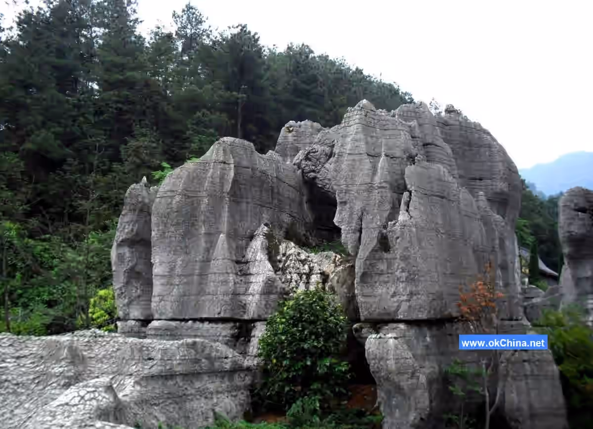
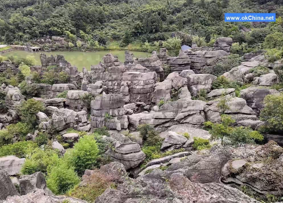
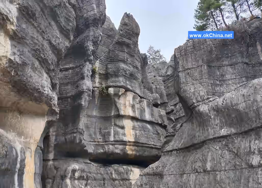
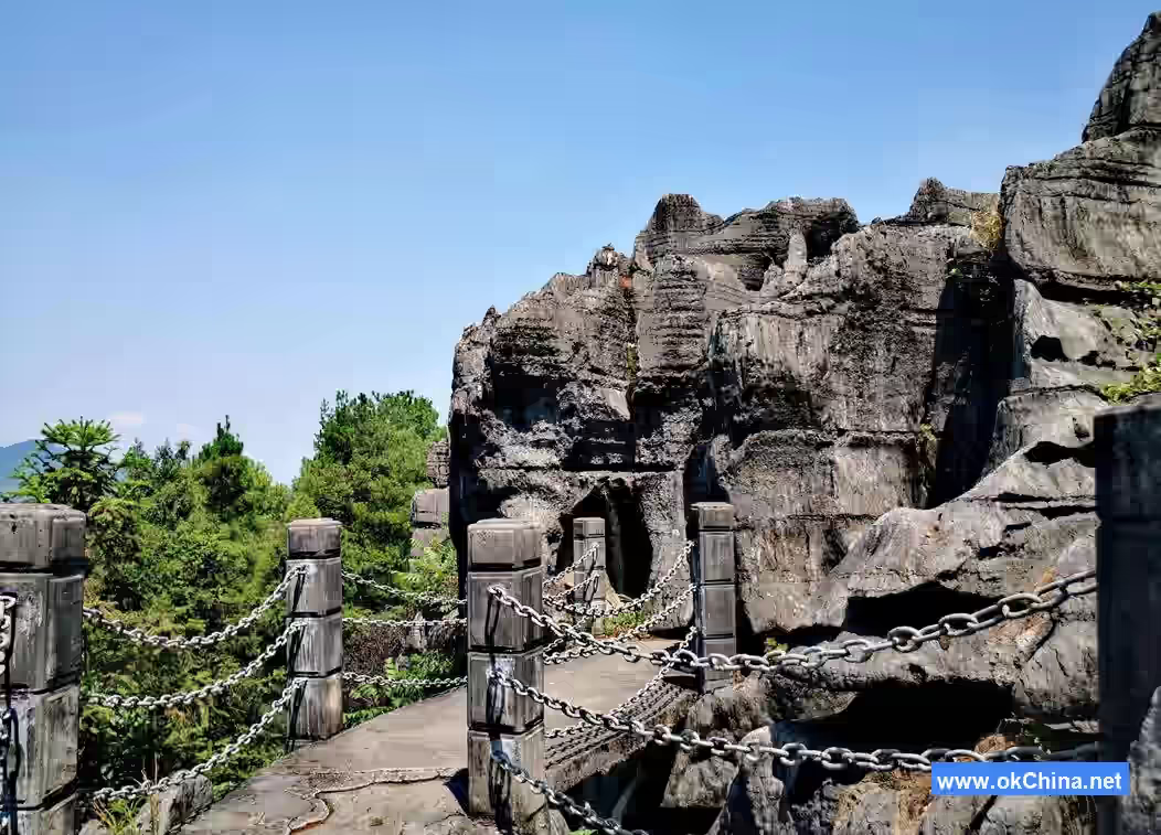
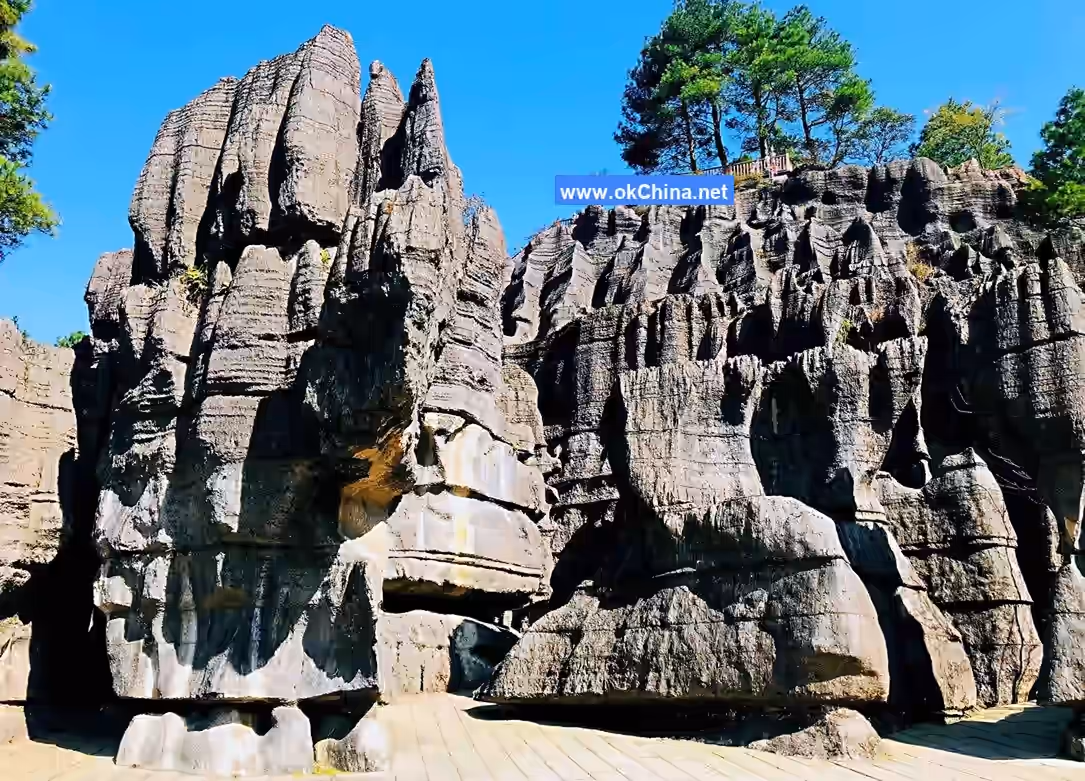
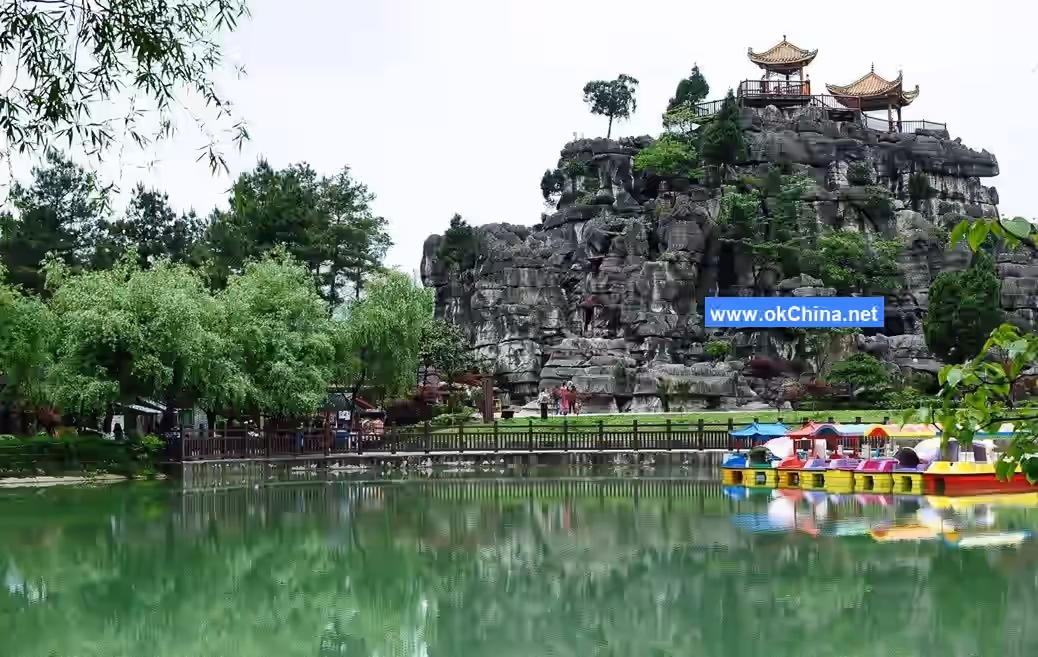
3.2 Wansheng Stone Forest
3.2.1 Overview
The Wansheng Stone Forest scenic area features six functional zones: "Exploring the Wonder of Dragon Scales, Geological Park Science Popularization, Romantic Ambiance Performance, Red Miao Culture Display, Sports Competition Experience, and Primitive Stone Forest Protection." It has formed twelve core attractions, including the "Three Unique Stones: Stone Fan, Stone Drum, Stone Turtle"; the "Three Wonders of Forest and Stone: Water Stone Forest, Mist Stone Forest, Cave Stone Forest"; the "Three Chapters of Science Popularization: Chinese Sinoceras Valley, Fossil Corridor, Geological Park"; and the "Three Miao Delights: Peach Blossom Dock, Dragon Scale Sea of Flowers, Miao King Palace."
3.2.2 Tianmen Cave
Located at the middle gate of the scenic area, Tianmen Cave is the underground palace of the Dragon Scale Stone Sea. It is named for having a skylight connecting it to the outside world. Formed 200,000 to 300,000 years ago, it is a karst landscape with a developed length of 585 meters and a tourist route of 720 meters. The cave contains various stalactites, stone curtains, stalagmites, stone columns, stone platforms, stone peaks, stone waterfalls, etc., presenting a dazzling array of forms.
3.2.3 Chinese Sinoceras
Within the over 10-square-kilometer area of the stone forest, limestone rocks are adorned with fossils like orthoceratites, graptolites, and coral stones, including shapes resembling stone turtles, snakes, and shells. Orthoceratites are invertebrate mollusks that lived in the ocean during the Ordovician period, 400-500 million years ago. They had hard shells, shaped like ox or goat horns, generally straight but sometimes curved or coiled, hence the name "horn stone." There are different types of orthoceratites. The Dragon Scale Stone Sea features a type called Sinoceras. The representative fossil in the scenic area is located below the "Ten Thousand Horses Galloping" attraction and is called the "Chinese Sinoceras." The largest Sinoceras fossil discovered so far is 1.2 meters long with a diameter of 0.12 meters, hailed as the "King of Chinese Sinoceras."
3.2.4 Ten Thousand Horses Galloping
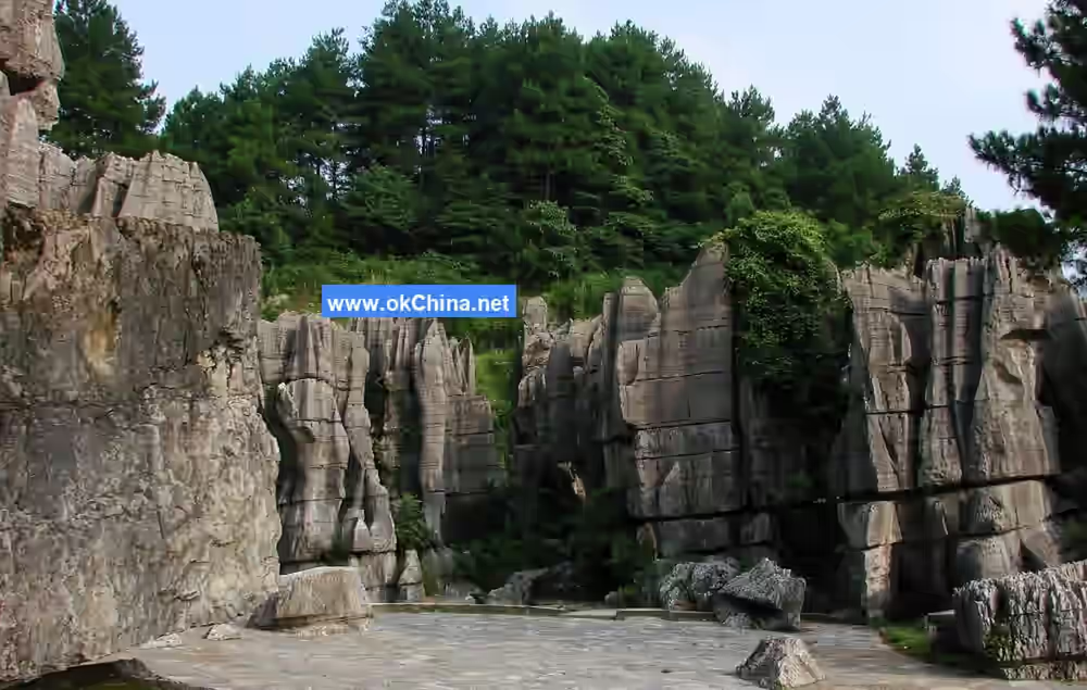
Situated at the Ten Thousand Horses Galloping Square, this is the square's iconic landscape. Rocks of various shapes are arranged together in an orderly yet staggered manner, resembling a herd of galloping steeds. The stone forest of Dragon Scale Stone Sea is mainly divided into two categories: sword-shaped and pagoda-shaped. Ten Thousand Horses Galloping belongs to the sword-shaped type, with thick bases and upper parts weathered into sharp, blade-like edges. The formation is primarily due to water dissolving along rock joints to create solution grooves and channels. As water flow was substantial and multidirectional, erosion occurred in various directions, leaving behind the harder parts to form these sword-like peaks.
3.2.5 A Thread of Sky
There are three "A Thread of Sky" features in the Dragon Scale Stone Sea. The deepest, longest, and most beautiful one is 50 meters deep, 200 meters long, and 1 to 2 meters wide. Looking up from within, the sky appears as just a thin line. The cliffs on both sides are sheer, like artificially stacked ancient city walls. This is a typical fissure cave landform formed by hundreds of millions of years of water erosion.
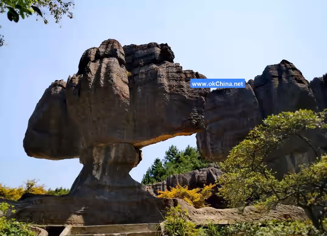
3.2.6 The World's First Fan
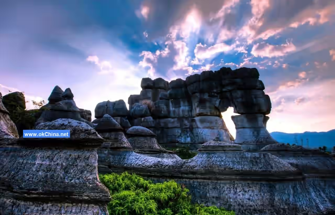
Located near the middle gate of the scenic area, this is the treasure of the Dragon Scale Stone Sea. The stone fan is larger at the top and smaller at the bottom, appearing precarious. The entire fan is 7 meters high, with a fan surface about 6 meters wide, 2 meters at its thickest point, and weighing approximately 200 tons. The fan handle is about 1.6 meters high, with the wider side around 1 meter. The massive fan surface seems artificially placed on the slender handle, yet it has stood firm for hundreds of millions of years.
3.2.7 Incense Burner Peak
Located beside Luhua Lake, Incense Burner Peak is a small hill composed of giant rocks, resembling a huge incense burner from a distance. Standing on the peak offers a panoramic view of the scenic area. After rain clears, clouds and mist often envelop the mountain, giving it an ethereal, fairy-mountain aura. Incense has been burned continuously on Incense Burner Mountain for years. Local Miao people regard it as a sacred mountain, coming to burn incense and worship during festivals, praying for abundant harvests, happiness, and good fortune.
3.2.8 Mist Stone Forest
Situated beside Luhua Lake, the mist in the Mist Stone Forest is created by artificial pipes spraying water mist throughout the stone forest, making it a man-made landscape within the Dragon Scale Stone Sea. There are also natural mist stone forests, primarily appearing in summer after rain or on sunny winter days, when the entire stone forest is often shrouded in a sea of mist. The stone peaks loom faintly within the mist, resembling ethereal fairy mountains.
3.2.9 Stone Drum Square
Stone Drum Square is located at the middle gate of the Heishan Valley scenic area. The stone drum here is stacked from 7 layers of circular stones, weighing 10 tons, standing 7 meters high with a diameter of 1 meter, and having a minimum contact area of 10 square centimeters, giving it a suspended appearance. The square also features two large bronze drums. Bronze drums are sacred ritual objects for the Miao people, who believe the souls of their ancestors reside within them. Therefore, the drums cannot be struck casually and are only played during the annual "Mountain Stepping Festival."
4. History and Culture
4.1 Mountain Stepping Festival
The Mountain Stepping Festival, also known as the Mountain Stepping Ground or Flower Mountain Stepping, is called "O Hao Dao" in the Miao language. It is the most distinctive and grand traditional festival of the Red-Headed Miao, renowned in southern Chongqing and northern Guizhou. Originally held from the 2nd to the 5th day of the first lunar month, it was later changed to May 1st to 7th on the Gregorian calendar. Similar to temple fairs of the Han Chinese, its main purpose is to gather people from various Miao mountain villages to worship deities and ancestors, celebrate harvests, and strengthen social bonds. During the festival, young men and women can court (also called "You Fang," "Sai Nian," or "He Gu Niang"), elders can reunite and reminisce, and there are also trade exchange activities. For the festival, Miao people of all ages dress in festive attire, bring their lusheng (reed pipes), and gather at the Mountain Stepping Ground. Young men play the lusheng and beat barrel drums, while young women dance gracefully. Performances and activities include cattle sacrifice to gods, lusheng dances, Suoluo dances, barrel drum dances, flower pole climbing, flying songs, Za Jiu (sipping wine) songs, walking on knife mountains, and crossing fire seas.
4.2 Fire Star Cutting Festival
This is the Chinese translation of the Miao term "Ruo Suo." Miao people traditionally live in mountainous forests, often in wooden houses or thatched huts, making them prone to fires caused by lightning strikes or improper fire use. Their ancestors believed these were disasters sent by the Fire God. To avert disaster, during the hot, fire-prone months of July and August in the lunar calendar, each clan would select a day for rituals to worship the Fire God. The Fire Star Cutting Festival is held annually within each clan, with households taking turns to host it. The specific time and activities vary by clan. Unlike the Mountain Stepping Festival, this activity is limited to a single clan, making it easier to organize but smaller in scale. Through this festival, they aim to drive away fire demons and disasters, pray for family auspiciousness and happiness, and also strengthen bonds among clan members.
4.3 Lusheng Dance
Miao people, young and old, are skilled in singing and dancing, with the Lusheng Dance being the most famous. The Lusheng Dance is rich in form and has a lively rhythm. Performers play the lusheng while dancing, showcasing distinctive body language.### 4.4 Preference for Five-Colored Clothing The Wansheng Red-Headed Miao are named after the women's custom of wrapping their heads with red cloth strips. The Miao ancestors had a tradition of "preferring five-colored clothing," a practice faithfully preserved in the attire of the Wansheng Miao. The Miao King Palace displays various Miao costumes. Miao men's clothing is relatively simple, consisting of a blue long gown with a right-front closure, a rolled collar, and embroidered edges, complemented by a white headscarf and blue leg wrappings. In contrast, Miao women's attire is more vibrant, often featuring bright-colored blouses, embroidered gloves, and a large wax-dyed or embroidered apron covering the chest. They wear pleated skirts with decorative edges at the waist and a colorful, disk-like turban adorned with patterned cloth or silk flowers and jewels. Their legs are wrapped in patterned bindings, making the entire ensemble splendid and magnificent.
Comments
Post a Comment