

Tiantangzhai Scenic Area in Lu'an City
1. Introduction
Tiantangzhai Scenic Area in Lu'an City is a tourist destination located in Tiantangzhai Town, Jinzhai County, Lu'an City, Anhui Province. Tiantangzhai is the second highest peak of the Dabie Mountains, and its name was inscribed by Mr. Wu Bangguo, former Chairman of the Standing Committee of the 11th National People's Congress. Bordering Luotian County in Hubei Province, it is renowned as "the last primitive forest in East China, a kingdom of plants, and a sea of flowers."
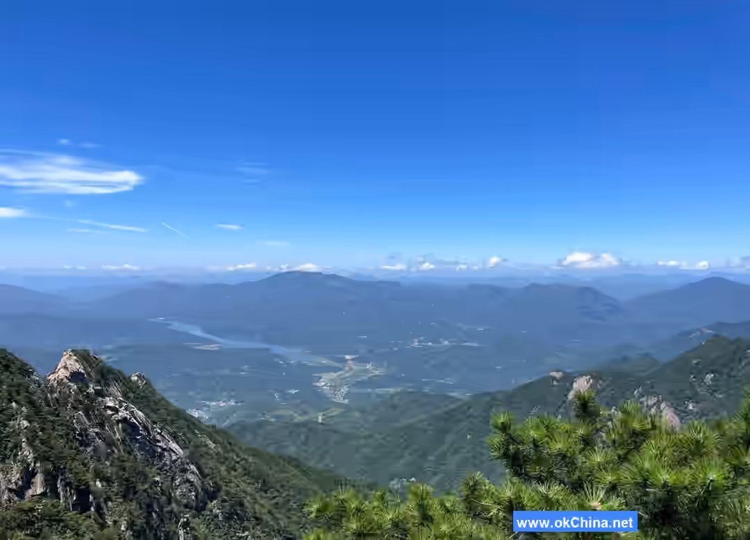
The Dabie Mountains, where Tiantangzhai is situated, form the watershed between China's northern and southern river systems. Waters north of the mountains flow northward into the Huai River, while those to the south flow into the Yangtze River. From the summit of Tiantangzhai, one can look north to the Central Plains and south to the Jingchu region, with majestic mountains spread out before the eyes. At an altitude of 1,729 meters, the summit features a celestial pond whose water neither overflows nor dries up, commonly known as the "Yaochi Pond."
The scenic area covers a total area of 120 square kilometers, with 25 peaks exceeding 1,000 meters in height. The highest peak of Tiantangzhai is one of the main peaks of the Dabie Mountains and serves as the watershed between the Yangtze and Huai River basins. The area has an average annual rainfall of 1,350 mm, humidity of 85%, and an average annual temperature of 12.6°C. The water quality meets Grade I standards for surface drinking water. The area is characterized by imposing passes, winding paths, towering mountains, lush forests, tall bamboos, deep pools, cascading waterfalls, peculiar pines, and strange rocks. Historically known as the "First Pass in the Southeast of Wu and Chu," it boasts a majestic and grand landscape.
2. Geographical Environment
2.1 Location and Boundaries
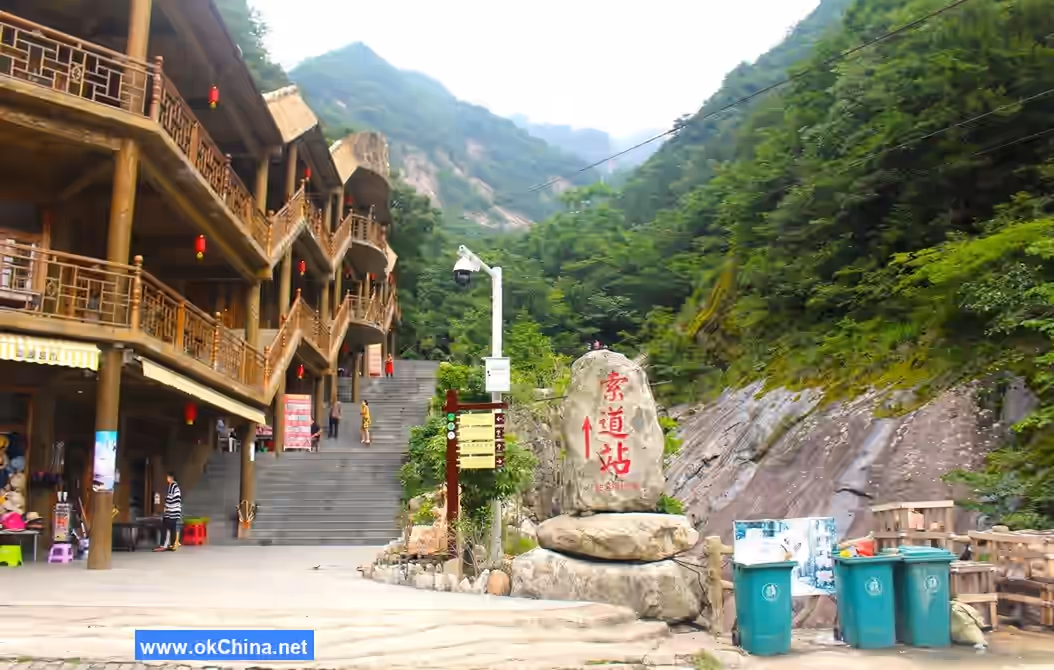
The Tiantangzhai Tourist Area is located in the southwestern part of Jinzhai County, Lu'an City, Anhui Province, situated in the heart of the Dabie Mountains at the border between Hubei and Anhui provinces. It borders Luotian and Yingshan counties in Hubei Province to the southwest and southeast. It is 125 kilometers south of Meishan Town, the county seat of Jinzhai, 138 kilometers northeast to Lu'an City via Huoshan County, 217 kilometers to Hefei City, and approximately 278 kilometers southwest to Wuhan City via Luotian County. Geographic coordinates: 31°10′–31°15′ N, 115°38′–115°47′ E, with a total area of 12,000 hectares.
2.2 Topography and Geology
The geological foundation of Anhui Tiantangzhai National Forest Park is primarily intermediate-acidic granite formed during the Yanshanian period, with the basement rock layer consisting of ancient Dabie Mountain complex rocks, dating back 2.66 billion years. The area is rich in geological relics, including peculiar peaks, canyons, strange rocks, and caves. Anhui Tiantangzhai National Forest Park initially formed during the Sinian period. Approximately 1.8 billion years ago, during the Proterozoic and Archean Dabie Mountain orogeny, the Dabie Mountains underwent folding and uplift. After the Lüliang Movement, they rose further. The Yanshanian Movement during the Mesozoic era caused additional folding and fracturing in the Dabie Mountains, accompanied by extensive magmatic activity, forming locally uplifted fault-block mountains, grabens, and fault-depression basins.
During the Himalayan Movement of the Tertiary to Quaternary periods and subsequent neotectonic movements, the region experienced intense uplift, forming the mountainous terrain. The rocks in the area are mainly granite, with minor amounts of granitic gneiss. The region features numerous peaks and intersecting valleys, with higher elevations in the south and lower in the north. The main peak, Tiantangzhai, stands at 1,729.13 meters above sea level, while the lowest point is 700 meters, resulting in an elevation difference of about 1,000 meters. The Tiantangzhai mountain range serves as both the boundary between Anhui and Hubei provinces and the watershed between the Yangtze and Huai Rivers.
3. Historical Development
3.1 Ancient History
Tiantangzhai was historically known as Hengshan or Duoyun Mountain and is the second highest peak of the Dabie Mountains. Strategically located at the junction of the main peaks of the Dabie Mountains between Anhui and Hubei, it has long been a contested military stronghold, a site for imperial tours, and a destination for notable figures.
During the contention of the "Five Hegemons," western Anhui was situated at the "head of Wu and tail of Chu," and Tiantangzhai was hailed as the "First Pass in the Southeast of Wu and Chu." Research indicates that the first military garrison and beacon tower at Tiantangzhai were built by the State of Chu. The wars between Wu and Chu in the Jianghuai region lasted nearly a century, with over twenty major battles recorded in historical documents.
In 570 BCE, Prince Chong of Chu attacked Wu, captured Jiuci, and reached this area.
In the late Southern Song Dynasty, Wen Tianxiang resisted the Yuan forces and sent Cheng Lun, a fellow imperial examination graduate, into the Dabie Mountains to organize the Western Righteous Army. Fu Gao, a righteous leader from Duoyun Mountain, rallied the people in response and rebuilt Tiantangzhai in 1277, though the forces were later defeated and dispersed.
3.2 Uprising in the Late Yuan Dynasty
In the late Yuan Dynasty, local cloth merchant Xu Shouhui, Jiangxi monk Peng Yingyu, and Macheng blacksmith Zou Pusheng conspired to rebel against the Yuan. They elected Xu as their leader and rebuilt Tiantangzhai in 1351, gathering tens of thousands to rise in rebellion, calling themselves the "Red Turban Army." In August of the same year, they captured Luotian and Xishui, proclaimed Xu emperor at Qingquan Temple, established the "Tianwan" state, and adopted the era name "Zhiping." Their influence grew rapidly, sweeping across several southeastern provinces, and they held power for 11 years. Remnants of sites such as Tiantang Pond, Horse Racing Ground, Coin Minting Hollow, Xiaoyao Palace, Invincible Stele, and Divine Granary can still be faintly discerned at Tiantangzhai.
3.3 Late Ming and Early Qing Dynasties
In the early Ming Dynasty, the Duoyun Inspection Department was established, with troops stationed for defense.
In 1641 during the late Ming Dynasty, peasant armies led by Ma Shouying, Luo Rucai, and He Yilong, active in the Dabie Mountains, launched a fierce attack on Tiantangzhai to join forces with Zhang Xianzhong. Sun Daqi, the Duoyun Inspector, led 100,000 soldiers and civilians to defend Tiantangzhai, relying on its natural defenses. The peasant armies, unable to capture it after prolonged attacks, laid siege to starve out the defenders. Eventually, when food ran out and a plague struck, both soldiers and civilians perished. The area became littered with corpses and piled bones, earning it the name "Epiao Yuan" (Starvation Hollow). The site remains traceable.
In 1646, Wang Ding, the former Ming supervisor of Henan who had retreated to his hometown at Hulu Nao in Daheyan, Luotian, emerged to organize anti-Qing righteous forces. He was appointed Minister of War by the Yongli Emperor and commanded the Fengyang Righteous Army. Using Tiantangzhai as his base, Wang directed the righteous forces across more than ten prefectures and counties in Hubei, Henan, and Anhui for four to five years, greatly enhancing Tiantangzhai's fame.
3.4 Modern History
In 1752, farmer Ma Chaozhu launched an uprising of White Lotus Sect followers at Tiantangzhai, shocking the Huguang region. The foundation of the Ma family house still exists in the mountains.
Between 1859 and 1864, Tiantangzhai became a strategic point contested by the Taiping Heavenly Kingdom forces, Qing troops, and local militias. Hu Linyi, the Governor-General of Huguang at the time, remarked on the mountain: "Internally, it can secure Hubei; externally, it can target Anhui. With substantial development and solid defenses, it commands awe in peacetime and offers a strategic advantage in times of conflict, providing infinite benefits through central command."
In the 17th year of the Republic of China (1928), the Lixia Festival and Liu-Huo uprisings broke out successively on the northern slopes of the Dabie Mountains, giving birth to two Workers' and Peasants' Red Army units. Tiantangzhai became an important part of the Hubei-Henan-Anhui Revolutionary Base Area. After the Red Army marched north to resist the Japanese, the red flag continued to fly in the Dabie Mountains, where arduous guerrilla warfare was waged.
In the 36th year of the Republic of China (1947), Liu Bocheng and Deng Xiaoping's army advanced south into the Dabie Mountains, and Tiantangzhai returned to the embrace of the people.
In the 37th year of the Republic of China (1948), the Liu-Deng headquarters moved to Jiuzihe. In March, Chen Xilian, Yan Hongyan, and others presided over the Jiuzihe Conference to study the strategic deployment for maintaining the Dabie Mountain base area. Tiantangzhai has since become a National Forest Park, a key scenic area, a National Nature Reserve, and a famous tourist destination.
Since 1994, Tiantangzhai has successively formulated the "Tiantangzhai Master Plan," "Tiantangzhai National Forest Park Plan," and "Tiantangzhai Scenic Area Plan." In 2002, Tiantangzhai was approved as a provincial-level tourism poverty alleviation experimental zone.
On June 21, 2010, the Trademark Review and Adjudication Board of the State Administration for Industry and Commerce issued a review ruling, revoking the tourism-related registered trademark "Tiantangzhai Tiantangzhai and Figure" granted by the State Trademark Office to the state-owned Luotian Tiantangzhai Forest Farm in Hubei Province. The ruling stated that the name of a tourist scenic area should be regarded as a public resource in services such as travel arrangements and should not be monopolized by individual entities. The Hubei Tiantangzhai Forest Farm and Anhui Tiantangzhai now share the "Tiantangzhai" registered trademark.
4. Attractions and Landscapes
4.1 Natural Landscapes
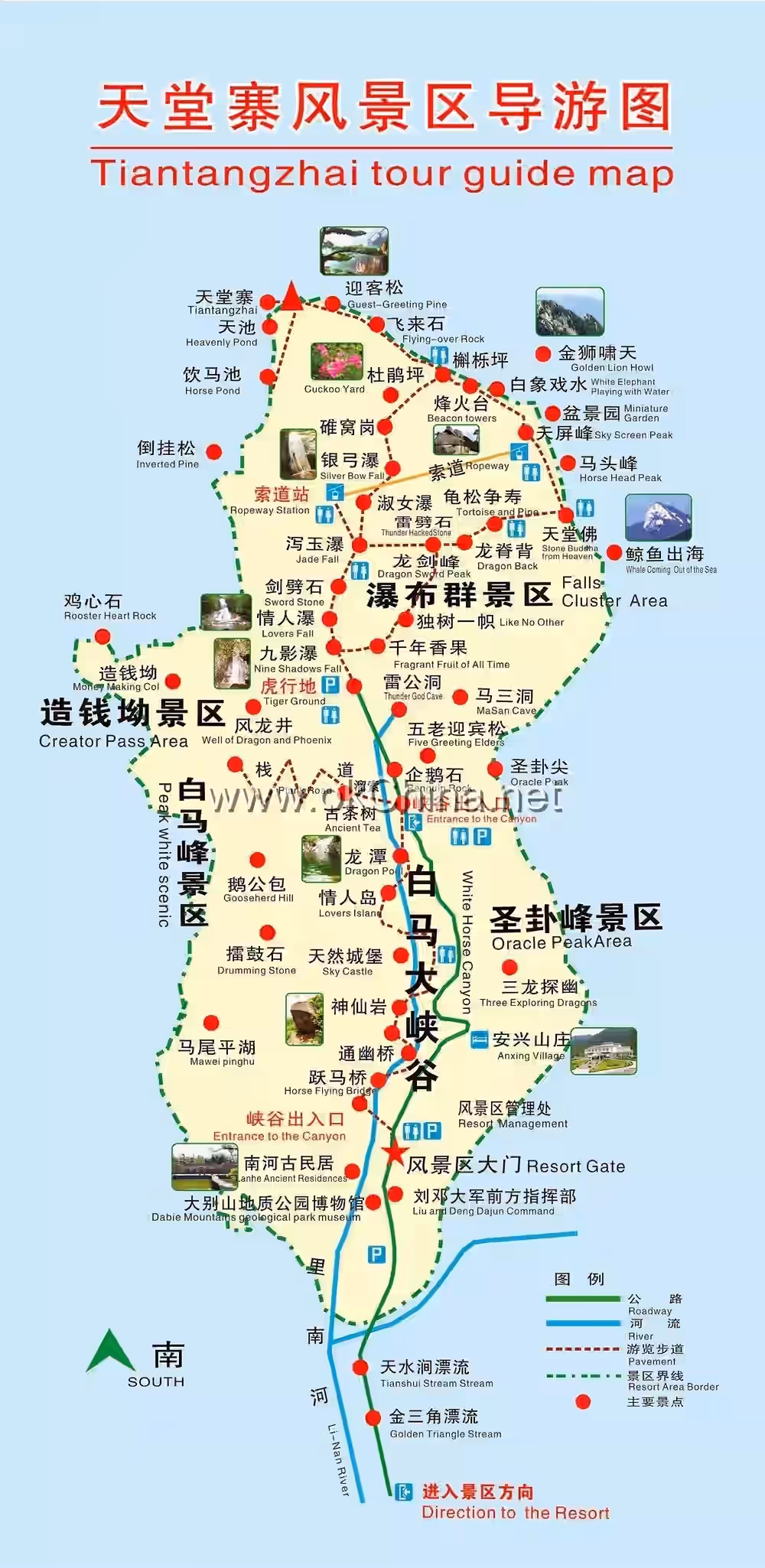
4.1.1 Waterfall Group
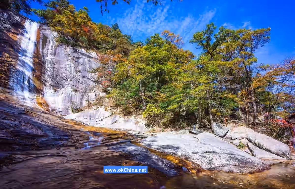
The water features of Tiantangzhai Forest Park are primarily manifested in waterfalls, streams, ponds, and pools, with Waterfall No. 1, Waterfall No. 3, and Longjing River being the most notable.
- Waterfall No. 1 (Jiuying Waterfall): This hanging waterfall has a drop of 71 meters and a curtain width of 8 meters. Below the waterfall lies a deep pool covering an area of 30 square meters.
- Waterfall No. 3 (Xieyu Waterfall): With a vertical height of 62 meters and a curtain width of 11–13 meters, the waterfall rock is pale purple, slightly inclined, and has an uneven surface.
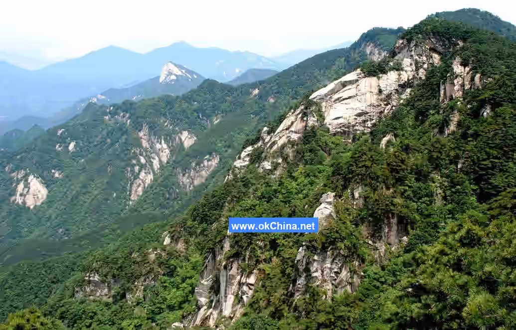
4.1.2 Peculiar Peaks and Strange Rocks
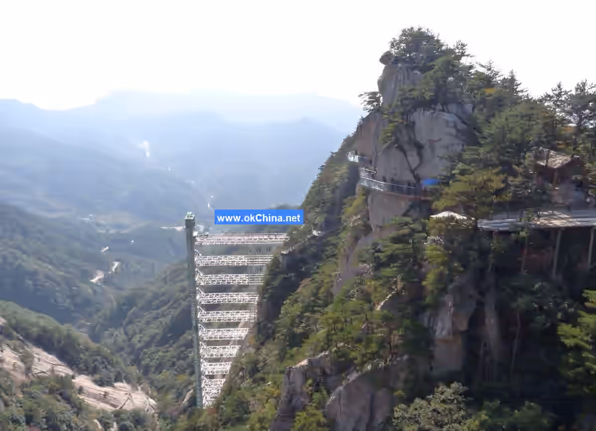
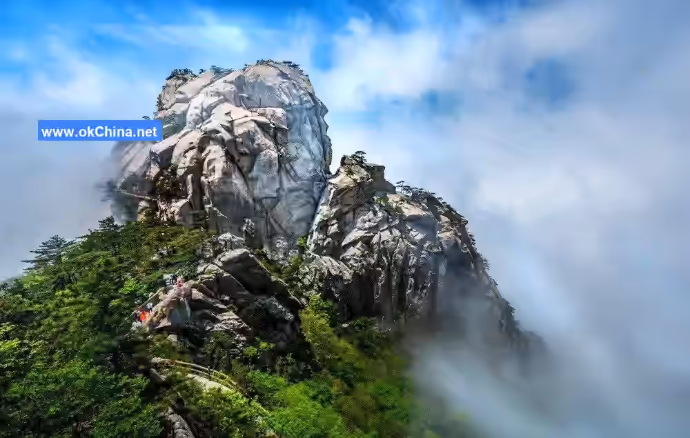
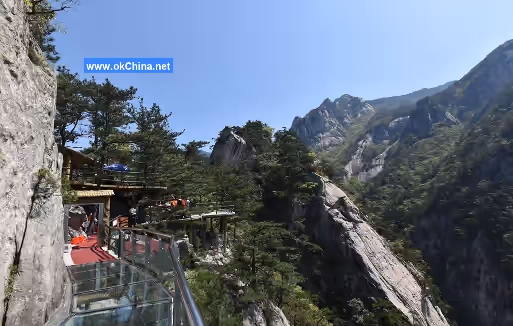
Nature's craftsmanship has sculpted Tiantangzhai's peaks and rocks into a fascinating garden of oddly shaped bonsai. Located in the heart of the Dabie Mountains, the unique granite and granitic gneiss have weathered to form a landscape characterized by surrounding mountains and numerous peaks, creating the distinctive mountain scenery of Tiantangzhai Forest Park. The most attractive peaks include Xiaohua Mountain, White Horse Peak, Philosopher Peak, Tiantangzhai, and Five Dragons Facing Heaven.
- White Horse Peak: With an altitude of 1,480 meters, White Horse Peak is composed of a saddle, back, and tail. Surrounded by thousand-meter cliffs, the ridge features famous spots such as "Horse Tail in Clear Snow" and "Saddle in Evening Glow," making it a main attraction of Tiantangzhai Forest Park.
- Dragon Sword Peak: The dragon's backbone stretches continuously, adorned with strange rocks and peculiar pines in various shapes. Notable sites include "Thunder-Split Rock" and "Tortoise and Pine Sharing Longevity," among others.
- Tiantangzhai Main Peak: Standing at 1,729.13 meters above sea level, the Tiantangzhai main peak is one of the main peaks of the Dabie Mountains. It marks the border between Anhui and Hubei provinces and serves as the watershed between the Yangtze and Huai Rivers. Tiantangzhai is majestic, perilous, secluded, and profound. The mountain is lush with vegetation, featuring distinct zonal distributions of Huangshan pine and Huangshan oak.
4.1.3 Immortal Valley
Walking 200 meters south along the river from the Luotian Tiantangzhai Scenic Area Management Office leads to Immortal Valley. The valley stretches approximately 2,500 meters and is formed by the convergence of Longjing River and Xiaoji River, with a valley width of about 30–40 meters.
4.1.4 Xiaohua Mountain
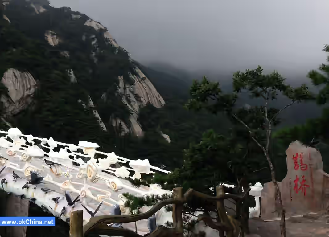
Xiaohua Mountain has an altitude of 1,102 meters. It is accessible only by a narrow path about a foot wide, with steep cliffs on both sides, leading to the ridge of the peak.#### 4.1.5 Stone Swallow Rock Located northeast of the West Stockade Gate and upstream of the Ethereal Valley, it is a rocky mountain entirely composed of rock mass, resembling a giant inverted swallow's nest suspended in the air. From a distance, it looks like a flock of swallows perched on a massive stone cliff, busily carrying mud to build their nests. Its majestic appearance is truly beyond words.
4.1.6 Philosopher Peak
Also known as the "Heavenly Inquiry" Peak, it is a mountain entirely formed of rock. A massive cliff at the northeastern end, approximately 100 meters high, strikingly resembles a giant head.
4.1.7 White Horse Peak
Features include Lovers' Waterfall, Whale Emerging from the Sea, Paradise Stone Buddha, Horse Head Peak, Paradise Dawn, Golden Lion Roaring at the Sky, and Red Army Village.
4.1.8 White Horse Grand Canyon
Located at the foot of White Horse Peak at an altitude of 1600 meters in Tiantangzhai, the White Horse Grand Canyon stretches about 6 kilometers. It is one of the main sources of the Huai River and also serves as the water source for Hefei, the capital city of Anhui Province.
4.1.9 Dragon Sword Peak Scenic Area
Situated above the Jade Cascading Waterfall, the entire peak is rock-based and is named for its resemblance to a giant sword.
4.2 Cultural Landscapes
4.2.1 Ancient Stockade Legacy
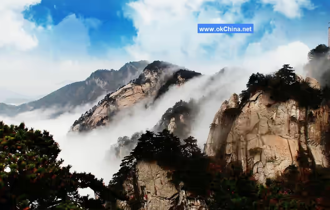
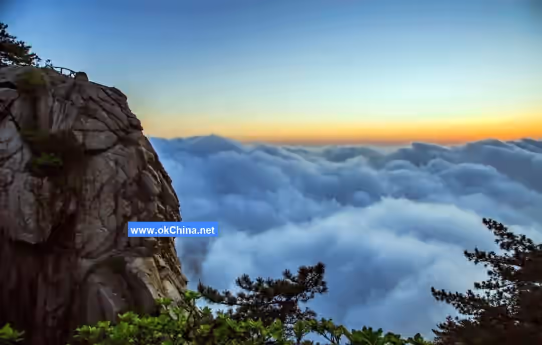
Tiantangzhai boasts multiple cultural landscape sites related to peasant uprisings. The main peak of Tiantangzhai, strategically located straddling Hubei and Anhui, has been a contested military stronghold. In the late Southern Song Dynasty, Cheng Lun initially built the Tiantangzhai stockade on Duoyun Mountain (Tiantangzhai Peak) to resist the Yuan. Later, during the late Yuan Dynasty, the monk Peng Ying and the cloth peddler Xu Shouhui gathered followers to rebuild Tiantangzhai in rebellion against the Yuan. Throughout history, people gathered at Tiantangzhai to resist oppression, leaving behind numerous historical sites. These simple, timeworn ancient ruins are integrated into Tiantangzhai's natural forests, evoking a sense of historical vicissitudes. An ancient poem says: "The ancient rock stockade pierces the clouds, the first pass in the southeast of Wu and Chu," and "This mountain alone stores heroes, from which many mighty figures emerged," describing this historical fact. The main peak of Tiantangzhai is often shrouded in clouds and mist year-round, making it the best spot for viewing sunrises and seas of clouds. In the right season, one might even witness a colored Buddha's halo. Another poem states: "In the past, this place was most cloudy; today, I joyfully watch the clouds and mist arise. The mountains before my eyes suddenly disappear, making me wonder if I'm in a small Penglai." Therefore, Liu Yuxi wrote: "Gazing east at the cloud-capped mountains as the sun sets is splendid."
4.2.2 Dragon Scale Bamboo
On the Qinglongzui (Green Dragon Mouth) of the ancient residential area in Xinwuwan, Nanhe, Tiantangzhai, there is a large bamboo grove. The bamboo is deep and the leaves are emerald green, with Hwameis and kingfishers residing there year-round. Botanists have called it a wonder of the plant kingdom.
4.2.3 Parrotia subaequalis
Parrotia subaequalis is a deciduous tree with a graceful posture and lush branches and leaves. It blooms in mid-March, flowers appearing before the leaves. The flowers are pale green, turning white after greening, with yellow anthers tinged with red. The flowers initially face upward, drooping after full bloom. From afar, the tree appears golden; up close, one can see silvery filaments. It is now listed as a nationally protected endangered plant.
4.2.4 Dabie Mountains Geological Museum
Located in the main area of the Anhui Dabie Mountains National Geopark, it covers an area of 6,667 square meters. The main exhibition hall is divided into sections: a sand table, mineral and rock specimen displays, animal and plant specimen displays, an ecological park area, a souvenir area, and an audiovisual hall.
4.2.5 Anhui Ancient Dwellings
Located 12 kilometers from the Tiantangzhai scenic area, under the jurisdiction of Nanhe Village, Tiantangzhai Town. These ancient dwellings have a long history, are rich in cultural heritage, and boast profound cultural积淀. Dwellings in Ming and Qing architectural styles line both sides of the Dangxi Stream for over 900 meters. Ancient streets, wells, docks, buildings, dwellings, and marketplaces, combined with the淳朴 ancient folk customs, form a typical western Anhui style. In 2008, the Nanhe Ancient Dwellings in Tiantangzhai Town were awarded the provincial title of "Forest Tourism Homestay."
The structure of Tiantangzhai's ancient dwellings primarily uses brick and wood, with stone foundation walls and mostly wooden column bases. They utilize bracket sets and reduced columns to expand interior space. Houses typically have two or three main halls with three or four courtyards, complete with eastern pavilions, western wings, study rooms, and towers. Exquisite boudoirs, study lofts, gardens, scripture halls, and side rooms are integral parts, forming the unique style of Tiantangzhai's ancient dwellings. For lighting, rainwater collection, and ventilation, each dwelling features a square skywell, with each courtyard leading to another hall, embodying the ancient Chinese philosophical concept of harmony between man and nature.
4.2.6 Hubei Luotian Ming and Qing Ancient Architectural Complex
The Xinwuyuan Ancient Architectural Complex is located in Guanjiping Village, Jiuzihe Town, Luotian County, Hubei Province, and is a Ming and Qing dynasty ancient building complex. It covers a total area of 0.5 square kilometers. The mountain village has about 120 residents in 30 households. The construction history of the complex dates back to the early Qing Dynasty, with a history of nearly two hundred years. This architectural complex is listed as a county-level cultural relics protection unit.
5. Cultural Activities
Tiantangzhai hosts activities such as the April Mountain and Water Carnival Month, the annual Tiankuang Festival on the sixth day of the sixth lunar month, the tradition of welcoming married daughters back home, folk song competitions, flower stick dancing, flower basket carrying, dragon lantern dances, land boat racing, the豪迈 Earth-Shaking Gongs and Drums, and激情飞扬 bonfire parties.
Main recreational activities include: bonfire parties, grand Yangko dance, dragon lantern dance, lantern dragons, straw bundle dragons, and bench dragons.
Comments
Post a Comment