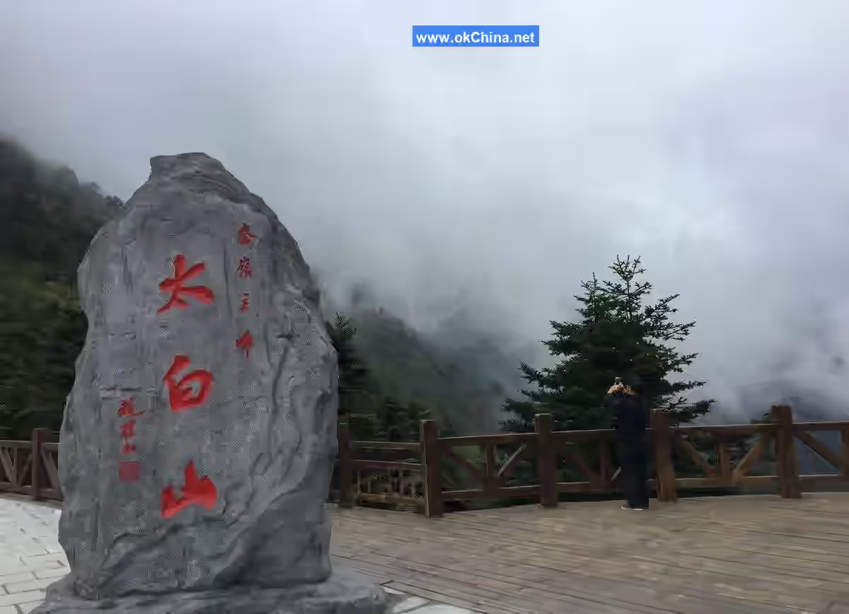
Taibai Mountain National Forest Park
I. Introduction
Taibai Mountain National Forest Park is located in Mei County, Baoji City, Shaanxi Province, on the northern foothills of Taibai Mountain, the main peak of the Qinling Mountains. The park covers an area of 2,949 hectares with a forest coverage rate of 94.3%. The park features forest landscapes as its main body, majestic mountains and peculiar peaks as its framework, and clear streams and emerald pools as its veins, interspersed with cultural relics and historical sites. The natural and cultural landscapes blend seamlessly, making it a rare natural scenic tourist area in western China, acclaimed as a green pearl of the region. It includes 10 scenic areas and over 180 attractions. With an altitude ranging from 620 meters to 3,511 meters, it is the highest-altitude national forest park in China.
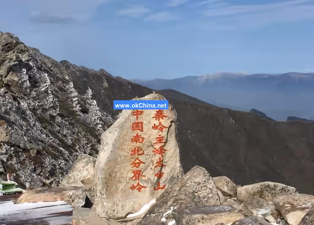
Taibai Mountain, situated within the Qinling range, stands out prominently among the peaks like a crane among chickens. Since ancient times, Taibai Mountain has been renowned throughout China and the world for its characteristics of height, cold, danger, wonder, richness, and mystery. With its beautiful scenery, Taibai Mountain is both a tourist destination and a site for Taoist activities. Since the Tang and Song dynasties, many scholars and literati have ascended the mountain to write, leaving behind widely celebrated poems and essays. The Illustrated Records of Scenic Spots in Guanzhong notes: Taoist texts state that Taibai Mountain is the Eleventh Grotto-Heaven of Taoism. Therefore, every midsummer, climbers admiring the scenery and pilgrims visiting the sacred mountain come in an endless stream.
II. Geographical Location
Taibai Mountain is divided from bottom to top into three geomorphological types: low mountain area, middle mountain area, and high mountain area, each with distinct forms and characteristics. The low mountain area is covered by loess, the middle mountain area features developed rocky peaks, and the high mountain area preserves glacial relics.
Low Mountain Area
This area lies between 800 and 1,300 meters above sea level. The terrain undulates, combining features of loess landforms and rocky mountain landforms, with relatively small relative height differences, loess cover, and rounded hilltops. Where bedrock is exposed at the mountain base, water flow often erodes and cuts along fault zones, forming deep canyons.
Middle Mountain Area
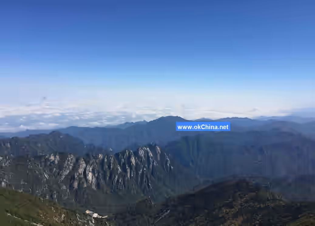
This area lies between 1,300 and 3,000 meters above sea level. The northern slope generally extends from Liujiaya to Fangyang Temple, and the southern slope from Huangbaiyuan to Sanqing Pond, belonging to the rocky middle mountain area. Below the Main Hall are deeply incised valleys, with V-shaped cross-sections formed by broken rocks in the gullies. The ridges between valleys are steep and often serrated. Above the Main Hall, rocky peaks stand in great numbers, with jagged and grotesque rocks in myriad forms. The area from the Main Hall to Doumu Palace features layered green peaks resembling a screen. The Maiduo Stone on the northeast ridge of the Main Hall is particularly peculiar. Near Doumu Palace, granite gneiss columnar peaks stand like giant stone pillars, towering proudly into the clouds. Between Doumu Palace and Fangyang Temple, massive blocky rocks are common, crowding and overlapping in the valleys.
High Mountain Area
This area extends from above 3,000 meters to the summit of Taibai Mountain, where Quaternary glacial landforms are relatively clear and well-preserved. The remnants of Quaternary glacial landforms in this area are classified by glacial action type into glacial erosion landforms and glacial deposition landforms. Morphologically, glacial erosion landforms include cirques, horns, and trough valleys; glacial deposition landforms consist only of terminal moraine ridges. Baxian Terrace is the center of Quaternary glacial activity, so various glacial landforms are mostly distributed around it.
Cirque Lakes and Horns
Big Taibai Lake and Second Taibai Lake are two typical, well-preserved cirque lakes on Taibai Mountain. The former is located northwest of Baxian Terrace, surrounded by cliffs on the east, south, and west, opening to the north. The latter is located southwest of Baxian Terrace, with its opening facing south. Third Taibai Lake is a glacial erosion lake affected by faults, with a surface elevation of 3,485 meters. Yuhuang Pond is the largest glacial erosion lake on Taibai Mountain, with a surface elevation of 3,380 meters. The only horn on Taibai Mountain is Baxian Terrace, which is an underdeveloped and not very typical horn.
Trough Valleys
Their cross-sections are U-shaped, with two typical examples: First, the Big Taibai Lake Trough Valley, located below its cirque, extends northwest for about 1,500 meters, ending near 3,100 meters above sea level, below which it is replaced by V-shaped valleys formed by fluvial erosion. The valley floor is about 200 meters wide, covered with blocks and gravel. Descending along the valley, there are three steps called glacial steps. Big Taibai Lake is located within the first glacial step, with varying distances between adjacent steps; the height difference between the first and second steps is nearly 100 meters, and between the second and third steps about 60 meters. Second, the Second Taibai Lake Trough Valley, located below its cirque, extends southward, slightly curved due to pre-glacial influences, about 3,000 meters long and 300-400 meters wide. The trough valley descends step by step in a staircase-like manner, with a terminal elevation of 3,000 meters above sea level.
Stone Seas, Stone Rivers, and "Horse Hoof Prints"
From the top surface of Baxian Terrace, northeast to Wengong Temple Ridge, and west through Paoma Liang to Ao Mountain, angular gravel blocks of various sizes are widespread, covering ridges and plateaus, connecting to form areas resembling seas and rivers made of stones, hence the names. Paoma Liang is covered with stone rings and patterned ground formed by freeze-thaw sorting, a special type of periglacial landform. These are regular geometric patterns formed by coarse gravel surrounding fine-grained soil and small crushed stones. The outer ring of coarse gravel arranged in a circle is called a stone ring; because they resemble hoof prints left by horses, they are named "Horse Hoof Prints," and Paoma Liang also derives its name from this.
Climate Characteristics
Low Mountain Temperate Monsoon Climate Zone
On the northern slope of Taibai Mountain, between 800 and 1,500 meters above sea level, the climate is temperate monsoon. The average annual temperature is about 11°C, with annual accumulated temperature between 3,200 and 3,500°C. Summer average temperatures range from 20 to 23°C, with extreme highs of 35-37°C. In winter, the average temperature of the coldest month is between -7 and -2°C, with snow cover and soil freezing periods often exceeding three months. Autumn precipitation accounts for 60-65% of the annual total.
Middle Mountain Cold-Temperate Monsoon Climate Zone
Between 1,500 and 3,000 meters above sea level, there is no summer, with short springs and autumns and long winters. The climate is cold and humid, with abundant rain and fog. The average annual temperature is 6°C. Active accumulated temperature ranges from 1,900 to 2,500°C, with a frost-free period of only about 140 days. Annual precipitation can reach 750-1,000 mm. Spring begins in late April or early May, with average May temperatures between 11 and 13°C. Extreme high temperatures can sometimes reach 30°C, but once cold waves strike, temperatures can drop below 0°C, so snow may still linger on shady slopes. Snowfall begins from late September to early October. Winter lasts from October to April of the following year, with extreme minimum temperatures between -25 and -12°C, deep snow accumulation, sometimes not completely melting until June or July of the next year. Annual relative humidity reaches 70-80%, resulting in high humidity and frequent fog, often with glaze and rime, creating magnificent scenery. Hence, the Tang dynasty calligrapher Zhang Xu wrote in his poem "Staying Guests in the Mountains": "Even if the sky is clear without a hint of rain, deep into the clouds, clothes are already damp."
High Mountain Subarctic Climate Zone
Between 3,000 and 3,360 meters above sea level, the climate is cold and humid, with an average annual temperature between -2 and -1°C, and annual precipitation about 800-900 mm. From October to April of the following year, average temperatures are below 0°C, with soil freezing periods lasting 7-8 months. Winter lasts for nine months of the year. In mid-June and mid-September, average temperatures range between 10 and 14°C. The upper limit of this zone marks the upper forest line of Taibai Mountain.
High Mountain Arctic Climate Zone
Above 3,350 meters on Taibai Mountain, the climate is arctic. This zone is cold and semi-humid, with no autumn, long winters, rapidly changing weather, strong winds, and intense solar radiation. Clear, cloudy, windy, and rainy conditions change in an instant, with frequent fog shrouding the peaks, making them appear and disappear. The cold period lasts 9-10 months per year, with the annual average temperature rarely exceeding 8°C. From October to April of the following year, average temperatures are below 0°C, with extreme minimum temperatures dropping to around -30°C. July and August are cool, with daily average temperatures between 5 and 10°C for about 50 days. Diurnal temperature variations are large, and southeast winds are common. The maximum precipitation altitude is 1,500 meters higher, so precipitation significantly decreases, with annual precipitation about 750-800 mm. Frost begins in August, and snowfall starts in September, continuing until May of the following year. The solid ice of Big Taibai Lake generally melts only in July. The summit, Baxian Terrace, is covered in ice and snow most of the time; in cold, snowy years, snow may remain year-round. In July and August, at noon on clear days, around Big Taibai Lake and Baxian Terrace, although cold winds blow, the sunlight feels scorching, and the perceived temperature can reach about 50°C.
Natural Resources
With forest landscapes as the main body, majestic mountains and peculiar peaks as the framework, and clear streams and emerald pools as the veins, interspersed with cultural relics and historical sites, the park forms a vivid picture where dynamic and static beauty harmonize, and natural and cultural landscapes blend seamlessly. It is a rare natural scenic tourist area in western China, acclaimed as a green pearl of the region.
Rich and Rare Biological Species
The Qinling Mountains are the natural dividing line between northern and southern China, a convergence point for the flora of North China, Central China, and West China, and a transition zone for the fauna of the Palearctic and Oriental realms. The park boasts a wide variety of biological species, abundant resources, complex flora and fauna, and ancient origins, serving as a natural gene bank for species. It includes over 1,850 species of seed plants and bryophytes, over 1,690 species of forest animals and insects, with 26 species of nationally protected trees and endangered protected plants, and 9 species of rare protected animals.
Taibai Mountain National Forest Park has a rich variety of species with ancient origins, making it a natural gene bank, often called the "Asian Natural Botanical Garden" and "China's Natural Zoo." Under the combined effects of Taibai Mountain's complex and varied geographical factors and specific cosmic factors, endemic and new species have formed on Taibai Mountain, such as Taibai larch (Larix potaninii var. chinensis), Mei willow (Salix meyi), Taibai ginseng (Panax taibaiensis), Taibai monkshood (Aconitum taipaicum), Taibai fritillary (Fritillaria taipaiensis), and Taibai honeysuckle (Lonicera taibaiensis). The park contains a total of 1,850 species of seed plants.Due to the ancient nature of the forest vegetation on Taibai Mountain, there are many rare and relict species. Among them, nine species are under national second-level protection, including Taibai larch, Tetracentron sinense, Cercidiphyllum japonicum, Sinowilsonia henryi, Eucommia ulmoides, Kingdonia uniflora, Circaeaster agrestis, Picea neoveitchii, and Ophioglossum thermale. Additionally, there are eleven third-level protected tree species, such as Acer miaotaiense, Dipteronia sinensis, Euptelea pleiosperma, Paeonia rockii, and Trillium tschonoskii.
The abundant forest resources and complex natural environment of Taibai Mountain National Forest Park provide an excellent habitat for wildlife, making it a natural paradise for rare birds and animals. The park is home to over 1,690 species of forest animals and insects, including three species under national first-level protection: the golden snub-nosed monkey, giant panda, and takin, as well as seven second-level protected animals, such as the clouded leopard, leopard, Temminck's tragopan, serow, and Chinese giant salamander.
Unique and Steep Mountain Landscapes
The low mountain areas feature deep and narrow valleys with picturesque mountain and cloud scenery. The middle mountain areas are characterized by steep slopes, serrated ridges, towering peaks, and overlapping mountain ranges. The high mountain areas showcase unique landforms shaped by Quaternary glacial activity.
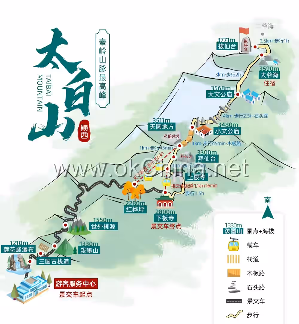
III. Main Attractions
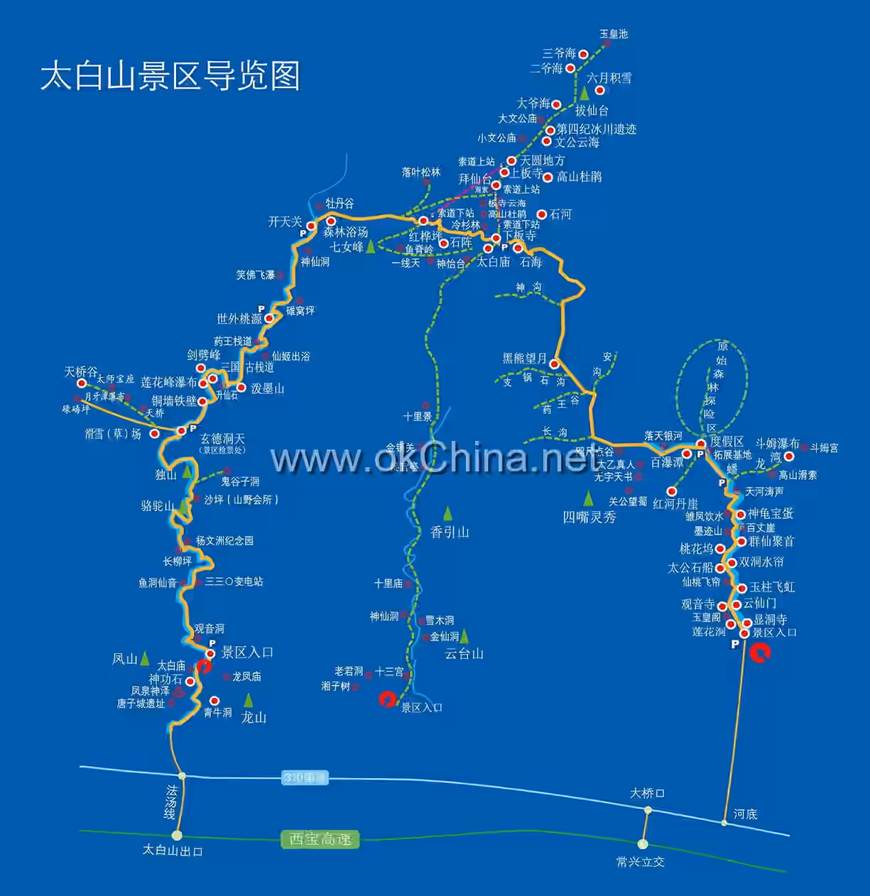
Taibai National Forest Park connects eight scenic areas and over 140 attractions through 40 kilometers of tourist roads and 28 kilometers of pedestrian trails. The main scenic areas and attractions include:
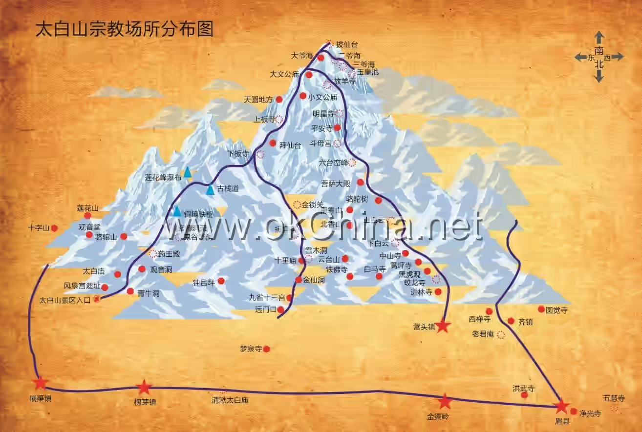
Longshan, Fengshan, and Fengquan Scenic Areas
Visitors can enjoy the "Eight Scenic Spots of Mei County," such as Fengquan Divine Spring and Fish Cave Fairy Sound. They can also explore historical sites like the Tangzi City Ruins, Fengshan Peak, Fengquan Palace, and Shengong Stone. Additionally, they can pay homage at Taoist temples like Qingniu Cave, Taibai Yaowang Temple, Longfengshan Temple, and Guanyin Cave. Tourist hotels, commercial stalls, and recreational facilities are concentrated in this area.
Dongtian Fudi Scenic Area
This area is historically recorded as the place where Guiguzi lived in seclusion, practiced Taoism, and taught disciples. Attractions include Xuande Cave Gate Tower, Dushan Mountain, and Dianjiang Platform.
Jiujiu Gorge Scenic Area
This area is densely packed with scenic spots and boasts stunning landscapes, making it the essence of the park's natural beauty. Highlights include the towering Copper Wall and Iron Cliff, the breathtaking Thousand-Foot Lotus Peak Waterfall, the winding cliffside plank roads, the vividly depicted Ink-Splashing Mountain, the idyllic scenery of the Peach Blossom Spring, and the historical relics of Sun Simiao at Duìwō Píng. Other attractions include Xiunü Yuli, Jianpi Peak, Shengxian Stone, Xianji Chuyu, and Yaowang Plank Road.
Xianqiao Valley Scenic Area
Located east of Jiujiu Gorge, this area features attractions such as the Giant Stone Fairy Bridge, Dajia (ancient wooden plank road), and the Three-Level Thousand-Foot Waterfall.
Kaitian Pass Scenic Area
This is a cold-temperate tourist area dominated by vast primeval forests. Visitors can admire the scenic forest belts of pine and red birch, as well as attractions like Xiaofo Flying Waterfall, Fairy Cave, Chongyang Palace, Lotus Hidden Valley, and Peony Gully.
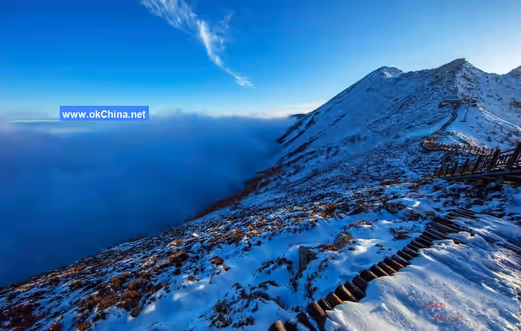
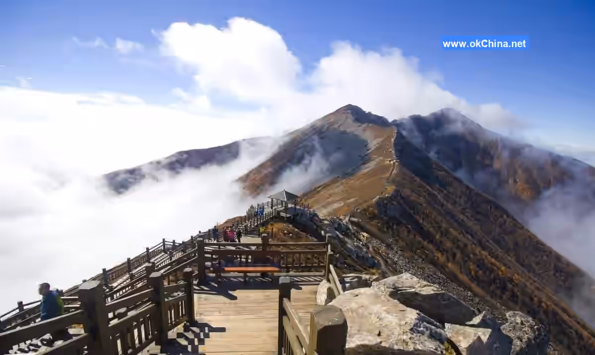
Cloud Sea Viewing Scenic Area
Located at an altitude of 2,300 to 3,511 meters, this area spans subarctic and arctic climate zones. Visitors can observe three plant landscape belts: Taibai fir, larch, and alpine shrub meadows. The Quaternary glacial relics here are diverse and bizarre. Temperatures are 5–15°C lower than at the foot of the mountain, making it an ideal place for summer retreats, vacations, and scientific research.
Hot Spring Area
The low mountain area of the park is rich in geothermal fields. The hot spring water temperature reaches 72°C and contains over twenty minerals and trace elements beneficial to human health, making it an excellent medical mineral water.
Natural Landscapes
"Taibai Snow in June"
"Taibai Snow in June" is one of the Eight Scenic Spots of Guanzhong. The Shui Jing Zhu records that Taibai Mountain is "the most magnificent among all mountains, with snow in winter and summer, appearing bright and white." The Tang Dynasty poet Du Fu wrote, "Still gazing at Taibai's snow, joyfully encountering Wugong's sky." Liu Zongyuan's Taibai Mountain Shrine Record begins: "To the southwest of Yongzhou lies Liang, where the mountain is called Taibai. The land is perpetually cold, and the accumulation of ice and snow never ceases." In the Song Dynasty, Su Shi described in Praying for Rain at Taibai Mountain that during a severe spring drought, the weather was dry and hot, and wheat seedlings withered, yet the mountain remained "with cliffs already extraordinarily steep, ice and snow carved sharply." The Yuan Dynasty poet Zhu Duo wrote in his poem Taibai Mountain: "Snowflakes dot the emerald screen, the autumn wind cannot blow them away," emphasizing the early snowfall and accumulation. The Yuan Dynasty Unified Records states: "The mountain (Taibai Mountain) is extremely high, perpetually covered in snow, appearing bright and white." In the Ming Dynasty, Wang Qi's Sancai Tuhui describes Taibai Mountain's perennial snow: "The mountain peak often retains snow that does not melt, appearing brilliant even in midsummer." He Jingming also wrote in Song of Taibai Mountain: "On the shady cliffs, ancient snow accumulates white, and the pines in the deep ravines are nearly broken," depicting the long-lasting snow on Taibai Mountain. Thus, the magnificent sight of Taibai's snow in midsummer has a long history and is indeed a spectacular wonder, not an exaggeration or fiction. In the past, during cold and snowy years, the towering peaks were perpetually snow-covered, radiating silver light visible for miles, hence the origin of the wondrous scene "Taibai Snow in June." In recent years, due to gradual climate warming, reduced winter snowfall, and frequent high-temperature droughts in midsummer, this spectacular sight has become increasingly rare.
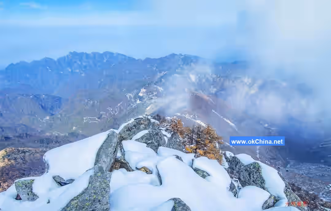
Doumu Strange Peaks
South of the main hall, strange peaks and rocks stand in clusters. Looking east from the main hall, a massive white boulder stands majestically on a series of lush pine-covered ridges, commonly known as "Wheat Stack Stone." Wheat Stack Stone is a huge granite-gneiss fault block, about 60 meters high and approximately 30 meters in circumference, shaped like a cylinder. On clear evenings, the setting sun illuminates the stone, turning it crimson. At this time, the evening mountains are dark, but Wheat Stack Stone shines brilliantly, exceptionally enchanting. Further up, there are the "Five Platforms" (namely, Scripture-Sending Platform, Dressing Table, Farewell-to-Mother Platform, Tear-Dripping Platform, and Homesickness Platform) and the "One Wall," where strange rocks form peaks in various shapes. At Doumu Palace, three isolated granite-gneiss pillar peaks rise abruptly from the ground, piercing the clouds, a breathtaking sight. The peaks' uniqueness is unparalleled. These pillar peaks resemble three giant stone pillars supporting the sky, towering into the clouds, majestic and magnificent. The three pillar peaks are respectively called "Sanhuang Platform," "Yuhuang Platform," and "Yaowang Platform," collectively known as "Doumu Strange Peaks." In the past, each peak had a temple, now in ruins.
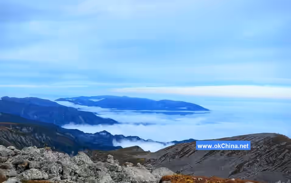
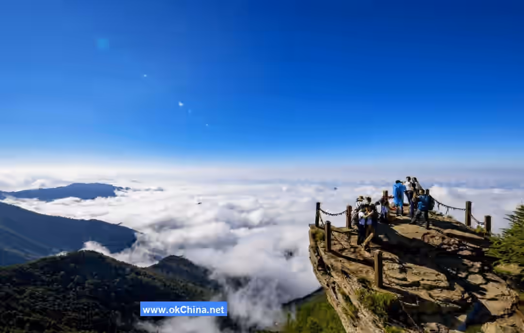
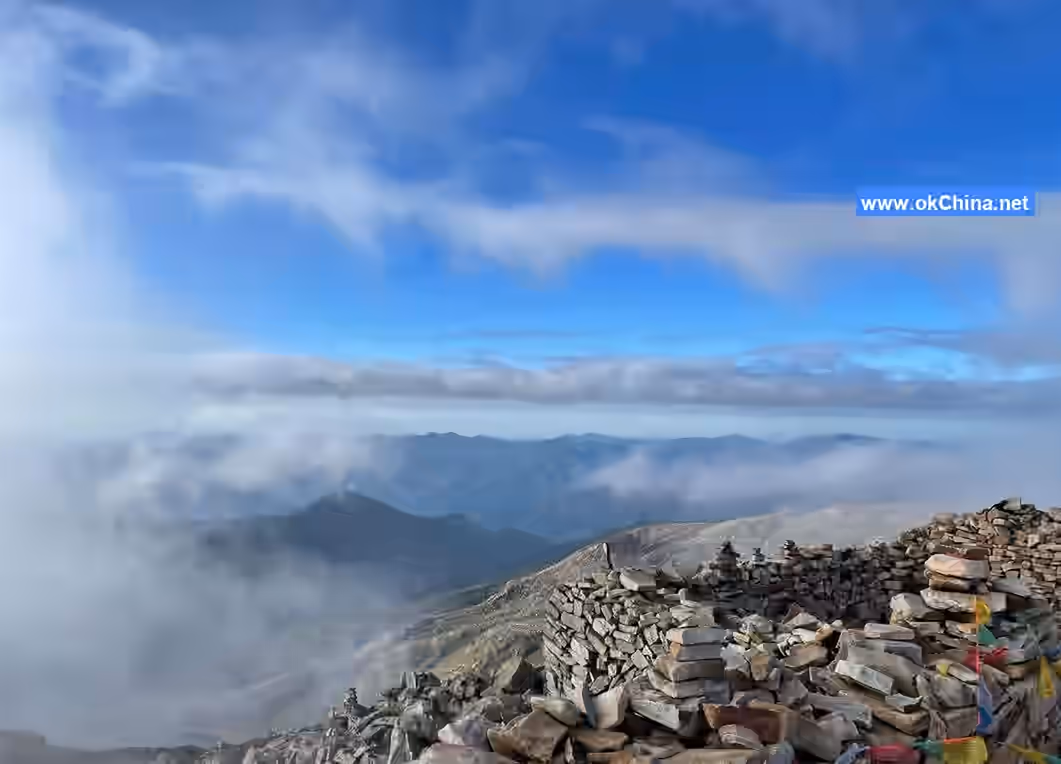
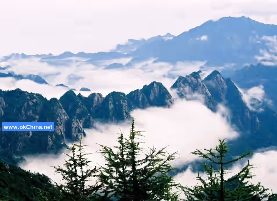
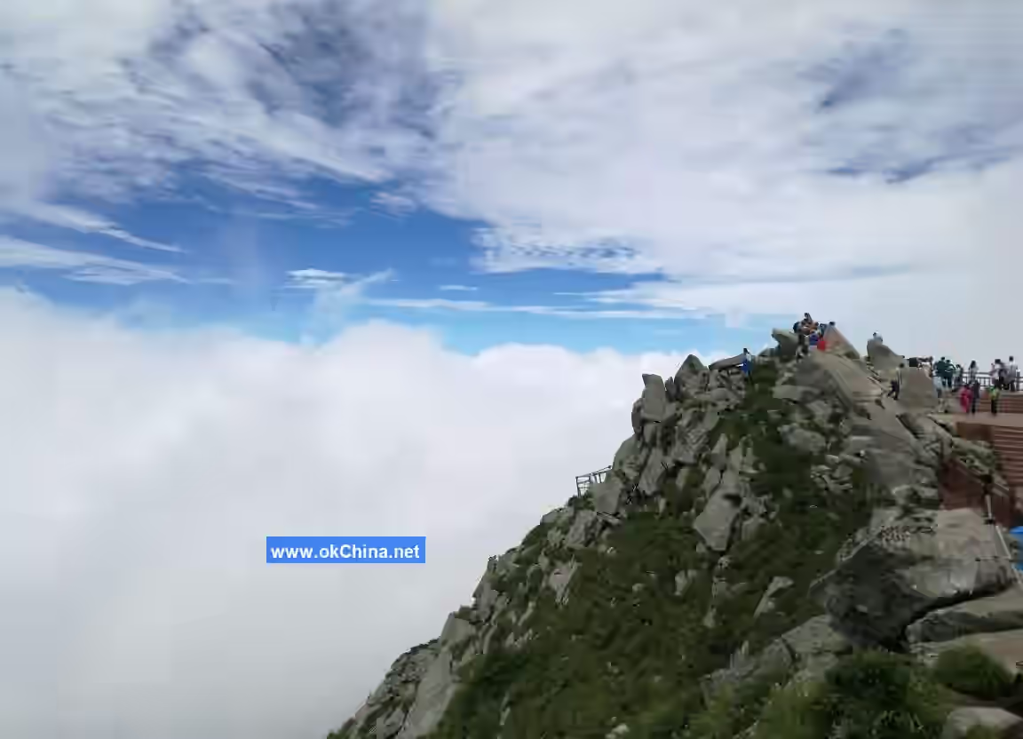
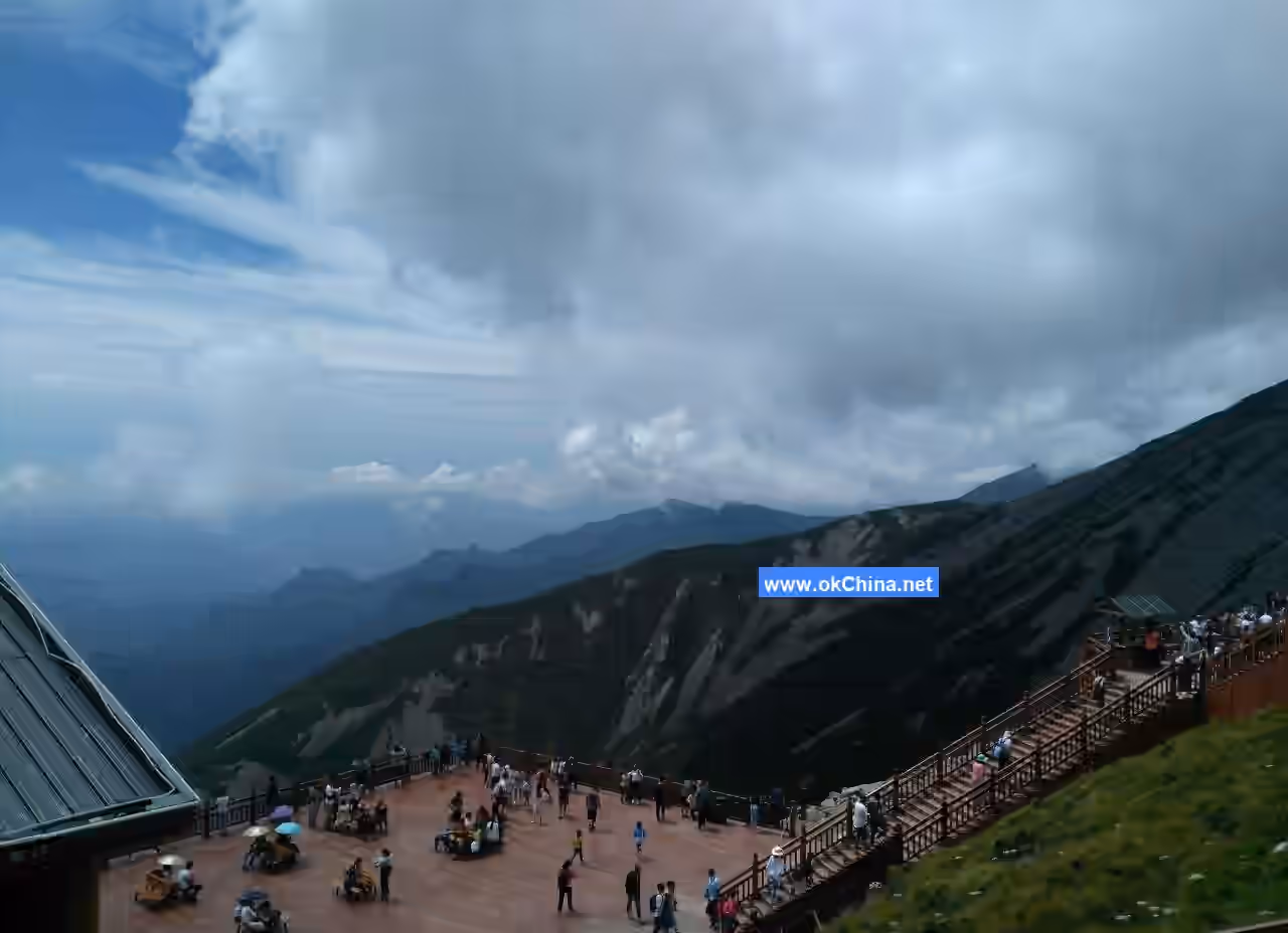
Cloud Sea Spectacle
Taibai Mountain boasts thousands of competing peaks and clouds hidden in countless ravines. At altitudes above 2,000 meters, one can witness extremely spectacular cloud seas, with Ping'an Temple offering the best view. Ping'an Temple is situated on a ridge at 2,700 meters, surrounded by towering peaks like a protective screen, with wide and deep ravines between them. Looking south, Baxian Terrace, Paoma Ridge, and Ao Mountain appear connected like camel humps. Gazing northwest, the winding Taichuan River is faintly visible. Standing at Ping'an Temple, one can see clouds surging like ocean waves, constantly changing. Sometimes they "surge like waves," unstoppable; sometimes they are "calm and tranquil," with fog dispersing and clouds hiding; sometimes dense clouds and fog blanket the sky; sometimes white clouds are as light as silk. During clear mornings and evenings, the cloud sea reflects golden sunlight, presenting a refreshing scene. Immersed in the cloud sea, one feels as if entering a mythical fairyland.
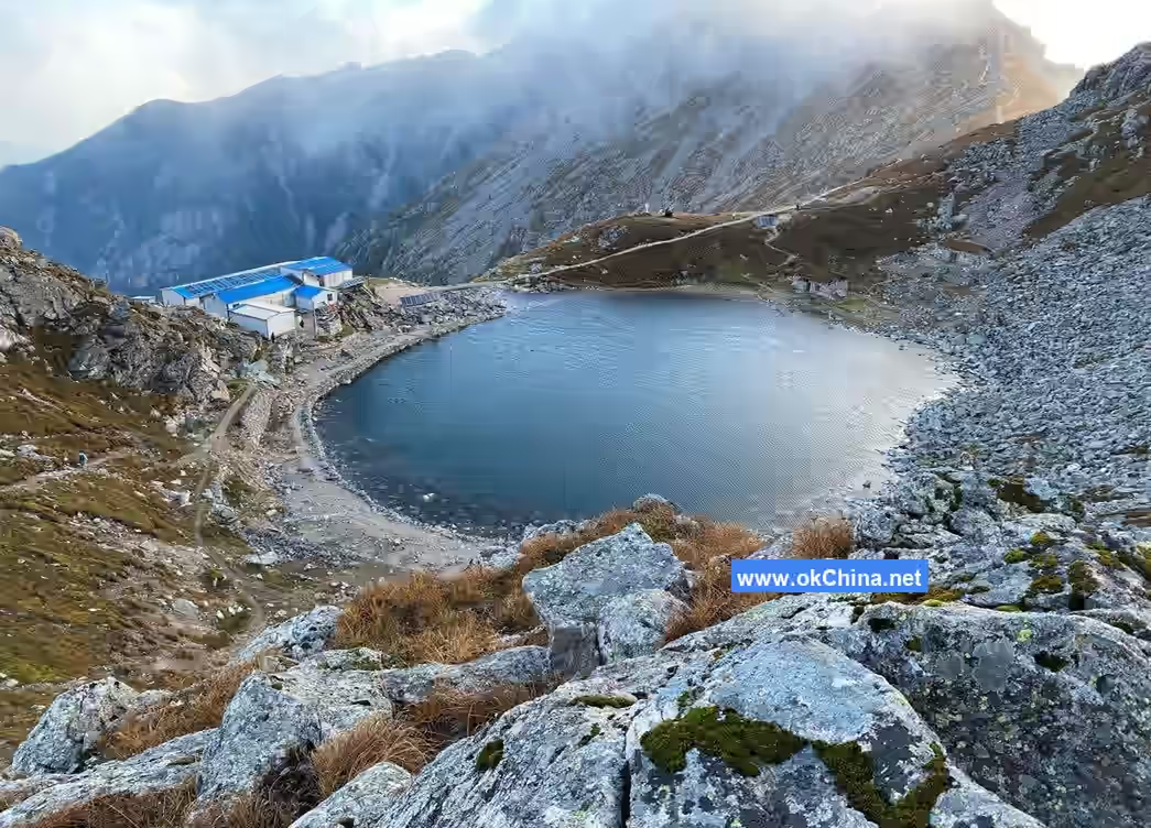
Alpine Strange Lakes
North and south of Baxian Terrace are distributed two cirque lakes and four glacial erosion lakes. Yuhuang Pond is the largest, located on the southern slope of Baxian Terrace at an altitude of 3,380 meters. The lake covers about 30 acres, round like a full moon. On clear days, the sparkling lake reflects the blue sky, white clouds, and mountain peaks, creating a captivating landscape. The smallest, Fo Pond and Sanqing Pond, are nearby. Santaibai Lake lies north of Yuhuang Pond in a trough valley, shaped like a jade ruyi. Ertaibai Lake is north of Santaibai Lake, shaped like a court tablet. Only Dataibai Lake, located in a trough valley north of Baxian Terrace, is round, covering 13.8 acres. On clear days, the lake water is as clear as a mirror, refreshingly cool, and the scenery is intoxicating. During the rainy season, the lake overflows, rushing down the valley with a roaring sound audible from afar. The weather here changes unpredictably; sometimes the lake is shrouded in mist, obscuring nearby objects, and sometimes the mist clears, revealing the green mountains and lake as before. Locals call this mist the "divine curtain." More surprisingly, when visiting in midsummer, one often sees a small bird by the lake called the white-capped redstart, similar in size to a swallow, with a black back, reddish-brown belly, and a white stripe on its head. It chirps "jiu jiu," flies agilely, skimming the lake surface like a dragonfly touching water, or perches calmly on rocks, endearing to observers. The white-capped redstart feeds on aquatic plankton or small leaves, often fluttering over the water to hunt. The Tang Dynasty writer Han Yu wrote: "Fish and shrimp can be scooped up, but who dares disturb the divine creatures? When leaves fall from the forest, birds swiftly rescue them, competing to chirp and fly in arcs, urgently feeding with the leaves." This vividly describes the "divine birds" carrying fallen leaves from the lake surface. Song Dynasty scholar Zhu Bian also described in Fengyue Tang Poetry Talks: "This pond is shaded by the forest, the water surface is serene, fish swim without fear of people, and no one dares to catch them. Fallen leaves in the forest are promptly carried away by birds and discarded far away, so not a single leaf falls into the water all year." Thus, people mystified this rare phenomenon—birds carrying fallen leaves—and passed down legends calling the bird the "water-purifying lad," claiming it "carries away even a leaf or a blade of grass." During the Tang Zhenguan period, a severe drought occurred, and Jingzhao Yin Han Gao fetched lake water to pray for rain, which coincidentally worked. In the Song Dynasty, when Su Shi served as the assistant magistrate of Fengxiang Prefecture, he wrote Praying for Rain at Taibai Mountain. Since then, climbing the mountain to fetch water for rain prayers became a custom, popular for generations. Begging "divine spirits" for blessings was a superstitious practice of the past when people lacked understanding of natural science.
The lakes of Taibai Mountain are unique because they are the highest-altitude and largest alpine lakes in China's inland regions. Moreover, they are exceptionally clear, pristine, and reflective.
Perennial Ice Cave
Located above Dataibai Lake, on the cliff north of Baxian Terrace, this is a natural rock cave about 10 meters deep and 3 meters high. Water drips from crevices in the cave ceiling, creating a damp, cold, and eerie atmosphere. Inside, three statues of the Taibai Mountain deity, cast in iron, are enshrined. In the past, due to extreme cold, water dripping from the crevices formed stalactite-like ice columns that never melted year-round, hence the name "Perennial Ice Cave." In modern times, as the climate has warmed, ice is rarely seen during hot summers.
Comments
Post a Comment