Siguniang Mountain Scenic Area in Aba Prefecture
1. Introduction
The Siguniang Mountain Scenic Area (MT.SIGUNIANG) in the Aba Tibetan and Qiang Autonomous Prefecture, abbreviated as Siguniang Mountain Scenic Area, is located within Siguniangshan Town, Xiaojin County, Aba Tibetan and Qiang Autonomous Prefecture, Sichuan Province. It belongs to the Qionglai Mountains of the Qinghai-Tibet Plateau, with its protected area situated 220 kilometers east of Chengdu. Siguniang Mountain is adjacent to the Wolong National Nature Reserve. Its geographical coordinates range from 102°42′30″E to 102°58′40″E and 30°54′16″N to 31°16′21″N, covering a total area of 560 square kilometers.
The Siguniang Mountain Scenic Area features a subtropical climate. It is situated on the eastern edge of the first topographic step, the Qinghai-Tibet Plateau, within the transitional zone from the second step, the Sichuan Basin, to the Qinghai-Tibet Plateau. The area has complex geological structures and diverse landforms and soil parent materials. The rivers within the area belong to the Qingyi River system, a secondary tributary of the upper reaches of the Yangtze River's Dadu River basin. The vegetation falls within the western Sichuan alpine gorge coniferous forest zone. The area is home to nationally protected wildlife such as giant pandas, snow leopards, and Sichuan takins. The core scenic spots of the Siguniang Mountain Scenic Area are known as the "Three Valleys and Four Peaks": the three valleys are Shuangqiao Valley, Changping Valley, and Haizi Valley; the four peaks are Yaomei Peak (the youngest sister), Third Sister Mountain, Second Sister Mountain, and First Sister Mountain.
2. Geographical Location
2.1 Location and Territory
The Siguniang Mountain Scenic Area in Aba Tibetan and Qiang Autonomous Prefecture is located in the eastern part of Xiaojin County, Aba Tibetan and Qiang Autonomous Prefecture, Sichuan Province. It is adjacent to the Wolong National Nature Reserve and is approximately 175 kilometers from Chengdu. Its geographical coordinates range from 102°42′30″E to 102°58′40″E and 30°54′16″N to 31°16′21″N, with a total protected area of 560 square kilometers.
2.2 Geology and Geomorphology
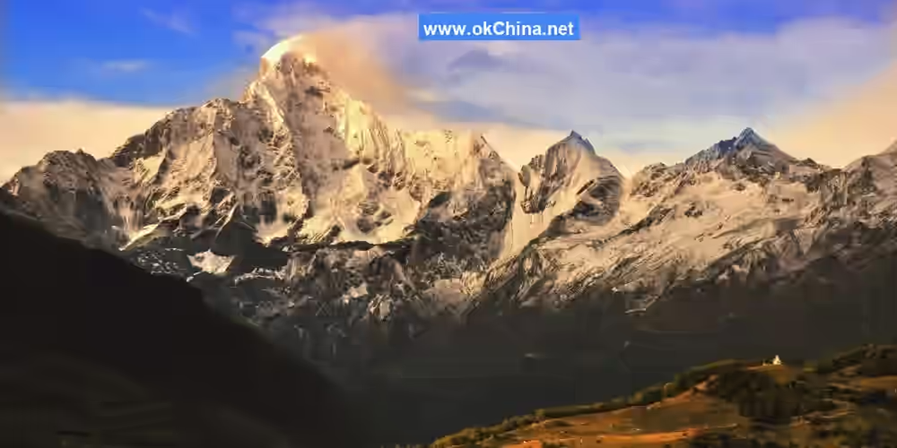
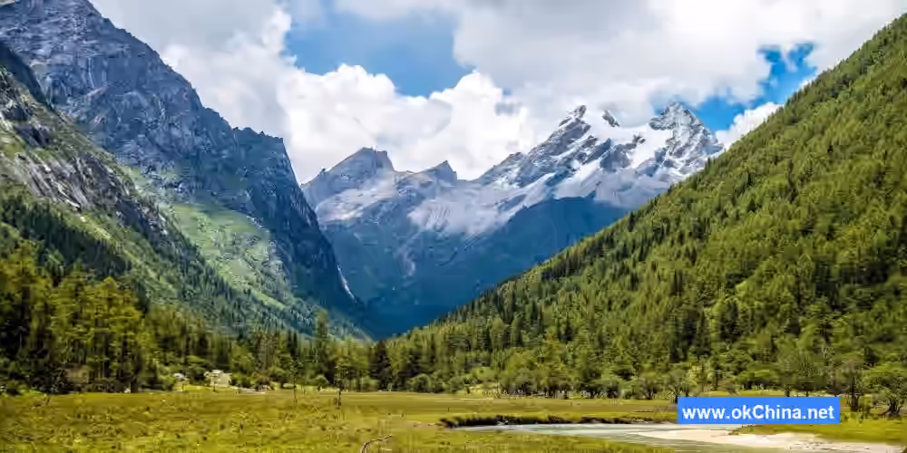
Siguniang Mountain is located on the eastern edge of the first topographic step, the Qinghai-Tibet Plateau, within the transitional zone from the second step, the Sichuan Basin, to the Qinghai-Tibet Plateau. Tectonically, it belongs to the Songpan-Ganzi fold belt of China's geosynclinal region. Geomorphologically, it is part of the western Sichuan high mountain and plateau region, specifically the alpine gorge sub-region within the middle reaches of the Dadu River's alpine gorge zone. The main geomorphic types include: dry-warm valley (semi-arid valley) landforms, alpine landforms, and extreme alpine landforms. The area features steep mountains and well-developed modern glaciers. There are 85 snow-capped peaks with elevations above 5,000 meters, which are perennially snow-covered and host modern mountain glaciers. The main peak, Siguniang Mountain, stands at 6,250 meters, making it the highest peak in the Qionglai Mountains, the second highest peak in Sichuan, and the third highest peak in the Hengduan Mountains.
2.3 Climate and Hydrology
The Siguniang Mountain Scenic Area has a subtropical climate. Due to the significant elevation differences within the area, the mountain climate changes markedly with altitude. From the Wori River Valley in the southwestern corner of the protected area to the summit of the main peak, a complex vertical climate zonation is formed, displaying a spectrum of temperate, cold temperate, subarctic, arctic, and permanent frost zones. The annual average temperature within the protected area is 5.9°C, while the average temperature at the summit of Siguniang Mountain is -17.1°C, with a frost-free period of 78 days. The area has distinct dry and rainy seasons, with uneven seasonal and regional distribution of precipitation. The annual rainfall is 931.5 mm. Sunshine is abundant, with a sunshine percentage as high as 51% and an average annual sunshine duration of 2,265 hours.
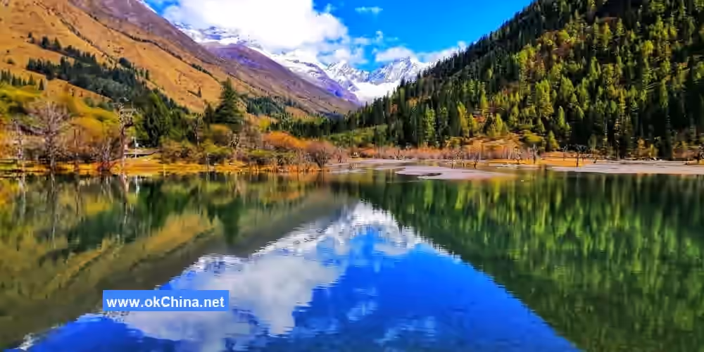
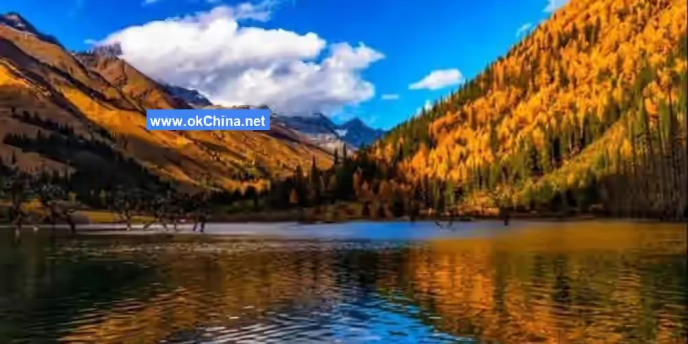
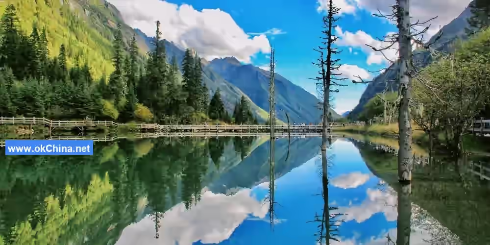
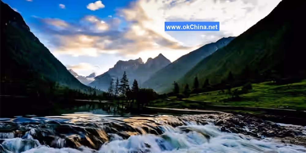
Rivers and streams within the protected area are distributed in a dendritic pattern, belonging to the Qingyi River system of the Dadu River basin, a secondary tributary of the upper Yangtze River. Major rivers such as Haizi Valley, Changping Valley, and Shuangqiao Valley are all tributaries of the Wori River and serve as its source. The Wori River is a tertiary tributary of the Qingyi River, with a total length of 79.1 kilometers and a basin area of 1,739 square kilometers. Water resources within the protected area primarily consist of meltwater from snow and ice, surface runoff, and groundwater, with no external or transboundary water sources. There are 25 lakes (Haizi) of various sizes within the area, with a total water surface area of 2.06 square kilometers, a storage capacity of 320,000 cubic meters, and nearly a hundred mountain streams and waterfalls.
2.4 Biodiversity
2.4.1 Animal Resources
There are approximately 49 species of mammals in Siguniang Mountain, belonging to 7 orders and 20 families; 7 species of fish, belonging to 2 orders and 3 families; and 9 species of birds endemic to China. In the Siguniang Mountain area, there are 5 species of nationally first-class protected mammals: golden snub-nosed monkey, white-lipped deer, takin, leopard, and snow leopard. There are 15 species of nationally second-class protected mammals: rhesus macaque, dhole, Asian black bear, brown bear, red panda, yellow-throated marten, stone marten, Eurasian otter, Asiatic golden cat, forest musk deer, alpine musk deer, sambar deer, serow, Chinese goral, and blue sheep. There are 11 species of nationally protected birds, including 4 first-class protected birds: bearded vulture, Chinese grouse, chestnut-throated partridge, and Chinese monal; and 7 second-class protected birds: Himalayan vulture, snow partridge, Tibetan snowcock, blood pheasant, Temminck's tragopan, Tibetan eared pheasant, and tawny owl. These account for 79% of the same-level protected birds in the province and 3.8% nationally.
2.4.2 Plant Resources
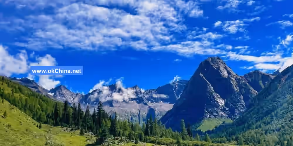
Siguniang Mountain is one of the few areas in Sichuan Province and even nationwide where subalpine and alpine vegetation at high altitudes is relatively well-preserved. This is particularly true for the alpine sclerophyllous evergreen broad-leaved forests represented by Fagaceae plants, ancient cypress forests dominated by Cupressaceae trees, dark coniferous forests and subalpine evergreen and deciduous coniferous mixed forests primarily formed by Pinaceae, as well as valley forest communities typically composed of plants from Salicaceae, Betulaceae, and Elaeagnaceae.
Preliminary surveys and data statistics indicate that Xiaojin County, with Siguniang Mountain as its main feature, has approximately 123 families, 536 genera, and 2,020 species of higher plants. Although this is fewer than the total number of plant species in the Wolong Nature Reserve, over 2,000 species are distributed within the core scenic area of "Three Valleys and One Mountain" at altitudes ranging from 2,700 to 6,250 meters. This is quite distinctive among similar areas and mountains of the same altitude within the province and the country. Coniferous plants are relatively diverse in this region and form distinct subalpine coniferous forest communities as dominant species, such as fir from the genus Abies, and Picea brachytyla and Picea purpurea from the genus Picea. Among angiosperms, genera with over 10 species distributed in the Siguniang Mountain area include Pedicularis, Saussurea, Gentiana, Primula, and Rhododendron. Among the known 123 families and 536 genera in the scenic area, 51 genera are widely distributed globally, accounting for 50% of China's globally distributed genera. Genera such as Polygonum, Ranunculus, Geranium, Gentiana, Senecio, Aster, and Carex are dominant herbaceous plants in the subalpine and alpine meadows of western and northwestern Sichuan.
The natural vegetation of Siguniang Mountain can be classified into 5 vegetation type groups, 8 vegetation types, and 22 formation groups or formations, including coniferous forests, broad-leaved forests, shrublands (scrub-grasslands), meadows, and alpine sparse vegetation. The wildflowers of Siguniang Mountain include not only regional species of alpine gorges but also components unique to the western high mountains and plateau regions. Among them are the rhododendron, primrose, and gentian, praised worldwide as the "Three Famous Flowers of China's High Mountains and Plateaus"; numerous species of the genus Pedicularis, which has its modern distribution center in the Himalayan region; typical subalpine and alpine meadow components such as Meconopsis, Ranunculus, Trollius, Anemone, Parnassia, and Saussurea; and many orchid species. In terms of woody flowers, besides rhododendrons, there are also Daphne retusa, Sorbaria arborea, various roses, various raspberries, various spiraeas, and various hydrangeas.
2.5 Scenic Area Layout
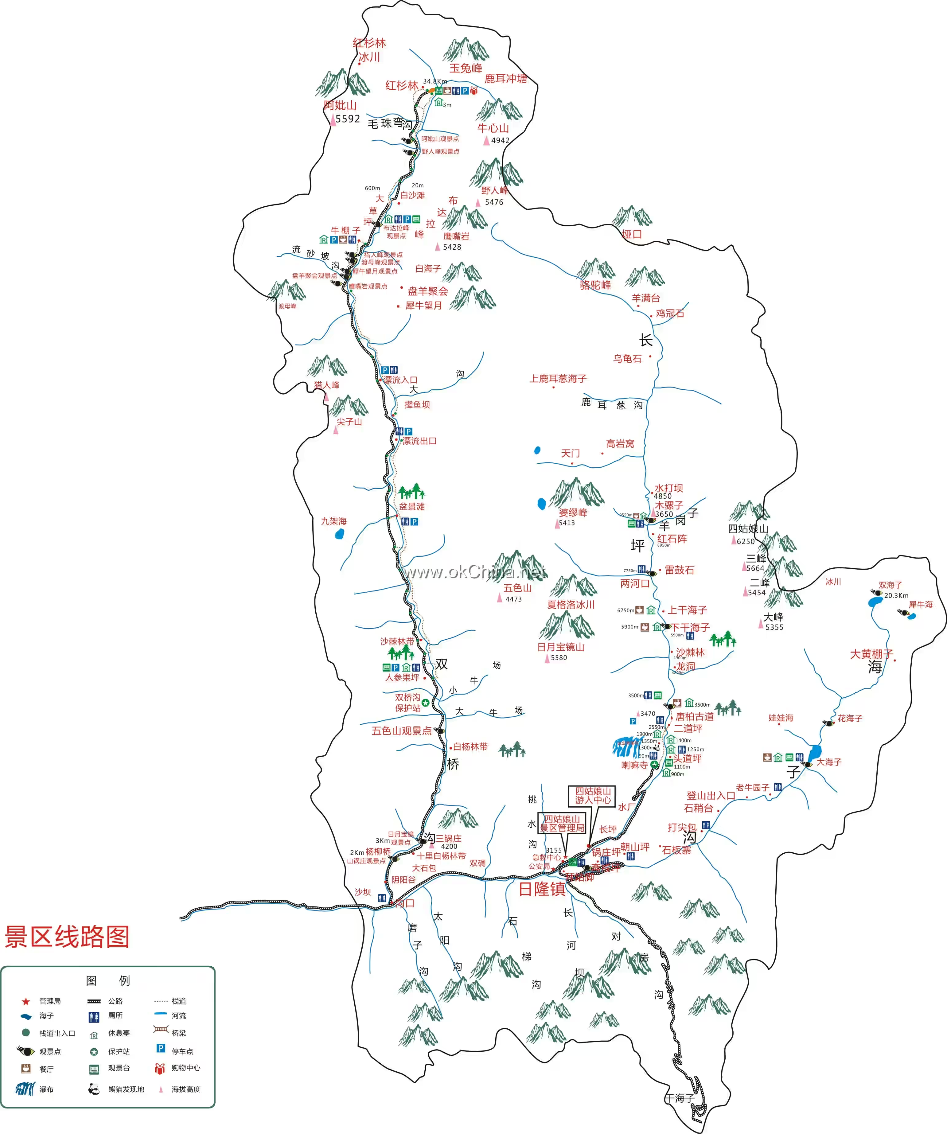
The Siguniang Mountain Scenic Area is primarily composed of the "Three Valleys and One Mountain." The core scenic area of Siguniang Mountain includes Shuangqiao Valley, Changping Valley, Haizi Valley, and Siguniang Mountain itself.
3. Major Attractions
3.1 Siguniang Mountain
Siguniang Mountain consists of four peaks, arranged from north to south, with ascending altitudes: First Sister Mountain, Second Sister Mountain, Third Sister Mountain, and Yaomei Peak. Siguniang Mountain is renowned for its majestic and steep peaks, which rise sharply into the blue sky, covered in ice and snow that gleams silver, earning it the title "The Alps of the East."
3.1.1 Yaomei Peak
Yaomei Peak, located at the northernmost part of the Siguniang Mountain Scenic Area, stands at 6,250 meters. It is second only to Gongga Mountain, known as the "King of Sichuan Mountains," and is called the "Queen of Sichuan Mountains" and the "Holy Mountain of the East."
3.1.2 First Sister Mountain
First Sister Mountain is located at the southernmost part of the Siguniang Mountain Scenic Area. Areas below 4,000 meters are mostly alpine meadows, with shrub forests at lower elevations, wildflowers everywhere, and yaks and horses commonly seen grazing. Wild mushrooms as large as bowls can be found on the mountain but are not easy to locate. Above 4,000 meters, First Sister Mountain is barren, with sharp, incredibly hard rocks. There is a small amount of snow at the summit in summer, and snowfall occurs from October to April of the following year, with snow on the mountain deep enough to reach past the knees.
3.1.3 Second Sister Mountain
Second Sister Mountain is located in the southern part of the Siguniang Mountain Scenic Area, adjacent to First Sister Mountain. The area consists of four mountains and three valleys, situated on the border between Xiaojin County and Wenchuan County in Aba Tibetan Autonomous Prefecture. It is a high peak of the Qionglai Mountains in the Hengduan Mountain region. In summer, rare animals living in the gorge regions of the Qinghai-Tibet Plateau can be seen on the mountain, and many precious medicinal herbs produced in Tibetan regions can be found. The summit of Second Sister Mountain is narrow and covered in perennial snow.
3.1.4 Third Sister Mountain
Third Sister Mountain is located in the central part of the Siguniang Mountain Scenic Area, with an elevation of 5,664 meters, approximately 200 kilometers west of Chengdu. Third Sister Mountain is rich in animal and plant resources, most notably the giant panda, and also features Tibetan and Qiang ethnic cultures.
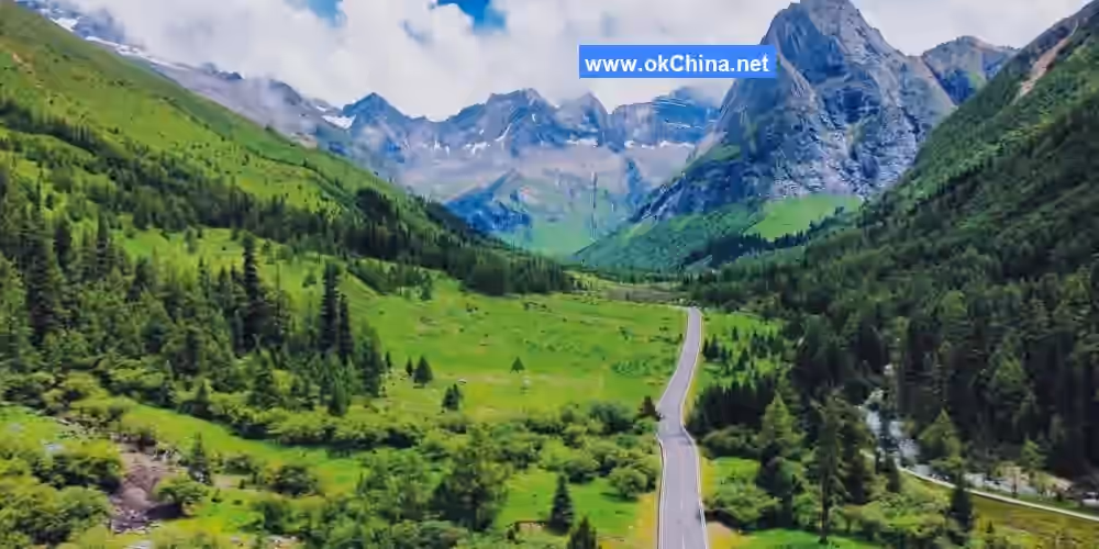
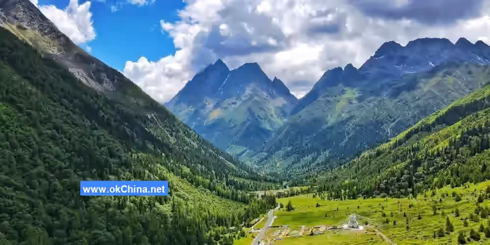
3.2 Shuangqiao ValleyShuangqiao Valley is one of the three valleys in the Siguniang Mountain scenic area, with a total length of over 40 kilometers and an area of approximately 216.6 square kilometers. The valley entrance is at an elevation of about 2,900 meters, while the larch forest at the valley's end reaches 3,840 meters, representing a vertical rise of nearly 1,000 meters. The valley derives its name from two wooden bridges built by local residents for easier passage. One of these bridges, constructed from willow wood, is commonly known as the Willow Bridge; the other, made from redwood, is referred to as the Makeshift Bridge. The scenery within the valley is divided into three sections: the front section features wonders such as the Willow Bridge, Yinyang Valley, Poplar Forest Belt, and Five-Color Mountain; the middle section showcases pristine landscapes like Nianyu Dam, Sea Buckthorn Forest, Jian Shanzi, and Jiujia Sea; the rear section includes Niupengzi Meadow and Changhetan, along with unique natural formations such as Ancient Ape Peak, Hunter Peak, Eagle Beak Rock, and Golden Rooster Ridge. The scenic area features boardwalks, and two wooden bridges have been built within the valley—one made from willow wood, commonly known as the Willow Bridge, and the other from redwood, referred to as the Makeshift Bridge.
3.2.1 Sun-Moon Treasure Mirror
The Sun-Moon Treasure Mirror peak stands at an elevation of 5,609 meters. This uniquely shaped peak consists of two mountains exhibiting tightly overturned synclinal structural features, formed due to intense compression. Covered in snow and ice year-round, it resembles a bright mirror.
3.2.2 Five-Color Mountain
Located 9 kilometers inside Shuangqiao Valley at an elevation of 5,430 meters, Five-Color Mountain is a peak featuring over 30 semi-circular layers, resembling a crescent moon from a distance. It is a typical folded mountain. The entire mountain is composed of rocks of varying colors, rich in minerals such as silicon, iron, zinc, and tin. Under specific sunlight, these rocks display colorful bands of red, yellow, cyan, blue, and white, forming over 30 concentric circles from the inside out, giving the mountain its name.
3.2.3 Ginseng Fruit Meadow
At an elevation of 3,300 meters, Ginseng Fruit Meadow marks the endpoint of Shuangqiao Valley's glacial landforms. Outside the road lies a vast meadow spanning hundreds of acres. During spring and summer, various alpine flowers cover the grassland. The meadow is named after a precious Rosaceae ground-stem plant that grows here, scientifically known as Potentilla anserina, referred to as "ginseng fruit" by the Jiarong Tibetans. The fruit has black skin and red flesh, with a sweet taste. It is both edible and medicinal, known for its unique effects of replenishing qi and blood, nourishing yin, and strengthening yang.
3.2.4 Longzhu Cuo
At an elevation of 3,490 meters, Longzhu Cuo is one of the main attractions in Shuangqiao Valley. Due to flooding and sedimentation blocking the river, the watercourse changed, submerging and killing the originally land-grown sea buckthorn trees. The stream water is rich in calcium compounds, which accumulated around the roots of the sea buckthorn trees, causing them to remain standing even after death.
3.2.5 Siguna Cuo
At an elevation of 3,580 meters, Siguna Cuo is said to be the sacred lake where the Four Maidens bathed. This is a naturally formed barrier lake created by debris flow impacts. The lake water is clear, with withered trees standing quietly. The lake reflects the surrounding mountains, ravines, snow peaks, and peculiar rocks, surrounded by trees and grasslands.
3.3 Jianzi Mountain
Jianzi Mountain, also known as Golden Spear Rock, stands at an elevation of 5,472 meters. It resembles a golden spear or sword used in ancient warfare, sharp and imposing.
3.3.1 Hunter Peak
Standing side by side with Jianzi Mountain at an elevation of 5,360 meters, Hunter Peak features three peaks of varying sizes formed by sandstone weathering. It resembles the cursive Chinese character for "mountain" or a robust hunter with a dog and a rifle heading toward the mountaintop, hence its name.
3.3.2 Eagle Beak Rock
At an elevation of 5,307 meters, Eagle Beak Rock is named for its resemblance to an eagle's beak. From afar, it looks like a soaring eagle; up close, it resembles a young bird waiting to be fed. It is a horn peak landform formed by glacial movement.
3.3.3 Potala Peak
Potala Peak, at an elevation of 5,240 meters, resembles the Potala Palace in Lhasa, Tibet. Due to its unique rock structure, it is an excellent site for rock climbing. In the 1990s, Japanese teams attempted multiple climbs and eventually succeeded in reaching the summit. In September 2003, two European outdoor climbing experts also summited Potala Peak.
3.3.4 Vajra Mountain
Located to the left of Potala Peak at an elevation of 4,942 meters, Vajra Mountain is shaped like an ox heart and is also known locally as Ox Heart Mountain.
3.3.5 Abi Mountain
At an elevation of 5,033 meters, Abi Mountain is rich in glaciers and is the most concentrated glacial area in Shuangqiao Valley. Beside Abi Mountain stands a very steep peak resembling the tip of a golden spear. The glaciers here are relatively concentrated, making it suitable for mountaineering and ice climbing. "Abi" means grandmother in Tibetan, and the mountain resembles a Tibetan grandmother wearing a headscarf, with a kind and亲切 appearance. Legend has it that this mountain is the embodiment of the Four Maidens' grandmother.
3.3.6 Jade Rabbit Peak
Jade Rabbit Peak stands at an elevation of 5,280 meters. Between two peaks west of the larch forest, a protruding rock resembles a rabbit with perked ears. Legend says it is the pet of the Four Maidens, hence the name. Surrounding Jade Rabbit Peak, modern glaciers have formed at around 4,600 meters, commonly known as "eternal snow," marking the modern snowline. The glacial surface features broken ice walls with a grayish-white color. The glaciers here are mixed with rock debris and dust, with a thickness of about 50 meters and an area of approximately 60,000 square meters.
3.3.7 Larch Forest
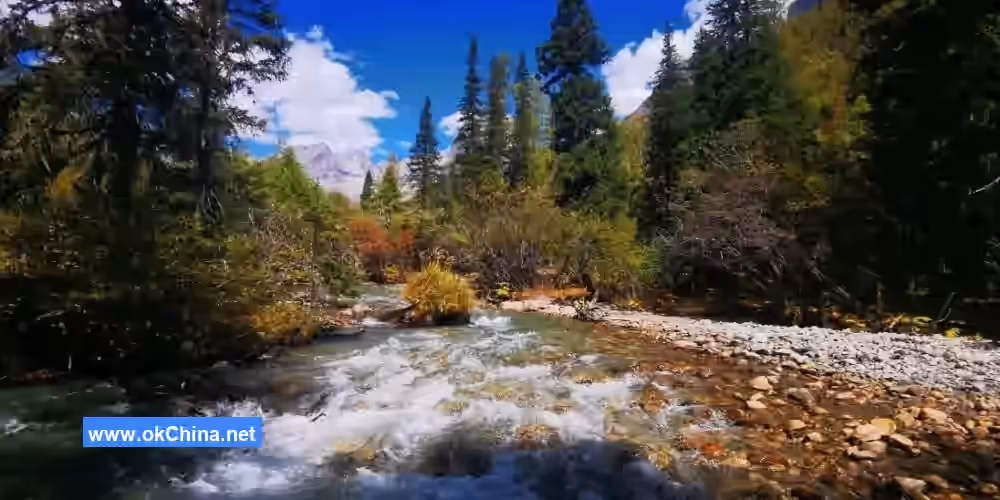
The Larch Forest is the last viewing point in Shuangqiao Valley, at an elevation of 3,840 meters. The larch trees growing here, scientifically known as Sichuan larch, are nationally protected second-class plants in the Hengduan Mountain system of Sichuan and are one of the unique tree species in this area. Larch trees have a long history, appearing almost simultaneously with the Quaternary glaciers. This larch forest stretches for 2 kilometers, covering over 50 hectares. It is complemented by evergreen coniferous species such as purple-cone spruce and fir, as well as alpine shrubs like rhododendron, mountain ash, honeysuckle, and sea buckthorn, forming a complete and unique Sichuan larch vegetation community.
3.4 Changping Valley
Located in the northeast of the Siguniang Mountain scenic area, Changping Valley is an ancient battlefield site. The valley stretches 29 kilometers with an area of about 100 square kilometers. Siguniang Mountain is situated 16 kilometers inside the valley. The scenic area features 21 viewing spots, including Lama Temple, Dead Tree Beach, Jiarongdu Waterfall, Muzuozi, Pomi Peak, and Camel Peak. Changping Valley is rich in primitive plant species and well-preserved vegetation, serving as an important base camp for climbing the Third and Fourth Peaks and an ideal location for rock and ice climbing.
3.4.1 Upper and Lower Ganhaizi
After the boardwalk in Changping Valley ends, travelers continue along dirt roads and horse trails to reach Upper Ganhaizi and Lower Ganhaizi. These two lakes originally had abundant water sources and were full of water. However, due to river course changes and water source depletion, Lower Ganhaizi turned into a swamp, while Upper Ganhaizi completely dried up, becoming a paradise for cattle and sheep. Upper and Lower Ganhaizi serve as important base camps for climbing the Third Peak and Yaomei Peak of Siguniang Mountain.
3.4.2 Red Stone Array
Located about 11 kilometers from the valley entrance, the Red Stone Array features rocks that appear fiery red. This natural phenomenon is caused by dense growth of red algae on granite. Granite is rich in metallic elements such as potassium and sodium, which are secreted from the rocks during the initial stages of weathering. This algal growth pattern is particularly conducive to absorbing high concentrations of potassium and sodium. The valley's humid and rainy climate provides the necessary moisture for algae growth, leading to their proliferation and the formation of this unique red stone spectacle.
3.4.3 Muzuozi
Located at the northern foot of Siguniang Mountain in the middle of Changping Valley, about 12 kilometers from the valley entrance, Muzuozi is a large, flat meadow at an elevation of 3,760 meters. It is the most botanically diverse area in the scenic area, suitable for horseback riding, flower viewing, and camping. It is home to plateau-specific plants and rare high-altitude animals such as large raptors.
3.4.4 Pomi Peak
At an elevation of 5,413 meters, Pomi Peak is a conical mountain composed of hard granite. With a climbing rope distance of 1,400 meters, maze-like routes, and unpredictable weather, it represents the pinnacle of high-altitude technical rock climbing routes and is a classic granite alpine world. Climbers from both China and abroad aspire to challenge this towering peak.
3.4.5 Camel Peak
Located west of Yaomei Peak and Yangmanta Peak, Camel Peak belongs to the Qionglai Mountain range and stands at an elevation of 5,484 meters. Its two peaks, east and west, resemble the humps of a camel. The mountain is primarily composed of hard granite, though weathering has made the rocks relatively fragmented. The two peaks of Camel Peak form a large col, which nurtures a glacier. Several glacial tongues extend down to 4,800 meters, with significant undulations.
3.5 Haizi Valley
Haizi Valley is one of the three valleys in the Siguniang Mountain scenic area and has the highest elevation among them. It stretches 19.2 kilometers with an area of 126.48 square kilometers. The valley entrance is located in Siguniangshan Town, and its scenery is entirely different from that of Shuangqiao Valley and Changping Valley. The valley features 12 viewing spots and 46 scenic sites. The front half is primarily alpine meadows, offering the best views of Siguniang Mountain and serving as an ideal location for photography enthusiasts. The latter half is dominated by lakes (haizi), but due to the long distance, it generally requires a full day to explore.
3.5.1 Guozhuang MeadowGuozhuangping, also known as the Pilgrimage Flat, sits at an altitude of 3,670 meters. It features a vast alpine meadow surrounded by poplar trees and azaleas. The forest is home to various wild mushrooms, such as matsutake, morels, and "laopo" mushrooms. Legend has it that four girls turned into mountains on the fourth day of the fifth lunar month to hold back a flood. To commemorate them, local Tibetans gather from all directions on this day each year to hold a grand "Mountain Pilgrimage Festival," praying for the girls' blessings as well as favorable weather and peace for their villages.
3.5.2 Dajianbao
Dajianbao is located 4 kilometers from Guozhuangping, and it is a resting spot for visitors entering Haizigou. From here, one can look around to see the Great Peak of Mount Siguniang and the vast alpine meadows to the north, Haizi Mountain to the northeast, and a mixed coniferous and broadleaf forest belt on the eastern slope. In the past, locals would rest here while gathering herbs or herding, eating the dry provisions they carried with them—a practice known as "dajian"—hence the name Dajianbao.
3.5.3 Laoniu Yuanzi
Laoniu Yuanzi is a place where local people graze cattle and horses. Around the Dragon Boat Festival each year, Tibetan herders drive their yaks and other livestock here from winter pastures to fatten them up. By around the Mid-Autumn Festival, they return the animals to the winter pastures to prepare for the cold season.
3.5.4 Bajiaopeng Hai
Bajiaopeng Hai is situated on the ridge to the right between Laoniu Yuanzi and Da Haizi, at an altitude of approximately 4,600 meters. The lake surface is roughly diamond-shaped. It serves as the highest camp for climbing Yinggezui Peak and is an ideal spot to capture reflections of Mount Siguniang.
3.5.5 Xiniu Hai
Xiniu Hai is the most famous lake at the end of Haizigou, with an elevation of about 4,400 meters. It boasts beautiful scenery, an oval shape, and a dark color due to the rocks and algae at the bottom. Surrounded by towering mountains, it offers a distant view of Yaomei Peak, the main peak of Mount Siguniang.
3.6 Seasonal Landscapes
3.6.1 Winter Snow Appreciation
In winter, Mount Siguniang is suitable for tourism on about 90% of the days, with average daytime temperatures as high as 10–15°C. Besides enjoying snowscapes and sunshine, visitors can engage in ice climbing, navigating varied terrains such as gravel, snow slopes, cliffs, and icy paths.
3.6.2 Summer Flower Viewing
In summer, Mount Siguniang enjoys temperatures around 18°C, with dense forests, lush green grasslands, boundless wilderness, and blue skies. The rafting experience in the Shuangqiaogou scenic area is renowned for its stunning scenery, featuring towering strange rocks, lush bamboo, and beautiful landscapes, often described as "boats gliding through the scenery, people wandering in a painting."
4. Cultural Resources
Traditional Mountain Pilgrimage Festival
Mount Siguniang, located in Xiaojin County, Aba Prefecture, is known as the "Sacred Mountain of the East." "Siguniang" is a Chinese transliteration of the Tibetan word "Sigula," meaning the mountain god who protects the land. Every year on the fourth day of the fifth lunar month, local Tibetans organize a grand pilgrimage and sacrificial ceremony to worship Mount Siguniang, praying for favorable weather, abundant harvests, and national prosperity. The essence of the pilgrimage culture lies in people’s reverence for nature, born from limited knowledge of geography and natural phenomena, reflecting a harmonious coexistence between humans and nature. The pilgrimage culture of Mount Siguniang dates back over 1,400 years. In the 7th century, the primitive Bon religion spread to the Aba region, teaching that all things possess a spirit—mountains have mountain gods, water has water gods, and trees have tree gods. Thus, local Tibetans have long regarded Mount Siguniang as the mountain god that safeguards the region.
The Mountain Pilgrimage Festival in this area can be traced back over 300 years. On the third and fourth days of the fifth lunar month each year, people from the "Four Zhai and Two Suo" (Four Zhai: Kala Zhai—now the Changping Village area of Siguniang Town; Zhangmu Zhai—now the second group of Changping Village; Dazha Zhai—now the Jinfeng Village area of Siguniang Town; Male Zhai—now the Shuangdiao Village area of Siguniang Town; Two Suo: Gabade Suo—now groups one to six of Dishui Village, Dawei Town; Dagunpo De Suo—now groups seven and eight of Dishui Village, Dawei Town) gather at Mount Siguniang to perform pilgrimage rituals, known as the "Mount Siguniang Pilgrimage Festival," or "Danmuze" in Tibetan. Over 300 years ago, the leaders of the "Four Zhai and Two Suo" took turns presiding over the festival, organizing the sacrificial activities on a six-year cycle.
This ancient custom has become part of the "Dragon Boat Festival Sacrifice" series of cultural activities in Aba Prefecture and serves as a cultural brand for Xiaojin County to promote Jiarong folk culture. On September 21, 2006, the Mount Siguniang Pilgrimage Festival was listed among the first batch of intangible cultural heritage items in Aba Prefecture.
Comments
Post a Comment