Qinghai Lake Scenic Area
I. Introduction
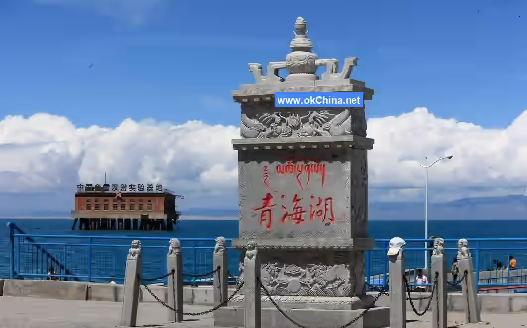
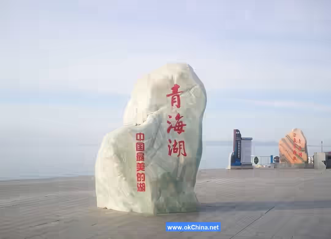
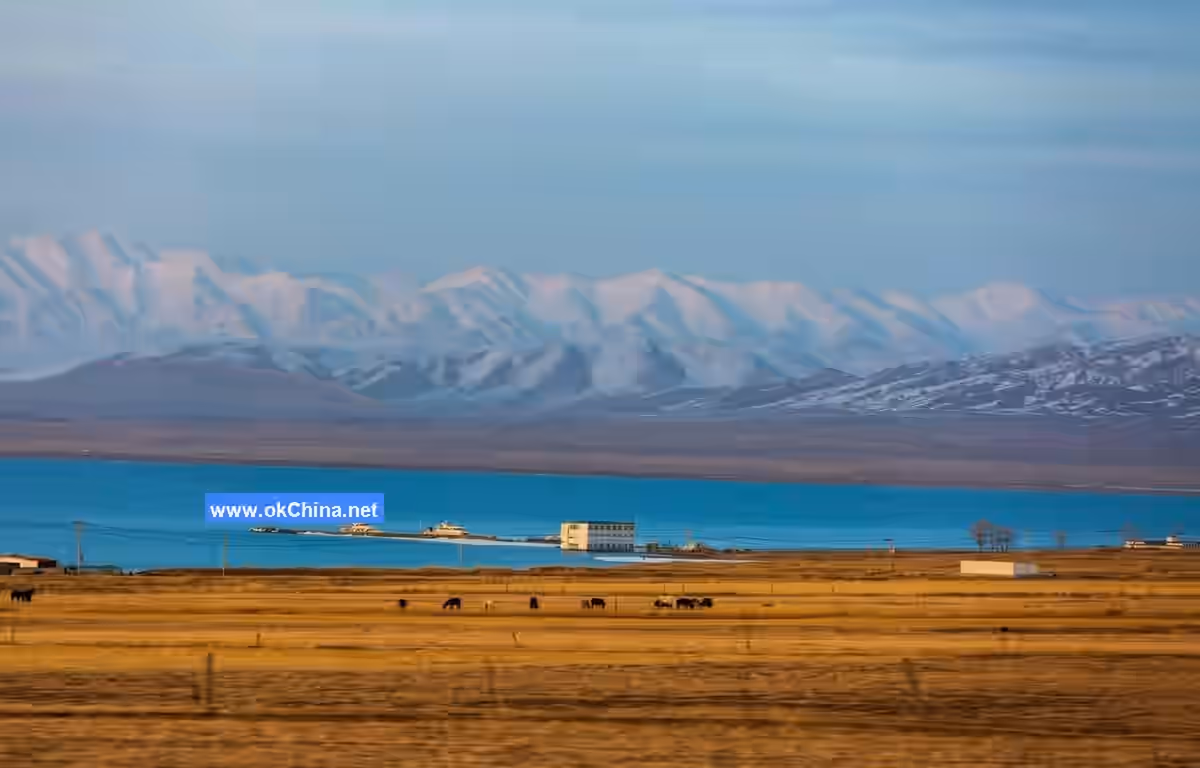
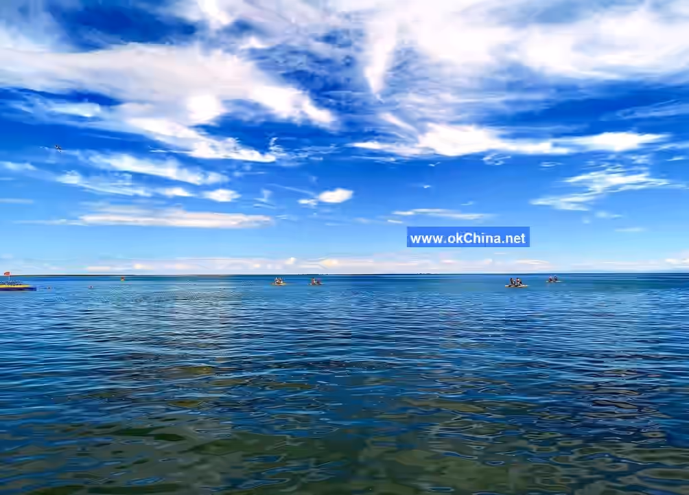
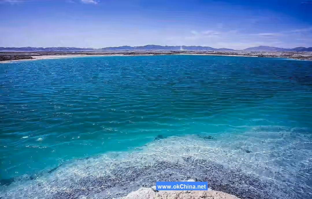
The Qinghai Lake Scenic Area in Qinghai Province is located in the northeastern part of the Qinghai-Tibet Plateau, northwest of Xining City, and south of Gangcha County, approximately 136 kilometers from Xining City. Historically known as the "West Sea," and also called "Immortal Sea," "Freshwater Sea," or "Beihe Qiang Sea," Qinghai Lake is China's largest inland lake and largest saltwater lake. The lake surface sits at an altitude of 3,196 meters, with a shoreline of 360 kilometers and an area of 4,583 square kilometers. The lake water is cold and highly saline. Within the lake lies Haixin Mountain (Sea Heart Mountain), surrounded by high mountains: Datong Mountain to the north, Riyue Mountain to the east, Qinghai South Mountain to the south, and Xiangpi Mountain to the west. The average summer temperature in the lake area is only 15°C, making it a natural summer resort.
The main scenic spots around the lake and its vicinity include Riyue Mountain, Daotang River, Hulimugou Rock Paintings, Xiangpi Mountain, Chaka Salt Lake, Chaka Monastery, Fucheng Ancient City, Bird Island, Haixin Mountain, Beixiangyang Ancient City, Shebuji Rock Paintings, Gahai Ancient City, Jinyintan Grassland, Atomic City Xihai Town, Sand Island, and Xihai County Triangle City.
II. Historical Development
The establishment of the Qinghai Lake area began during the Han Dynasty. Between the 1st and 2nd years of Emperor Xuan of Han's Shenjue era (61–60 BCE), the Western Han army advanced against the Xianling Qiang and other tribes in the Huangshui River basin, reaching the vicinity of Qinghai Lake.
In the first year of the Datong era of the Western Wei Dynasty (535 CE), Tuyuhun King Kualü established a regime 7.5 kilometers west of Qinghai Lake.
In the fourth month of the fifth year of the Daye era of the Sui Dynasty (609 CE), Emperor Yang of Sui personally led troops to campaign against the Tuyuhun, quickly defeating them and establishing the Xihai Commandery with Fucheng as its administrative center. By the thirteenth year of the Daye era (617 CE), as the Sui Dynasty neared collapse, the Tuyuhun returned to Qinghai Lake with their forces.
During the Tang Dynasty, the Tuyuhun were a vassal state. In the tenth year of the Zhenguan era of Tang (636 CE), the Tibetan Empire crossed the Yellow River northward and entered the southern region of Qinghai Lake.
In the first year of the Jianlong era of the Song Dynasty (960 CE), to contain the Western Xia, the Song Dynasty adopted a policy of appeasement towards the Tibetan tribes in the Gansu-Qinghai region. In the tenth year of Emperor Renzong of Song's reign (1032 CE), the Hehuang Tibetan Gusiluo local regime emerged in eastern Qinghai, with most of Qinghai Lake coming under Gusiluo's control, who then submitted to the Song Dynasty.
In 1994, the Qinghai Lake Scenic Area was officially established with approval from the State Council.
In 2007, the "Qinghai Lake Scenic Area Protection and Utilization Administration of Qinghai Province" was established. This administration exercises unified management functions over the Qinghai Lake National Nature Reserve, Qinghai Lake National Geopark, and the Qinghai Lake Scenic Area.
III. Location and Layout
Location and Territory
The Qinghai Lake Scenic Area is situated in the northeastern part of the Qinghai-Tibet Plateau, within the Qinghai Lake Basin in the northwestern part of Qinghai Province. It spans Gonghe County in Hainan Prefecture, Haiyan County and Gangcha County in Haibei Prefecture, located between 99°36′–100°16′ east longitude and 36°32′–37°15′ north latitude. The total area is 7,577.84 square kilometers, of which the water area is 3,720.80 square kilometers and the land area is 3,857.04 square kilometers.
Geological Formation
Qinghai Lake is a tectonic rift lake, with its basin edges mostly connected to surrounding mountains via faults. During its initial formation 200,000 to 2 million years ago, it was an exorheic freshwater lake connected to the Yellow River system. About 130,000 years ago, due to neotectonic movements, the surrounding mountains uplifted intensely. From the end of the Pliocene epoch, the intense uplift of Riyue Mountain in the eastern part of the lake blocked the originally eastward-flowing Daotang River, forcing it to flow westward into Qinghai Lake, leading to the formation of Gahai and Erhai lakes, which later separated into sub-lakes like Haiyan Lake and Sand Island Lake. During the Northern Wei Dynasty, Qinghai Lake's perimeter was reputed to be a thousand li; it was 400 kilometers during the Tang Dynasty and reduced to 350 kilometers during the Qianlong era of the Qing Dynasty. Ancient lake shore遗址 can be found about 20 kilometers from the front edge of the Buha River delta; Chahan City (built during the Han Dynasty), located 25 kilometers from the eastern shore, was originally on the lakeshore. The eastern and western shores have since receded by 25 kilometers and 20 kilometers respectively, with the water level dropping by about 100 meters. Currently, Qinghai Lake is oval-shaped with a perimeter of over 300 kilometers. In 1908, Russian explorer Kozlov estimated the lake surface level at 3,205 meters and the area at 4,800 square kilometers; topographic maps published in the 1970s measured the lake level at around 3,195 meters and the area at 4,473 square kilometers; in 1988, the water level was 3,193.59 meters and the area was 4,282 square kilometers. From 1955 to 1988, the lake water level dropped by an average of about 10 centimeters per year. The current water volume is 73.9 billion cubic meters, with a maximum length of about 104 kilometers, a maximum width of about 62 kilometers, a maximum depth of 3.14 meters, an average mineralization of 12.32 g/L, and a salinity of 1.24%.
Topography and Landforms
The main geomorphological types in the Qinghai Lake Scenic Area include plateau lakes, lacustrine deposits, alluvial deposits, and aeolian landforms. The area around Qinghai Lake primarily consists of alluvial plains and low mountains.
Hydrology
Qinghai Lake's water supply comes primarily from rivers, followed by springs at the lake bottom and precipitation. There are over 70 rivers of various sizes around the lake, showing a distinctly asymmetric distribution. The northern, northwestern, and southwestern shores have more rivers with larger drainage areas and numerous tributaries; the southeastern and southern shores have fewer rivers with smaller drainage areas. The Buha River is the largest river flowing into the lake, originating from the Amunikiniku Mountain, a branch of the Qilian Mountains. It is about 300 kilometers long, with a main stem of 92 kilometers and dozens of tributaries, over ten of which are significant. The downstream river width is about 50–100 meters, with a depth of 1–3 meters and a pH of 8–8.2. Its drainage area is 16,570 square kilometers, accounting for about half of the total drainage area of all rivers entering the lake. Its annual runoff is 1.12 billion cubic meters, constituting 60% of the inflow into the lake. The main rivers providing runoff补给 to Qinghai Lake annually are the Buha River, Shaliu River, Wuha'alan River, and Ha'ergai River. These four major rivers have a combined annual runoff of 1.612 billion cubic meters, accounting for 86% of the total inflow. This area is also where fish migrate to spawn and birds congregate. The annual river inflow补给 into Qinghai Lake is 1.335 billion cubic meters, precipitation补给 is 1.557 billion cubic meters, and groundwater补给 is 0.401 billion cubic meters, totaling 3.493 billion cubic meters. Due to strong winds and high evaporation in the lake area, the annual evaporation from the lake is 3.93 billion cubic meters, resulting in an average annual net loss of 0.437 billion cubic meters.
Climate
The Qinghai Lake Scenic Area has a plateau continental climate with ample sunlight and intense solar radiation. Winters are cold and summers are cool, with a brief warm season and a long cold season. Spring often brings strong winds and sandstorms. Rainfall is relatively low, with rain and heat occurring in the same season, and distinct dry and wet seasons. The multi-year average temperature in the lake area is -0.7°C. The average temperature of the hottest month ranges from 10.4°C to 15.2°C, while the average temperature of the coldest month is -31°C. The multi-year average precipitation in the lake area is 319–395 mm, and the multi-year average evaporation is 1,300–2,000 mm, with evaporation from June to September accounting for 60% of the annual total. Evaporation is highest in winter and spring. The lake surface freezes from December to March each year, with ice thickness reaching 60–80 cm.
Biodiversity
The Qinghai Lake Scenic Area is home to a total of 189 bird species, 41 mammal species, 5 amphibian and reptile species, and 8 fish species. Among these, 35 species are under national first or second-class protection. The four dominant large waterfowl species are the Brown-headed Gull, Great Black-headed Gull, Bar-headed Goose, and Great Cormorant, with numbers exceeding 45,000. There are 445 species of wild plants belonging to 174 genera and 52 families. The main vegetation includes Kobresia humilis, Kobresia pygmaea, Polygonum viviparum, Stipa, and Thalictrum alpinum, with some low shrubs along the rivers. The lake water contains 53 species of phytoplankton, with diatoms being dominant. There are 29 species of zooplankton and 22 species of benthic animals.
Scenic Area Layout
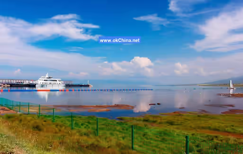
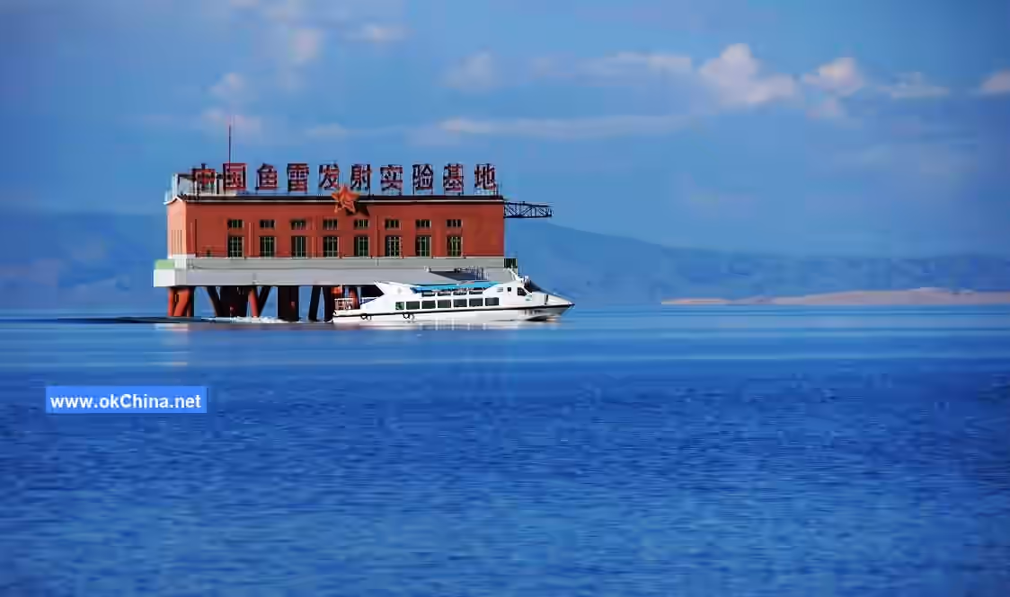
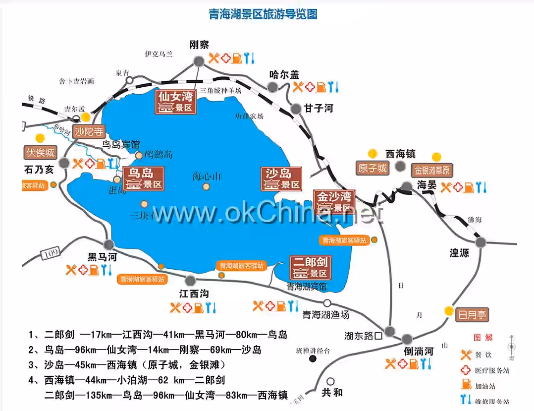
The Qinghai Lake Scenic Area is divided into six scenic zones: the Lakeside Water Body, Erlangjian, Bird Island, Sand Island (Jinshawan), Fairy Bay, and Riyue Mountain. Each zone implements graded protection. The main landscape resources include Qinghai Lake, Bird Island, Sand Island, lakeside滩地, Riyue Mountain, Erlangjian, Fairy Bay, the Southern Route of the Silk Road, the Tang-Tibet Ancient Road, ancient city遗址, and the 151 Torpedo Launch Test Base.
IV. Main Attractions
Erlangjian Scenic Area
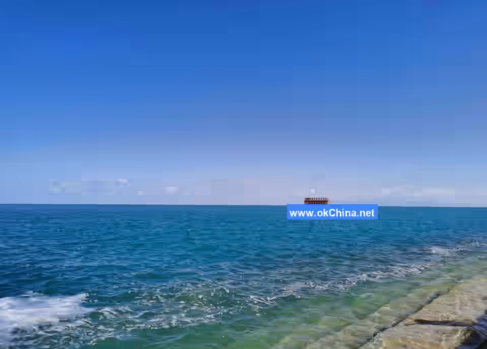
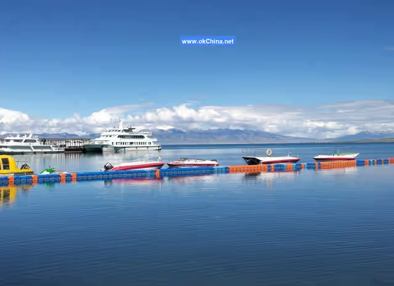
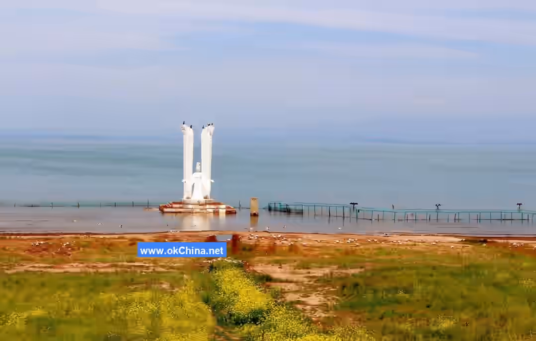
The Erlangjian Scenic Area is located on the southern shore of Qinghai Lake. Previously known as the 151 Base, it was China's first torpedo launch test base and serves as a tourism reception base and ethnic culture experience base around Qinghai Lake. Due to its unique geographical location within Qinghai Lake and its ecological natural resources centered on grasslands, beaches, and wildlife, Erlangjian has become a pearl of the Qinghai Lake tourism area. Erlangjian is positioned as "a place to serve people." It has established a viewing area comprising a bird-watching platform, sea-viewing bridge, and sea-viewing pavilion; a leisure area with tourism projects such as large-scale ethnic歌舞, Tibetan culture gardens, and sacred lake祭祀 ceremonies; and a water recreation area featuring activities like cruise ships, water摩托, water bicycles, and self-drive boats.
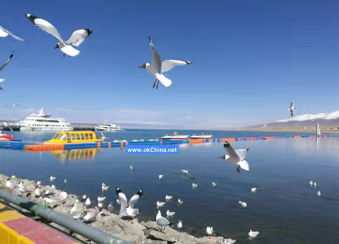
Bird Island Scenic Area
The Bird Island Scenic Area, also known as Little West Mountain or Egg Island (named for the abundance of bird eggs), is located on the western shore of Qinghai Lake, 4 kilometers north of the Buha River estuary. The island is larger at the eastern end and narrow and long at the western end, resembling a tadpole, with a total length of 1,500 meters. After 1978, the northern, western, and southern parts of the lake bottom became exposed, connecting the island to the land.
The island is named for the hundreds of thousands of migratory birds that栖息 there, making it a place of spirit and vitality by Qinghai Lake. From April to June each year, nearly 100,000 migratory birds陆续 migrate here to breed, forming a major spectacle of Qinghai Lake. To protect the birds' hereditary territory from disturbance while allowing more visitors to observe birds up close, a new multi-functional semi-bunker bird-watching room has been built on Bird Island, integrating a bird-watching室, rest室, café, and multimedia exhibition hall. The bunker通道 is 443 meters long with a floor area of 2,800 square meters.
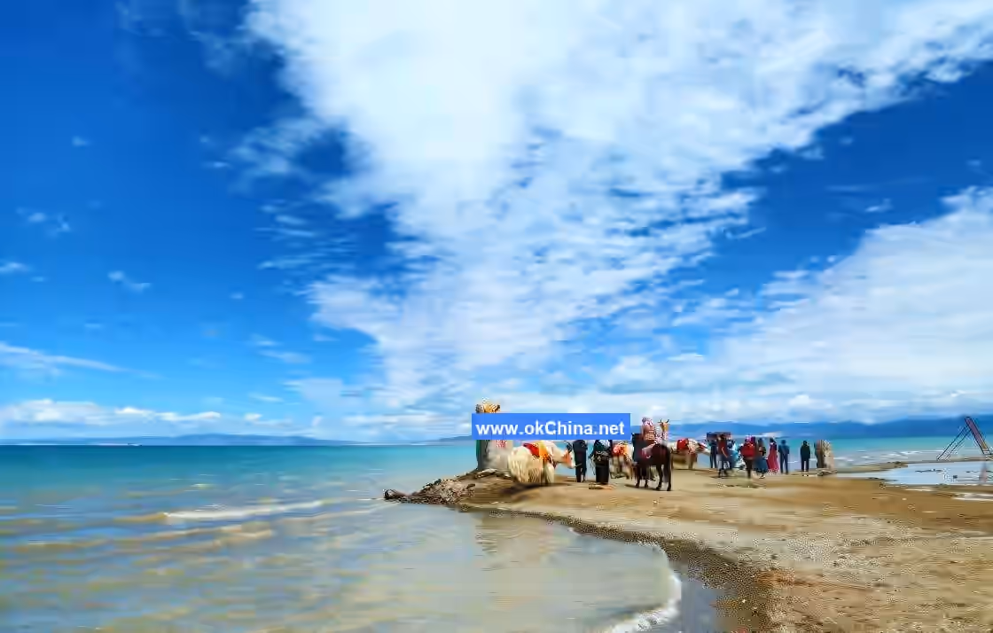
Sand Island Scenic AreaSand Island Scenic Area is located on the northeastern shore of Qinghai Lake. Within the area, the Golden Sand Bay and Silver Sand Bay lie side by side, while Sun Lake, Crescent Lake, and Reed Lake dot the landscape. The golden and silver sands reflect each other, and seabirds gather in flocks. Water yachting, sand sliding, beach motorcycles, beach off-roading, horseback riding, and camel riding are the distinctive tourism experiences offered at the Sand Island Scenic Area.
Fairy Bay Scenic Area
Fairy Bay Scenic Area is situated on the northern shore of Qinghai Lake. It is an important wetland of Qinghai Lake and a traditional sacred site for Tibetan ethnic rituals to the lake. The area boasts a rich variety of flora and fauna, with unique wetland landscapes. It is particularly favored as a migration and栖息地 for dozens of bird species and serves as a home for swans.
【Islands Within the Lake】
Haixin Mountain
Located slightly south of the center of Qinghai Lake, about 25 kilometers from Bird Island, Haixin Mountain is elongated in shape, wider in the middle and narrower at both ends. It stretches 2.3 kilometers in length, 0.8 kilometers in width, and covers an area of 1.14 square kilometers. The highest point on the island is 3,266 meters above sea level. Composed of granite and gneiss, the island features a spring on its eastern edge that provides drinking water. The southern edge has exposed rocks forming steep cliffs, while the eastern, western, and northern sides are gentle滩地. Most of the island is covered with sandy soil, supporting vegetation such as wheatgrass, achnatherum, sickle-shaped oxytropis, kobresia, lanceolate yellow flower, and Siberian polygonatum, with vegetation coverage exceeding 50%. Birds and禽类 concentrate along the island’s cliffs and gravel滩地 for栖息.
Haixipi
Haixipi is located 6 kilometers north of the Buha River estuary, sharing the same location as Bird Island at the tip of the alluvial滩地 of the Buha River. The northeastern edge of the island features a断层陡崖紧靠 the lakeside, with a nearly cylindrical rock standing in the lake just outside the陡崖, serving as a breeding ground for cormorants. Vegetation coverage on the island exceeds 90%.
Sand Island
Located in the northeastern part of the lake within Haiyan County, Sand Island was once the largest island in Qinghai Lake. It is approximately 13 kilometers long, about 2.8 kilometers at its widest point, and covers an area of 18 square kilometers. The highest point on the island is 3,252 meters above sea level. The island was formed by砂垄 protruding above the water surface and accumulating wind-blown sand. In 1980, the northeastern end of Sand Island connected with the mainland, turning it into a peninsula and enclosing a 33-square-kilometer Sand Island Lake. The surface is entirely covered with gravel, with no vegetation, making it a栖息 and breeding ground for渔鸥.
Three Rocks
Also known as孤插山, Three Rocks is located in the southwestern part of the lake. It consists of seven densely clustered limestone rocks and reefs, standing about 17 meters high and covering an area of approximately 0.056 square kilometers. It is 20 kilometers from Bird Island and Haixin Mountain. The island only supports growth of plants like牛尾蒿 in the gaps between碎石块, with vegetation coverage less than 5%.
Bird Island
Also known as Little West Mountain or Egg Island (named for the abundance of bird eggs), Bird Island is located 4 kilometers north of the Buha River estuary. The island is larger on the eastern end and narrow and elongated on the western end, resembling a tadpole, with a total length of 1,500 meters. After 1978, the northern, western, and southern sides of the lake bottom were exposed, connecting the island to the mainland. Bird Island has gentle slopes, with its surface covered by sand, soil, and stones. Several springs flow on the southwestern side of the island. The main vegetation includes二裂季陵菜, white藜, wheatgrass, sickle-shaped oxytropis, Siberian knotweed, kobresia, and早熟禾. Bird Island is a unique breeding ground for birds in Asia and ranks first among China’s eight major bird reserves. It was once an important open site in Qinghai Province.
In recent years, to protect the ecological environment and natural resources of Qinghai Lake, this attraction was closed on August 29, 2017, and all tourism operations were suspended.
V. Cultural Value
Historical Legends
Over 1,000 years ago, during the marriage alliance between the Tang Dynasty and Tibet, Princess Wencheng远嫁 Tibetan King Songtsen Gampo. Before her departure, the Tang emperor bestowed upon her a Sun-Moon宝镜 that could reflect images of her hometown. On the journey, the princess missed her hometown and took out the宝镜, indeed seeing the long-missed Chang’an. Tears streamed down her face. However, the princess suddenly remembered her mission and threw the宝镜 away. Unexpectedly, when the宝镜 hit the ground, a golden light flashed, transforming into Qinghai Lake. Another legend says that the youngest son of the East Sea Dragon King once引来了 108湖水, converging into this vast West Sea, and thus he became the West Sea Dragon King. Yet another tale recounts that Sun Wukong, after causing havoc in heaven, was chased here by Erlang Shen.
Hosted Events
Qinghai Lake International Sculpture and Land Art Tourism Season
On June 17, 2017, the Qinghai Lake International Sculpture and Land Art Tourism Season opened at the Sand Island Scenic Area of Qinghai Lake, featuring 13 sand sculpture works themed “National Unity, Creating the Chinese Dream.” The event征集了 one main sculpture, three permanent sand sculptures, and nine辅助 sculptures, and推出 five land art works: “Qinghai Lake, Our Home,” “Tree of Life,” “Theme Slogan,” “Stone Mosaic Pottery,” and “Bird’s Nest.”
“Protect Qinghai Lake, I Am a Volunteer” Activity
On September 30, 2024, the “Protect Qinghai Lake, I Am a Volunteer” themed 2024 National Day Qinghai Lake Ecological Environmental Protection徒步活动 kicked off on the beautiful shores of Qinghai Lake. Organized by the Qinghai Lake Scenic Area Protection and Utilization Administration, the徒步活动 covered a round trip of 6.6 kilometers, with a折返点 where participants could check in and receive精美纪念品. The event also included巡回 exhibitions of photography works titled “Qinghai Lake, Our National Park,” promotional activities for national park creation and ecological environmental knowledge quizzes, a “Protect Qinghai Lake, I Am a Volunteer”横幅千人签名, a “Small Trash Reflects Civilized Behavior”垃圾回收兑换, collections of the most beautiful瞬间 pictures and videos,趣味体育 activities, and online徒步 events.
Comments
Post a Comment