

Tianshan Tianchi Scenic Area in Changji Hui Autonomous Prefecture
1. Introduction
The Xinjiang Tianshan Tianchi Scenic Area is located on the mountainside below Bogda Peak in Fukang City, Changji Hui Autonomous Prefecture, Xinjiang Uygur Autonomous Region. It is a National Scenic Area and a National AAAAA Tourist Attraction in China. The scenic area covers a total area of 160 square kilometers (with a planned area of 548 square kilometers), centered around Tianchi Lake. It stretches from Shimen in the north to the snow line in the south, from Mayashan in the west to Dadonggou in the east, featuring four complete vertical natural landscape zones.
In 2013, the Xinjiang Tianshan Tianchi Scenic Area was inscribed on the UNESCO World Heritage List. In June 2015, the myth of the Queen Mother of the West associated with Tianshan Tianchi was included in China's fourth batch of National Intangible Cultural Heritage Representative Projects. In 2015, it was rated as one of the first "China's Trustworthy Tourism Price Scenic Areas" by the National Tourism Administration. In 2016, it was listed on the "National Day Holiday Tourism Red List" and rated as the "Best Scenic Area for Tourism Order" by the National Tourism Administration. Major attractions include Small Tianchi, Denggan Mountain, the North Slope Tour Area of Tianchi, Liquan Cave, and more.
Tianchi was anciently known as Yaochi (Jade Pool). During the reign of Emperor Taizong of the Tang Dynasty, a "Yaochi Protectorate" was established at the foot of Bogda Peak. The name "Tianchi" (Heavenly Lake) appeared less than two hundred years ago, likely derived by combining one character each from "tianjing" (heavenly mirror) and "shenchi" (divine pool). It has also been called Haizi, Longtan, Yaochi, and Shenchi. In the 48th year of the Qianlong Emperor's reign (1783), Mingliang, the Military Governor of Xinjiang, surveyed the terrain of Bogda Mountain and Tianchi, opening rocks to channel water.
2. Location and Layout
2.1 Location and Territory
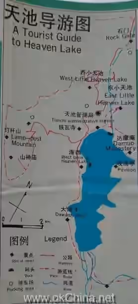
The Xinjiang Tianshan Tianchi Scenic Area is located in Fukang County, Fukang City, Changji Hui Autonomous Prefecture, Xinjiang Uygur Autonomous Region. It is situated on the mountainside below Bogda Peak on the upper reaches of the Sangong River on the northern slope of the Tianshan Mountains. It is 37 kilometers from Fukang city center and 97 kilometers (some say 110 kilometers) from Urumqi. The lake surface elevation is approximately 1910 meters. Its central coordinates are 43°53′12.25″N, 88°07′46.37″E. The scenic area covers a total area of 160 square kilometers (with a planned area of 548 square kilometers), centered around Tianchi Lake. It stretches from Shimen in the north to the snow line in the south, from Mayashan in the west to Dadonggou in the east, featuring four complete vertical natural landscape zones.
2.2 Topography and Landforms
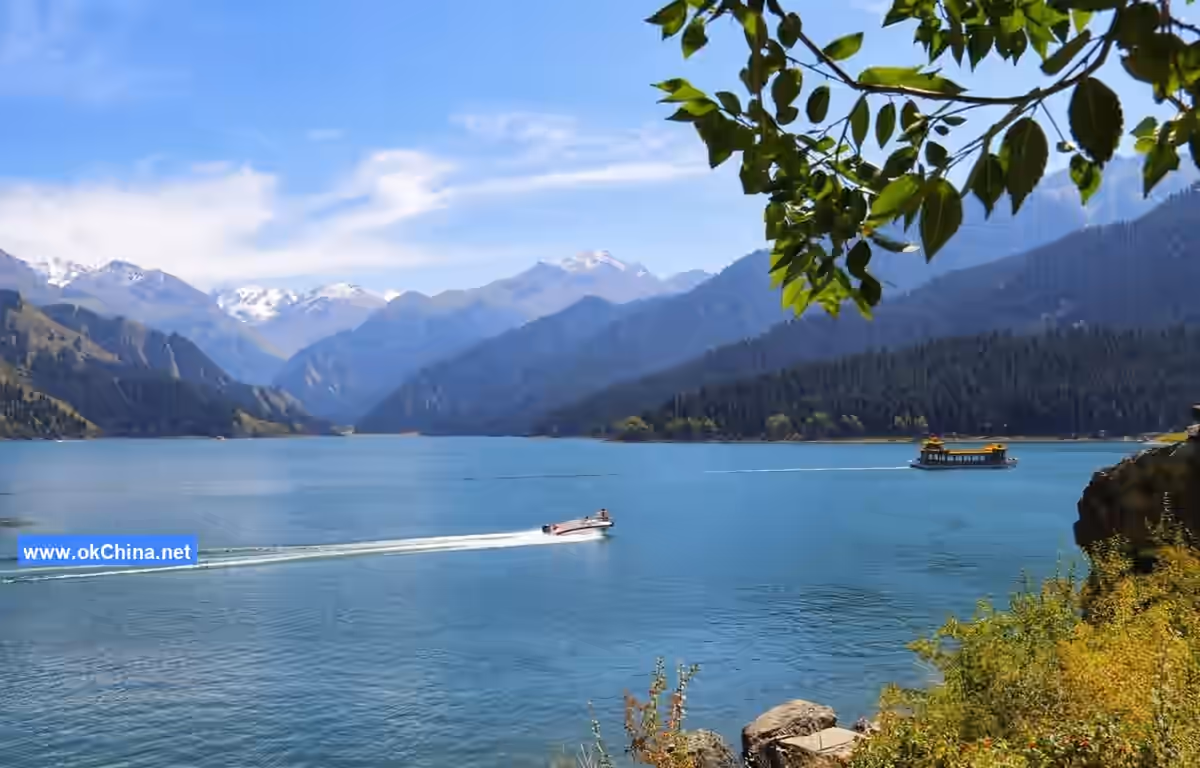
Bogda Peak in the Tianshan Mountains has an elevation of 5445 meters, with perennial snow and glaciers. Tianshan Tianchi is a high-altitude barrier lake formed by ancient glacial debris flow blocking the river channel. Its shape is winding and deep due to its original valley formation. The lake surface is crescent-shaped, with a north-south length of 3.5 kilometers (some say 3400 meters) and an east-west width of 0.8 to 1.5 kilometers. The widest point is about 1500 meters, the deepest point is 103 meters (some say about 105 meters), and the area is 4.9 square kilometers.
The water level of Tianchi varies between a high-water period and a normal-water period throughout the year. The lake water rises from April to September and falls from September to April of the following year, completing one cycle. The active water level fluctuates between 10 and 13 meters, and the average annual water temperature is maintained at 7.4 degrees Celsius.
The natural scenic area is centered around the alpine lake. With varying altitudes, it is divided into four complete natural landscapes: the glacial snow belt, the alpine and subalpine belt, the montane coniferous forest belt, and the low mountain belt. Xinjiang Tianshan Tianchi is a moraine lake created by ancient glacial movements. Since the Quaternary period, there have been four major glacial movements on Earth. The formation of Tianchi can roughly be divided into three stages. After three accumulations, a closed depression formed among the mountains, blocking meltwater and alpine precipitation. The terminal moraine reached a height of 286 meters, thus creating Tianchi.
2.3 Climate Characteristics
Tianshan Tianchi is located near Urumqi. Xinjiang has a typical continental arid climate. Southern Xinjiang is arid, with long sunshine hours, little rain, and an annual precipitation of only 20-100 mm, while Northern Xinjiang receives 100-500 mm. The average annual temperature on the plains of Southern Xinjiang is 10-13°C, while on the plains of Northern Xinjiang it is below 10°C. The frost-free period on the plains of Southern Xinjiang is 200-220 days, while on most plains of Northern Xinjiang it is less than 150 days.
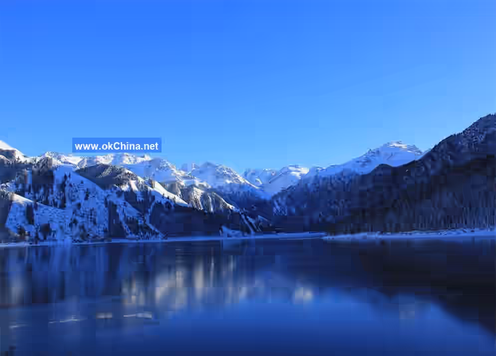
The scenic area lies within the Tianshan temperature inversion layer. Due to the influence of atmospheric circulation, the temperature is relatively stable and mild. The average annual temperature in the scenic area is 2.55°C. The warmest month, July, has an average temperature of 15.9°C, and the coldest month, January, has an average temperature of -12.4°C. The winter snowfall period lasts 6-7 months, and the freezing period lasts up to 5 months. The lake ice thickness exceeds 1 meter, making it a natural ice skating rink.
2.4 Animal Resources
The Bogda Peak Man and Biosphere Reserve has ancient, complex, and unique wildlife resources and flora/fauna composition. There are 32 species of mammals, 144 species of birds, and 5 species of amphibians, reptiles, and fish. Nationally protected wildlife includes snow leopards, brown bears, stone martens, red deer, argali, and Himalayan snowcocks.
2.5 Plant Resources
The forests in the Xinjiang Tianshan Tianchi Scenic Area are important plant resources. There are 191 species of higher flowering plants, covering 41.5% of the core scenic area. The reserve of large fungi resources is abundant, with over 20 species of edible fungi including straw mushrooms, pine mushrooms, deer antler mushrooms, and morel mushrooms.
3. Important Attractions
3.1 Shimen (Stone Gate)
Tianchi Shimen: The scenic name is "A Line of Sky at the Stone Gate." At an elevation of 1500 meters, it is located 5.9 kilometers north of Big Tianchi. It is a stone gorge formed by the ancient channel of the Sangong River cutting through. This mountain pass is the natural gateway into the scenic area. The gorge is about a hundred meters long, with the narrowest point only about ten meters wide. The vertical cliffs on both sides are tens of meters high, creating a steep and perilous scene. Looking up, one sees a sliver of sky, with the Sangong River winding alongside.
Fifty Bends: The scenic name is "Fifty Bends to Heaven." It is a winding mountain path below Shimen. (Nowadays) after passing Shimen, the mountain road leading to the top of Tianchi starts from the flat ridge "Another Village" above, consisting of about fifty bends.
3.2 West Small Tianchi
West Small Tianchi: Elevation 1600 meters (some say 1660 meters). Located northwest of the main lake (Big Tianchi Sea), about two kilometers northwest at its foot, to the lower right of the third bend of the Fifty Bends road. The lake water seeps from the southwest of the Tianchi Dam, enters the pool in the form of a waterfall, and then flows into the Sangong River. It was anciently called Yunu Pond (Jade Maiden Pond), traditionally said to be where the Queen Mother of the West washed her feet. The scenic name is "The Queen Mother's Foot Basin." It is also called Small Dragon Pond, hence also known as "Moon Reflected in Dragon Pond."
West Small Tianchi Waterfall: The scenic name is "Jade Belt and Silver Curtain." It hangs on the right side of the road not far past West Small Tianchi, cascading dozens of meters through the air. Its descent forms West Small Tianchi. Legend says it is the bathing water of the Queen Mother. On the opposite mountain peak, a hexagonal, pointed-roof "Waterfall Viewing Pavilion" was built during the Guangxu era.
Liquan Cave: The source of the West Small Tianchi Waterfall. This place resembles a cave but is not quite one, hidden and difficult to find. Also called "Hidden Breast Cave," hence the scenic name "Sweet Spring Hidden in the Breast." The spring water gushes from underground, clear and sweet. Legend says it is the Queen Mother's sweet spring. Records of the Grand Historian, Volume 123 states: "The Benji of Yu says: 'The rivers and mountains of Kunlun. Kunlun is over 2,500 li high, where the sun and moon hide to become light. On it are sweet springs and the Jade Pool.'"
3.3 East Small Tianchi
East Small Tianchi: Elevation 1860 meters. Located at the northeastern outlet of the main lake (some say 500 meters east), half a kilometer to the left of the last bend of the Fifty Bends. This pool covers several hundred meters in circumference, with an area of about 10,000 square meters. It is formed by water from the main lake cascading down through a man-made sluice gate at the eastern end of the Tianchi Dam. Both the inlet and outlet have waterfalls, connecting pools and falls. There is an outlet in the north; the pool water drops 200 meters here, forming a rolling waterfall that flows through the Sangong River Gorge. Its ancient names include Black Dragon Pond (/Flying Dragon Pond). Legend says it was originally a swimming pool for celestial maidens, later occupied by a black dragon as its lair. Another legend says it was where the Queen Mother of the West bathed and groomed, hence called "Grooming Stream" and "Bathing Immortal Basin." The environment is secluded, the water clear to the bottom, the pool depth mysterious. Dense pines and cypresses surround the pool, creating a profound space and serene scenery. After opening walking paths along East Small Tianchi and the waterfall, the touring space expanded, enriching the sightseeing content. However, several viewing pavilions and bridges are somewhat lacking in number, location selection, and design.
East Small Tianchi Outlet Waterfall: The scenic name is "Hanging Spring Flying Waterfall." Located on the north bank of East Small Tianchi, the cliff face is nearly a hundred meters high, called the "Hundred-Meter Cliff." In late spring and early summer when ice and snow melt, the pool water rises and leaks out here, dropping to form a nearly hundred-meter-high rolling waterfall that flows through the Sangong River Gorge. It splashes straight down with a thunderous sound. When sunlight refracts, a colorful ribbon appears in the sky, creating a spectacular scene. A poem says: "Countless pearls of spring hang in mid-air."
East Small Tianchi Source Waterfall: The scenic name is "Crocodile Spitting Pearls." Together with "Icy Pool Silver Curtain" and "Hanging Spring Flying Waterfall," they are called the "Three Waterfalls of Tianchi." Crossing the hill south of East Small Tianchi leads to the north shore of Big Tianchi. Here lies a huge natural dam, 289 meters high, formed by the accumulation of ancient glacial terminal moraines and mountain collapse debris. The entire dam resembles a crocodile's tail, hence called "Crocodile Dam." Tianchi water discharges through a man-made sluice gate named "Crocodile Sluice" at the eastern head of the dam, forming a waterfall about 10 meters high. The water splashes into the "Black Dragon Gorge Valley," converging into a mountain stream. Flowing north not far, it forms a pool, which is East Small Tianchi.
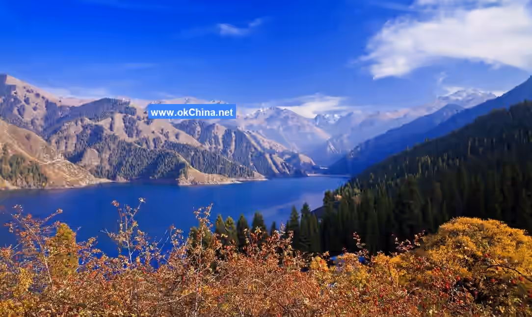
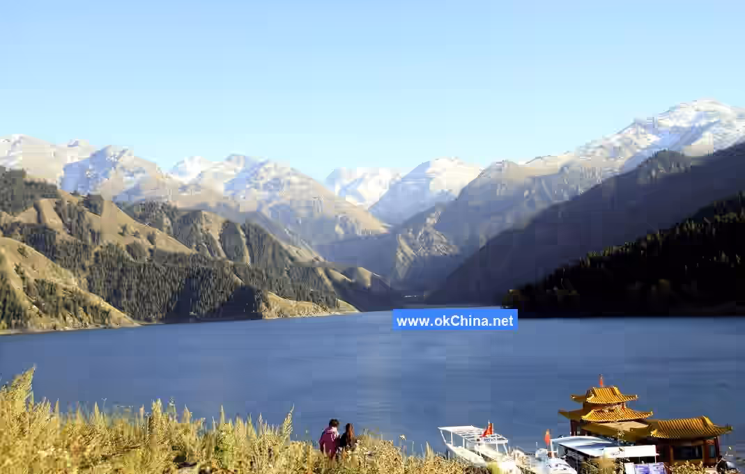
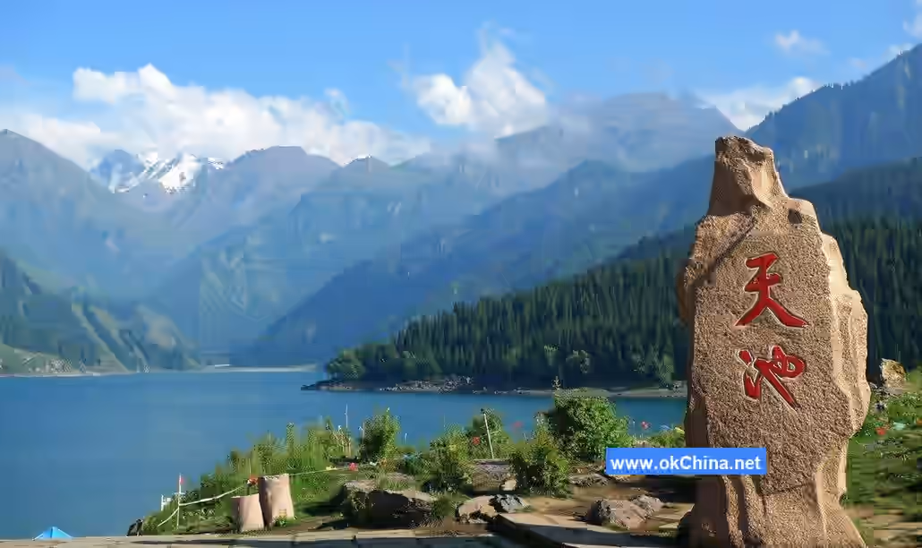
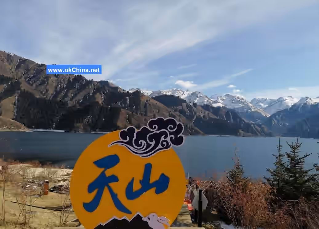
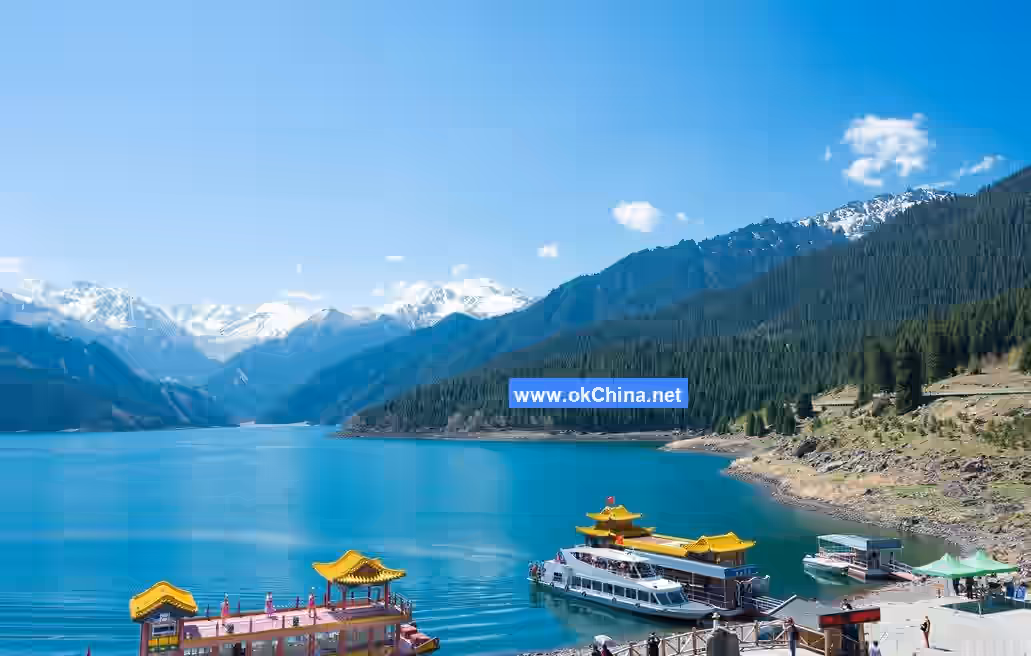
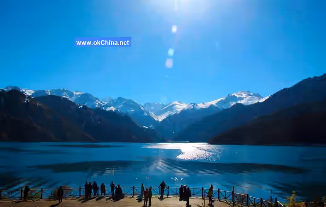
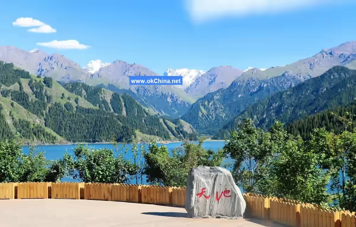
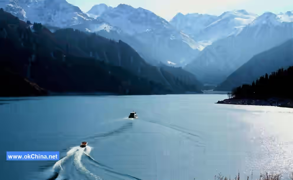
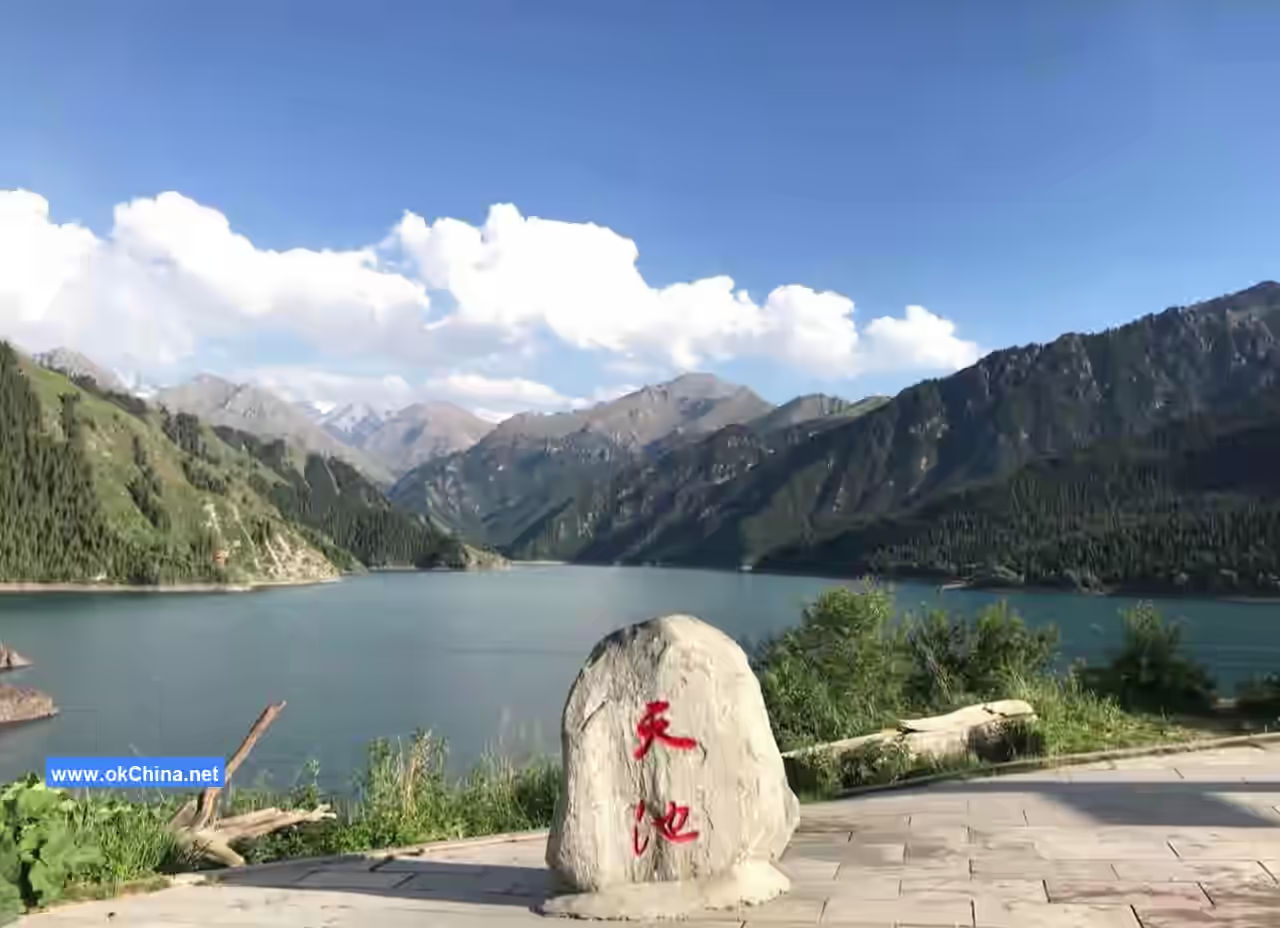
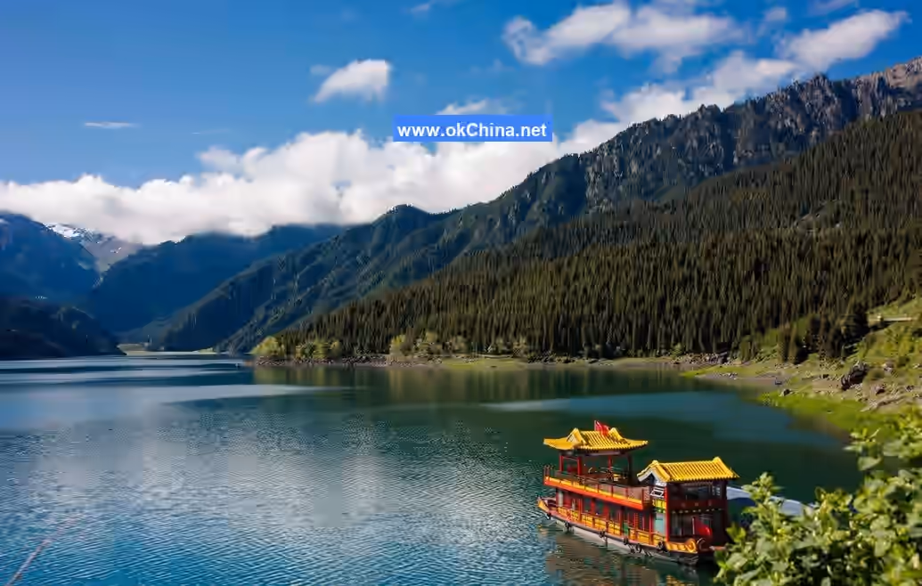
3.4 Big TianchiTianchi Great Haizi: Also known as the Main Lake or Great Tianchi, it is located within the mid-mountain valley forest belt on the northern foothills of the Bogda Mountain Range. The lake surface sits at an elevation of 1,910 meters and forms a north-south oriented rectangle (some say a crescent shape). It measures 3.5 kilometers (3.4 kilometers) in length from north to south, 0.5–1.5 kilometers in width from east to west, with a circumference of 9.7 kilometers. The average water depth is 60 meters (40 meters), with a maximum depth of 103 meters (102 meters) in the northeast. The lake surface area is generally 2.75 square kilometers (3.5 square kilometers), with a maximum area of 4.90 square kilometers. The average water storage capacity is 130 million cubic meters (generally 160 million tons, with a maximum capacity of 200 million tons). Its formation is subject to various theories, including glacial formation, fault depression, collapse, and debris flow. The lake water primarily consists of precipitation and meltwater, supplemented by a small amount of groundwater. The Great Tianchi resembles a gourd with its head facing south and body north; the Sangong River at its southern section is likened to the gourd's stem. Legend says the lake surface was the Queen Mother of the West's dressing mirror, named "Heavenly Mirror," hence the scenic name "Heavenly Mirror Floating in the Sky."
The lake is embraced by peaks and valleys, with steep ridges towering on both sides and clear, beautiful water at its center, surrounded by forests, grasslands, and blooming flowers. The lake water is icy and clear, containing artificially farmed cold-water scaleless fish. The trees around Tianchi are mostly Schrenk's spruces, a species that grows at altitudes between 1,500 and 2,700 meters and has a history of 40 million years. Ming Liang wrote: "From here (referring to the West Small Tianchi), crossing several high ridges, one finally reaches the summit."
Ancient Zhenhai Elm (also known as the Sea-Calming Needle): An ancient elm tree growing on the northern shore of Tianchi Great Haizi at an elevation of 1,910 meters. It can be seen by looking toward the lakeshore from the Crocodile Dam. It is the only elm tree within several kilometers of the core scenic area around the lake, holding significant ecological value. Legend claims it transformed from the Queen Mother of the West's precious hairpin, planted here to subdue water monsters. In reality, it is likely a descendant of elm trees planted later by people, either in commemoration of King Mu of Zhou by the Queen Mother of the West or simply because elms were suitable for the local hydrology and soil. This ancient elm grows alone, standing proudly facing the lake to the south. Its crown is large like an umbrella, lush and verdant with dense branches and leaves. The unique natural environment adds to its mystique. For a long time, the distance between the tree's roots and the lake's water surface has remained constant. Even during high-water years, the rising lake level never reaches the roots, much like a "Sea-Calming Needle."
Crouching Dragon Mountain: Also known as the Beauty of the Eastern Shore. Its head faces north and tail south, with a dragon spine forming nine undulating gentle peaks. The dragon claws on the western side of the spine extend into the lake as five branches. At sunset, the fading light outlines the silhouette of a young maiden along the mountain. She lies on her back with bent legs, her head resting on the high mountain. Her long eyelashes become several pine trees on the mountaintop, and her full bosom transforms into two rounded, rising peaks. Legend says this young maiden comes to rendezvous with the Crouching Dragon every sunset.
Crocodile Mountain: Also known as the Crocodile of the Western Shore, located on the long ridge mountain body of Tianchi's western shore. Legend says it was transformed from a crocodile, hence the name. The crocodile's head faces south and body north, with an arched back forming gentle peaks and its feet inserted into the lake. The crocodile's tail is the aforementioned "Crocodile Dam."
Sangong River Floodwaters: Also known as the "Yellow Dragon of the Southern Lake." The Sangong River enters the lake at the southern section of Great Tianchi. Due to relatively high summer precipitation in the Bogda mountainous area, often with torrential downpours, the upstream catchment area of the Sangong River covers 168 square kilometers. During heavy rains, the river surges northward, visible looking south from the northern part of Tianchi.
Great Bay: Scenic name "Great Bay Reflection," located in the southwestern part of the Great Tianchi lake surface. This area is calm with peaks reflected in the lake. On the southwestern side of Tianchi Great Haizi, there is a large expanse of gently sloping grassland, an excellent spot for viewing reflections and a resting place on the trail from the western to the southern shore. Timing is crucial for viewing reflections. During the day, Tianchi experiences upslope winds, and at night, downslope winds. The wind shift usually occurs around 9 or 10 a.m. daily, when Tianchi is most calm, and reflections are picturesque.
3.5 Queen Mother of the West Temple
Queen Mother of the West Ancestral Temple: Originally Damo Nunnery, commonly called the Goddess Temple. It is situated on the hillside of Tianchi's northeastern shore, halfway up the mountain on the eastern side of Tianchi. It covers an area of approximately 2,000 square meters, with a building area of over 400 square meters. The main hall enshrines a statue of the Queen Mother of the West (Wangmu Niangniang). Historical records describe it as a grand structure that was once very popular. It was destroyed by war in 1932. Reconstruction began on the original site in 1992, and it was rebuilt again in 2000. The temple houses some relics from the original Goddess Temple, such as ancient bells, eaves tiles, and murals. It is one of the holy sites for Taoist believers worldwide to trace their roots and worship ancestors.
Damo Precipitous Path: From the northern shore of Great Tianchi, follow a path extending eastward on the left for several hundred meters to see a dock. Then, follow the small path along the eastern shore southward; a roughly half-hour walk leads to the Goddess Temple tourist area. Along the way, one can see a mountain path on the left leading from the water outlet to Damo Cave. It is winding, narrow, and long, very dangerous and rarely traversed. It is said to have been opened by Damo.
Immortal Dwelling Cave (Ancient Immortal Dwelling Cave): Located 50 meters above and to the right of the Queen Mother of the West Temple, above Damo Nunnery. Faintly discernible murals remain inside the cave. Legend says it was a dwelling place for immortals, also known as Guanyin Cave. On the hillside 50 meters above and to the right of the Immortal Dwelling Cave, there is an independent rock about five or six meters high, resembling an immortal gazing into the distance, raising its right arm to welcome immortal guests coming to the Peach Banquet, named "Welcoming Immortal Abode."
Damo Cave (Damo Meditation Cave): Located above and to the right of the Queen Mother of the West Temple on Tianchi's eastern shore, above the Ancient Immortal Dwelling Cave. It is said to be where Bodhidharma "faced the wall in meditation and achieved enlightenment." A statue of Patriarch Damo was once enshrined inside.
Guanyin Pavilion Ruins (Guanyin Pavilion Site): Above Damo Meditation Cave. The construction date is unknown. It once housed two Taoist priests and was destroyed in the late Republic of China period.
Immortal Gathering Platform: On the shore of Tianchi in front and to the left of the Queen Mother of the West Temple, now a flat circular grassland.
Laozi's Ancient Cave: On the eastern shore of Tianchi. Records of the Grand Historian, Volume 63, states: "Laozi then wrote a book in two parts, expressing the meaning of the Way and its Virtue in over five thousand words, and then departed (west through the Hangu Pass), none knew where he ended." Legend says Laozi came to this mountain and almost broke precepts while joyfully swimming in Tianchi with the Queen Mother of the West and others, so he further cultivated himself in Laozi's Ancient Cave.
Buddha's Light Viewing Pavilion: Also known as "Sea Viewing Pavilion," located on the shore of Tianchi's eastern bank. At sunrise, if the sky is filled with scattered clouds, a Buddha's light flickers above the Queen Mother of the West Temple. Those unaware of the reason consider it the "Morning Glow on Sea Peaks."
3.6 Lamp Pole Mountain (Zen Lamp Mountain)
Elevation 2,718 meters, located about 4 kilometers (some say 3 kilometers) from the western shore of Great Tianchi. The mountain runs north-south, about 3 kilometers long and 2 kilometers wide, with a visitable area of 0.2 square kilometers. It is the second-highest peak among the group of peaks west of Tianchi, belonging to the mid-mountain valley forest belt. The mountain features large pastures; both Laojun Temple and Dongyue Temple were built here. In the past, Taoist priests erected a pine pole on the mountaintop with a sky lantern hung on it, kept lit day and night to signify peace in the world, hence also called the Peace Lantern. Lamp Pole Mountain is an excellent viewing spot. From above, one can gaze at the Bogda Snow Peak in the distance and look down upon the full view of Tianchi. It is also a perfect location for "Viewing Pines on the Western Mountain" and watching the sunset. Looking west from here, Urumqi can be seen in its entirety, especially at night when the city lights up, offering a distant view of Urumqi's myriad lights. Legend says the pine pole erected on this mountain with the "sky lantern" was to commemorate Bodhidharma's contemplation and the Zen teachings he transmitted in the "Damo Meditation Cave" opposite. Follow the winding mountain road on the western side of Great Tianchi upward for several hundred meters. Upon seeing the roadside sign for "Xinjiang Yaochi International Travel Service China Tianshan Tianchi Mark Zhong Resort" (containing the Silk Road Ancient Path Mark Zhong Dining Plaza, etc.), continue upward about 3 kilometers to reach it.
Sky-Supporting Three Stones: Three huge rocks towering on the summit of Lamp Pole Mountain, formed by the weathering of a volcanic dike along fissures. Their shape resembles halberds, hence named "Three Halberd Stones," also called "Sky-Supporting Stones." The stone pillars point to the vast sky, as if relying on them to prop up the heavens.
Great Cauldron Bottom Pit: Located 2,530 meters west of Tianchi Great Haizi, it is an ancient glacial cirque formed during ancient glacial activity, shaped like a cauldron bottom, hence the name. Elevation 2,180 meters, area 125,000 square meters. Steep cliffs surround the south, west, and north sides, with an opening to the east. The pit bottom is grassland, with spruce forests on the southern and western sides. The north-facing sunny slope has undulating grasslands, forming a distinct scene. A large depression at the foot of Zen Lamp Mountain, elevation 2,180 meters, 538 meters lower than the Zen Lamp Mountain peak. Shaped like a large cauldron bottom, the "cauldron mouth" tilts toward Tianchi. It is an undulating grassland with lush green grass and dense spruce forests. Sheltered from mountain winds, the temperature is relatively high. Additionally, several springs emerge from the pit bottom. Therefore, spring arrives earliest here, with abundant water, lush grass, and blooming flowers, earning the scenic name "Immortal Gathering Jade Terrace."
Dongyue Temple Ruins: Located on a terrace on the southern mountainside of Lamp Pole Mountain, southwest of Tianchi. The terrace is surrounded on three sides by Horse Tooth Mountain and Lamp Pole Mountain, facing the Great Cauldron Bottom Pit to the northeast. Dense spruce forests grow around the terrace. Dongyue Temple is also called Bogda Mountain Temple, or simply Mountain Temple. It was first built in the 16th year of the Guangxu reign of the Qing Dynasty (1890) and was burned down several times later. In the 11th year of the Republic of China (1922), Dongyue Temple was rebuilt on the original site. It was destroyed again during the war in 1933 and never restored. Chen Cheng (AD 1365–1457) recorded in Records of the Western Regions: "...over a hundred li away is the Spiritual Mountain, traditionally said to be the place where one hundred thousand arhats attained Nirvana. Near the mountain is an earthen platform over ten zhang high, said to have been built during the Tang Dynasty. Beside the platform is a monk's temple, below which is a stone spring and several mu of forest. From here, going in and out, traveling over twenty li, passing through a gorge to the south, there is an earthen house with many willow trees beside it. Along the south of the earthen house, climb the mountain slope; on the slope is a small stone-built house, less than five chi high, seven or eight chi wide. Inside the room are five small Buddha statues, with many wooden plaques beside them, all inscribed with foreign characters, said to record the names of mountain travelers. In front is an earthen pool, not very large, shallow without accumulated water, clean without dust or filth.""Tai Xu Eight Trigrams": Refers to the "Eight Trigrams Pavilion Site" and "Tai Xu Hermitage Site" located below the "Dongyue Temple Site," built by Yang Feixia, who served as the Garrison Commander of Ili during the Republic of China era. The "Eight Trigrams Pavilion" is a two-story octagonal structure with a cross-section shaped like the eight trigrams, hence its name. The "Tai Xu Hermitage," situated below the Eight Trigrams Pavilion, was where Yang Feixia built a thatched hut for spiritual practice, named after his alias "Tai Xu."
3.7 Horse Teeth Mountain
Horse Teeth Mountain, with an elevation of 3,056 meters, is located 4.5 kilometers southwest of the Great Heavenly Lake (some say two kilometers). It connects to the southern part of Chandelier Mountain, stretching about 5 kilometers in length and covering a visitable area of 0.5 square kilometers. Formed by rows of ancient glacial erosion, its peaks are steep, upright, and pierce the sky, resembling a row of giant horse teeth, hence the name. On the northern side of the mountain, at the edge of the forest, there is a columnar stone forest formed by weathered and water-eroded columnar eruptive rocks. Its shapes are exceptionally beautiful, making it the best ice-carved mountain rock in the Heavenly Lake scenic area. The Horse Teeth Mountain Stone Forest is a unique feature of the Heavenly Lake scenic area. Under weathering and erosion, these massive rocks form peculiar horse teeth-like landscapes with diverse shapes, inspiring endless imagination when walking through the stone forest. Characterized by its mountainous landscape, Horse Teeth Mountain is the highest among the ten peaks surrounding Heavenly Lake. From its summit, one can look north to Heavenly Lake and Chandelier Mountain, east to the three peaks of the Bogda Snow Sea, and west to the clearly visible Urumqi.
3.8 Iron Tile Temple Ruins
The Iron Tile Temple Ruins are located on the west side of Heavenly Lake, 700 meters from the lakeshore, situated on a terrace covering over 4,000 square meters. Facing northeast with its back to the mountain and overlooking Heavenly Lake, it is surrounded by green pines on three sides, offering a serene and elegant atmosphere. The front is flat and open, providing a natural panoramic view. The northern lake embankment, the lake water, the eastern Sleeping Dragon Mountain scenery, and the movements of tourists are all in sight. There are two accounts of the Iron Tile Temple's construction time:
In the early Yuan Dynasty, Qiu Chuji, the Taoist master of the Quanzhen School, was summoned to meet Genghis Khan during his western expedition. Leading eighteen disciples to the foot of the Tianshan Mountains, Qiu Chuji and his followers built a temple on the mountain by the Heavenly Lake shore, roofed with iron tiles, hence the name Iron Tile Temple. Another account states that the Iron Tile Temple was built in the 41st year of the Qianlong era of the Qing Dynasty (1776), named for its blue brick walls and iron tile roof. Historically, the Iron Tile Temple was destroyed and rebuilt three times. During the Qing Dynasty, it was renamed Fushou Temple. In 1946, when Yu Youren visited Heavenly Lake and stayed at Fushou Temple, he was puzzled by the blending of Buddhism and Taoism and the Taoist temple being named as a Buddhist temple. He then inscribed a new name: "Lingshan Taoist Temple."
3.9 Northern Slope of Bogda Peak
Looking south at Bogda Peak from Crocodile Dam, this is the last of the Eight Scenes of Heavenly Lake, "Viewing Snow from the Southern Mountain." The other seven scenes, in order, are the previously mentioned "Stone Gate Line," "Dragon Pool Blue Moon," "Hanging Spring Waterfall," "Sea-Calming Needle," "Viewing Pines from the Western Mountain," "Three Rocks Reaching the Sky," and "Morning Glow at Sea Peak." The "Poem of the Eight Scenes of Heavenly Lake" about these scenes was composed by contemporary poet Xie Yukang. From Crocodile Dam, one can take a ferry to the southern shore of Heavenly Lake and continue southward.
Ziyanzhan Valley and Red Deer Valley: The valleys are deep with rapid streams, roaring waters, and cool, pure river water. The riverbanks alternate between steep cliffs and wide, flat areas. The vegetation in the valleys is divided into five layers based on height: the top layer consists of conical crowns of spruce trees; the second layer is Tianshan rowan; the third layer includes roses, honeysuckle, and red-berried barberry; the fourth layer comprises over 200 species of herbaceous plants such as lady's mantle, bluegrass, deer grass, meadow rue, Tianshan iris, and alpine celery; and the fifth layer is moss and lichen. These plants either coexist or stand alone, adorning the mid-mountain valleys with a thousand postures and myriad charms. The valleys are rich in wildlife, including mammals like red deer, roe deer, wild boar, brown bear, fox, lynx, stone marten, ferret, and hare, as well as birds such as rock partridge, chukar partridge, black stork, willow warbler, nutcracker, goldfinch, red-fronted serin, rosefinch, and iris.
Meadow Grassland: This is the subalpine meadow grassland natural landscape area within the Bogda Peak northern slope tourist zone, located at an altitude of 2,800–3,500 meters. The mountainous terrain features undulating east-west connected platforms, formed by erosion from flowing water during the slow uplift of the mountains, scientifically termed "peneplain," commonly known as "terraces." June to August is summer here, with an average July temperature of 3°C–4°C. Summer brings ample precipitation, making it excellent summer pasture. The plants in this area are perennial and very short. There is a wide variety of plant species with extensive coverage, creating a lush green meadow grassland scene. Due to the high altitude and intense ultraviolet radiation, the flowers here include gentian, aster, edelweiss, geranium, viviparous knotweed, and golden flower. The area is inhabited by various wildlife: elegant red-billed choughs, adorable little marmots, and plump, clumsy large brown bears; as well as snow chickens and snow leopards on distant snowy mountains. Additionally, ibex and argali sheep once lived here. There is a rock carving in the upper section of the meadow grassland natural landscape area.
Mountaineering Base Camp: Located at the junction of the meadow grassland natural landscape area and the alpine gravel desert natural landscape area above it, at an altitude of 3,540 meters, this is the base camp for climbing Bogda Peak. From the southern shore of Heavenly Lake to the base camp, climbers generally take one of two routes: one goes east along the Dadong Valley, then turns south over the "Three Pass Col," which is relatively gentle; the other goes south along the General Valley, then turns east over the "Yikenqi Col," which is steeper. The total distances of the two routes are 25 kilometers and 30 kilometers, respectively.
Ice and Stone Flowers: The alpine flower known as snow lotus belongs to the Asteraceae family and has aliases such as snow chrysanthemum, snow lotus flower, stone lotus, auspicious lotus, big wood flower, jade flower, Queen Mother of the West flower, sage grass, utpala flower (as referred to in Buddhist scriptures), alpine rose, and king of herbs (Kazakhs at Heavenly Lake call the snow lotus "Huojiaquepu," meaning "king of herbs"). It grows on glacial till gravel slopes and snowy rock crevices at altitudes of 2,600–4,000 meters.
Glacier Snow Sea: This is the glacier snow sea natural landscape area above the snow line (around 3,800 meters altitude) within the Bogda Peak northern slope tourist zone. This area experiences the most frequent avalanches in the Tianshan Mountains, with high density, varied paths, and significant drop heights. Avalanches are most likely to occur during and after summer snowfall, posing many challenges for climbers. The perennial snow here compresses the underlying snow into ice, forming glaciers. The advance and retreat of glaciers change with climate fluctuations, covering the mountains. The largest glacier stretches 27 kilometers, and as these massive glaciers move down valleys, they leave extensive traces, forming the ancient glacial relics of the aforementioned alpine gravel desert natural landscape area.
3.10 Bogda Peak
The mountain range runs east-west, with an elevation of 5,445 meters. Above 2,800 meters is the high mountain area, characterized by steep terrain, exposed bedrock, widespread rock piles, perennial snow, severe cold, and danger. It hosts numerous glaciers covering an area of 55.05 square kilometers, with an ice reserve of 1.84 billion cubic meters, equivalent to 1.64 billion cubic meters of water, serving as a natural high-mountain solid reservoir and the source of many rivers. It is the uppermost part of the glacier snow sea natural landscape area. The summit features three peaks standing side by side: the easternmost main peak is Bogda Peak at 5,445 meters, with perennial glacial snow on its summit, making it a famous high peak in the eastern Tianshan Mountains, known as the "First Peak of the Eastern Tianshan." The middle peak is "Ling Peak" at 5,287 meters, and the westernmost is "Sheng Peak" at 5,213 meters. Bogda Peak glistens with silver light, complementing the green waters of Heavenly Lake in the valley, creating a beautiful scene of high mountains and a flat lake. It is also known as the "Guardian Deity of the Junggar Basin."
Comments
Post a Comment