Gansu Guangegou National Forest Park
I. Introduction
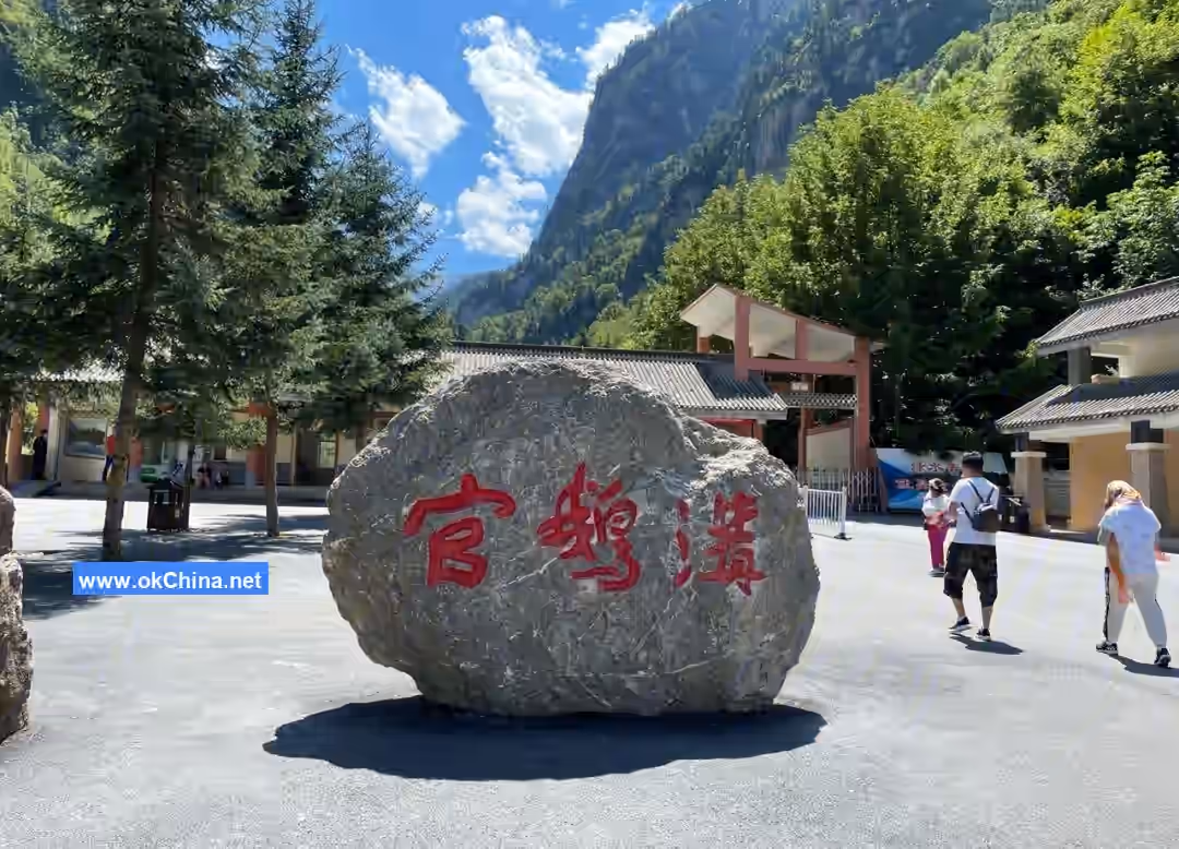
Gansu Guangegou National Forest Park is located in the suburbs of Tanchang County, Longnan City, Gansu Province. It comprises core scenic areas such as Guanzhu Gully, E'man Gully, and Leigu Mountain. The park's geographical coordinates range from 104°01′1.82″E to 104°28′49.66″E and 34°08′34.35″N to 33°50′33.15″N. It stretches 49 kilometers from east to west and 17 kilometers from north to south, with a total area of 66 square kilometers.
The forest coverage rate of Gansu Guangegou National Forest Park reaches 75.1%. Within the park, there are 4 species of national first-class protected animals, 23 species of national second-class protected animals, and over 700 plant species from more than 50 families. It features more than 20 lakes of various forms and over 10 waterfalls. Characteristic folk villages within the scenic area, such as Luren Ancient Village, Yinping Village, and Xinping Village, are well-preserved.
In 2003, Guangegou was designated as a National Forest Park. In 2007, it was rated as a National 4A-level Tourist Attraction. In 2014, it was recognized as a National Geopark. In July 2022, Guangegou was designated as a National 5A-level Tourist Attraction.
II. Location and Layout
Location and Territory
Gansu Guangegou National Forest Park is located 2.5 kilometers southwest of Tanchang County, Longnan City, Gansu Province. It is 36 kilometers from Hadapu Railway Station, 116 kilometers from Longnan City proper, 340 kilometers from Lanzhou, the provincial capital of Gansu, 670 kilometers from Chongqing Municipality, 540 kilometers from Chengdu, the provincial capital of Sichuan, and 650 kilometers from Xi'an, the provincial capital of Shaanxi. The park's geographical coordinates range from 104°01′1.82″E to 104°28′49.66″E and 34°08′34.35″N to 33°50′33.15″N. It stretches 49 kilometers from east to west and 17 kilometers from north to south, with a total area of 66 square kilometers.
Topography and Landforms
Gansu Guangegou National Forest Park lies in the interlacing zone of the northeastern edge of the Qinghai-Tibet Plateau and the branch ranges of the Qinling and Minshan mountain systems. The elevation ranges from 1,748 meters to 4,154 meters. The area features undulating, continuous mountains and crisscrossing gullies, with a distinct "two valleys flanking one ridge" landform characteristic. The terrain slopes from northwest to east. The branch range of the West Qinling Mountains extends from east to west, starting from Xiaojiawan, passing through Yangjialaoliang, Heitou Mountain, Guanba Mountain, Jiepai Mountain, and Tutaizi Liang, then northwestward, gradually rising to the watershed dividing the North and South Qinling Mountains and the Yellow River and Yangtze River basins. The branch range of the Minshan Mountains extends from northwest to southeast, starting from Bairilaji Mountain, passing through Yingpan Mountain, Congdi Mountain, Shanshenye Liang, and Mazonggang Liang, forming a natural barrier bordering Diebu and Zhouqu counties. Due to the widespread distribution of branch ranges from the West Qinling and Minshan mountain systems and the long-term erosion and cutting by rivers such as the Minjiang and Bailongjiang, the terrain within the area is exceptionally complex, with extremely pronounced mountainous features. The southern part is characterized by deep mountains and valleys, while the northern part features loess ridges and hills. The terrain slopes from northwest to southeast. The area contains high mountains and steep ridges, including Leigu Mountain, the second-highest peak in Longnan City at 4,154 meters. Other high peaks include Mazonggang Liang at 4,143 meters, Shanshenye Liang at 4,037.9 meters, and Yingpan Mountain at 3,668 meters.
Climate
Gansu Guangegou National Forest Park is situated in the hinterland of the Chinese mainland, within the Minshan mountainous sub-region of the northeastern edge of the Qinghai-Tibet Plateau, between the South and North Qinling Mountains. It is a transitional zone between the northern subtropical, temperate, and plateau climates, primarily characterized by a temperate continental monsoon climate. The climate is mild and humid with four distinct seasons. According to Gansu's climate zoning, it belongs to the Longnan temperate humid zone. The climate within the forest park varies significantly due to topographic influences, with distinct horizontal and vertical distribution, exhibiting the phenomenon of "four seasons on one mountain, different scenery everywhere." The annual average temperature is 8.8°C, the effective accumulated temperature ≥0°C is 3,410.5°C, the annual average frost-free period is 160 days, the average temperature of the hottest month (July) is 19.2°C, the average temperature of the coldest month (January) is 2.9°C, the extreme maximum temperature is 35.0°C, the extreme minimum temperature is -16.9°C, the maximum frozen soil depth is 45 cm, the annual average sunshine duration is 2,095 hours, and the annual sunshine percentage is 47%. Major disastrous weather includes hail, rainstorms, drought, continuous overcast rain, cold waves, and frost. Droughts mostly occur in April and during the dog days of summer.
Hydrology
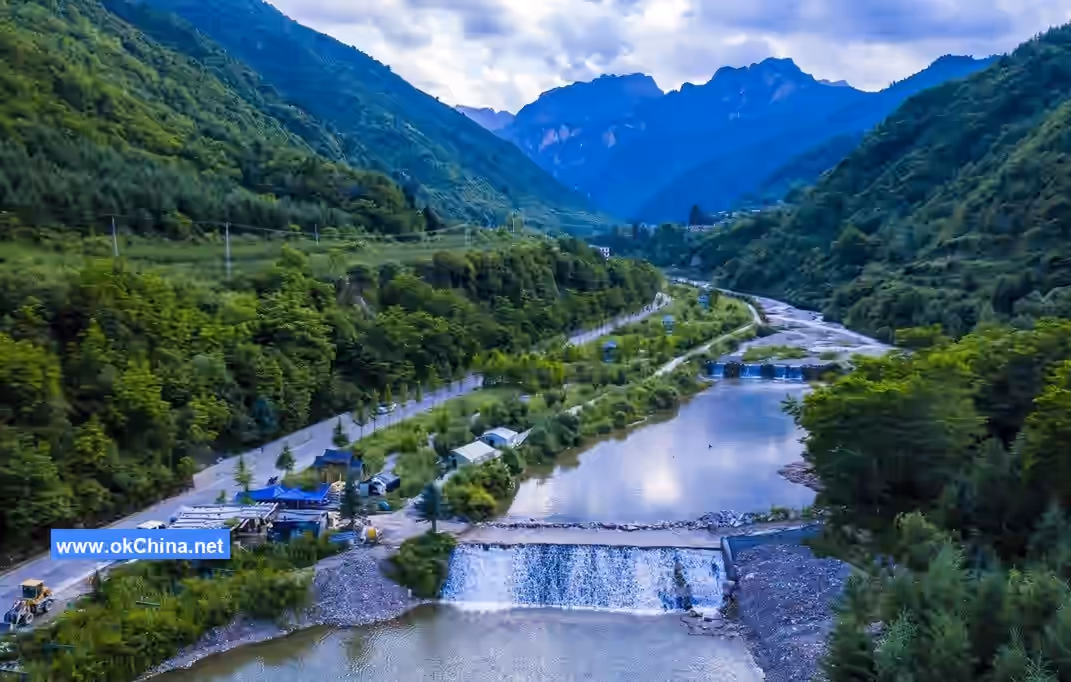
Gansu Guangegou National Forest Park belongs to the Minjiang River basin. Within its territory, there are four rivers that are primary tributaries of the Minjiang River: Dahebagou River, Guange River, Gangou River, and Nanhe River. 97% of the water is freshwater, with mineralization between 1-2 g/L, pH between 7.2-8.2, and total hardness between 9-20, meeting the water quality standards for human and livestock drinking.
Dahebagou River
The Dahebagou River originates from Leigong Mountain. It is 21.5 kilometers long with a drainage area of 147.6 square kilometers. It flows through villages in Xinchengzi Township, Tanchang County, including Xinping, Yuecangpu, Lugangtou, and Daheba, before converging into the Minjiang River at the location of the Xinchengzi Township government. Its multi-year average flow is 1.12 cubic meters per second, with a minimum dry-season flow of 0.15 cubic meters per second. The average longitudinal gradient is 8%. It has good water conservation conditions and stable flow.
Guange River
The Guange River originates from Mazonggang Liang. It is 21.0 kilometers long with a drainage area of 95.0 square kilometers. It flows through villages in Chengguan Town, Tanchang County, including Luren, Lijie, Washeping, and Guange, before converging into the Minjiang River at the headquarters of the Minjiang Forestry General Farm. Its multi-year average flow is 0.72 cubic meters per second, with a minimum dry-season flow of 0.15 cubic meters per second. The average longitudinal gradient is 6%. It has good water conservation conditions and stable flow.
Gangou River
The Gangou River originates from Shanshenye Liang, the watershed dividing Zhouqu and Tanchang counties. It is 16.0 kilometers long with a drainage area of 66.3 square kilometers. It flows through villages in Hejiapu Township, Tanchang County, including Caopingzi, Gangou, and Hekou, before converging into the Minjiang River at Hekou. Its multi-year average flow is 0.095 cubic meters per second. The average longitudinal gradient is 7.5%. The water is clean and the flow is stable.
Nanhe River
The Nanhe River originates from Yingpan Mountain, the watershed dividing Diebu and Tanchang counties. It is 28 kilometers long with a drainage area of 398.2 square kilometers. It flows through villages in Nanhe Township, Tanchang County, including Baluchuan, Rushu, Rencang, and Nanhe, before converging into the Minjiang River at Nanhekou. Its multi-year average flow is 0.85 cubic meters per second. The average longitudinal gradient is 2.6%. The water is clean and the flow is stable. Its main tributaries include Chigou River, Yingpangou River, Taizigou River, Huangjialugou River, Zhebanggou River, and Zhugegou River.
Natural Resources
Animal Resources
Gansu Guangegou National Forest Park is home to 4 species of national first-class protected animals, including the white-lipped deer, leopard, clouded leopard, and Chinese grouse; 23 species of national second-class protected animals, including the tufted deer, serow, Asian black bear, blue eared pheasant, brown eared pheasant, forest musk deer, and Temminck's tragopan; and 7 species of provincial key protected animals, including the leopard cat, Chinese giant salamander, Reeves's muntjac, and stone marten.
Plant Resources
Gansu Guangegou National Forest Park grows over 700 species of plants from more than 50 families, including trees such as spruce, purple-cone spruce, Qinling fir, Chinese pine, Pott's larch, Huashan pine, juniper, oak, birch, and poplar; and shrubs such as peony, Acer mono, Chinese herbaceous peony, wild lilac, boxwood, corn poppy, iris, and rhododendron. It also distributes over 100 species of medicinal plants, including Siberian ginseng, Chinese caterpillar fungus, Chinese goldthread, pinellia, fritillary, Chinese wild ginger, and rhubarb, as well as edible fungi like morel mushrooms and wild mushrooms.
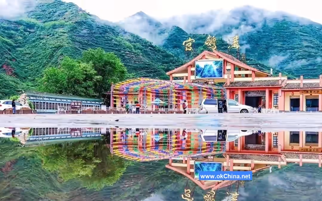
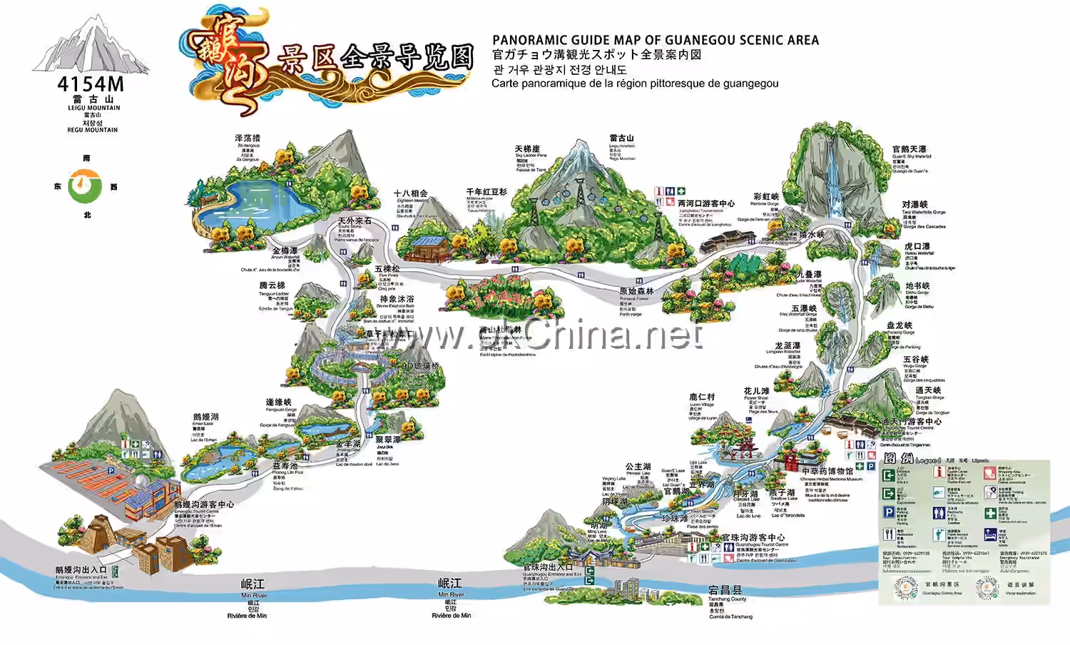
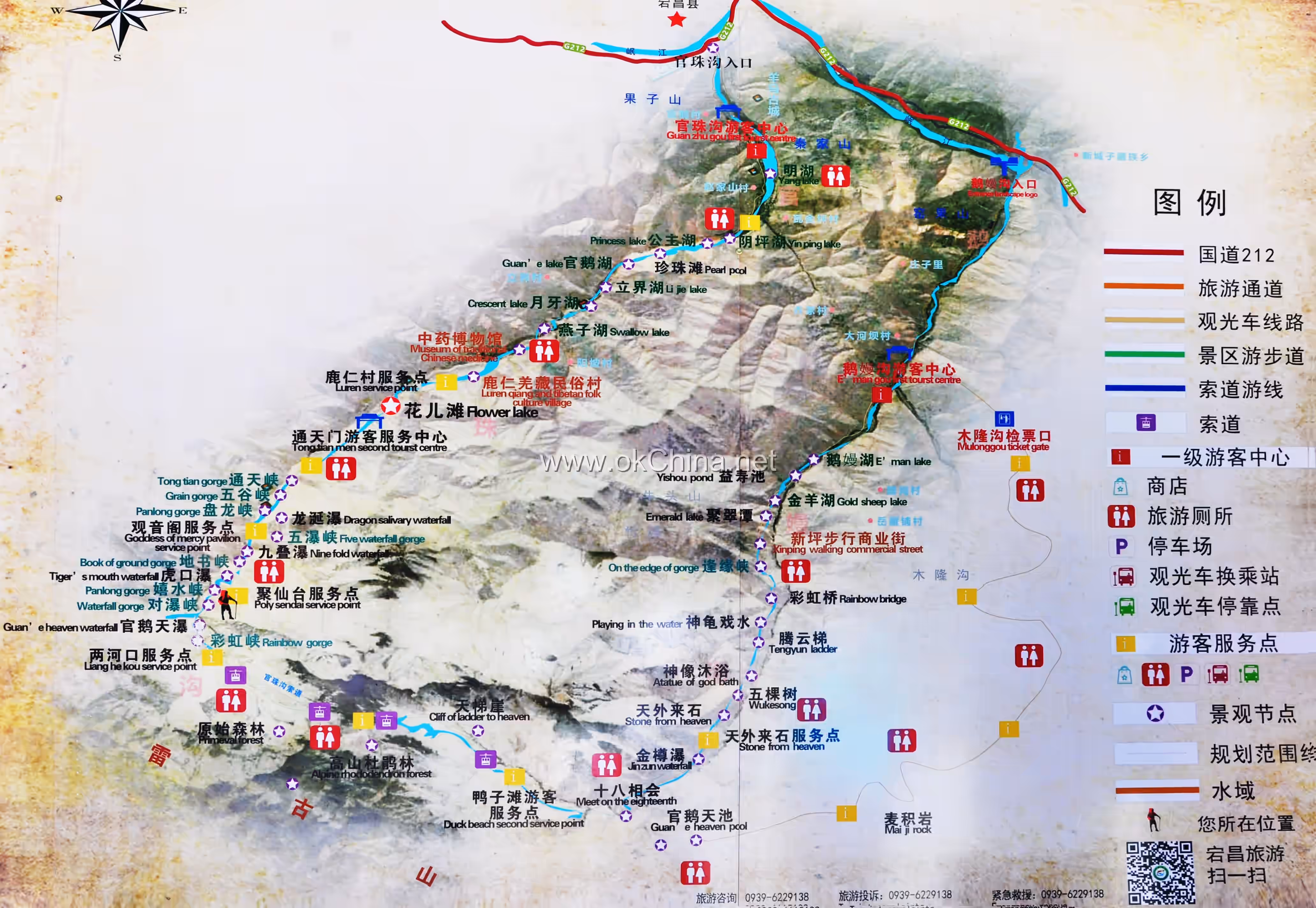
III. Major Scenic Areas
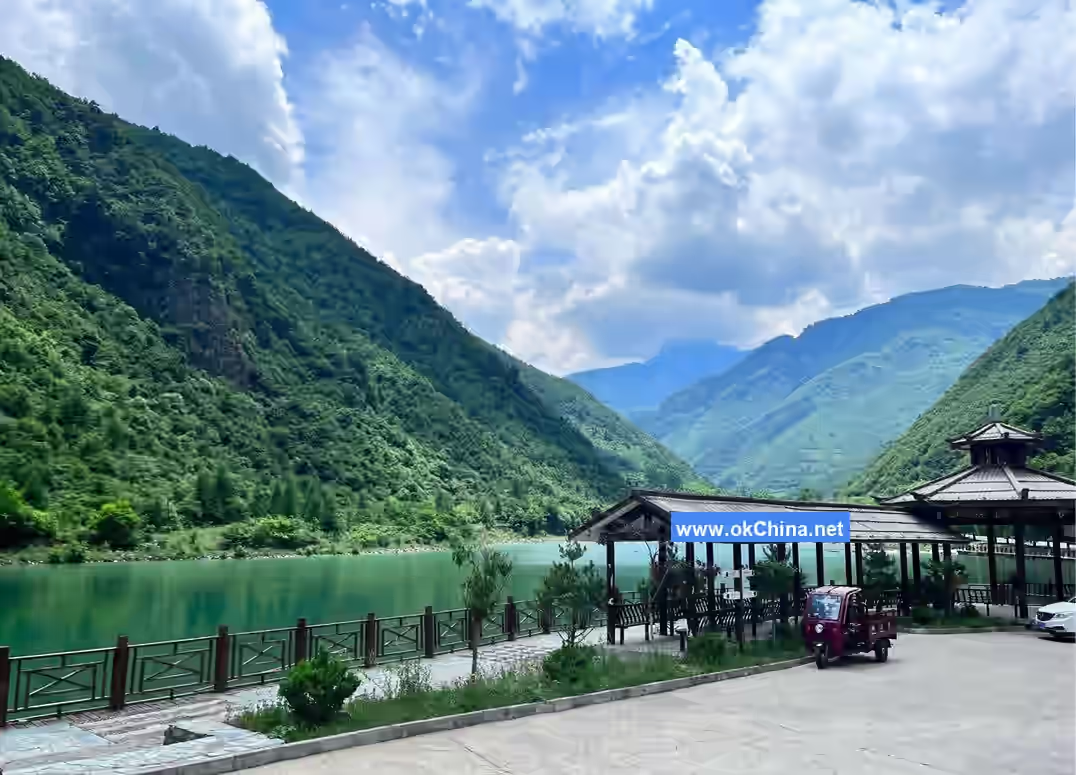
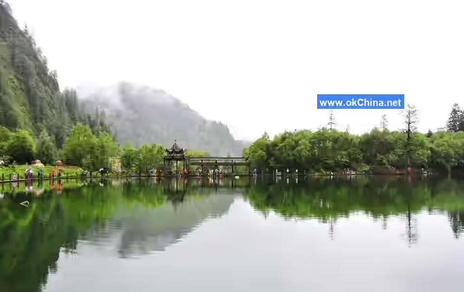
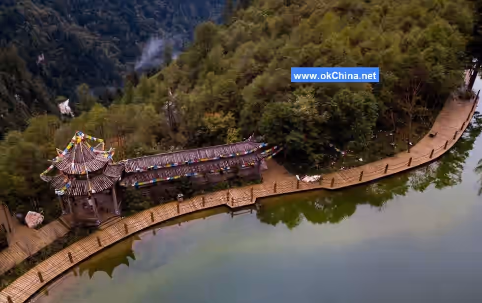
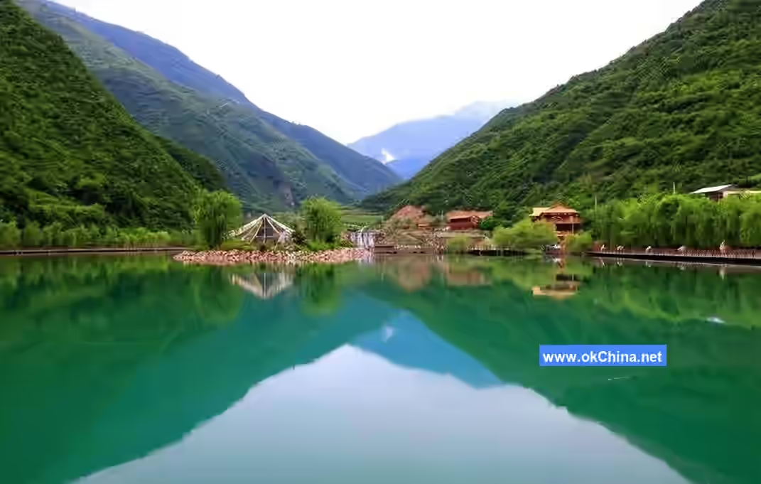
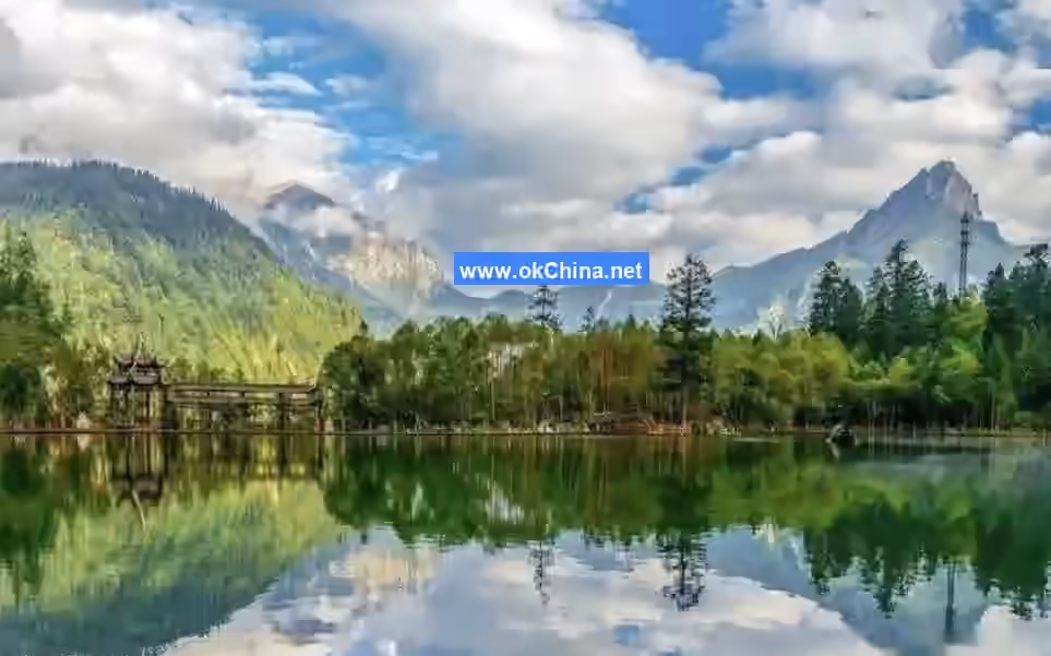
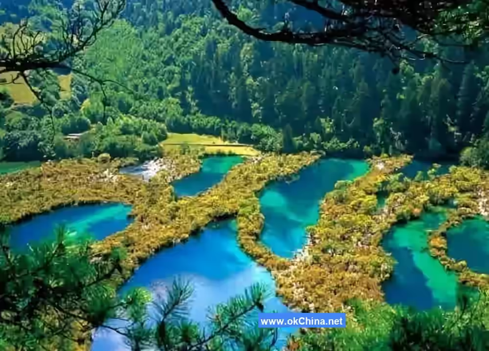
Yinping Lake
Yinping Lake is a tranquil and beautiful gem within Guangegou National Forest Park. The lake resembles a giant mirror, nestled among the surrounding mountains. Its clear water reflects the lush trees and majestic peaks along the shore, blending the landscape into a natural ink-wash painting.
In the early morning, when the first rays of sunlight touch the lake surface, it sparkles like scattered pieces of gold. Occasionally, ripples appear on the lake, stirred by early-rising fish playfully swimming, breaking the serenity. Strolling along the wooden boardwalk by the lake, breathing in the fresh air mingled with the moist scent of the lake and the fragrance of trees, refreshes the mind and spirit. The surrounding peaks are often shrouded in mist and clouds, adding a touch of mystery to Yinping Lake, making it seem like a fairyland.
On one side of Yinping Lake lies a dense forest where various birds sing joyfully from the branches. Their songs, interwoven with the murmuring sound of the lake, create a beautiful symphony of nature. Visitors can listen quietly here, feeling the harmony and beauty of nature. In the evening, the afterglow of the sunset dyes the entire lake surface orange-red. Where the water meets the sky, the colors are dazzlingly brilliant. Sitting on a bench by the lake at this moment, admiring the beautiful sunset, all worries are left behind, and the heart is filled only with intoxication and attachment to this magnificent scenery.
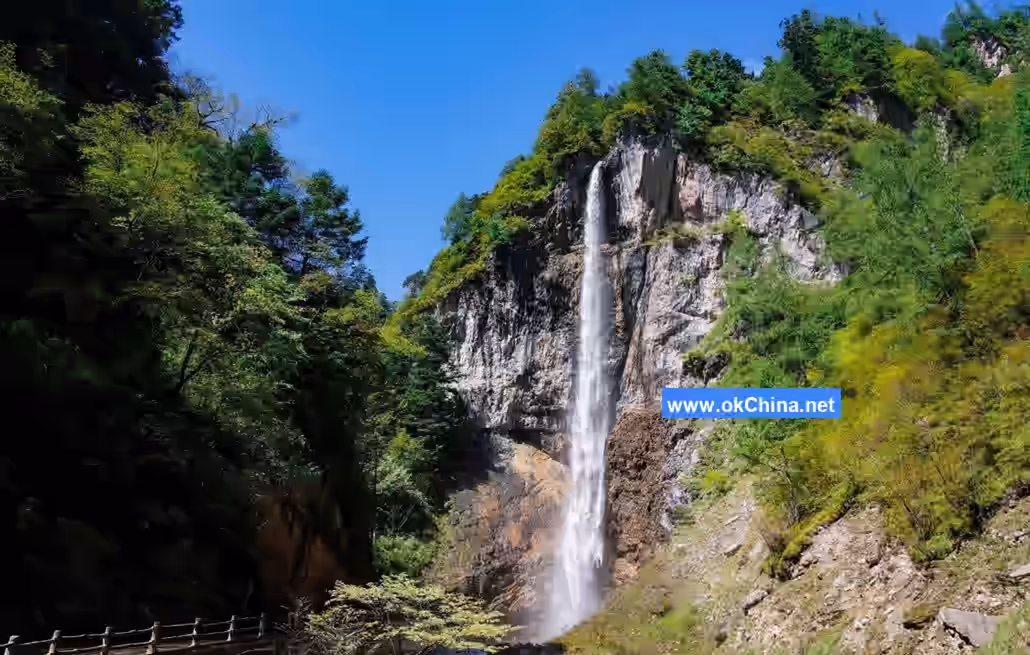
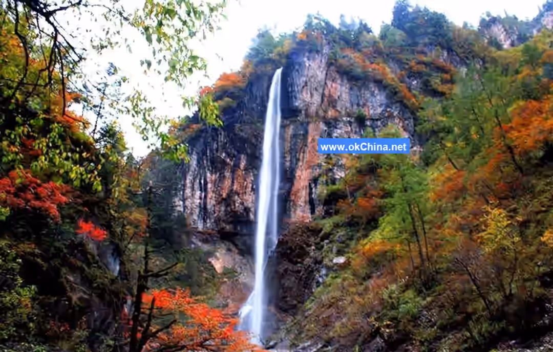
Tiger's Mouth Waterfall
Named for its shape resembling an open tiger's mouth, Tiger's Mouth Waterfall is a highly distinctive waterfall landscape in Guangegou. The torrential water cascades down from a height like ten thousand galloping horses, displaying tremendous momentum. The roar of the waterfall echoes through the valley, deafening, as if it were a passionate movement played by nature.
Standing before Tiger's Mouth Waterfall, the first sight is the massive column of water gushing out from between the cliffs and precipices, crashing down into the pool below with an overwhelming force. The splashing water sprays several meters high, refracting sunlight to form brilliant rainbows arching over the waterfall, creating a dreamlike scene. The mist generated by the waterfall impacting the pool fills the air, making one feel as if in a fairyland. A cool, refreshing sensation brushes against the face, dispelling the fatigue of the journey.The rocks around Tiger's Mouth Waterfall have been sculpted by long-term water flow into various shapes. Some resemble fierce beasts crouching, while others look like immortals pointing the way, adding a mysterious charm to the waterfall. Ascending slowly along the stone steps beside the waterfall allows visitors to appreciate the majestic beauty of Tiger's Mouth Waterfall from different angles. Viewed from the side, the waterfall resembles a silver dragon winding its way down; from above, one can feel its surging power. This is not only an excellent spot for viewing the waterfall but also a paradise for photography enthusiasts. Every angle captures breathtaking scenes, freezing the grandeur and beauty of Tiger's Mouth Waterfall in the lens.
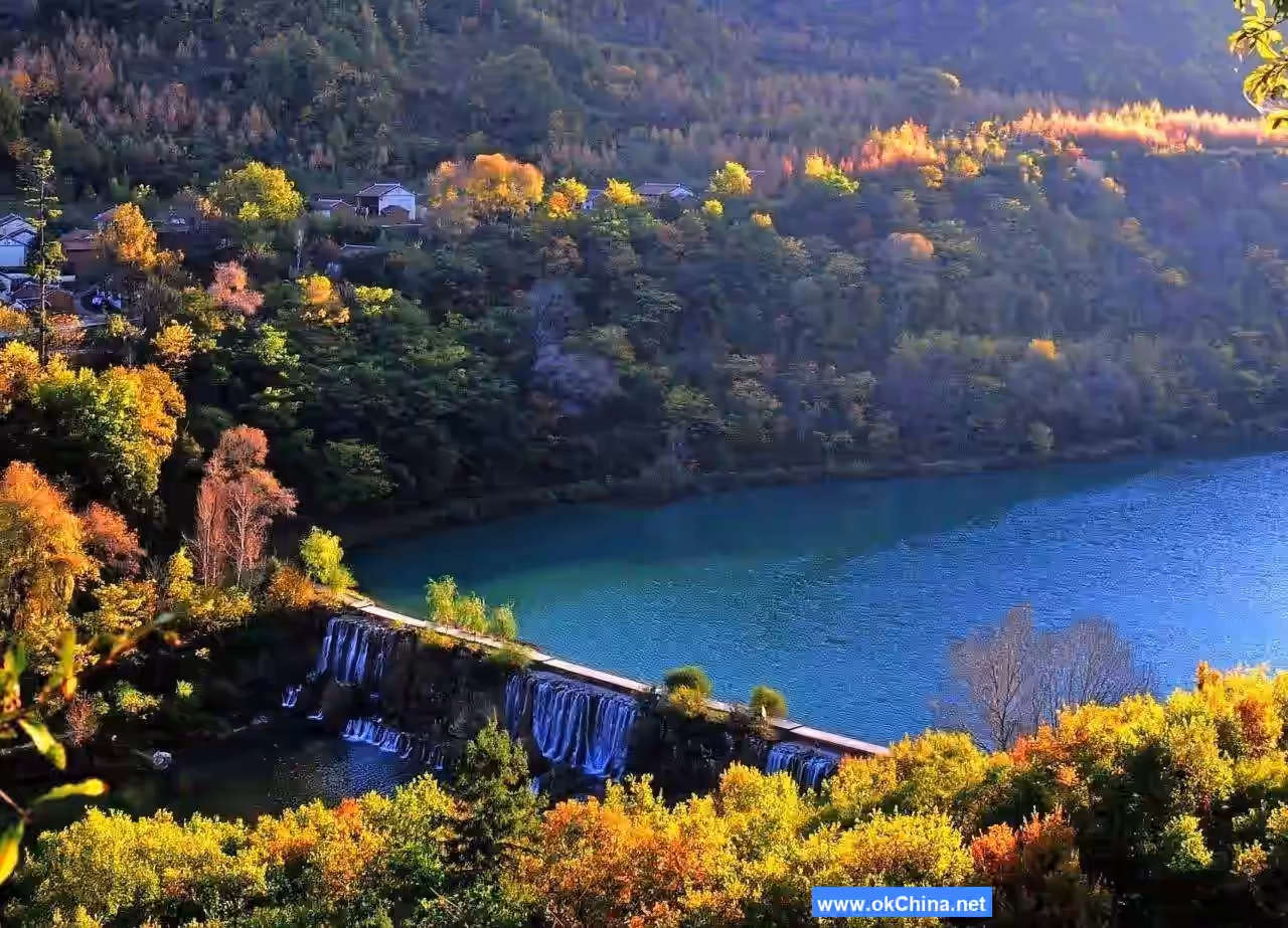
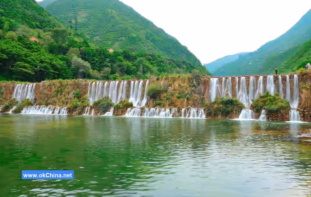
Five Waterfalls Gorge
Five Waterfalls Gorge is the essence of Guan’e Valley, featuring five waterfalls of varying shapes and sizes within the canyon. Each waterfall possesses its own unique charm, forming a picturesque cluster of waterfalls.
Upon entering Five Waterfalls Gorge, visitors are first greeted by Dragon’s Saliva Waterfall. The water flow here is slender and gentle, like saliva dripping from a dragon's mouth, falling in delicate strands. Under the sunlight, it sparkles with a crystalline glow, resembling strings of pearls descending from the sky. The pool below the waterfall is clear to the bottom, with ripples stirred by the breeze reflecting the surrounding green mountains and trees, creating a breathtaking scene.
Continuing along the gorge, visitors arrive at Tiger's Mouth Waterfall, whose majestic momentum leaves a deep impression, as described earlier. Further in lies Nine-Tier Waterfall. True to its name, the water cascades layer upon layer, one waterfall connecting to the next, like a white ribbon dancing through the mountains. Each tier has its own unique form and rhythm—sometimes rushing, sometimes gentle, sometimes wide, sometimes narrow—intertwining to create a spectacular and ever-changing waterscape.
Deeper into the gorge, visitors can see Guan’e Sky Waterfall, which follows Tiger's Mouth Waterfall. Guan’e Sky Waterfall is the most spectacular in Five Waterfalls Gorge, towering dozens of meters high with water surging down like a silver river descending from the heavens. Standing at its base and looking up at the sky, one sees the water pouring down and splashing, feeling the greatness and wonder of nature, and an awe for its power naturally arises. Finally, Tiger's Mouth Waterfall brings the journey through Five Waterfalls Gorge to a perfect conclusion, its unique shape and rushing waters leaving visitors lingering with fond memories.
While traversing the gorge, in addition to admiring the beauty of the waterfalls, visitors can also appreciate the peculiar landscapes of the surrounding peaks. The mountains are steep and rugged, with strange rocks jutting out—some like swords piercing the sky, others like camels crawling forward, and still others like graceful fairies standing tall. The gorge is shaded by lush greenery, with various rare plants thriving, complementing the waterfalls and peaks to form a vibrant and dynamic natural ecosystem.
IV. Cultural Resources
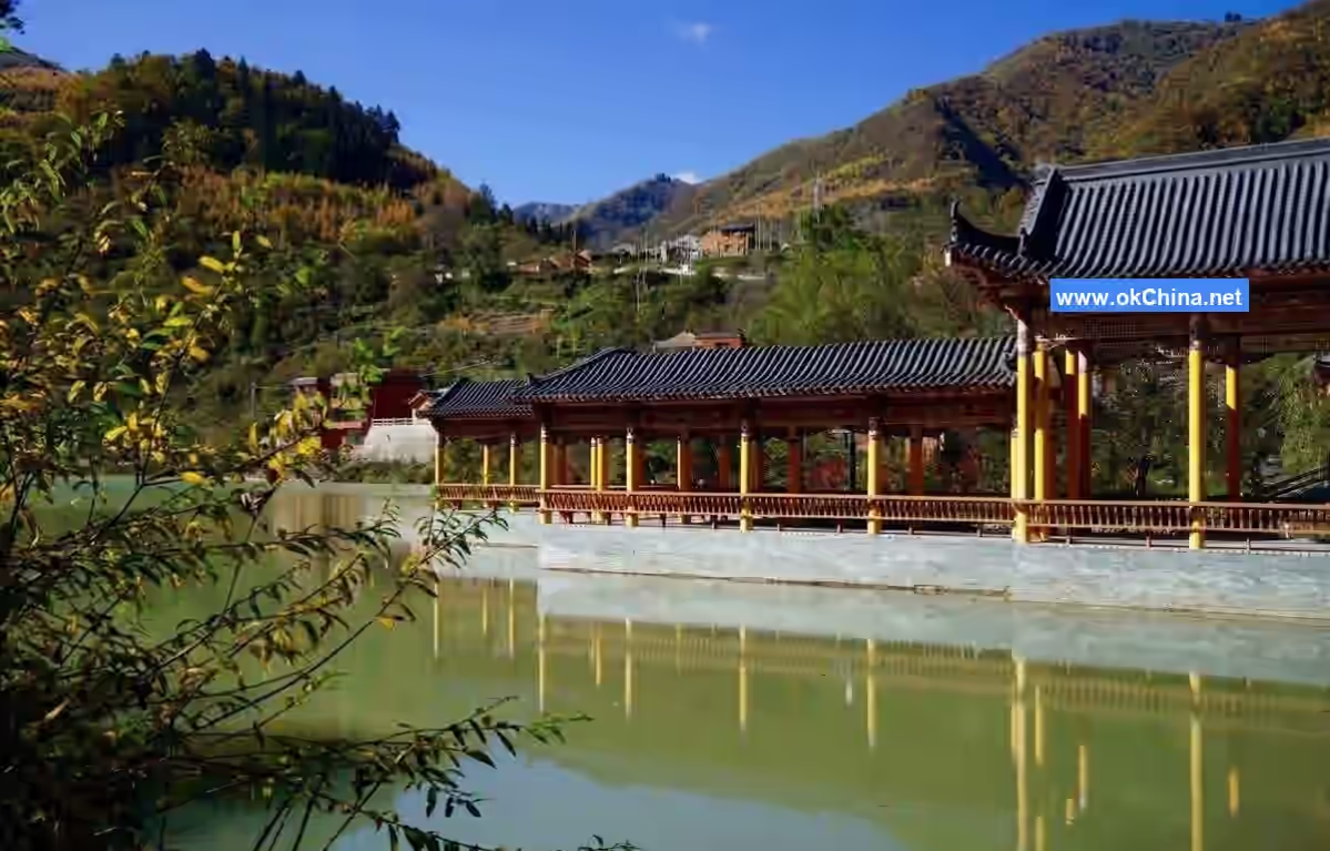
Tibetan and Qiang Ethnic Folk Culture
The Guan’e Valley area is inhabited by ethnic minorities such as Tibetans and Qiang people, whose unique folk cultures add rich ethnic charm to this land.
The lives of Tibetan compatriots are closely linked to their religious beliefs. Entering a Tibetan village, one can see brightly colored Tibetan-style buildings with exquisite religious patterns and the Eight Auspicious Symbols painted on the walls. At the center of the village, there is often a resplendent temple where Buddha statues are enshrined amid the smoke of incense. Tibetan people are warm and hospitable; when guests visit, they present white hada scarves as a gesture of sincere welcome and blessing. Visitors can also taste authentic Tibetan delicacies, such as butter tea and highland barley cakes. Butter tea has a rich flavor and helps ward off the cold, while highland barley cakes are sweet and fragrant, filled with the unique aroma of barley.
During traditional Tibetan festivals, such as Tibetan New Year, the entire village is immersed in a joyful and harmonious atmosphere. People dress in their finest attire, dancing the lively Guozhuang dance and singing melodious Tibetan folk songs. They gather around bonfires, hand in hand, singing and dancing to celebrate the arrival of the New Year. Additionally, Tibetan Thangka art is renowned far and wide. Thangka is a religious scroll painting mounted on brocade and hung for worship, featuring exquisite craftsmanship and vibrant colors. Its content often depicts Buddhist stories and Tibetan history and culture, with each Thangka containing profound cultural significance and artistic value.
The Qiang people also have a unique folk culture. Qiang architecture is most famous for its watchtowers, which are tall, sturdy structures serving both defensive and residential purposes. The construction technique of these watchtowers is remarkable, using no nails or rivets but relying entirely on the interlocking of stones, showcasing the Qiang people’s exceptional architectural skills. Qiang clothing is also distinctive, with both men and women favoring traditional attire embroidered with intricate patterns, often featuring flowers, birds, fish, insects, and geometric shapes symbolizing good fortune and happiness.
Traditional Qiang festivals, such as the Qiang New Year, are equally lively. On this day, the Qiang people worship their ancestors and pray for favorable weather and abundant harvests in the coming year. They hold various traditional activities, such as pole-pushing and Shalang dance. Pole-pushing is a competitive event where two teams push against each other with wooden poles, creating an intense and exciting scene. Shalang dance is an elegant group dance where people of all ages form a circle and dance gracefully to the rhythm of music, showcasing the unity and joy of the Qiang people. Traveling in Guan’e Valley and deeply experiencing the folk cultures of the Tibetan and Qiang ethnic groups allows visitors to better understand the historical and cultural heritage of this land and appreciate the unique charm and profound depth of minority cultures.
Comments
Post a Comment