

Boundary Island
1. Introduction
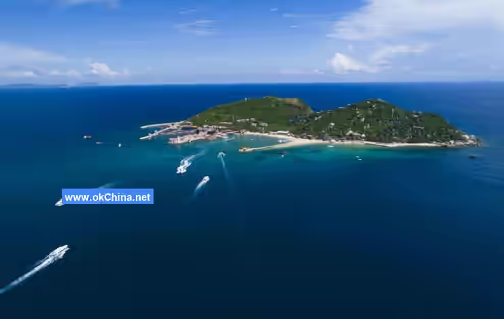
Boundary Island Scenic Area in Hainan is a national 5A-level tourist attraction, covering an area of 0.45 square kilometers. It is located at Exit 15 of Niuling on the Haikou-Sanya East Line Expressway in Hainan Province, embodying the distinctive characteristics of a tropical island paradise. Due to its unique geographical location, climatic features, island topography, and regional culture, Boundary Island is also known as "Beauty Island," "Guanyin Island," "Nameless Island," "Sleeping Buddha Island," and "Ice and Fire Island." The distance from Haikou to Boundary Island is 174 kilometers, while it is only 68 kilometers from Sanya.
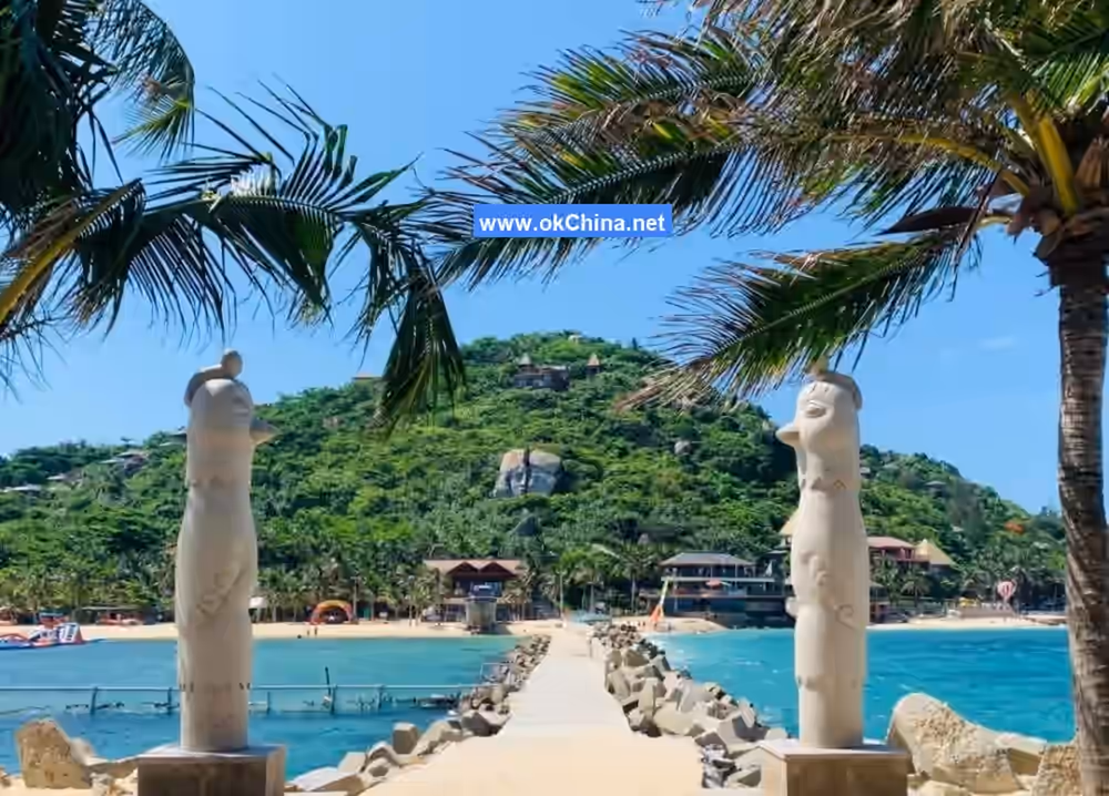
Boundary Island has been uninhabited since ancient times, boasting exceptionally clean marine environments and rich marine ecological resources. It is considered the most suitable island in Hainan for diving and exploring the underwater world, with an ecological environment comparable to that of the Xisha Islands. The island's unique topography features mountains, rocks, water, and reefs, with clear seawater and excellent visibility, providing unparalleled diving conditions. This has attracted professional divers and tourists from Hong Kong, Macau, Guangdong, Beijing, and other regions to dive at Boundary Island, which is internationally recognized by diving experts as one of the best diving destinations.
The island's excellent marine ecological environment also attracts newlyweds to participate in romantic underwater weddings here. Setting aside traditional lavish attire, couples don colorful diving suits, with fish as guests and sea turtles as the choir. Boundary Island has hosted over 20 underwater weddings, with more than 300 couples having tied the knot here.
Additionally, the island offers marine animal viewing, including dolphins and whale sharks, as well as sea parasailing, jet skiing, semi-submersible submarine tours, and other marine recreational services. It also provides elegant leisure activities such as sea fishing and outdoor adventure programs.
Visiting Boundary Island, like other scenic spots and historical sites, offers unique charms in spring, summer, autumn, and winter. Only by experiencing it firsthand can one appreciate its picturesque beauty. Therefore, it is advisable to familiarize oneself with the general overview of Boundary Island before visiting.
2. Geographical Environment
2.1 Location and Territory
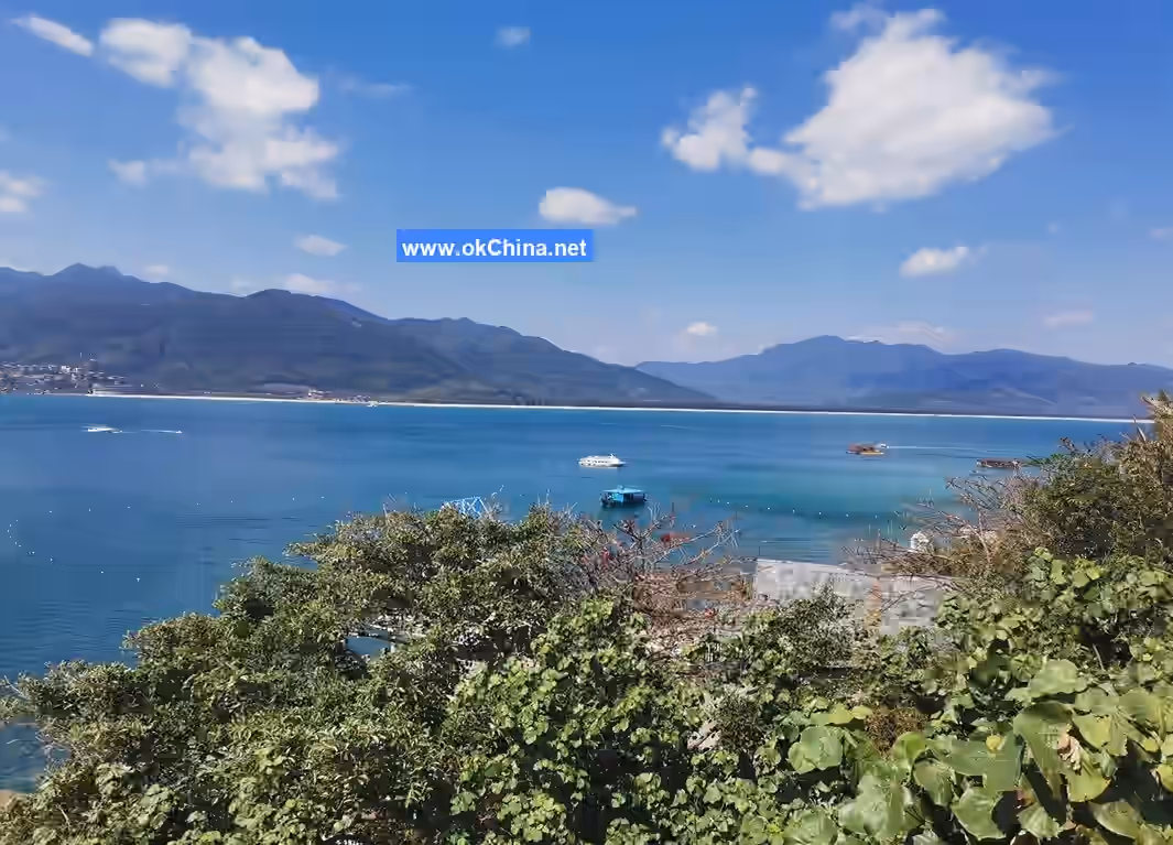
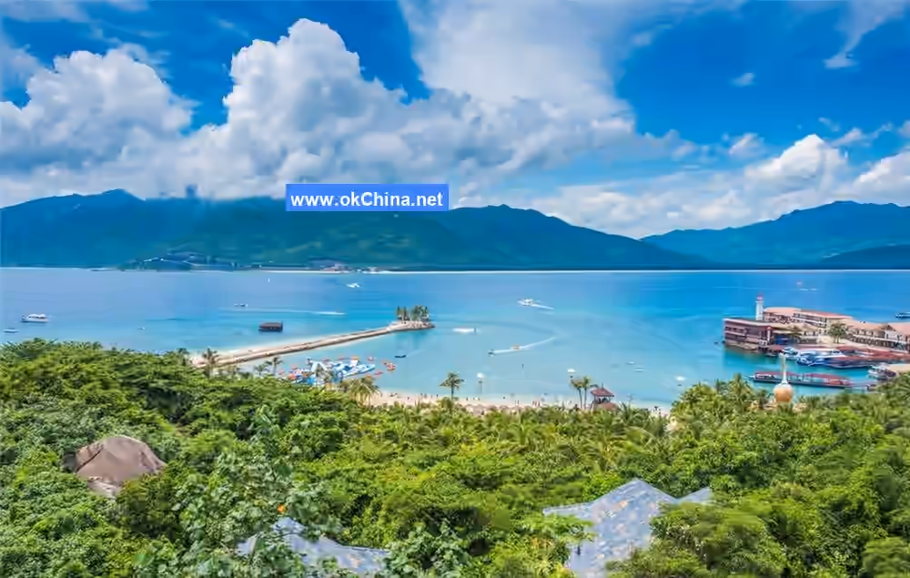
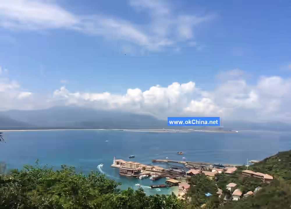
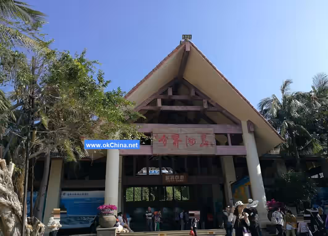
The Boundary Island Scenic Area in Lingshui County is located at the junction of Wanning City and Lingshui Li Autonomous County in Hainan Province, China, at coordinates 110°11′47″E, 18°34′51″N. It falls under the jurisdiction of Lingshui Li Autonomous County. The scenic area's entrance and exit, as well as the ferry terminal, are located 500 meters southeast of the Niuling Interchange, approximately 60 kilometers from Sanya City, about 180 kilometers from Haikou City, and around 20 kilometers from the urban area of Lingshui Li Autonomous County. Boundary Island is situated in the southeastern sea of Hainan Island, about 1.2 nautical miles from the nearest coast of Hainan Island, with a one-way ferry ride taking approximately 15 minutes.
2.2 Topography and Landforms
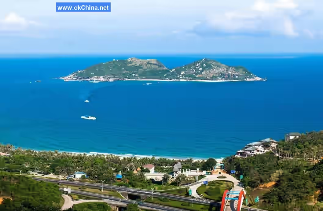
The Boundary Island Scenic Area in Lingshui County encompasses Boundary Island and its surrounding waters, covering an area of approximately 506,277 square meters. The island itself lies in a northeast-to-southwest elongated strip in the blue sea, appearing saddle-shaped from a distance, with an area of about 0.41 square kilometers and a coastline of 2,876 meters. The northern part of the island is mostly flat, while the southern part is mountainous. The island consists of two low peaks, with the northern peak reaching a maximum elevation of 100.9 meters and the southern peak reaching 96.1 meters. The total land area of the island is 45,328 square meters.
2.3 Climatic Features
The geographical location of the Boundary Island Scenic Area in Lingshui County is highly unique. The northern side of the island experiences a tropical maritime climate, while the southern side has a subtropical monsoon climate. The average annual temperature is 24.8°C, which is 2°C lower than that of the urban area of Lingshui Li Autonomous County. The extreme maximum temperature is 37.1°C, and the extreme minimum temperature is 7.2°C. The average wind speed is 4 meters per second, with northeastern winds prevailing in spring and winter and southwestern winds in autumn and summer. The average annual precipitation is 2,103.0 millimeters.
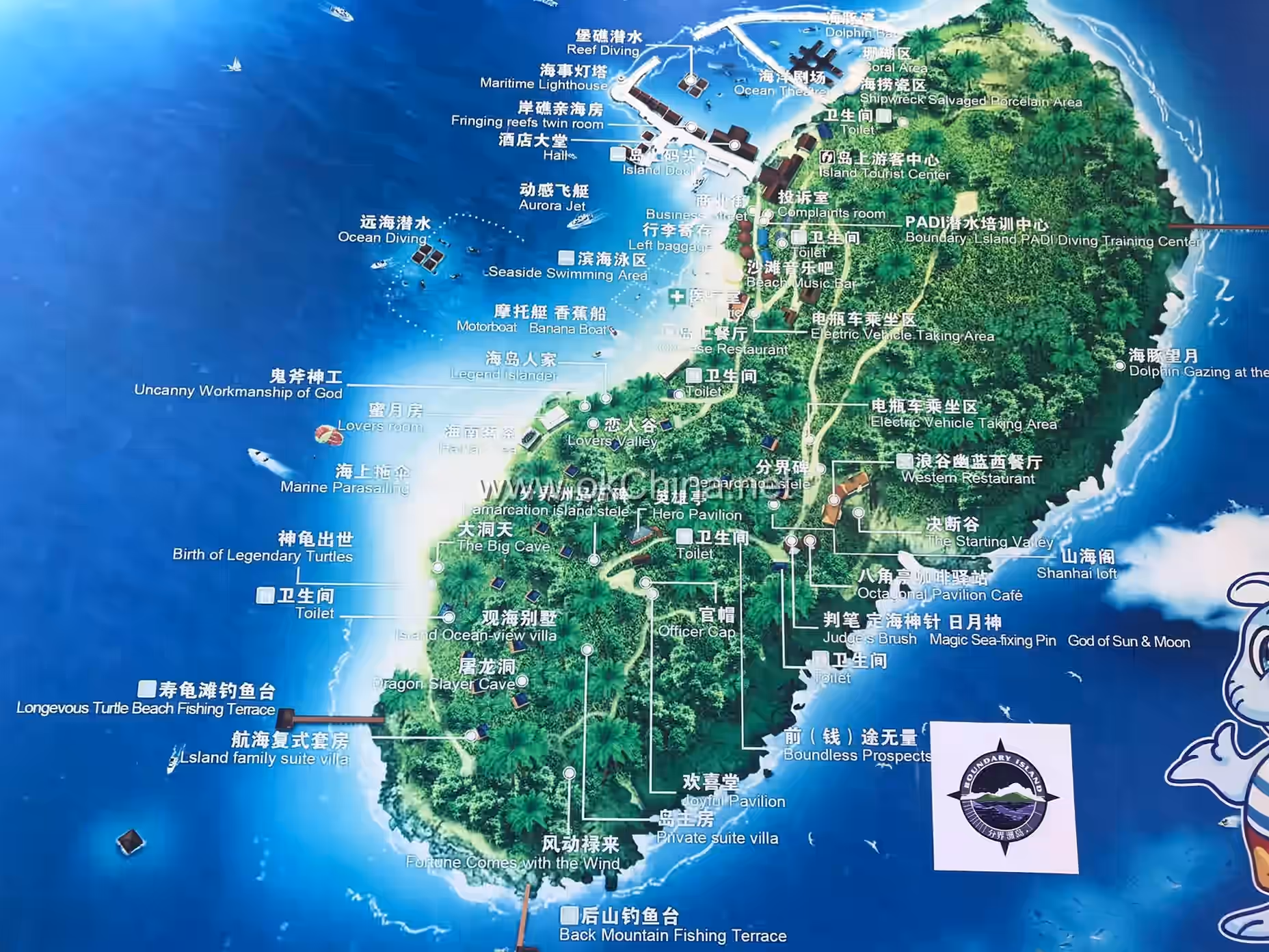
3. Main Attractions
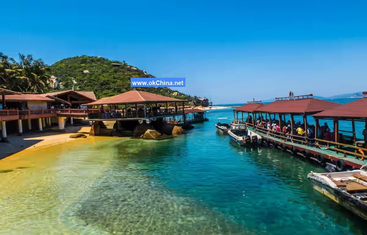
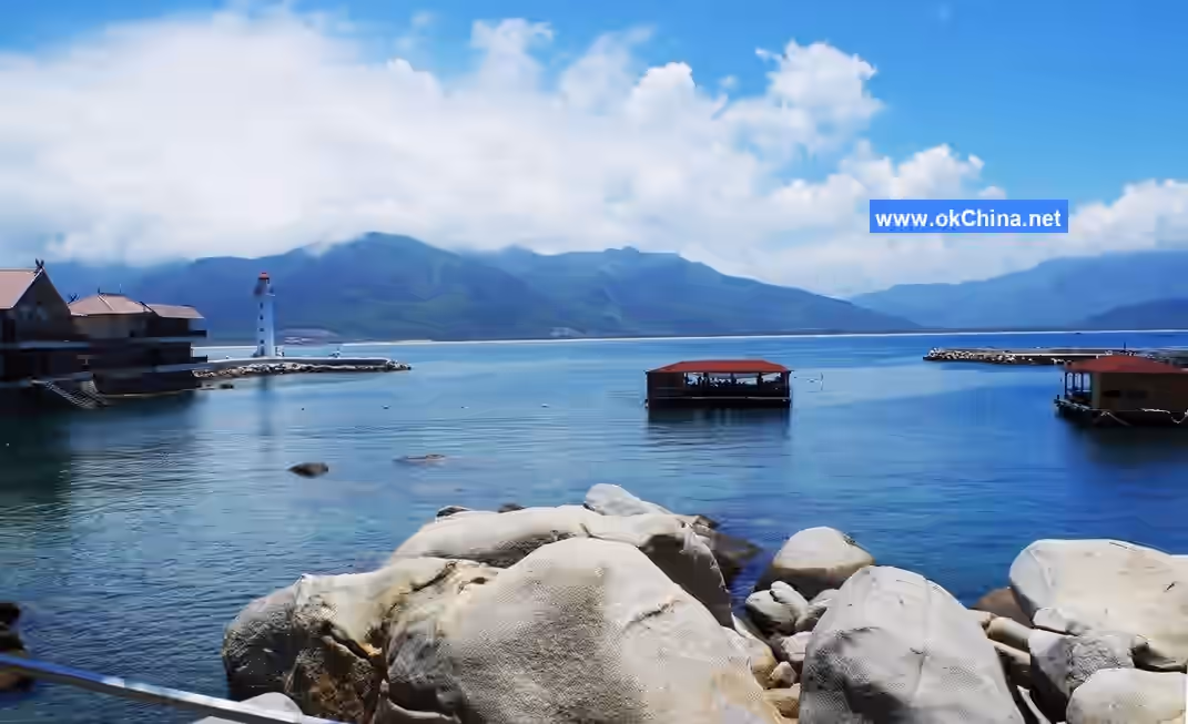
3.1 Pier and Sea Fishing
The pier and sea fishing area are located on the northern side of Boundary Island. A breakwater with a sloping embankment of about 200 meters has been constructed on the island, with the passenger ferry terminal built on the western side of the breakwater. The terminal uses a wooden floating pier structure with eight berths and a wooden pavilion on top. The sea fishing area is located along the breakwater and consists of a sea fishing club service counter and nine sea fishing guest rooms (A1-A9). The buildings are constructed with a concrete structure, two stories high, primarily providing shore reef fishing leisure activities for tourists. Visitors can fish from the breakwater or the balconies of the guest rooms, offering excellent waterfront services.
3.2 Marine Culture Museum
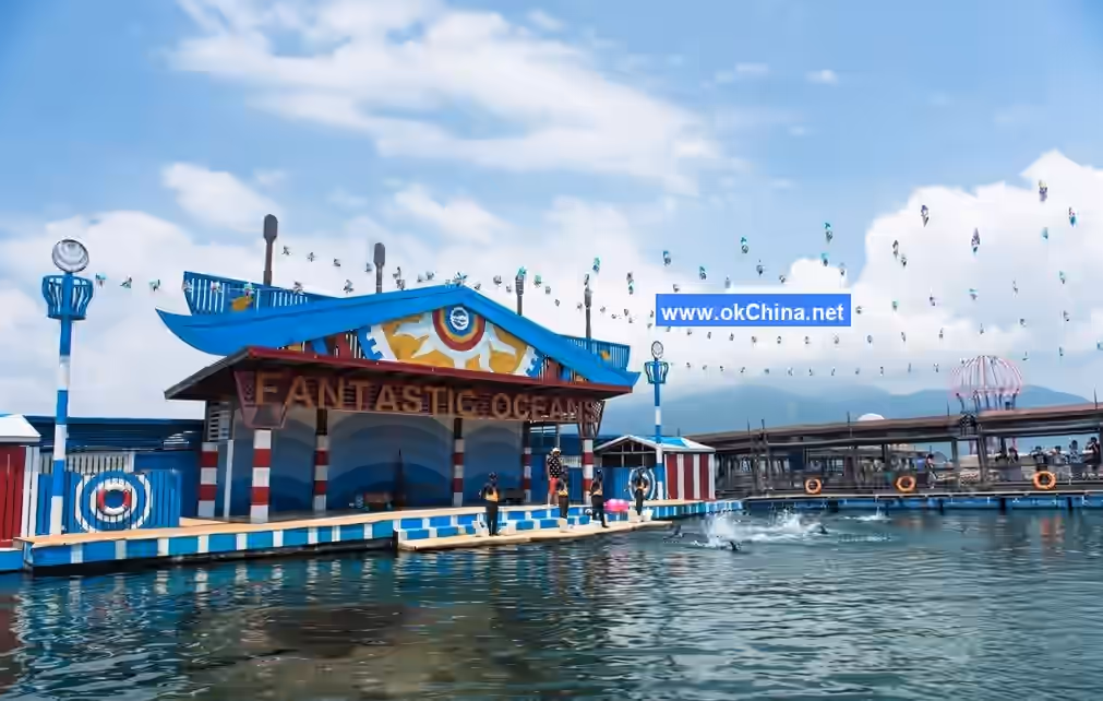
The Marine Culture Museum area is located on the northern side of Boundary Island. To effectively reduce the impact of wind and waves on the pier breakwater, a northern breakwater approximately 250 meters long was constructed on the northern side of Boundary Island. This, together with the pier breakwater, forms a calm water area for marine life breeding, performances, viewing, diving, and other activities. Initially, the Marine Culture Museum only featured the "Dolphin Bay" attraction. Starting in 2014, unique tourism projects such as "Dolphin Bay," "Coral Museum," and "Marine Ceramics Museum" were merged and renamed the "Marine Culture Museum" for visitor enjoyment.
Dolphin Bay is divided into viewing areas for whale sharks, dolphins, sea lions, hawksbill turtles, green sea turtles, and coral reefs. It houses three large whale sharks, the largest measuring 6 meters in length and weighing 2 tons, as well as over 20 highly intelligent dolphins and sea lions, each weighing over a hundred pounds. Visitors can watch performances by whale sharks, dolphins, and sea lions in the Dolphin Bay Wild Marine Animal World or observe whale sharks, dolphins, sea lions, hawksbill turtles, green sea turtles, diverse coral reefs, sea anemones, and small fish up close from artificially built floating bridges and corridors.
3.3 Stone Stele
On the northern mountain of the Boundary Island Scenic Area in Lingshui County, there is a stone stele marking the boundary of Boundary Island. The line connecting this boundary stele and the Niuling Tunnel on Hainan Island serves as the climatic dividing line between northern and southern Hainan. It is also an important cultural boundary between the regions inhabited by ethnic minorities such as the Li, Miao, and Hui peoples and the Han Chinese region on Hainan Island. Historically, it marked the boundary between the Qiongzhou Prefecture and Yazhou Prefecture. Additionally, it serves as the administrative boundary between Lingshui Li Autonomous County and Wanning City and is regarded as a "spiritual boundary line" where people can shift their moods.
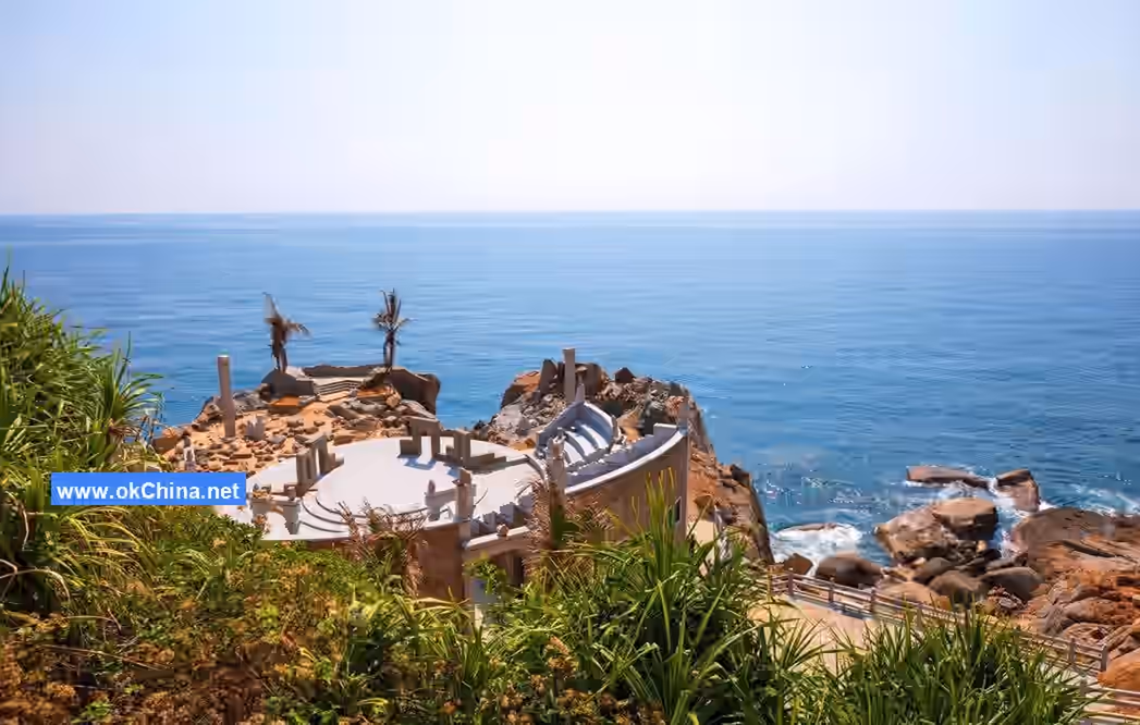
3.4 Great Cave Heaven
Great Cave Heaven is located on the eastern side of Boundary Island. Together with Little Cave Heaven in Sanya City, they are collectively known as "Great and Little Cave Heaven." At Great Cave Heaven, visitors can see ancient banyan trees with intertwined roots, entwined ancient vines, and naturally formed stone houses and benches, creating a picturesque natural landscape.
3.5 Diving Activities
Based on different underwater environments and dive sites, Boundary Island has developed five types of diving activities, ranging from simple experiences to slightly adventurous ones.
3.5.1 Experience Diving
As the name suggests, this focuses on the sensory experience. Experience diving at Boundary Island involves being transported by speedboat to a fixed diving platform or Boat No. 1, from which divers descend via the diving platform or boat. The depth is approximately five meters, primarily allowing participants to experience the feeling of diving with equipment.
3.5.2 Reef Diving
This is a popular activity combining experience, leisure, and sightseeing. Divers also descend from a diving platform to a depth of about eight meters. At the dive site, they can observe marine life such as coral reefs, tropical fish, and sea anemones. This activity takes into account the physical endurance of first-time divers, making it suitable for a broad audience.
3.5.3 Cliff Diving
Located on both sides of Boundary Island's mountainous terrain, this activity involves transporting participants by speedboat to designated dive sites. Divers descend directly from the speedboat to explore the unique underwater topography formed by submerged rock formations. The main attraction is viewing underwater cliff landscapes, and sometimes coral reefs can also be seen. The diving depth is around ten meters.
3.5.4 Cave Diving
The dive site is located behind Boundary Island. Transportation is also provided by speedboat, which serves as the diving platform. This activity focuses on exploring underwater caves and is unique to Hainan. The diving depth ranges from ten to fifteen meters, depending on individual physical endurance.
3.5.5 Wreck Diving
This is a unique diving activity at Boundary Island, centered around viewing a sunken modern iron ship. After being transported by boat to a dive site marked with buoys near Fugui Beach on Boundary Island, divers descend from the boat. During high tide, the maximum diving depth is approximately 24 meters. Divers can observe the large iron ship up close, with its deck now covered in numerous hard corals and other attachments. Two lionfish are said to guard the ship's sides year-round, and large schools of fish inhabit the cabin, reportedly including several large groupers. Whether divers can enter the cabin depends on safety conditions at the time. This is a more adventurous activity, recommended for those with prior diving experience, and can be considered a personal challenge.
4. Development History
At the summit of Boundary Island, there is a stone stele erected by the Hainan Provincial Geographic Names Office, marking a boundary line that serves as the climatic dividing line between northern and southern Hainan. This natural boundary, extending from the distant sea through Boundary Island and continuing to the opposite Niuling, is recognized as the climatic divide for Hainan. It is often observed that while Niuling's northern side is shrouded in thick clouds, its southern side enjoys bright sunshine. In winter, the northern side may be overcast, while the southern side remains sunny. The capricious and ever-changing weather is fully displayed here. In fact, the entire Boundary Ridge (Niuling) is an extension of the Wuzhi Mountain range, formed millions of years ago by the collision of continental plates, giving rise to this beautiful island.The earliest historical record of Boundary Island is found in the Lingshui County Gazetteer compiled by Qu Yun in the 57th year of the Qianlong era. It states: "Jiashe Isle lies forty li east of the city. Beyond the ravine of Jiashe Isle is the great sea, with an island in the middle, rising over thirty zhang high." This refers to what is now known as Boundary Island.
Additionally, research indicates that Boundary Island served as a strategic military stronghold in ancient times and a sheltered anchorage for merchant ships. At the entrance to the Boundary Island scenic area, on Niuling Hill, lies the Wanling Ancient Post Road, the essential route connecting Wanning and Lingshui. This post road was constructed during the late Yuan and early Ming dynasties. Although the ancient road has since vanished, many scholars, poets, officials, and merchants of the past left numerous poems praising Boundary Island, earning it a longstanding reputation since ancient times.
Comments
Post a Comment