

Zhumadian Chaya Mountain Scenic Area
1. Introduction
The Zhumadian Chaya Mountain Scenic Area is located in Suiping County, Zhumadian City, Henan Province. It borders Zhumadian City to the south, approximately 300 kilometers from Wuhan, and Luohe City to the north, about 180 kilometers from Zhengzhou. The total area of the scenic area is 148 square kilometers, with the core area covering 50 square kilometers. It features a typical granite geological landscape of natural mountains and waters, renowned as a "blessed land of caves and heavens, naturally beautiful scenery, and a world wonder."
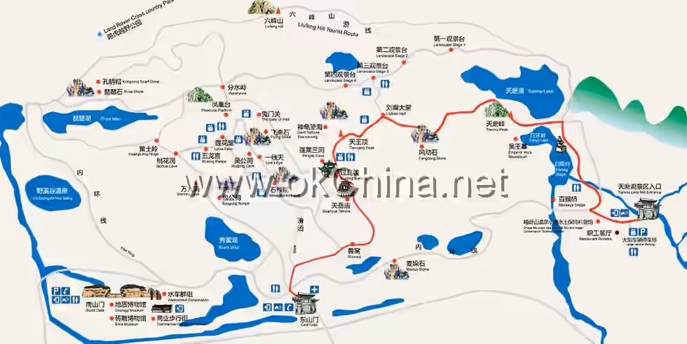
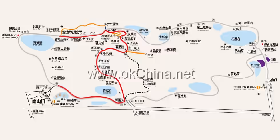
The history of the Zhumadian Chaya Mountain Scenic Area can be traced back to the Spring and Autumn Period during the contention between the Wu and Chu states. During the Tang Dynasty, Shang Rang, a general under Wang Xianzhi, stationed troops here. Emperor Qianlong of the Qing Dynasty visited Chaya Mountain three times. The scenic area officially opened to tourists in 1989. The Chaya Mountain Tourist Area consists of five major scenic zones: South Mountain, North Mountain, Liufeng Mountain, Tianmo Lake, and Pipa Lake. South Mountain, North Mountain, Huaguo Mountain, and Liufeng Mountain stand majestically, while Xiumi Lake, Pipa Lake, Baihua Lake, and Tianmo Lake are scattered among them. The area boasts nine major wonders, nine famous peaks, nine famous caves, nine famous shelters, and nine famous strange rocks, with over 300 scenic spots in total, including more than 60 famous ones. It is characterized by four distinctive features: "uniqueness, perilousness, profundity, and serenity."
2. Geographical Environment
2.1 Location and Territory
The Zhumadian Chaya Mountain Scenic Area is situated in Suiping County, Zhumadian City, Henan Province. It borders Zhumadian City to the south, approximately 300 kilometers from Wuhan, and Luohe City to the north, about 180 kilometers from Zhengzhou. National Highway 107, the Beijing-Guangzhou Railway, the Shijiazhuang-Wuhan High-Speed Railway, and the Beijing-Zhuhai Expressway run through Suiping County, with the scenic area only 20 kilometers away. The total area covers 148 square kilometers, with the core area spanning 50 square kilometers.
2.2 Topography and Landforms
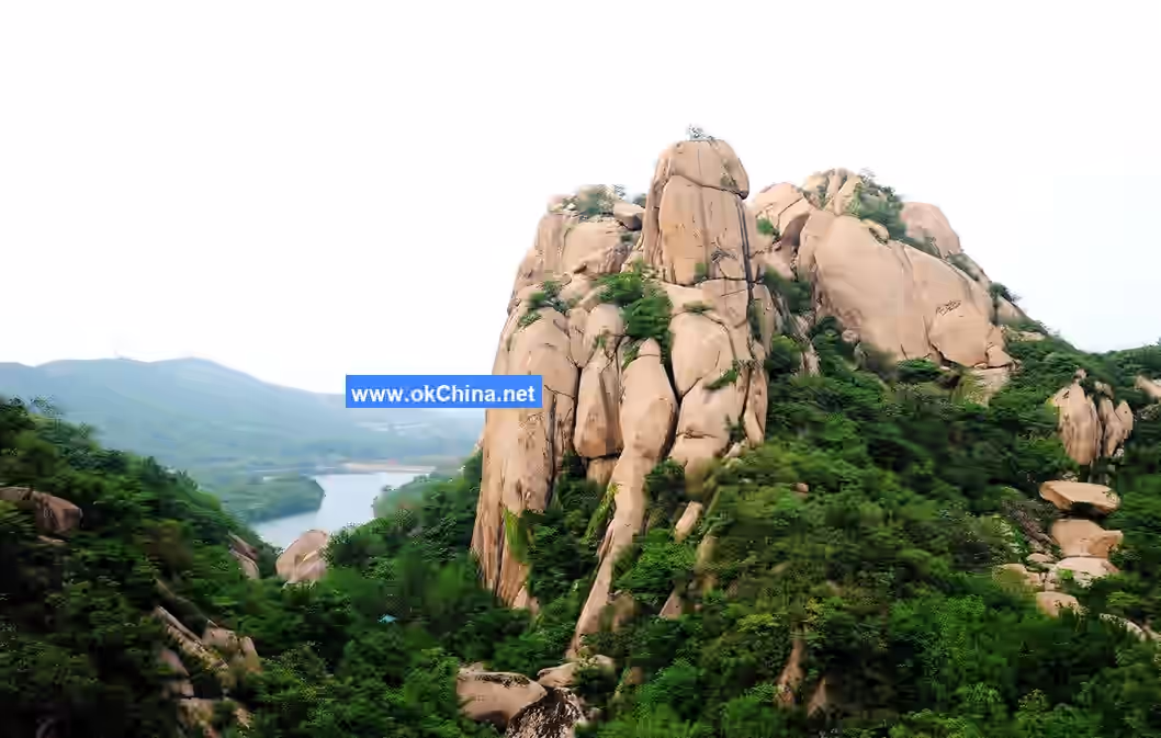
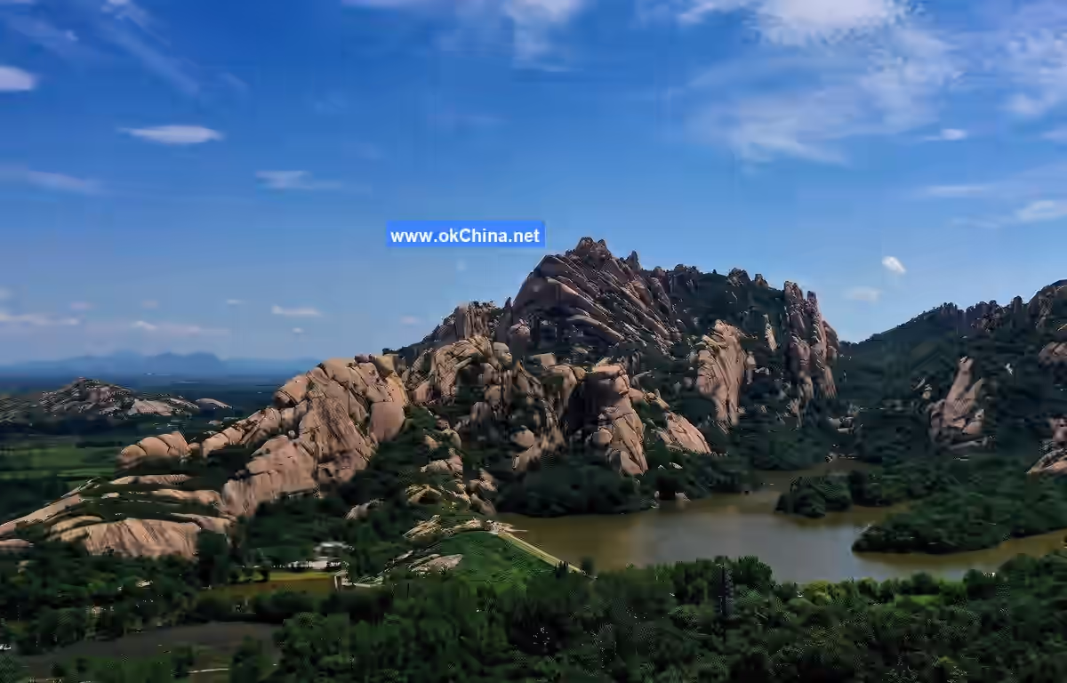
The area where the Zhumadian Chaya Mountain Scenic Area is located belongs to the eastern extension of the Qinling Funiu Mountains, serving as a transitional zone between the southern North China Plain and the Qinling Funiu Mountains. Its eastern and southern parts are alluvial plains of the Shahe River in the Huai River Basin, divided into two landform types: mountainous and plain. The mountain ranges mostly run east-west and northeast-southwest, with higher elevations in the west and lower in the east. Except for the Chaya Mountain massif, which is composed of massive granite, other mountains are primarily composed of layered sedimentary or metamorphic rocks.
2.3 Climate
The Zhumadian Chaya Mountain Scenic Area lies in the transitional zone between the northern subtropical and warm temperate zones, characterized by a sub-humid continental monsoon climate. It exhibits features of both a warm temperate semi-humid monsoon climate and a continental climate. The climate is mild, with abundant rainfall, ample sunshine, simultaneous occurrence of rain and heat, and a long frost-free period. Winters are dominated by cold northwest continental winds, while summers are influenced by southeast sea breezes. The area experiences cold winters, hot summers, warm springs, and cool autumns, with four distinct seasons and a pleasant climate. The annual average temperature is 15.1°C. The average annual precipitation is 972.0 mm, with spring accounting for 20.6%, summer 53.8%, autumn 18.9%, and winter 6.7%. The average annual relative humidity is 72%. The average annual total cloud cover is 6.2, sunshine duration is 2179.07 hours, and the average annual total solar radiation is 117.7 kcal/cm². The frost period generally begins around November 7 and ends around March 25, with an average frost-free period of 224 days. The prevailing wind directions throughout the year are north and northerly winds, followed by south and southerly winds. The average wind speed is 2.8 meters per second, with the highest monthly average wind speed occurring in April at 3.1 m/s and the lowest in October at 2.3 m/s.
2.4 Hydrology
The rivers within the Zhumadian Chaya Mountain Scenic Area belong to the Hongru River system of the Huai River Basin, serving as third- and fourth-order tributaries of the Ru River system. The annual and intra-annual variations in runoff are significant. Due to their location in the piedmont zone, most rivers are short streams with steep slopes, resulting in low water flow during dry seasons, sometimes even drying up, while heavy rains during the wet season can easily cause floods.
2.5 Biodiversity
The Zhumadian Chaya Mountain Scenic Area hosts a variety of plant species. Woody plants include over forty species such as Thousand-Hole Cypress (ancient cypress), Pagoda Tree, Masson Pine, Wild Hawthorn, and Tung Oil Tree. Herbaceous plants number no less than a hundred species, including Centipede Grass, Calamus, Ganoderma, Dwarf Lilyturf, and Motherwort.
3. Main Attractions
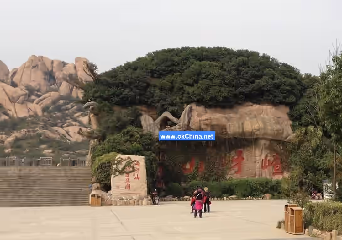
3.1 South Mountain Gate Area
The main attractions in the South Mountain Gate Area include the Main Monument, Patchwork Bridge, Stone Arch Bridge, South Mountain Gate, Journey to the West Culture Square, Geological Museum, Journey to the West Brick Carving Museum, and Waterwheel Folk Street.
3.1.1 Main Monument
The Main Monument, erected with original stones from Chaya Mountain, is located at the main mountain gate of Chaya Mountain, also known as the South Mountain Gate. The front features the large characters "Chaya Mountain Scenic Area" inscribed by Zhang Hai, former Chairman of the Chinese Calligraphers Association. The east side bears the mountain's name inscribed by Qi Gong, another former Chairman of the Chinese Calligraphers Association. The west side displays the main monument of the Chaya Mountain National Geopark. The back features the company logo of Tianjin Port Haijiali Co., Ltd. and the inscription "Chaya Sentiment, Hometown Love" by Chairman Song Fujin.
3.1.2 Patchwork Bridge and Stone Arch Bridge
The Stone Arch Bridges are constructed using local stone materials, while the Patchwork Bridge is paved with folk stone rollers and millstones.
3.1.3 South Mountain Gate
The area surrounding the South Mountain Gate is the main mountain gate square of Chaya Mountain, divided into a front square and a rear square, covering a total area of approximately 100,000 square meters. It mainly consists of the main mountain gate passage, comprehensive service area, parking area, National Geopark main monument area, waterwheel cluster area, and sightseeing water system area.
3.1.4 Waterwheel Folk Street
The Waterwheel Folk Street includes Feicui River, the folk street, and the largest waterwheel cluster in Asia. The cluster comprises up to six waterwheels, with the tallest reaching 28 meters and a diameter of about 20 meters; the shortest is 24 meters tall, with a single unit weighing 9.6 tons, making it the largest in Asia. The Chaya waterwheels resemble giant ancient wheels, capable of lifting water to a height of 26 meters. The hub at the center of the wheel spokes is as thick as a person's embrace. Around the wheel, about 50 wooden buckets are slanted, along with twice as many wooden planks.
3.2 South Mountain
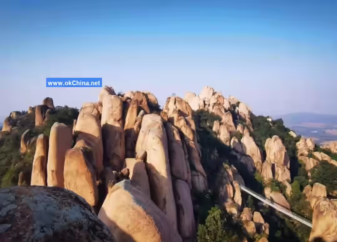
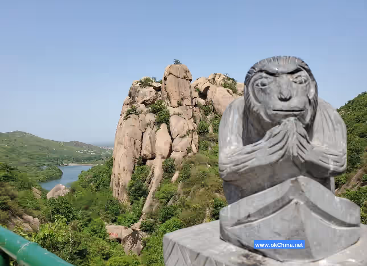
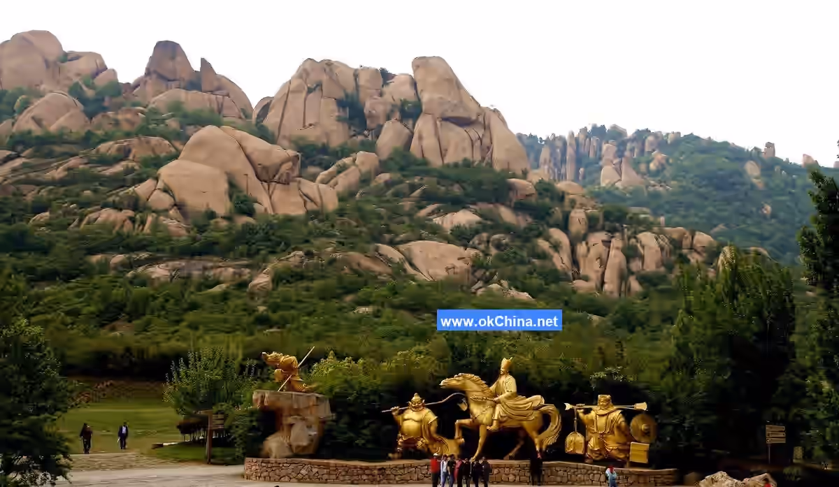
The main attractions of South Mountain include Two Monkeys Gazing at the Moon, Xiumi Lake, Mila Peak, Wugong Pavilion, Chaya Immortal, Heifeng Cave, Bao Gong Temple, Peach Blossom Cave, Animal Stone Realm, Heaven-reaching Divine Turtle, Sea Lion Rock, Frog Gazing at the Sky, Second Gate, Wild Elm, War and Peace, Five Dragons Palace, Journey to the West Sculpture Garden, Thousand-Hole Cypress, Hundred-Step Ladder, Slide, Phoenix Terrace, Laojun Garden Peak, Qianlong Bed, Flying Rock, Longevity Rock, Wugong Cave, One-Line Sky, Chinese Bonsai Garden, Stone Monkey, Mother-Child Rock, Suspension Bridge, etc.
3.2.1 Two Monkeys Gazing at the Moon
Two Monkeys Gazing at the Moon is the first of the famous "One Stone, Three Scenes" of Chaya Mountain. The scene features a rock resembling a monkey carrying another monkey on its back, gazing at the moon, symbolizing "generations of nobility." The other two scenes are the World's First Stone Monkey and Lovers' Rock.
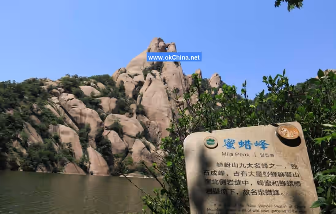
3.2.2 Xiumi Lake
Xiumi Lake is named after the Mila Peak beside the lake, meaning "beautiful scenery and sweet lake water."
3.2.3 Wugong Pavilion
Wugong Pavilion was built to commemorate the 500th anniversary of Wu Cheng'en's birth. "Wugong" is the respectful title used by locals for Wu Cheng'en, who wrote Journey to the West while staying at Chaya Mountain.
3.2.4 Bao Gong Temple
Bao Gong Temple is named after the revered honest official and important Song Dynasty minister, Bao Zheng, enshrined in the main hall. It was initially built during the Song Dynasty, restored during the Ming, Qing, and Republic of China periods, and rebuilt on its original site in 1997.
3.2.5 One-Line Sky
One-Line Sky is over 10 meters high, more than 20 meters long, and only 30 centimeters wide. Looking up from inside, one can only see a sliver of sky, hence the name "One-Line Sky."
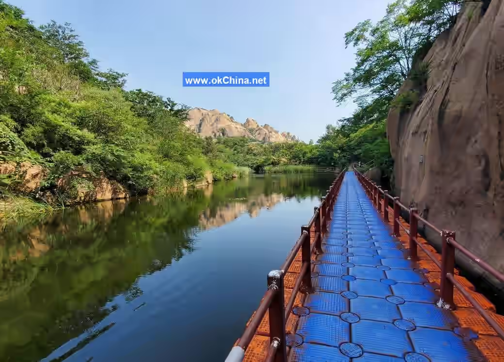
3.3 Tianmo Lake
The main attractions of Tianmo Lake include Buddha's Finger, Hanging Needle Rock, Viewing Platform, Bibo Pond, Eagle's Sorrow Ravine, Great Curtain Cliff, Guan Yu Peak, Mountain-guarding Stone Monkey, Echo Valley, Tianmo Peak, Tianmo Lake, Moon Bay, Bread Rock, Hundred-Monkey Bridge, Exquisite Peak, etc.
3.3.1 Hanging Needle Rock
Hanging Needle Rock is located on Wanghualing Ridge, west of the main peak Phoenix Terrace on South Mountain. It is an independent stone pillar, 28 meters tall, wider at the top and narrower at the bottom, resembling an inverted steel needle.
3.3.2 Hundred-Monkey Bridge
Hundred-Monkey Bridge is 107 meters long and 15.2 meters high. It is a landscape bridge designed as a 16-arch, 15-barrier water dam, with 130 stone monkeys on its railings, hence the name.
3.3.3 Eagle's Sorrow Ravine
The Eagle's Sorrow Ravine has always been free of evil spirits, but it is deep, steep, and wide, with crystal-clear water. Crows and magpies dare not fly over it because, seeing their reflections in the clear water, they mistake them for fellow birds and often plunge into the water, hence the name "Eagle's Sorrow Ravine." Because the ravine here is deep and secluded, surrounded by sheer cliffs, it resembles the "Eagle's Sorrow Ravine" from Journey to the West where the little white dragon emerged from the water, hence the name.
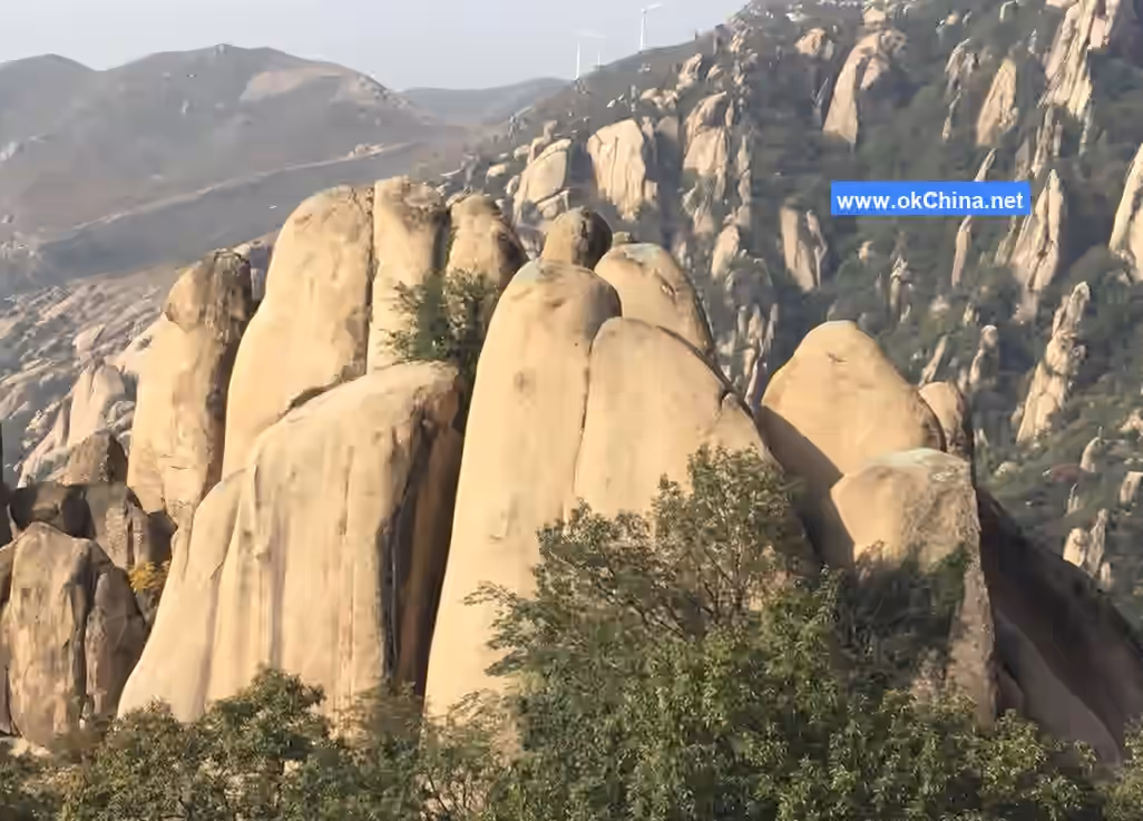
3.3.4 Wanfo Ridge (Ten Thousand Buddhas Ridge)
This is a geological landscape formed by the weathering and erosion of densely packed vertical joints in granite. The upper part, weathered into spherical shapes, resembles rows of Buddha heads paying homage, hence the name "Wanfo Ridge." Legend has it that this is where Tang Monk Xuanzang preached at Chaya Mountain. Before his pilgrimage to the West, Xuanzang visited Chaya Mountain, preached at seventy-two temples, and took two disciples, Dao Quan and Dao Yi. After the Tang Monk left, locals discovered a huge rock at the place where he preached, resembling the monk sitting on clouds delivering sermons. People began to burn incense and worship it, offering reverence.
3.4 Pipa Lake
The main attractions of Pipa Lake include Pipa Lake, Pipa Rock, Yonghong Dragon, Hairy Child Wall, Red Boy, Cuo'e Peak, Geological Science Park, Hundred-Zhang Cliff, Fengshui Ridge, etc.
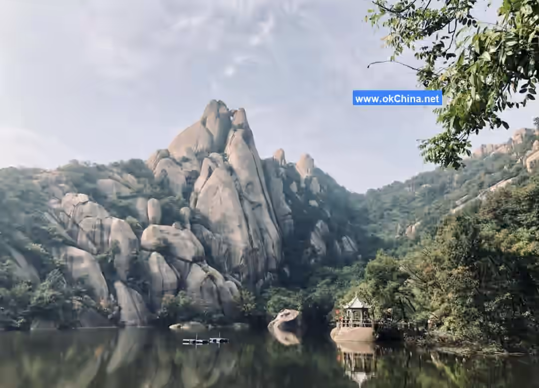
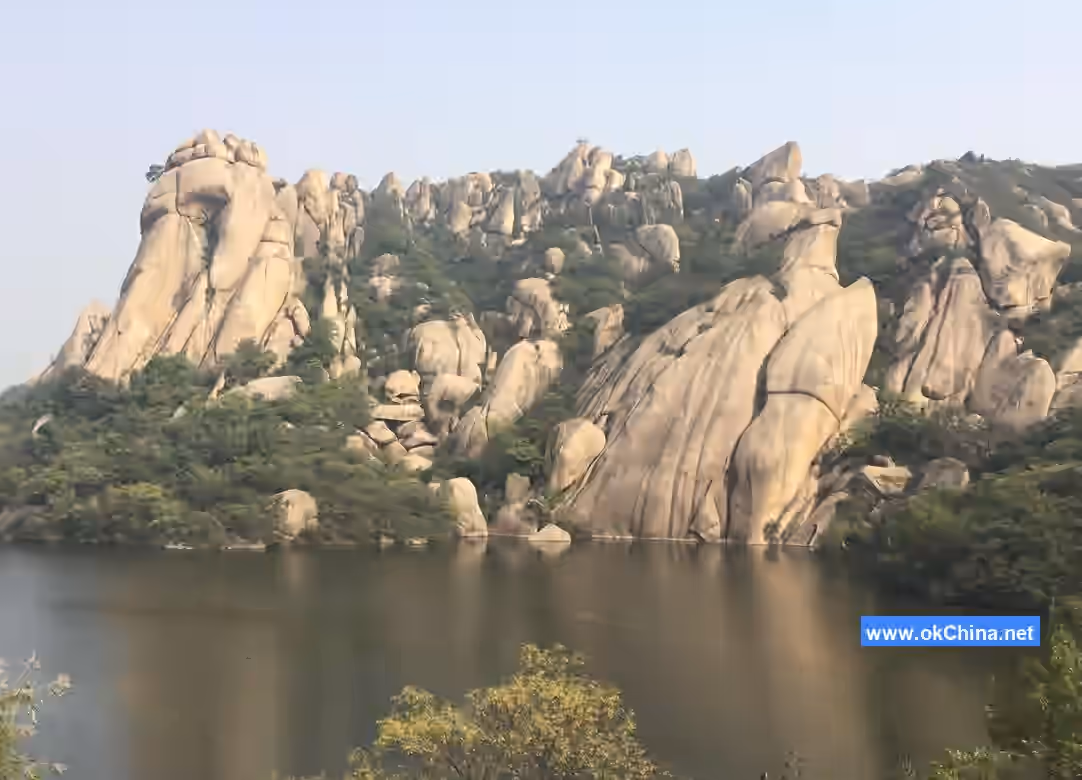
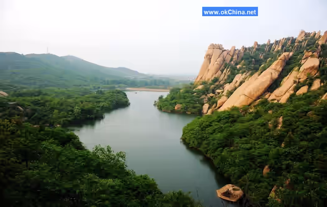
3.4.1 Pipa Lake
Pipa Lake, also known as Yonghong Reservoir, is named for its lute-shaped surface and the Pipa Rock by the lakeside. Pipa Lake lies against the mountains, facing the sun, with steep valleys and dense forests.
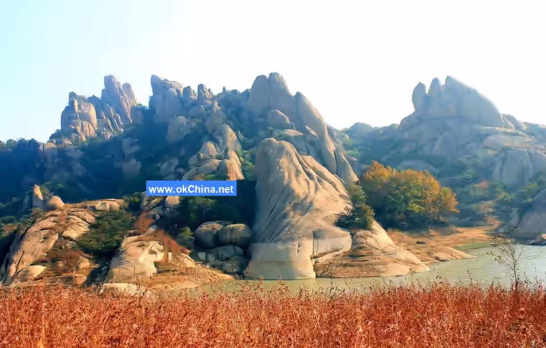
3.4.2 Hundred-Zhang Cliff
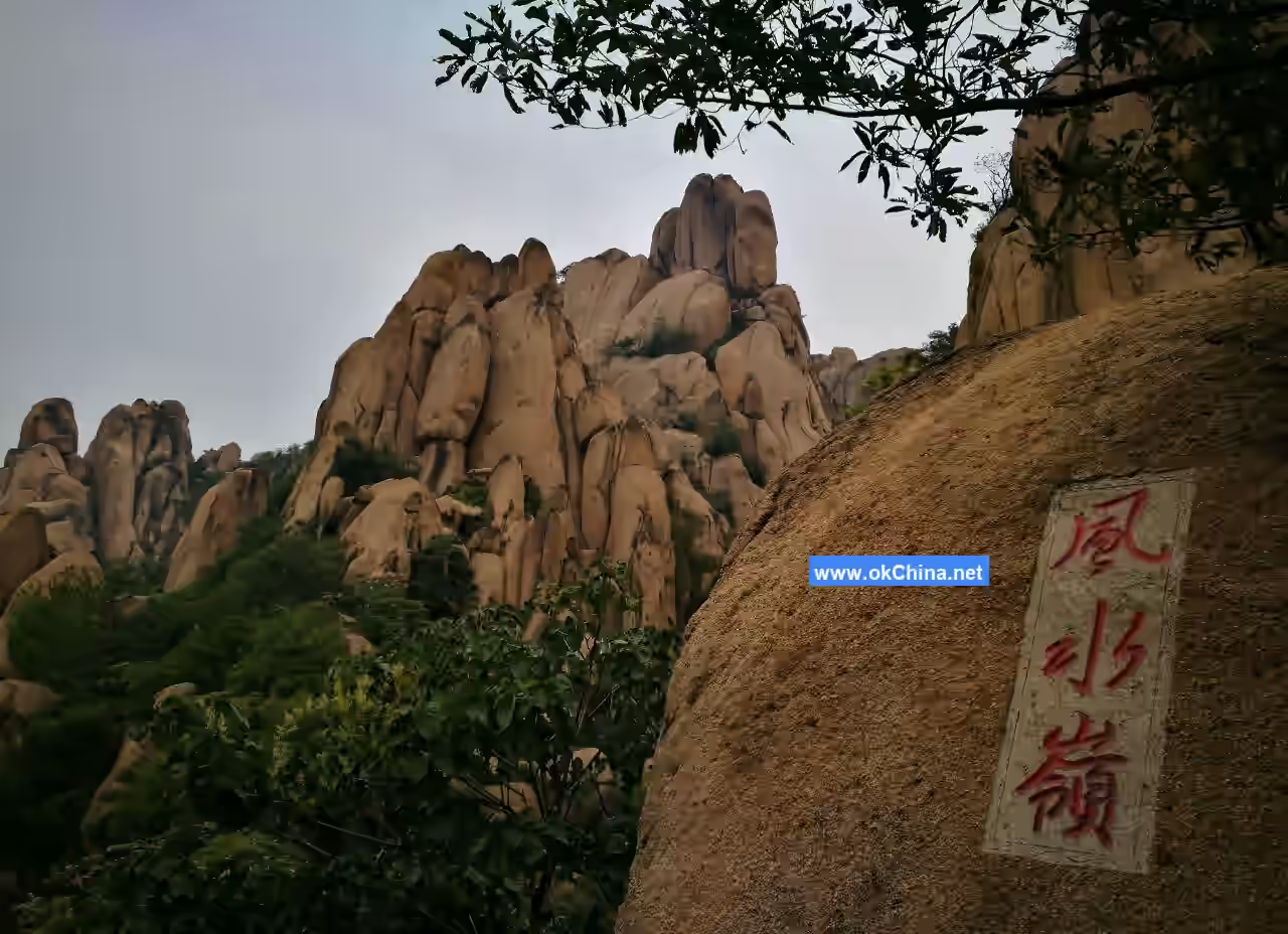
Hundred-Zhang Cliff is a landscape of exposed rock cliffs formed by the uplift or subsidence of granite due to orogenic movements. It is named for its towering height, seemingly a hundred zhang (a traditional unit of length, approximately 3.3 meters).#### 3.4.3 Fengshui Ridge Fengshui Ridge is located in the mid-southern section of the Tianmo Lake—Pipa Lake fault canyon. It is an intrusive mountain mass trending east-west. The mountain resembles a ridge running horizontally from east to west, with naturally formed streams on its slopes flowing separately into Pipa Lake and Tianmo Lake. Fengshui Ridge also serves as a crucial transportation junction on Chaya Mountain. From here, heading east through the Ghost Gate Pass leads into the North-South Mountain fault canyon, providing access to both the North and South Mountains. Traveling south leads to Pipa Lake and Huangtu Ridge, heading west offers tours of Liufeng Mountain, and going north leads directly to Tianmo Lake.
4. Cultural History
4.1 Origin of the Name
According to the New Book of Tang, it was called "Chaya Mountain" in the fifth year of the Qiandao era of the Southern Song Dynasty (1169 AD). The Great Ming Unified Gazetteer records it also as "Cuo'e Mountain." Due to massive rock collapses forming numerous caves, the mountain became full of hollows and cavities that whistle with the wind, earning it the name "Linglong Mountain" (Exquisite Mountain). Folklore tells of eight treasures within the mountain: black gold, the fire steed beast, the golden-headed old mother crow, beeswax gold, the nine-dragon cup, the eight-trigram furnace, a dragon, and a phoenix. King Wen of Zhou greatly admired these and conferred upon the mountain the title "Eight Treasures Exquisite Mountain." "Chaya" is a descriptive term meaning the mountain's terrain is peculiarly and beautifully rugged; "Cha" implies piled and scattered rocks, while "Ya" suggests jagged and uneven, like dog's teeth.
4.2 Historical Development
- Yao and Shun Era: People already inhabited the area around Beidianfang Village on Chaya Mountain. Legend says Shun enfeoffed Yao's son Dan Zhu to this land, calling it Fangdi.
- Spring and Autumn Period: King Zhao of Chu granted Fangdi to Fu Gai, the younger brother of King Helü of Wu, establishing the State of Wufang. Its capital was built near Dianfang Village at the foot of Chaya Mountain. After Fu Gai's death, he was buried by Tianmo Lake below Tianmo Peak.
- 4th Year of Tang Qianfu (877 AD): Shang Lang, a general under Wang Xianzhi of the Tang Dynasty, stationed troops here. Later, Huang Chao joined forces with Shang Lang to defend the mountain and jointly attacked Songzhou.
- 15th Year of Ming Chongzhen (1642 AD): The peasant rebel army led by Li Zicheng captured Suiping County town and killed the county magistrate Liu Ying. Legend holds that prior to this, Li Zicheng's uncle, Gao Yingxiang, led his forces to station near Laojun Cave on Chaya Mountain, where he reviewed troops and appointed commanders. Remains such as the "High Official Hall" and "Appointment Platform" still exist.
- 6th Year of Qing Tongzhi (1862 AD): Nian Army leader Li He led four to five hundred men to hold Chaya Mountain, resisting Qing forces.
- 12th Year of Qing Guangxu (1902 AD): Miao Jinsheng from Bali Pu, Suiping, gathered a crowd and rebelled, establishing a regime on Chaya Mountain and proclaiming himself "King Miao."
- May, 33rd Year of the Republic of China (1944): The 13th Brigade of the New Fourth Army's 5th Division was established with Hongshi Cliff on Chaya Mountain as its base. In November of the same year, the Henan Guerrilla Independent Corps, led by Huang Lin, crossed the Huai River north with its main force to open up an anti-Japanese base area around Chaya Mountain. The headquarters was set up at Hongshi Cliff, with Commander Huang Lin, Deputy Commander Yu Zhilong, and Political Commissar He Zhenya.
- April 20, 1958: The Chaya Mountain Satellite People's Commune was established on Chaya Mountain. It was the first people's commune established in China and the second in the world after the Paris Commune. In July of the same year, Chen Boda, then alternate member of the CPC Central Committee Political Bureau and editor-in-chief of Red Flag magazine, conducted research at Chaya Mountain and drafted the Charter of the Chaya Mountain Satellite People's Commune. In August, after revisions and approval by Mao Zedong, the charter was distributed at the enlarged Politburo meeting held in Beidaihe. On September 1, the charter was published in full in Issue 7 of Red Flag magazine. In October, the office building of the Chaya Mountain Satellite People's Commune was constructed. On October 13, Chairman Mao Zedong personally visited and inspected the Chaya Mountain Satellite People's Commune.
- March 1988: The Suiping County Tourism Bureau and the Chaya Mountain Scenic Area Management Office were established.
4.3 Historical Culture
Chaya Mountain is the creative birthplace of Journey to the West, one of China's Four Great Classical Novels. There is a cave on Chaya Mountain named "Wu Gong Cave." Because Wu Cheng'en spoke with a Jiangsu accent, the local mountain dwellers affectionately called him "Wu Manzi" (Wu the Southerner) and named the cave he lived in "Wu Gong Cave." The cave roof is about half the size of a basketball court, sheltered from the wind and facing the sun. Inside are a stone bed and a stone table, where Wu Cheng'en wielded his brush to create Journey to the West. The pomegranate tree in front of the cave is said to have been planted by Wu Cheng'en himself over 350 years ago, and locals call it "Wu Gong's Pomegranate Tree."
4.4 Film and Television Works
In 1996, CCTV's Journey to the West production crew, including chief director Yang Jie and Sun Wukong's actor Liu Xiao Ling Tong, came to Chaya Mountain to scout locations and subsequently used it as a filming site for the sequel to Journey to the West. After the series aired, its impact was significant. Chief Director Yang Jie emotionally stated, "Chaya Mountain added brilliance to Journey to the West, and Journey to the West made Chaya Mountain famous."
Comments
Post a Comment